A man entered the Soldier Readiness Processing Center at Fort Hood, Texas on November 5, 2009. It was about 1:34 p.m. He sat at an empty table, paused for a few seconds, stood up, shouted, and began firing a weapon.
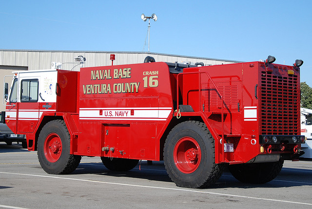
Within 10 minutes, 13 people were dead and more than 30 others were injured. Two minutes and 40 seconds after the first call to 911, first responders from base were at the scene. A minute and a half later, officers shot the suspect. Ambulances arrived two and a half minutes after that, once the suspect was taken into custody.
Although emergency responders from off base arrived at Fort Hood quickly, unfortunately there was no way for them to know where on the base the victims were located. The base had no standardized address system, meaning there were no street addresses like the ones you would find in cities.
Soon after the Fort Hood shooting, the US Navy decided to create standardized addresses and improve the Navy Emergency Response Management System (NERMS) using enterprise, geospatially enabled dispatch capabilities supported by Esri technology.
This is being accomplished at 300 Navy sites in the continental United States through the Navy Emergency Management Addressing Project (NEMAP). NEMAP incorporates standardized geospatial addressing for facilities and routable street centerlines into dispatch systems at the Navy’s Regional Dispatch Centers (RDCs).
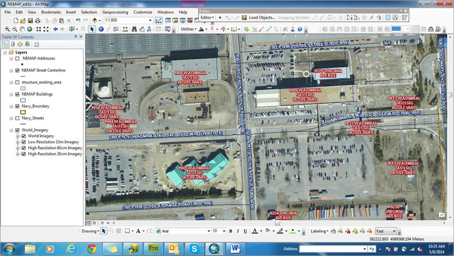
RDC dispatchers route all 911 calls placed on naval installations. Providing them with this geospatial data will shorten response times, increase locational information, and streamline procedures for responding to incidents. The Navy will share this data with the local governments near the bases to improve the situational awareness for everyone during crises.
“Navy base and facilities street addressing is a huge undertaking given the number of Navy properties across the country,” said Sanovia Peterson, NEMAP project execution coordinator, Naval Facilities and Engineering Command’s Anti-Terrorism Force Protection. “NEMAP and NERMS are laying the groundwork for the Navy’s transition to the next generation of 911.”
NERMS now includes three main functions: 911 Routing and Management Service (911-RMS), computer-aided dispatch (CAD), and geographic information system (GIS) technology. As the Navy transitions to Enterprise NERMS (E-NERMS) in the future, there will be one centralized system that could even include real-time mobile field dispatch capabilities.
Improving the E911 Systems
Independent reviews of the Fort Hood shooting determined there had been no Department of Defense (DoD) policy that mandated a 911 capability on DoD installations. The secretary of defense (SECDEF) soon directed all DoD facilities to implement Enhanced 911 (E911) policies. The goal: create military response systems that work in tandem with local government systems to provide streamlined, expedited responses to emergency situations.
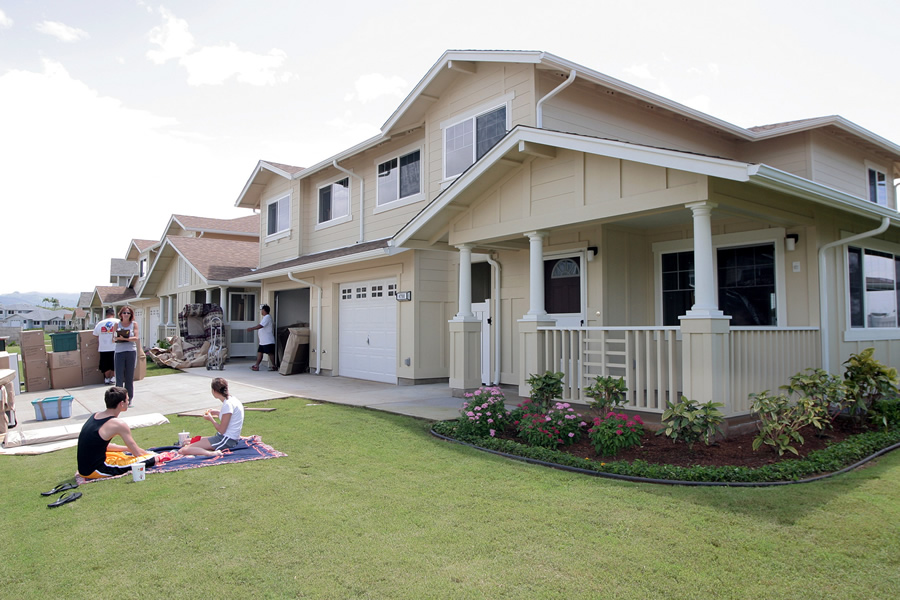
When 911 calls are placed within a military installation, the caller hears the question, “What is the location of your emergency?” Call takers need to glean the location of the incident from both the building number and the name of the road or roads. Most military installations lack street addresses like those in a city and do not support geospatially enabled enhanced 911 systems such as those local governments use. Effective and rapid 911 emergency response relies on industry-standard routing and addressing procedures. Most civilian agencies have these procedures in place, along with a GIS-based 911 addressing capability, making it important for the Navy to adopt their guidelines and incorporate them into its 911 system.
To meet the directive for E911, the Commander, Navy Shore Installations Command (CNIC) instituted standardized base addressing. This provides routable street centerlines and corresponding addresses in GIS format for every facility at every Navy installation in the United States.
NEMAP was funded through the Navy’s Anti-Terrorism Force Protection program and administered by the Naval Warfare Systems Command (SPAWAR) Systems Center Pacific (SSC Pacific). SSC Pacific issued a competitive contract to establish National Emergency Number Association (NENA) and 911-compliant base addressing for Navy bases within the continental United States. The contract was awarded to Serco Inc. with GISi as a location technology partner. Together, they developed the critical addressing data to integrate into NERMS.
Addressing Data Issues
Designing the process and technology for a standardized addressing system was not easy. GIS data that contains thousands of address points and street centerlines for more than 65 Navy commands and 300 sites needed to be developed and processed. The NEMAP team chose Esri’s ArcGIS platform because it provided an ideal environment for developing agile and scalable data that could be easily integrated and expanded into E-NERMS.
Esri’s ArcGIS platform provided a strong framework to manage, store, and edit the address data; and the team added on tools as the project progressed and automation became necessary. ArcGIS Data Reviewer, an ArcGIS extension, provided the early quality assurance/quality control (QA/QC) reports and was also used to ensure topologically correct street centerlines. GeoComm’s GeoLynx DMS software, because of its intuitive user interface and automation capabilities, was also employed to increase productivity and provide an added level of data integrity with its QA/QC reports.
NEMAP’s centerline and address point data were patterned after Esri’s ArcGIS for State and Local Government’s Emergency Response model. This was the best approach since much of the addressing guidance and direction would come from local governments. NEMAP data had to integrate easily into local government GIS and response systems across the country, both initially and for future data updates. Using this Esri data model, the team was assured that the data would be 911-compliant according to NENA and the Federal Geographic Data Committee (FGDC). The data also would meet basic E-NERMS requirements.
A workflow needed to be devised to generate addresses, which the team dubbed the NEMAP Secret Sauce. When the project began in 2013, the team collected existing GIS base data, verified it in the field, and established a rapport with local government authorities and Navy stakeholders. Slowly this Secret Sauce gelled as the project progressed.
The NEMAP team took the Navy’s structure/facility data and built on it. Each installation was analyzed. Then unnamed roads and special areas such as restricted areas, special storage, and fenced in facilities were identified. The team verified questionable areas, established addressing, and worked with authorities and stakeholders to create an addressing plan that would ensure streamlined data into the local Master Street Address Guide (MSAG).
NEMAP’s GIS analysts created centerline ranges by assigning a set of values for the left and right sides of the road. Local governments approve the ranges to ensure they work within the local government response systems. After that, addresses can be assigned to all buildings and structures. Once addressing is complete, local government and the Navy will have a set of topologically correct street centerlines with 911-compliant ranges and addresses for every place on base.
Taking the Human Factor into Account
Addressing would be far trickier than the steps that lead to it, the team found. People are a huge factor to take into account—where they live and work and how long it takes for emergency responders to reach them. Though the most important question is whether the assigned addresses will work in the Navy and local CAD systems, questions inevitably arose for each base:
- Are there established addresses as opposed to historic building numbers? Do they need to be changed based on the new plan?
- Will housing need new addresses?
- How do you create routes through weapons storage areas?
- Does an airfield need a centerline with ranges?
- Are there facilities that can be accessed by the general public?
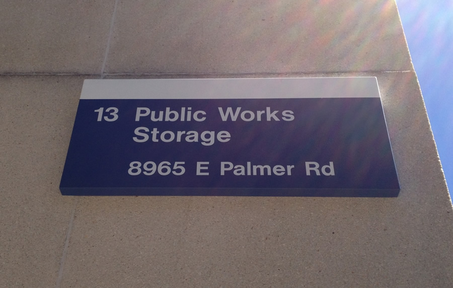
Assigning new addresses will often open a large can of worms. Installations will need to change building numbers, street signs, mailing addresses, and most public relations materials. Input needs to come from Navy stakeholders such as real property; GeoReadiness; housing; naval supply, public works; safety; and in some cases, even the installation’s commanding officer.
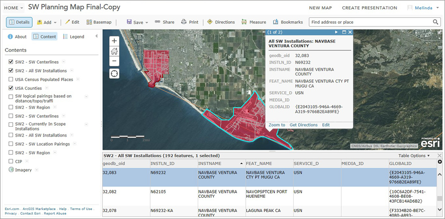
Local government authorities who may need to weigh in include emergency managers, addressing and MSAG coordinators, planning departments, and local fire departments. These sources provided valuable information to the NEMAP team, contributing to the development of a set of best practices.
Many land-use types are found on base, making it difficult to apply one addressing method to all sites without being subjective. The following are examples of established NEMAP best practices that are unique to military addressing:
- Established addressing—The NEMAP golden rule was to have the least impact possible on people who work and live on base as long as the addresses were 911 compliant. Strong efforts were made to preserve established addresses, especially at family housing, publicly accessible facilities, and the commanding officer’s building.
- Compound addressing—Addresses were assigned to a group or groups of structures that are accessible by one location, gated and/or fenced areas, and weapons storage areas. Though this produces duplicate addresses, it was treated like a set of apartments with unit numbers. This practice satisfies security personnel, ensuring restricted areas will require an escort past gates.
- Unnamed Roads—These consisted of common routes that cut through the base and did not require a name, rarely used trails in isolated rural areas, and occasionally long access roads lacking designation as a driveway. A generic naming convention was used to allow the Navy to quickly identify where names were needed.
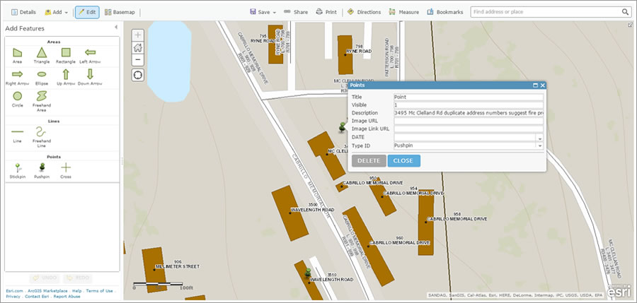
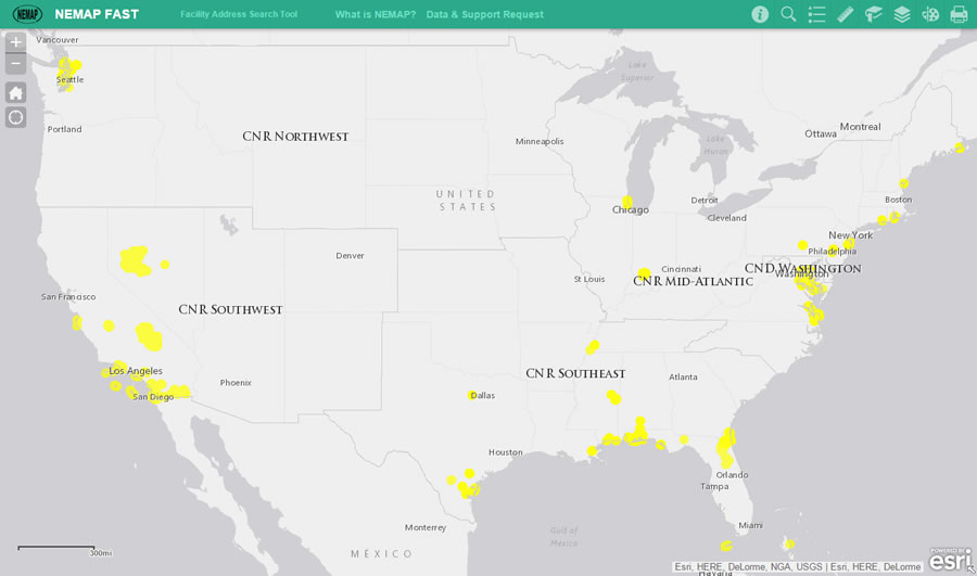
Using ArcGIS Online, the NEMAP team built a collaboration site to overcome the challenges. The NEMAP Workspace is a place where local government authorities and any Navy stakeholders who conduct reviews can access and view interactive maps of their areas of interest or responsibility. The team generated “Review Maps” for the local government and Navy to collaborate on in a central location. Map Notes are used to highlight areas of interest or concern by placing both text and graphic elements on the map. As data is completed and stored, it’s published to the Facility Address Search Tool (NEMAP FAST) and is available for all long-term NEMAP stakeholders who need a quick reference for an address. The NEMAP Workspace is an invaluable resource for collaborative review, as participants need little to no prior knowledge of GIS to navigate the maps and website.
Reaching the End
By the summer of 2015, all Navy bases in the continental United States will have 911-compliant addresses and routable street centerlines. For the NEMAP project, addresses will have been created for about 35,000 facilities at more than 300 Navy sites. More than 13,000 miles of street centerlines will have been processed, too.
NEMAP is a small part in the overall NERMS infrastructure, but this data is essential in its effective operation, and it must be maintained. In the future, the NEMAP data will help save lives.
Navy RDC dispatchers will not have to rely solely on asking “What is the location of your emergency?” They will be able to see the location of the emergency on their computers or mobile devices as the call comes in.
About the Authors
Amy Hrdlicka, GISP, is a geospatial project manager at GISi. She has supported development of geospatial applications for the Navy for more than seven years. Her work focuses on facilities, asset management, and emergency response for the GISi Navy program.
E-mail: Amy.Hrdlicka@gisinc.com
Marvin Garland, GISP, works for Serco-NA Inc. supporting SPAWAR Systems Center Pacific. He serves as the geospatial/GIS subject matter expert and project lead for NERMS and NEMAP. E-mail: Marvin.Garland@serco-na.com
For more information, contact Ronald Anderson, NEMAP contract lead, SPAWAR Systems Center Pacific. E-mail: Ronald.Anderson@navy.mil
