Water Articles

Most recent

     Urban Public Utility Gains Efficiencies with Digitized Permitting and Asset Management

Salt Lake City Department of Public Utilities has improved efficiency and increased transparency using dashboards and interactive maps.

Read this article

Card image for article: Get the Lead Out: CFPUA’s Process from Locating to Replacement of Galvanized Services
Water Utilities
Water Utilities

Get the Lead Out: CFPUA’s Process from Locating to Replacement of Galvanized Services

GIS-based solutions improved analysis and workflow efficiency, saving Cape Fear Public Utility Authority $2 million.

Show Description Hide Description
Card image for article: Small City, Big Initiatives: City of Seguin Improves Water and Electric Asset Management with GPS and GIS
Water Utilities
Water Utilities

Small City, Big Initiatives: City of Seguin Improves Water and Electric Asset Management with GPS and GIS

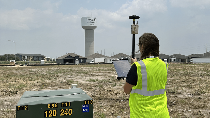
Seguin’s Utilities Department uses high-accuracy maps to assist compliance with regulations and migration to ArcGIS Utility Network.

Show Description Hide Description
Card image for article: Modernized Operations Improve Efficiency and Data-Driven Decisions for a Growing Water District
Wastewater
Wastewater

Modernized Operations Improve Efficiency and Data-Driven Decisions for a Growing Water District

Elements XS and ArcGIS Enterprise led to more effective staffing and efficiency, resulting in a satisfied customer base and happier employees.

Show Description Hide Description
Card image for article: Migrating at Scale: A Ten-Database Utility Network Case Study
Water Utilities
Water Utilities

Migrating at Scale: A Ten-Database Utility Network Case Study

EPCOR USA fully migrated multiple geometric network datasets to ArcGIS Pro with ArcGIS Utility Network with minimal downtime.

Show Description Hide Description
Card image for article: It's about Connectivity - GIS Connects Data and Staff at South Walton Utility Company
Water Utilities
Water Utilities

It's about Connectivity - GIS Connects Data and Staff at South Walton Utility Company

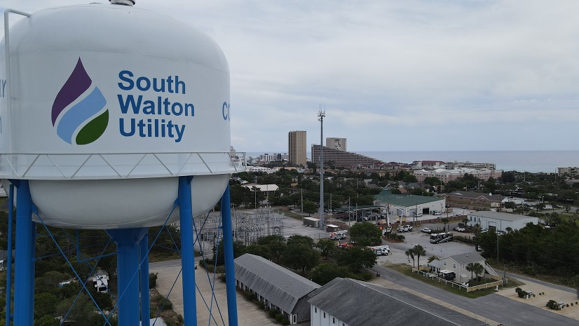
GIS-based systems support daily workflows at South Walton Utility Company.

Show Description Hide Description
Card image for article: CAD to GIS—Work Management and Asset Management All in One Place
Water Utilities
Water Utilities

CAD to GIS—Work Management and Asset Management All in One Place

The City of Kansas Board of Public Utilities enables all groups of the Water Division with a GIS-based asset management and work order system.

Show Description Hide Description
Card image for article: Warren County Water District Looks to "Elevate" Its Hydraulic Modeling with Survey-Grade Maps
Water Utilities
Water Utilities

Warren County Water District Looks to "Elevate" Its Hydraulic Modeling with Survey-Grade Maps

Warren Water implemented GIS, mapped system assets with high accuracy, and improved efficiency with digital workflows.

Show Description Hide Description

Show More