Emergencies can happen anywhere. But, as any first responder knows, an emergency inside of a building comes with its own special set of unknowns—especially if the building is large and complex, or the emergency requires tactical response. Keeping people safe in the places where they work and visit is critical. For example, in 2022, 50 million students on average were enrolled in approximately 121,000 K–12 schools each day in the United States. Keeping students safe in the places where they learn and grow is crucial. To keep school facilities and other buildings secure and enable fast, efficient response to intrusions and incidents, telecommunicators, first responders and school safety personnel need quick and ready access to shared information that supports interoperable communication and coordination.
Most state and local governments have a geographic information system (GIS) and use it in a multitude of ways. It is foundational enterprise technology that helps people make better decisions through real-time visualization, advanced analytics, and the collection and sharing of location data.
When it comes to indoor maps, especially those used to improve and ensure school safety, there are compelling reasons why these maps should be built and delivered in the same way as the GIS used by public safety telecommunicators, first responders, school resource officers, and the decision-makers that support them. GIS-based indoor maps can also support and extend other systems, such as NG911, broadening the reach of the investment made in creating and updating these maps.
- In today’s Public Safety Answering Point (PSAP) and first responder systems, indoor maps represented with GIS data can be used to create detailed dispatchable addresses. GIS improves communication and coordination. GIS-based indoor maps inherently support the creation of detailed site/structure address points with subaddress information, like building name, floor number, room number, unit number, and wing. Computer-aided dispatch, 911 call handling, and 911 mapping systems can use these address points to support detailed location verification, helping direct first responders to incident locations quickly, with as little ambiguity as possible.
- These same indoor site/structure address points can meet the requirements of Next Generation 911 (NG911). NG911 uses GIS data to validate caller locations and route calls geospatially to the most appropriate PSAP. Many states, regions, and localities have high-quality and complete site/structure address points that power their NG911 systems today or will in the future. However, many indoor spaces have not yet been mapped in GIS, making it impossible to validate caller locations or route 911 calls indoors, or even determine which PSAP should answer the call. GIS-based indoor maps provide a tremendous benefit in also creating the GIS data that can power NG911 indoors. And, in line with the Phase 2 requirements of the FCC Report & Order 24–78 adopted on July 18, 2024, this becomes especially important when VoIP providers and Multi-Line Telephone Systems begin validating indoor locations using NG911 Location Validation Functions (LVFs) provisioned with locally authoritative indoor site/structure address points to ensure accurate addresses.
- Indoor maps that are floor-aware can be delivered as elevation-aware GIS data. GIS-based, floor-aware indoor maps, combined with elevation-aware 911 caller location (already received with 80 percent of wireless 911 calls), can be used to determine a caller’s location in three dimensions, show the caller on a 3D map, and help responders arrive on scene as quickly as possible. Without this data and systems that can utilize it, responders are left guessing on which floor and in which room a caller might be calling from—which can significantly impact response times in multistory buildings.
- GIS technology supports frequent data updates, keeping data current, and indoor maps should be no exception. NG911 is mission-critical, and the GIS data that powers it, by its nature, is also mission-critical. NG911 supports near real-time GIS data updates to ensure location validation and that geospatial 911 call routing systems use the freshest, most accurate data. Indoor maps should follow suit and allow building owners or their designees to provide frequent updates when changes to interior spaces occur—from changing the name of a room to reconfiguring whole floors. Changes to indoor maps can and should be automatically disseminated to emergency responders and 911 mapping applications using existing data standards to ensure the most up-to-date information is available. And, due to the mission-critical nature of NG911, any changes made to indoor maps should be made available to NG911 systems as quickly as possible.
- Building owners currently share GIS data with government and/or private entities that provide or support emergency services, and indoor maps should be no exception.
Today, many public safety agencies and private entities use established agreements and workflows to obtain critical public safety information, in the form of GIS data, from building owners, facility managers, and others who know of information that would be useful during emergencies. Things, such as the locations and types of utility shut-off valves, lock boxes, and hazardous materials, are captured in GIS preincident plans, which can be accessed via 911 call handling and CAD systems. This improves telecommunicator and first responder situational awareness, ensures first responder safety, and helps provide the best possible outcomes. Indoor maps should be no exception. GIS data providers, such as building owners, can also share this data with government and private entities to support enterprise workflows across a wide range of business systems, while leveraging existing GIS investment. - GIS data can be reused outside of public safety, saving time and money. GIS-based indoor maps, especially those built using standards, can support needs outside of public safety, such as facility and space management, scheduling systems, and environmental health and safety systems. This allows the investment made in creating and maintaining GIS-based maps to be leveraged in multiple ways—across the entire state and local enterprise—saving taxpayer dollars and eliminating the need to create multiple sets of indoor maps that would otherwise live in multiple, disconnected data silos.
- Basemaps, the background maps that provide reference information for other layers in a GIS, offer essential geographic context for data visualization. Many jurisdictions choose different basemaps and often use locally customized basemaps that support their unique public safety missions. Whether a road-centric basemap, imagery or hybrid, the local school and public safety jurisdiction should be able to view and interact with indoor maps in the same maps they use daily. Information should not be spread across multiple maps or multiple systems; instead, to ensure maximum situational awareness, maps and data should be as unified and familiar as possible.
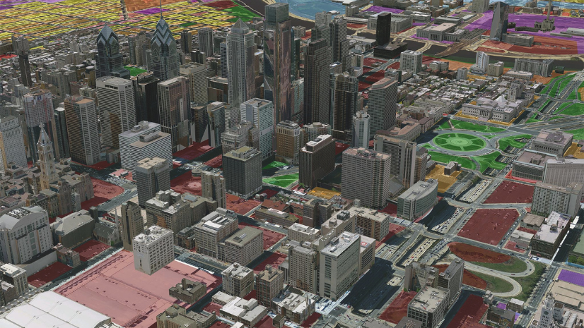
- GIS-based indoor maps offer rich levels of up-to-date detail with an interactive user experience. Only GIS-based indoor maps capture rich levels of detail inside and outside of structures and are interactive. Users can zoom into these maps and click features depicted within them to obtain more information. For example, GIS-based maps can integrate additional content to improve situational awareness, like real-time streaming CCTV camera feeds and 360-degree photos of rooms and other interior spaces, giving users additional perspectives of the environment. GIS-based indoor maps also support near real-time updates whenever building layouts or infrastructure change.
- GIS-based indoor maps can use industry-standard symbology for consistent interpretation and shared understanding. The visual style of GIS-based indoor maps, and the symbols that are used within them, can conform to guidelines provided by the National Association of Public Safety GIS (NAPSG) Foundation. These important guidelines are widely adopted across public safety, and they ensure stylistic consistency across the emergency communications ecosystem. This is important because it provides a common visual language that all telecommunicators and first responders can easily understand, which becomes especially helpful when multiagency response is required. GIS-based maps can become the single source of truth for all stakeholders.
- GIS-based floor plans enable advanced capabilities. Only GIS-based indoor maps can be combined with 911 caller, first responder, and school staff location data to enable wayfinding, positioning, navigation, analytics, and data collection. In other words, GIS brings the legacy of GIS tools and expertise into indoor spaces. This intelligence provides greatly enhanced situational awareness in the moments when it is needed most, to help support fast, coordinated emergency response.
Learn more about the benefits of GIS and how it supports emergency communications, from NG911 to response in the field, on our website.


