
When it comes to emergency response, knowing where our resources are located is critical. Whether it’s tracking an air tanker navigating through smoke-filled valleys or following a helicopter as it refills its bucket from a dip site, knowing where aircraft are is essential.
With the built-in integration of ArcGIS Velocity and FlightAware, organizations can now bring live, global aircraft locations right into ArcGIS Online. This means not only can we go beyond simple aircraft location tracking, but we can perform advanced functions including alerting and sorting by tail number to track only planes of interest.
Visualization in Under Five Minutes
Before ArcGIS Velocity, ingesting, processing, and visualizing real-time aircraft data wasn’t exactly seamless. Setting up feeds, configuring APIs, and building analytics pipelines could take hours—even for GIS professionals.
Now? It takes less than five minutes.
With FlightAware’s Firehose API streaming thousands of aircraft positions per second and ArcGIS Velocity handling ingestion, analysis, and visualization at scale, organizations can rapidly deploy live flight tracking in a way that was previously very tedious.
How does it work?
– ArcGIS Velocity simplifies data integration by offering native connectors like the FlightAware Firehose, enabling organizations to securely authenticate and access live aircraft feeds, eliminating the need for custom development. Its emphasis on configuration over coding streamlines the process of ingesting data, making it more accessible and efficient for users of varying technical backgrounds.
– Users can filter and refine data—focusing on specific aircraft, geographic areas, airlines, or airspace of interest.
– Once connected, these aircraft positions flow through Velocity, where analysis occurs, and into ArcGIS Online, where they can be visualized and enriched.
Beyond the Dots: Real-Time Analytics in Action
So, what can we actually do with this data, besides track aircraft?
Geofence and Alert Around an Incident
As aircraft enter or exit a predefined area around an incident or a defined area of interest, ArcGIS Velocity can send alerts to the appropriate organizations or roles within an incident management team.
Track Aircraft Through Weather Events
Another use case revolves around weather hazard alerting. For instance, by using Baron Weather data within ArcGIS Velocity, users can create real-time alerts for aircraft flying into areas of extreme turbulence.
– ArcGIS Velocity ingests live wind data as polygonal boundaries from Baron Weather.
– A 10-nautical-mile buffer is created around these hazard zones.
– When an aircraft enters this zone, it triggers an automatic alert, notifying
Conducting After-Action Reviews
When an aircraft incident or near miss occurs, investigators need to reconstruct flight paths to understand what happened. Additionally, historical flight activity may be required to facilitate an after-action review. The Velocity and FlightAware integration allows users to:
– Write to a historical feature layer, which enables playback of historical flight tracks.
– Reconstruct temporal aircraft or ground movements in ArcGIS Online and overlay conditions like wind speed, visibility, airspace restrictions, or any other GIS data.
For example, after a recent helicopter crash, analysts were able to replay the aircraft’s final flight path, identifying critical factors that may have contributed to the incident.
Enabling the Common Operating Picture
Much has been written and said about creating a common operating picture. Knowing where all our resources are in near real-time is paramount to creating a successful common operating picture.
With ArcGIS Velocity and FlightAware:
– Agencies can monitor an entire airspace, allowing them to track tankers, lead planes, and helicopters in a single, integrated view with their other existing resource locations or GIS data.
– Replay aircraft movements to evaluate strategy effectiveness.
The Future of Aviation Awareness
What does all this mean for the future of real-time data and GIS?
This integration is just the beginning. With branded connectors becoming the norm in ArcGIS Velocity, organizations will have access to more preconfigured options for ingesting real-time data—whether it’s aircraft, vessels, weather, or even sensor networks.
Want to See It in Action?
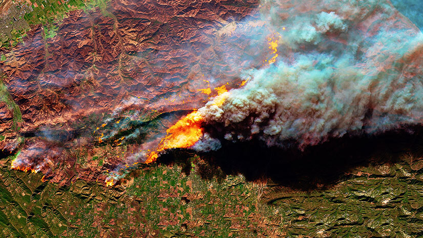
Check out the awesome visualization below that details the Palisades Fire aviation operations from January 9, 2025, to January 11, 2025: