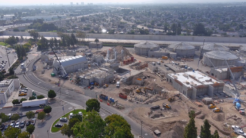
By Stephanie Bernard, Public Relations Manager at Mustang Special Utility District
At Mustang Special Utility District, the integration of geographic information system (GIS) technology has fundamentally transformed how we manage, maintain, and expand our water and wastewater infrastructure. Before adopting GIS, our staff relied on paper plans and PDFs, which often made field operations cumbersome and time-consuming. Today, we have embraced a suite of powerful Esri products that provide a streamlined, real-time interface for our field employees, our GIS team, and departments across the district.
Data Collection and Mapping
The integration of GIS started with mapping our existing infrastructure and tracking new developments. Using ArcGIS Field Maps along with Eos Positioning Systems Arrow 100 receivers, our GIS staff can precisely map features in the field including valves, maintenance holes, and all water and wastewater lines.
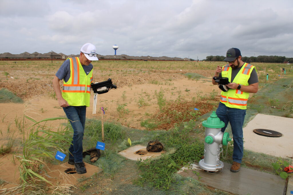
Staff now have access to an online interface where they can make live edits directly from the field using Field Maps. This product is indispensable for our team, as they use it every day to not only perform routine tasks but also respond to main breaks and reduce service disruption for our customers.
Data collection continues to be a time-consuming process that requires our GIS team to pull information from the field. With a service area of over 220 square miles that is growing in population exponentially, collecting assets and information in the field never stops. Driving from one location to the next can take upwards of two hours, limiting the time our GIS staff could spend in the office. Now, with real-time updates, field employees can input the data directly, significantly reducing response times and aiding our GIS team with this monumental task.
Enhancing Decision-Making with Interactive Tools
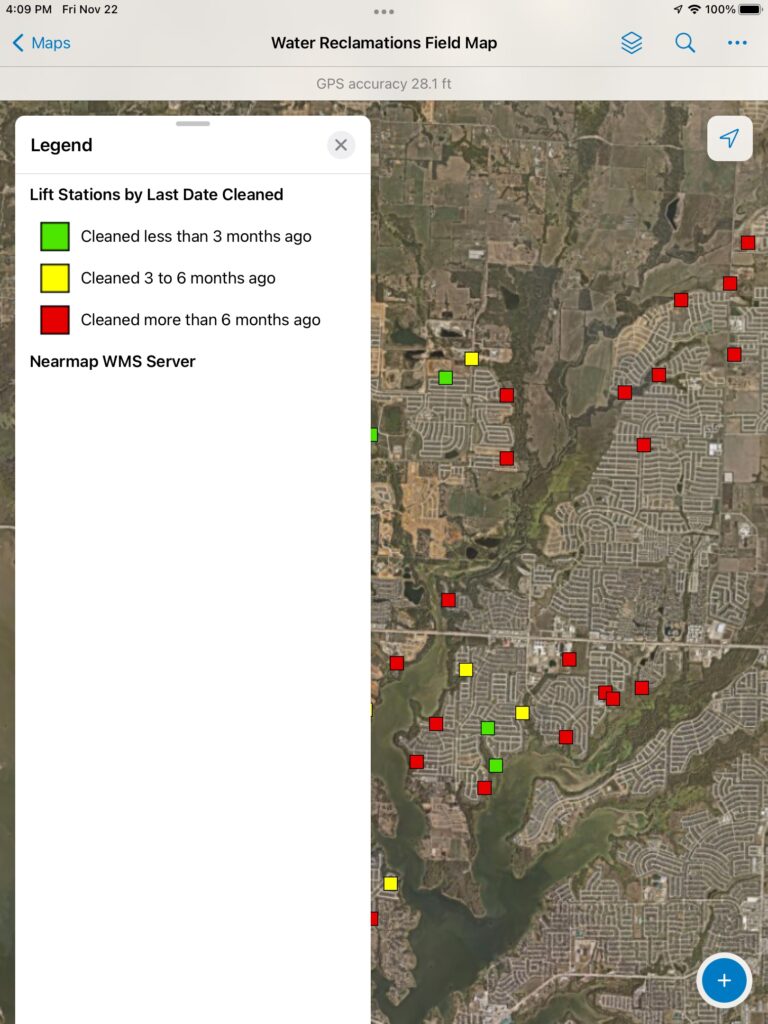
GIS is more than just a data collection tool; it has become a platform for visualization and decision-making across multiple teams and departments including the meter services and the regulatory compliance and support teams, and the Water Operations, and Water Reclamation Departments. ArcGIS Experience Builder, another Esri product, helped our in-house GIS team build custom maps that offer staff a central hub for accessing and interpreting data. Through ArcGIS Arcade, the team builds custom symbols into these maps. These symbols serve as visual triggers for maintenance, inspection, and other key functions. By using a color-based system—green for inspected and red for not inspected or needs attention—our staff can easily plan maintenance routes with a quick look. This approach allows field staff to make informed decisions quickly, whether they’re identifying areas that need repairs or isolating water supply with mapped valves.
Additionally, Mustang Special Utility District utilizes nine dashboards, built using ArcGIS Dashboards, in operations. These dashboards are crucial during main breaks or sanitary sewer overflows, when identifying affected customers and isolating impacted areas is a priority. Once a main break, unplanned outage, or sanitary sewer overflow occurs, operations staff use the infrastructure maps to identify affected customers and pass the information along to our customer service team members, who then quickly communicate with those customers. Our regulatory compliance and support team members use this same function to create maps and notify the Texas Commission on Environmental Quality (TCEQ) as required during these events.
Meanwhile, our Water Reclamation Department has greatly improved its operations with the help of Esri products. Staff track everything from flow directions and force mains to maintenance schedules and subdivision maintenance bonds. The various layers and their related tables enable the operations crews to collect asset information and operate efficiently without a dedicated work order system, simplifying day-to-day tasks and long-term planning.
Enhancing Monitoring and Compliance
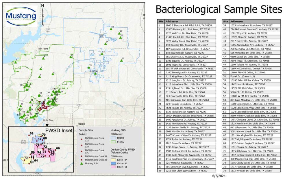
Our regulatory compliance and support team also benefits from GIS technology. The team members use interactive maps to manage data from bacteriological and Nitrification Action Plan sampling points. GIS helps them determine secondary sampling locations if needed and gain a deeper understanding of the varying pressure planes throughout our water distribution system, enhancing overall water quality monitoring.
Furthermore, GIS has played a pivotal role in establishing our lead and copper inventory, an Environmental Protection Agency (EPA) requirement. With Esri’s Lead Service Line Inventory Solution as well as Field Maps, we can track and manage this information efficiently, ensuring that we meet federal compliance regulations while also maintaining safe drinking water for our customers.
Conclusion
Esri GIS products have revolutionized Mustang Special Utility District’s operations, from real-time mapping to advanced data visualization as well as water main break and sanitary sewer overflow response. The ability to integrate data across various departments and provide staff with the tools to make live updates in the field has not only improved efficiency but also enhanced our ability to serve our growing community effectively. With GIS and the support of Esri, we can continue to innovate, maintain compliance with regulatory requirements, and ensure the reliability of our water and wastewater systems well into the future.
Stay Connected with Esri’s Water Team
ArcGIS is an extensive information system that enables modernization of workflows with easy-to-use applications for the field and office. Strengthen your organization with smart water solutions that will increase efficiency and provide insight for decision-makers. Visit the Esri Water Utilities web site for more information.
Join the Water Utilities Community
Follow #EsriWater on social media: X | LinkedIn
Subscribe to the Water Industry newsletter “Esri News for Water Utilities and Water Resources“


