In construction, location intelligence is crucial for ensuring projects are completed safely, efficiently, and cost-effectively. Successful project delivery requires meticulous planning, seamless execution, and adaptability to evolving site conditions. Esri’s location-intelligent solutions are revolutionizing how construction projects are planned, managed, and executed, ushering in a new era of efficiency and collaboration.
Bridging the Gap Between the Office and the Field
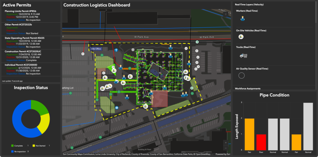
Coordination between office teams, project managers, superintendents, and field crews is critical but often challenging. Esri’s construction solutions ensure that all teams work from a single, data-driven project plan, enhancing collaboration, reducing delays, and improving communication between the office and the job site. By integrating location intelligence, construction teams can optimize project execution and mitigate risks
Optimizing Performance with Location Intelligence
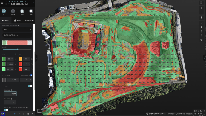
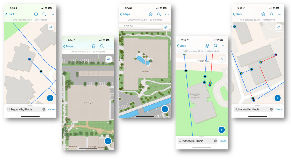
Esri’s real-time location intelligence enables construction teams to optimize labor, materials, equipment, and logistics. Tracking resources and site activities using geospatial data allows builders to make informed decisions, improve safety, increase efficiency, and keep projects on schedule and within budget. Incorporating GIS technology into field operations streamlines logistics, reduces waste, and minimizes costly disruptions.
Digital Handover: Beyond Project Completion
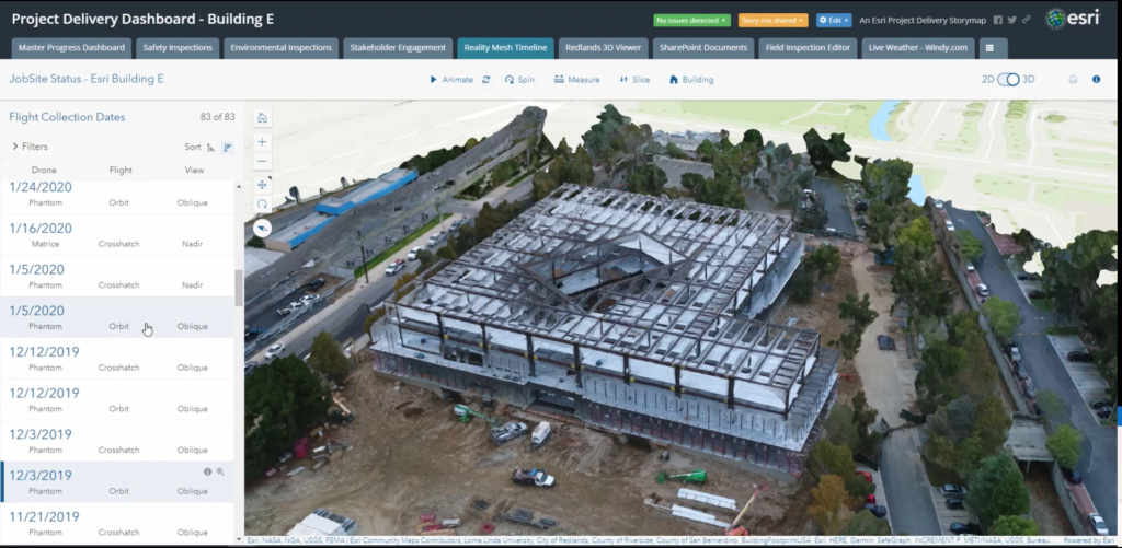
The construction process does not end when the final brick is laid—it transitions into a Digital Handover. Esri’s GIS solutions provide a comprehensive Digital Twin, updated throughout the project lifecycle. This enriched dataset ensures a seamless transition from construction to operations and maintenance, allowing project owners and stakeholders to continue leveraging valuable insights post-construction.
Building Stronger Relationships Through Digital Handover
A well-managed digital handover is more than just a project milestone—it’s an opportunity to strengthen long-term relationships with project owners. The data collected throughout the project serves as a valuable resource for ongoing collaboration and informed decision-making. By ensuring a smooth flow of project information, construction firms position themselves as trusted partners for future projects.
The Value of Location for every Construction Project
Location intelligence enhances safety, improves efficiency, and optimizes resources across all types of construction projects. Integrating geospatial data throughout the construction process transforms project delivery, making it more adaptable, data-driven, and responsive to real-world challenges.
Advancing Construction with Esri’s GIS Technology
The construction industry is evolving, and Esri’s GIS technology is at the forefront, driving smarter project delivery. GIS enables construction managers to coordinate teams, streamline workflows, and optimize site planning, reducing inefficiencies and conflicts. Project managers use GIS for real-time project monitoring, identifying schedule deviations, and making data-driven decisions to keep projects on track. By integrating multiple data sources into a comprehensive, location-driven project view, GIS enhances productivity, communication, and decision-making, minimizing costly errors.
Transforming Digital Handover with GIS
Esri’s GIS-powered Digital Handover goes beyond traditional project closeout by providing a long-term foundation for operational efficiency and asset management. The Digital Twin, enriched with location data captured throughout the construction phase, offers a dynamic, comprehensive view of the built environment, ensuring a seamless transition into facility operations.
A New Era of Construction Efficiency
Esri’s Location Intelligence solutions are redefining construction project delivery. From resource optimization to improved safety and efficiency, geospatial technology offers unparalleled advantages in modern construction. Today, success is about more than just completing projects—it’s about delivering high-quality, cost-effective, and sustainable infrastructure. Esri’s GIS technology is leading this transformation, driving innovation and efficiency across the construction sector.
To learn more about Esri’s Location Intelligence solutions, visit https://go.esri.com/construction-blog