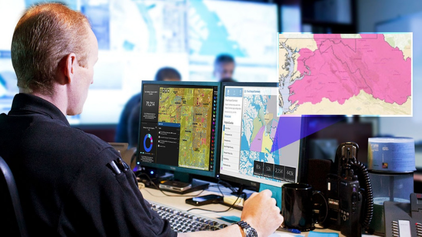
Agencies today must be able to identify threats and hazards, reduce risk, respond to rapidly evolving events, communicate with the public, and measure the success of incident response efforts. Through the power of GIS technology, organizations can now adopt a smarter, more integrative approach to emergency response.
Around the world, incident management teams (IMT) rely on spatial data to improve their response capabilities. Gathering reliable, actionable information that all personnel can use anytime, anywhere is key to understanding, planning, and responding. GIS technology can be used to improve overall communication and collaboration needed to realize better outcomes.
Join Esri public safety personnel and subject matter experts as they provide a four-part educational webinar series for incident management team personnel.
Incident Intelligence Development and Reporting Using GIS
How do incident management teams (IMT) develop intelligence and leverage GIS to support incident objectives? Join Esri public safety personnel as they present GIS solutions and configurations to support response. These workflows can be leveraged by a geographic information systems specialist (GISS), the situation unit, field observers, and other IMT personnel to maintain a common operating picture, evaluate and share information, track resources, and identify safety hazards.
GIS for Operations
Incident management teams (IMT) are faced with a wide range of challenges. These challenges require coordinated field operations, resource accountability, field data collection, and the integration of multiple agencies from multiple disciplines. Join Esri public safety personnel as they present GIS solutions and configurations that can support the operations section during IMT incident response.
GIS for Public Information and Stakeholder Engagement
How do incident management teams (IMT) develop and deliver consistent, verified messaging to the public and participating agencies during an incident? GIS can support public information and liaison activities including evacuation, sheltering, and reentry. Join Esri public safety personnel as they demonstrate GIS applications that assist IMTs in coordinating public information with multiple agencies. Attendees will learn how GIS can assist with media interactions, support liaison issues with stakeholders, and ensure the public is receiving appropriate, verified messaging.
GIS Tips and Technical Resources from the Esri DRP
Are your incident management maps and apps configured correctly and ready for heavy use by your team, the public, and the media? Do you know where to find additional data resources for various natural hazards and how to quickly launch additional capabilities based on ever changing needs of the incident? Join members of the Esri Disaster Response Program (DRP) to learn tips and tricks for viral apps to ensure your operations run smoothly. You’ll also learn how to access additional mapping and data resources during activations.
For more information, please visit esri.com/pswebinar or email us at publicsafetyinfo@esri.com.