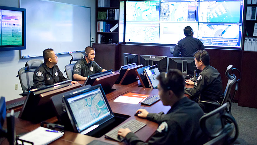
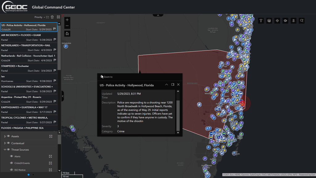
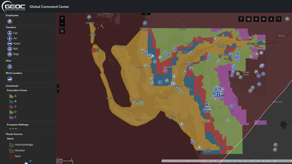
In the town of Hollywood Beach, Florida, an alert appeared in Lockheed Martin’s Global Emergency Operation Center. Nearby, police were responding to a shooting, the threat perimeter encompassing Lockheed employees and assets. Within moments, Lockheed’s team could visualize the event, identify the employees and assets at risk, and assess the immediate actions needed. This rapid response wasn’t magic; it was the power of Esri’s ArcGIS, driving the innovative Global Command Center application at Lockheed Martin.
Staying Ahead in a Dynamic World
Lockheed Martin is no stranger to the limelight, known globally for pushing boundaries, delivering needed solutions, and creating advanced technology. With over 120,000 employees in 350 facilities across 40 countries, it also bears a colossal responsibility: ensuring the safety and security of each individual. This mission is amplified by the unpredictable global landscape, punctuated by hazards ranging from natural disasters to human-made crises.
In 2014, faced with an increasingly volatile global landscape, Lockheed Martin took a proactive step to address these emerging challenges. It unveiled the Global Emergency Operation Center, or GEOC. This state-of-the-art center wasn’t just a response mechanism—it was a beacon of Lockheed Martin’s commitment to its vast workforce. Strategically designed, the GEOC became a nexus for collecting critical intelligence from myriad sources. But it went beyond mere data collection. It was built to analyze this inflow of information, transform it into actionable insights, and then spread this knowledge swiftly across Lockheed’s global network. The paramount function, however, was its capacity to provide immediate assistance to Lockheed Martin’s employees, wherever they were, ensuring their safety during uncertain times. This center not only fortified Lockheed Martin’s operational resilience but also underscored its unwavering commitment to its greatest asset: its people.
Harnessing the Power of Esri’s ArcGIS
The creation of the GEOC was certainly a significant step in this security mission. Lockheed Martin, with its foresightedness, recognized the escalating demands of real-time data and the indispensable requirement of a tool that could offer a broad view of global risks, map threats to their assets, and facilitate quick action. With such a need in mind, Lockheed turned to Esri, the leader in location intelligence and GIS solutions, and ArcGIS.
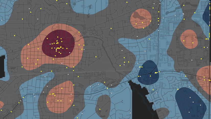
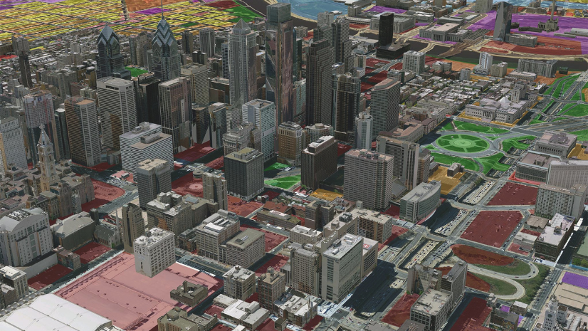
Taking advantage of the multifaceted capabilities of ArcGIS, Lockheed’s dedicated team of GIS professionals conceptualized and brought to life a custom Global Command Center. In doing so, Lockheed was able to visualize an exhaustive list of internal assets, ranging from sprawling facilities to employees in transit, and relate them seamlessly against looming external threats. By integrating sources from the National Weather Service to private data companies, Lockheed Martin is now able to cast a vast, protective safety net that is always alert and responsive.
This real-world translation of technology is nothing short of spectacular. Whether it is a tragic train accident in the Netherlands or the ferocious onslaught of category 4 Hurricane Ian bearing down on Florida, Lockheed Martin’s GEOC, supercharged by ArcGIS, showcases an unmatched ability to identify potential impacts; assimilate critical data streams; and trigger swift, life-saving responses to prioritize and safeguard employee well-being.
Empowering Decision-Makers
One of the distinguishing facets of Lockheed Martin’s Global Command Center, backed by ArcGIS, is its unmatched ability to empower decision-makers with real-time data. In an era where information is power, the ability to decipher and act on critical data points as they emerge can mean the difference between proactive management and retroactive mitigation. The detailed visualizations and comprehensive situational awareness facilitated by ArcGIS give Lockheed Martin the ability to discern patterns, predict outcomes, and strategize solutions faster and more effectively. This readiness isn’t just a technical marvel; it’s a human-centric approach to safeguarding every individual under Lockheed’s umbrella.
But the brilliance of this partnership goes beyond the immediate power of technology. It lies in fostering a collaborative ecosystem. By assimilating data from diverse sources and leveraging the efforts of local and state governments, Lockheed Martin’s GEOC serves as a testament to the power of collective intelligence. Such collaboration underscores that in today’s interconnected world, securing people, assets, and interests requires not just advanced tools but also a cohesive, global effort. This holistic approach amplifies resilience, ensuring that crises can be weathered not just by one organization but by interconnected communities and organizations.
Reimagining the Future of Safety
With alerts assessed, potential threats visualized, and swift actions taken, Lockheed Martin and ArcGIS are redefining the paradigms of global security protocols. But beyond the immediacy of crisis response lies a vision for the future—a world where predictive analytics, combined with geospatial intelligence, paves the way for minimizing risks before they even emerge. The convergence of Lockheed Martin’s forward-thinking ethos with Esri’s geospatial technology and knowledge hints at a future where safety and security transcend reactive measures, evolving into a realm of predictive protection. This partnership shines as a beacon, showing what’s achievable when dedication to personnel security converges with technological innovation. The world is indeed safer when giants like Lockheed Martin chase excellence while putting its vast family of employees first—always.
To learn more, watch Lockheed Martin’s full presentation from the 2023 Esri User Conference: