On July 18, 2024, the Federal Communications Commission (FCC) adopted a new set of rules that impacts the deployment of Next Generation 911 (NG911) across the United States. In one of the most significant actions the FCC has taken in support of NG911, PS Docket 21-479, Facilitating Implementation of Next Generation 911 Services (NG911) Report and Order, will allow 911 authorities, for the first time, to compel Originating Service Providers (OSPs) to send them NG911 IP-native calls instead of legacy Enhanced 911 (E911) calls. This will allow 911 authorities to finally decommission aging E911 technology. This has significant implications not just for NG911 but for geographic information system (GIS) technology as well. Let’s explore why.
What is NG911, and how does it use GIS?
To better understand the impact of the FCC’s Report and Order, we must first explore legacy E911 and how NG911 improves the reliability of 911 service and expands its reach. This includes not only accessibility to 911 itself but also the value it brings to first responders.
The first 911 call was made in Haleyville, Alabama, on February 16, 1968. Since then, the telephone systems supporting 911 calls have seen limited changes. While some enhancements were introduced to share caller and location information with 911 Public Safety Answering Points (PSAPs), the legacy E911 system has struggled to keep up with modern expectations like video calling and improved accessibility for diverse language and hearing needs.
NG911, on the other hand, is a cutting-edge IP-based system designed to address these limitations. It is composed of hardware and software with standardized interfaces, along with standardized data formats and support for rich, configurable policies. NG911 processes a variety of emergency call types, integrates detailed call data to help staff make intelligent routing decisions, and facilitates seamless communication between different public safety entities. By enabling interoperability among disparate 911 networks, NG911 transforms the current isolated PSAP landscape into a connected system where emergency communications flow smoothly across jurisdictions.
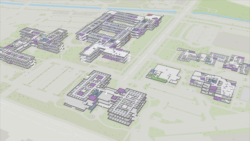
GIS is a foundational component of NG911. In NG911, OSPs use GIS data to prevalidate caller locations to ensure that 911 calls will route correctly and that GIS data is used to route 911 calls to the appropriate PSAPs. In E911 systems, tabular Master Street Address Guides (MSAGs) and selective routers are used for call routing. Meanwhile, in NG911, GIS data is used by Location Validation Functions (LVFs) to guarantee location validity and with Emergency Call Routing Functions (ECRFs) to geospatially route calls in real time, using device location and GIS data like site/structure address points, road centerlines, and PSAP emergency service boundaries. This GIS data is provided by local 911 authorities that work with their corresponding GIS departments to create and maintain the GIS data required to support 911. This data—locally authoritative and considered the gold standard of addressing—powers much more than just geospatial call routing in NG911. It also enables interoperability, additional data discovery, and access to authoritative GIS data across jurisdictional borders. GIS extends the reach of 911 into the field as well. When coupled with mission-critical, resilient public safety broadband networks, first responders can be equipped with a true shared common operating picture—powered by high-quality, up-to-date GIS data that works across jurisdictional lines—and see the same maps at the same time to provide effective coordinated response.
What is the FCC’s Report and Order, and how does it impact NG911?
The FCC’s Report and Order will allow 911 Authorities, when they are ready, to request the delivery of IP-native calls from OSPs to demarcation points established by the 911 Authorities themselves. Report and Order covers a defined set of OSPs: wireline providers, wireless providers, covered text providers, interconnected VoIP providers, and Internet-based Telecommunications Relay Service providers. There are two implementation phases defined in Report and Order, and their distinction is very important, especially to GIS professionals who support emergency communications.
In Phase 1, when a 911 Authority is ready to receive native NG911 calls, it can request “delivery of 911 traffic in IP-based Session Initiation Protocol (SIP) format to one or more in-state NG911 Delivery Points designated by the 911 Authority.”* This is the first stage in getting NG911-native SIP emergency calls delivered to a state’s Emergency Services IP Network (ESInet). OSPs have a limited amount of time to comply with the request: 6 months for major carriers and 12 months for minor carriers, though longer if an OSP and the 911 Authority agree to an extended time frame. In Phase 1, there are no requirements for call location to be conveyed in a NG911-native format. Likely, locations will be formatted just as they are in E911, with abbreviated street name components, MSAG communities, and other attributes as seen today in E911 Automatic Location Identification (ALI) data.
In Phase 2, when a 911 Authority is ready, it can request “delivery of 911 traffic . . . in an IP-based SIP format that complies with NG911 commonly accepted standards,”* including location in Presence Information Data Format—Location Object (PIDF-LO). For GIS professionals who support 911 Authorities, this is very important. According to Report and Order, “Phase 2 will facilitate the full use of the functional elements of NGCS [Next-Generation Core Services], including LVF.”* This means that, for the very first time, OSPs will be required to deliver true NG911-native location data, which by its nature must be validated against authoritative GIS data.
At each phase, 911 Authorities must prove they are ready before issuing requests to OSPs. Readiness at Phase 1 involves, for example, having infrastructure capable of receiving IP-based SIP 911 traffic; proving it has an ESInet provider, NGCS provider, or Customer Premises Equipment (CPE) provider that can conduct connectivity testing; identifying the designated NG911 delivery point(s); and proving it can submit a valid request. At Phase 2, 911 Authorities must prove, before issuing requests to OSPs, that they have additional capabilities such as an ESInet that is connected to fully functioning NGCS with access to LVF and Location Information Server (LIS) services.
What does the FCC’s Report and Order mean for GIS in emergency communications?
Phase 2 of Report and Order calls for the use of NG911-native call location, which unlocks a host of benefits—not limited to improved call routing. Because civic locations will be validated against authoritative GIS data—the same data used within call handling and computer-aided dispatch (CAD) systems in the PSAP, as well as mobile CAD systems in the field—the same address used for routing an emergency call can be guaranteed to be valid and consistent across all public safety systems that use that GIS data. This is true even when the address contains subaddress elements, which cannot be validated in E911 systems that use MSAGs. Other applications like 911 call logging and analytics solutions, records management systems, and even national incident reporting databases like the National Emergency Response Information System (NERIS) will benefit from having the same representations of the authoritative addresses captured in GIS, making reporting and analytics significantly more effective and powerful.
Report and Order helps enable the accelerated deployment of NG911’s location-based benefits like never before. However, the pace of deployment is ultimately controlled by 911 Authorities and their ability to fund the upgrades they need. For that reason, NG911 deployments may not reach Phase 2 and use GIS-validated civic locations for some time.
Nevertheless, sooner than you may have thought, your authoritative address data will become truly mission critical. OSPs will use your GIS data via the LVF to validate NG911 civic locations, and it will also be used by the ECRF to route live 911 calls. For you as a GIS professional, this means that, importantly, the authoritative address data you create and maintain on a daily basis will control the validity of OSP location records. You, not they, will be in ultimate control of the authoritative representation of an address. You will be called upon to resolve discrepancies between your authoritative addresses and those maintained by the OSPs when their location validation queries fail. This may have a significant impact on OSPs, since their location records are often their customer addresses and are used not only for 911 but also within their billing and other administrative systems.
Especially at the onset of Phase 2, there may be many location records that fail validation. This will happen most often when VoIP service providers validate their location records, and whenever location records with subaddresses (building, unit, floor, room, and so on) are validated. The benefits that Phase 2 of Report and Order brings forth will require modifications to your workflows (involving more OSPs than before) and may require a large amount of data remediation work. Even if that work is done by an OSP to correct its location records, you will have to help OSP staff understand what they must change so that their addresses validate properly.
What else might change in the future?
The FCC has proposed new rules to enhance NG911 location accuracy, interoperability, and resiliency, including augmenting the Global Positioning System with alternative positioning, navigation, and timing technologies. If adopted, these rules will emphasize the importance of accurate and authoritative subaddress information. Managing subaddress data in GIS, particularly for indoor spaces, will enable 911 systems to estimate dispatchable addresses of emergency callers, helping first responders navigate to incidents more quickly than if they only have a street address without building, floor, and room details.
What can you do now?
While it may be a few years until 911 Authorities implement Phase 2 of Report and Order, time goes by quickly. You should start thinking about the work that lies ahead. If you’re unfamiliar with NG911 standards such as the NENA Standard for the NG9-1-1 GIS Data Model and the NENA Next Generation 9-1-1 United States Civic Location Data Exchange Format (CLDXF-US) standard now is a good time to start brushing up on them. Refreshing your knowledge of NENA best practices, such as the ones in the NENA Information Document for GIS Data Stewardship for Next Generation 9-1-1, is advisable as well.
Before the 911 Authority you support reaches Phase 1, start evaluating the completeness and accuracy of your addressing data. Make sure you’ve accounted for all road centerlines and site/structure address points within your jurisdiction. Also, if you have not yet embarked on converting your addresses to the CLDXF-US standard, now is the perfect time to begin that work. You should also ensure that synchronization between your addressing data and the records maintained in ALI databases and your MSAG is 98 percent or better.
Then, before Phase 2, get prepared for data remediation work. This will be the first time your data will participate in NG911 LVF validation. Determine what OSPs will validate: Will they only validate thoroughfare addresses at first, or will they validate subaddresses as well? If they will not be validating subaddress elements initially, figure out when they plan to, since there will likely be a significant amount of fallout and remediation work needed to resolve those errors. And, if possible run comparisons between your GIS data and as many OSP location databases as you can. That way, you can get ahead of validation problems as early as possible.
Lastly, if your GIS data lacks subaddresses for the facilities that have them, start thinking about how you will capture and maintain them. Any building or campus with a Multi-Line Telephone System (MLTS) or a VoIP phone system will likely have its interior spaces addressed, and that information will be stored within OSP or MLTS location databases. However, it is common that no corresponding subaddress data exists within GIS. NG911 address validation will require it, so look for ways you can obtain it more easily than mapping it all from scratch. Indoor maps, if built using GIS, can conveniently provide that data. Many states have enacted school safety initiatives that require mapping their K–12 schools; those efforts can be a springboard for capturing and maintaining subaddresses for those facilities. Even if you are years away from validating subaddresses, start planning as soon as possible.
Above all else, know that the decisions you make when creating and maintaining your authoritative addressing data will impact how well NG911 functions within the jurisdiction you support. Your decisions will also impact the OSPs that serve the people within your jurisdiction. The earlier you prepare, the easier the transition to Phase 2 will be, and the faster the people you serve will realize the additional benefits of NG911 that Report and Order unlocks.
To learn more about the benefits of GIS and how it supports emergency communications, from NG911 to response in the field, go to our website.
*Federal Communications Commission. PS Docket 21-479, Facilitating Implementation of Next Generation 911 Services (NG911) Report and Order. Washington, DC: Federal Communications Commission, 2024. https://docs.fcc.gov/public/attachments/FCC-24-78A1.pdf.
About the author