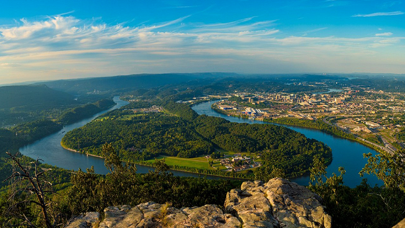
I am going to be very direct. Parks are the lifeblood of our communities in so many ways, and their importance will continue to increase into the future, which justifies the need for smart operations. Parks and recreation deliver considerable value related to mitigating our major challenges:
- Parks and recreation facilities are a key part of economic development initiatives – economic development is listed as the number one priority for US mayors in the National League of Cities State of the Cities report for 2024. In it they list increased green and sustainable development (bike lanes, parks, green spaces, etc.) as one of the most utilized strategies by mayors to address economic development challenges.
- The increase in park and recreation use since the COVID-19 pandemic – as this recent National Recreation and Park Association (NRPA) article states, there is “…a new normal that makes public parks, plazas and recreation facilities more important to people than ever.”
Parks and recreation facilities play a pivotal role in climate sustainability and resilience:
- Carbon sequestration – one way to reduce the amount of carbon dioxide in the atmosphere to help slow down climate change, is to increase the number of plants.
- Green/Natural Infrastructure – there is an increased effort in designing and deploying green and/or natural infrastructure to assist in mitigating various challenges like flood protection, water and/or air filtration, nonpoint source pollution, etc. Parks play a key role in these solutions.
- Heat mitigation – as the earth’s temperature continues to increase, one of the primary ways to battle this is to plant more trees and expand our parks.
- Conservation – protecting, maintaining, and restoring our species, their habitats, and the related ecosystems is increasingly important as our population and its effects on the planet continue to grow and parks and recreation facilities are at the forefront of this battle.
- Health – parks and recreation facilities play a vital role in providing places for people to work on their physical and mental wellbeing.
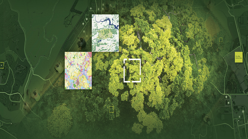
Park and recreation facility management is a location-based business. GIS is the mission-critical enterprise IT system for understanding all park operations across your entire community, from equitable distribution of services, to planning and design, effective operations, and leveraging parks for climate adaptation strategies. GIS gives your park and recreation management the geospatial advantage.
Park and recreation professionals apply GIS to the following focus areas:
- Planning & Design
- Smart Operations
- Education & Outreach
- Community Health & Well-Being
- Equity
- Climate Resilience
What does Smart Operations mean? This is 2024, nobody managing park and recreation facilities should be doing so with paper, or related digital versions such as spreadsheets and PDFs. Agencies have and continue to invest millions of dollars into these facilities, it is justified to invest in more advanced technology for protecting them and extracting the most value from that significant investment. It is time to take advantage of well-established technologies like GIS to support parks and recreation.
With Smart Operations powered by GIS, park and recreation professionals experience new efficiencies, more proactively manage their assets, and deliver a higher level of service. GIS transforms operations and maintenance activities into real-time streams of information used to establish more accurate situational awareness for better data-driven decision-making.
GIS can integrate with other mission-critical enterprise systems like work order and asset management, finance, sensor networks, and customer service to provide a comprehensive, up-to-date view of your operations in a geographic context. This holistic view includes incorporating artificial intelligence for better preventative maintenance and automated data collection and analysis.
Park and recreation professionals use GIS to:
- Enable a holistic and proactive approach to real-time, sustainable park and recreation asset lifecycle management.
- Improve levels of service to the public by decreasing response time for service requests
- Provide digital maps and apps to mobile workers and other stakeholders for improved field work efficiency, accountability, and safety.
- Automate workflows and increase insight through artificial intelligence for predictive maintenance of park and recreation assets.
- Analyze asset distributions across park service area for equity considerations like age, equipment type and use.
Smart Operations with ArcGIS In Action
The City of Eugene, OR Deploys GIS to Efficiently Restore Normalcy During Severe Ice Storms – Learn how the Eugene, OR used what they call “mission-critical technology” to replace handwritten lists and printed paper maps, better preparing them for emergency response during ice storms. On August 15th, the Eugene Public Works Parks and Open Space (POS) team will join the Next-Generation Public Works Powered by ArcGIS Webinar Series to talk about how they are blazing a trail to smart parks.

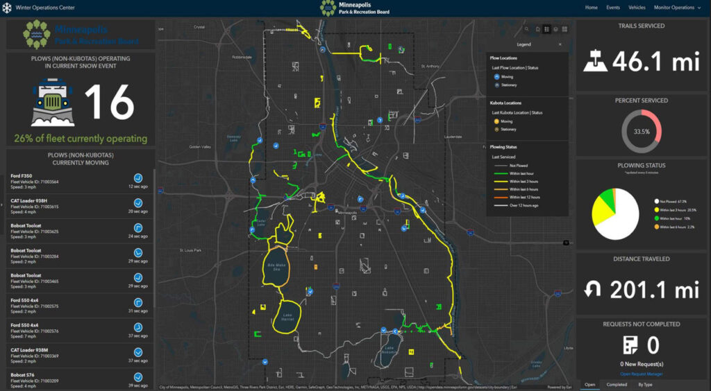
The Minneapolis, MN Park and Recreation Board Leverages Winter Weather Solutions to Improve Trail Plowing Activities – Learn how MPRB uses ArcGIS for a holistic view of operations and has streamlined snowplowing both in the field and the office. The real-time data has allowed MPRB to work proactively, respond to plowing needs live in the field, and transparently communicate with the public.
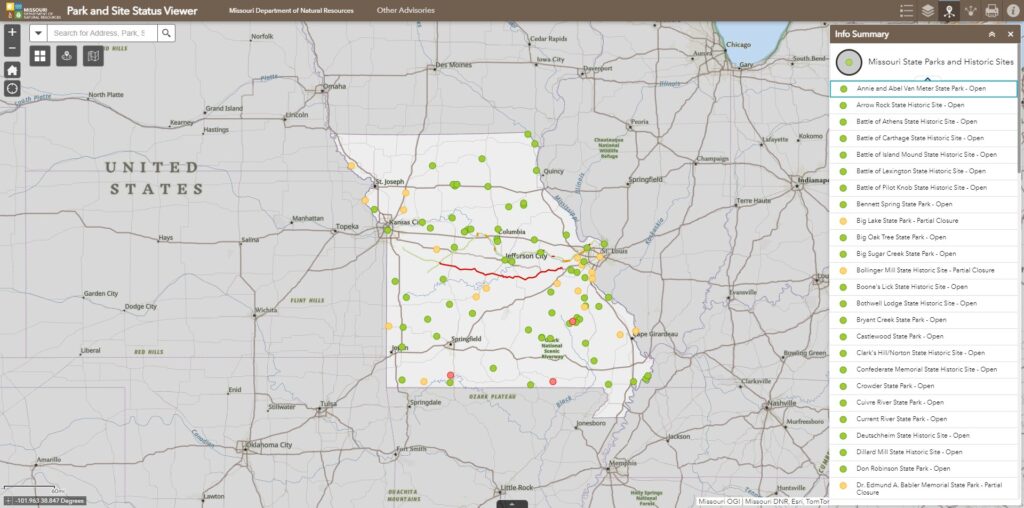
Missouri State Parks Implements a Central Asset Management Program – Learn how Missouri State Parks use ArcGIS to organize all their geospatial data in a central asset management program and streamline how they track assets in ninety-one state parks. Park regions are now able to plan and prioritize repairs and replacement efforts.
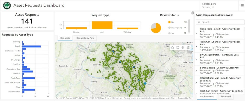
In Maryland, Montgomery County boasts a complex park system that includes 419 parks across 38,000 acres. These parks include campsites, facilities, and trails–complex infrastructure that requires inventory, oversight, and maintenance. To manage these park assets and amenities, Montgomery County has turned to GIS. Data collection on park assets and their attributes is achieved using ArcGIS Survey123 and ArcGIS Field Maps. ArcGIS Instant Apps facilitate review and collaboration across all park operations staff, including engineers, asset inspectors, and more
Parks are a critical part of our society and communities. Their importance is higher more than ever and will continue to increase. The time is now to provide modern resources to manage their operations. GIS is the technology designed to help park and recreation professionals maximize the impact they and their facilities can make on their community.
Follow the lead of your peers and implement GIS-based solutions to turn your operations into smart operations. Visit our new Planning Parks and Recreation for the Next Generation website to learn more!