Welcome to the world’s largest gathering dedicated to Geographic Information Systems (GIS)! The Esri User Conference, taking place from July 15th to 19th in San Diego, California. Themed “GIS—Uniting Our World,” this conference highlights the power of geography as a universal language to cultivate inclusivity, collaboration, and holistic problem-solving. Join us as we explore how leveraging the common language of geography empowers individuals and organizations to make a meaningful difference on a global scale.
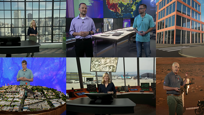
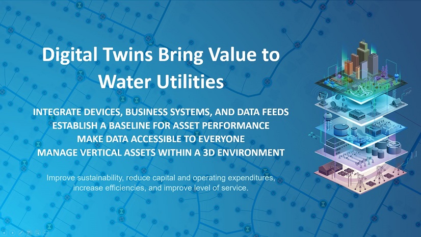
A digital twin, built on GIS technology, emerges as the most versatile and comprehensive form of digital twin as technology evolves. It acts as a central hub for aggregating data from various sources, including sensor networks and IoT devices, all tied together by their common attribute: location. This interconnected data offers decision-makers valuable insights into critical locations through the universally understood visual language of maps, enabling them to determine patterns, connections, and relationships.
By leveraging location intelligence, leaders seamlessly integrate geospatial digital twins into their decision-making processes, offering a space to explore ideas without investing significant time, money, or disrupting projects. It provides leaders with essential information for decision-making and action, while also facilitating operations monitoring, allowing for the observation of current states or changes over time, leading to the emergence of effective strategies.
As you prepare for the 2024 Esri User Conference, this blog will guide you in navigating and maximizing your experience by highlighting Digital Twin-focused sessions and activities. It provides a curated selection of sessions on digital twin technologies, special interest groups, partner presentations, and customer showcases, ensuring you make the most of this event.
Agenda Highlights
- Esri Showcase
- Special Interest Group Meeting
- Customer Sessions
- Esri Demonstration Sessions
- Partner Demonstration Sessions
- Technology Workshops
- Registering to Attend
Esri Showcase
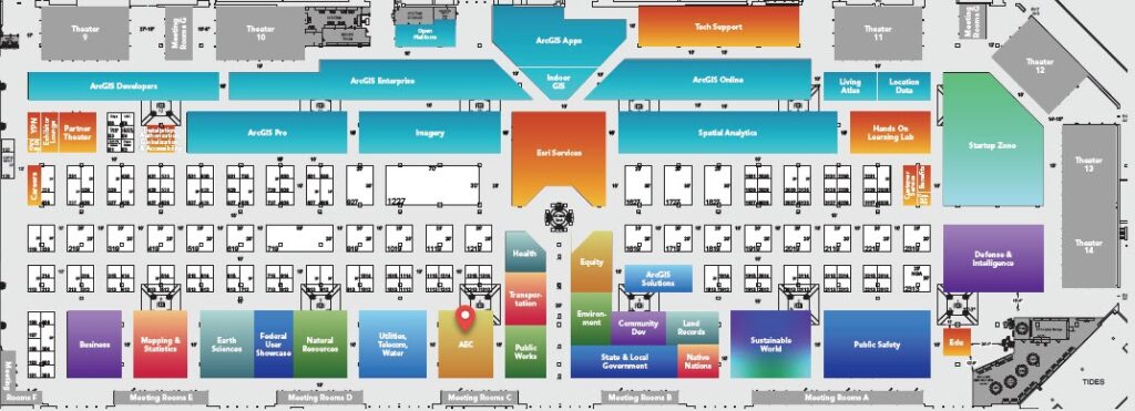
If you will be joining us at the San Diego Convention Center, you can find the dedicated product areas and a focused infrastructure zone on the main show floor(Ground Level, Exhibit Halls A/B/C/D). Visit us to speak with industry and product experts, see demonstrations, and learn more about creating a connected Digital Twin across all infrastructure Industries.
Infrastructure Showcase Hours
The Esri Infrastructure Showcase is in exhibit halls A/B/C/D on the ground level of the San Diego Convention Center (SDCC).
Tuesday, July 16: 9:00 a.m. — 6:00 p.m.
Wednesday, July 17: 9:00 a.m. — 6:00 p.m.
Thursday, July 18: 9:00 a.m. — 4:00 p.m.

Special Interest Group Session
Digital Twin SIG
- Thursday, July 18, 11:30 a.m. — 12:30 p.m.
- SDCC— Ballroom 6 DE
- Special Interest Group Meeting
Attend this SIG to meet and engage with other users who are focused on deploying Digital Twins in their industry. Esri will have experts on site to hope facilitate conversations and connect you with like minded peers.
Micah Micallough, Esri
Please take a moment to fill out this survey before this session begins. Your responses will help shape our conversation and allow you to share your insights.


Customer Sessions
Preserving Your Community by Planning for the Future
- Tuesday, July 16, 8:30 a.m. — 9:30 a.m.
- Marriot—Grand Ballroom 11
- User Presentation
How do planners address climate change and preserve communities? Planners are integrating digital twins into scenario planning to make data driven decisions that best serve the needs of communities. Communities across the world are prioritizing GIS to address sea level rise, redevelopment challenges, and preserving community character. Learn how GIS solutions have been used to plan for the future and enable community leaders to visualize multiple scenario impacts.
Husam A Samman, Infrastructure Planning Department- Ministry of Municipality | Tech-Driven Renaissance: Magna’s Historic District Revival, Great Salt Lake Municipal Services District
Leveraging Digital Twins
- Tuesday, July 16, 1:00 p.m. — 2:00 p.m.
- Marriott— Grand Ballroom 10
- User Presentation
Don’t miss this opportunity to learn best practices and practical tips for leveraging ArcGIS in your organization’s digital twin initiatives. Join industry experts and revolutionize your approach to asset management and planning. Discover the power of ArcGIS in driving innovation and unlocking the full potential of digital twins across industries.
Gord Reynolds, Infrastructure Ontario | Alois Brunel, Deepomatic | Stephane Guindolet, Altice France
GIS Solutions in AEC: From Digital Twins to Facility Asset Management
- Wednesday, July 17, 1:00 p.m. — 2:00 p.m.
- Marriot—Grand Ballroom 10
- User Presentation
Discover how GIS applications address business challenges in facility design, construction, and operations. The session starts with a case study using ArcGIS Indoors to explore the benefits of Digital Twins in the AEC industry. Next, learn how the Detroit Zoo utilized GIS to improve facility asset management. From mapping utility assets to integrating data, managing inventory, planning maintenance, allocating resources, and assessing risks, GIS provides precise location and attribute information for informed decision-making.
Robert Mabe, Spalding DeDecker | Suzanne Manhire, GSA Pacific Rim Region
Visualizing Data and Improving Stakeholder Decision Making with Precision
- Wednesday, July 12, 1:00 p.m. — 2:00 p.m.
- Marriott— Grand Ballroom 6
- User Presentation
A streamlined approach to manage a collection of regional data improves stakeholder engagement and helps ease the process for decision makers to understand the impact of urban scenarios. Learn how creating digital twins has transformed the way cities across the world are envisioning and designing urban development.
Dan Meehan, Houseal Lavigne | Cody Ferguson, Montana Department of Commerce

Esri Demonstration Sessions
ArcGIS 3D Analyst: 3D Feature and Surface Analysis
- Tuesday, July 16, 4:00 p.m. — 4:45 p.m.
- SDCC— Expo Demo Theater 9
- Demo Theater Presentation
How do different 3D data types help to solve problems? This presentation demonstrates how to use lidar data, 3D feature analysis, and surface analysis tools to develop digital twins, create asset inventories, maintain protected sightlines, and examine shade equity.
Khalid Duri, Esri | Jinwu Ma, Esri
Building Broadband Networks in an Immersive Era
- Wednesday, July 17, 2:30 a.m. — 3:15 p.m.
- SDCC— Expo Demo Theater 13
- Demo Theater Presentation
Building communications networks has never been more needed or more complex. Join us to learn how to use ArcGIS technology to modernize the network planning and build-out process in an immersive era of 3D maps and digital twins. See in action how ArcGIS streamlines the process of analysis-driven decision-making.
Eileen Kelsey, Esri | Patrick Ryan, Esri

Partner Demonstration Sessions
usBIM.geotwin: The Seamless Integration of openBIM, GIS, and AI
- Thursday, July 18, 9:15 a.m — 9:45 a.m
- SDCC— Expo Partner Presentation Theater
- Partner Presentation
The seamless integration of openBIM, GIS, and AI technologies, revolutionizing the creation of geospatial Digital Twins and Smart Cities.
Alfonso Perna | ACCA software S.p.A

Technology Workshop Sessions
ArcGIS: How to Create a Digital Twin
- Wednesday, July 17, 8:30 a.m. — 9:30 a.m. | SDCC — Room 16 AB
- Thursday, July 18, 10:00 a.m — 11:00 a.m. | SDCC — Room 15 AB
- Technical Workshop
Digital twins are everywhere, but how do you build one within the ArcGIS system? This presentation highlights the different phases of building a digital twin, including subsurface assets, ground elevations, and visualizing the natural and built environments while connecting to real-time data sources.
Brian Baldwin, Esri | Michael Gould, Esri
ArcGIS Urban: Creating the Planning Digital Twin
- Wednesday, July 17, 2:30 a.m. — 3:30 a.m.
- SDCC—Room 30 AB
- Technical Workshop
The term “digital twin” is everywhere these days—but what is a digital twin? And what is the role of GIS in implementing digital twins in your urban planning work? Join us to learn how ArcGIS Urban helps you build a foundation for your planning digital twin, answer essential questions, and represent the future of communities in realistic and immersive experiences.
Christine Ma, Esri | Brooks Patrick, Esri
ArcGIS Reality: An Overview of Reality Mapping
- Tuesday, July 16, 10:00 a.m. — 11:00 a.m. | SDCC — Room 31 ABC
- Wednesday, July 17, 8:30 p.m — 9:30 p.m | SDCC— Ballroom 6CF
- Technical Workshop
Do you want accurate digital representations of the physical world in your mapping workflows? This presentation shows how ArcGIS Reality enables you to generate accurate and up-to-date 2D and 3D data products from drone, aerial, or satellite imagery and how these products enhance your GIS and create a foundation for digital twins. Explore the apps that support reality mapping within ArcGIS and the Reality Engine and its outputs. Presenters provide an overview of the workflow and present common uses for the generated data.
Camilio Cortes, Esri | Jonah Hall, Esri | Jorge Nieto, Esri
Digital Twin Resources
Interested in expanding your knowledge further? Download our latest Digital Twin Ebook and Digital Twins Resources brochure to learn how other users have leveraged GIS to develop their organizations’ Digital Twins and discover practical applications of our products.
Service Appointments
If you are looking for guidance and feedback on how best to design, implement, and strengthen your organization’s geospatial solutions. From July 16-18, we are offering in-person attendees the opportunity to connect one-on-one with Esri experts through service appointments.
Sign up for an appointment by choosing your appointment type and completing the form. An Esri staff member will follow up with you to schedule your appointment. Please note that while appointments are complimentary, availability is limited and we are currently offering one appointment per in-person attendee.
Join us at the 2024 Esri User Conference
Register today to attend in-person, virtually with digital access, or for the plenary only.