ArcGIS Image for ArcGIS Online

Included with ArcGIS user types

Imagery hosting, streaming, and analysis in the cloud

Go to purchase options

ArcGIS Image for ArcGIS Online allows you to host, analyze, and stream imagery and raster collections. Save on infrastructure costs and maintenance using a secure, scalable, and performant cloud environment that quickly integrates imagery into all of your workflows.

Simplify the way you work with imagery

Follow an end-to-end demonstration that shows how you can make decisions with up-to-date GIS data created from aerial, elevation, and lidar data.

Play the video
A laptop monitor displaying a pink contour map with analysis options, overlaid with an image of the featured video presenter

What can you do with ArcGIS Image for ArcGIS Online?

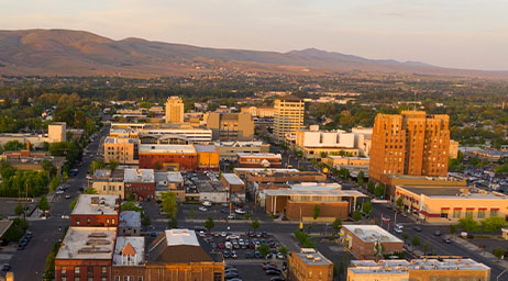
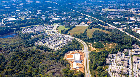
Make imagery accessible

Scale imagery and raster data so hundreds or even millions of people can interact with them at the same time. Stream imagery of large construction sites, cityscapes, and entire regions, as well as post event imagery, rectified scenes, ortho mosaics, elevation, multidimensional or categorical rasters. Grant permissions to what can be consumed. 

Free yourself from infrastructure management

Host, analyze, and stream imagery and rasters without infrastructure. Meets your IT requirements including security, authentication, and privacy. ArcGIS Online provides logging and other advanced reports so you can keep up with your organization's activities. You can also integrate your organization-specific login.

Stay on budget as volumes of data increase

Save on infrastructure costs and maintenance using a secure, scalable, and performant cloud environment managed by Esri. The cost to store imagery is fixed, and there is no additional charge for accessing your tiled imagery, so even if the imagery goes viral your costs do not change. 

Simplify image management

Manage all your imagery and rasters with a simple four-step web experience. ArcGIS Image supports all forms of imagery and rasters, standard projections and multiple metadata sensors, and collection platforms. To ensure images are ready to use, the metadata associated with your imagery remains intact.

Image analysis in the cloud

Perform powerful image and raster analytic workflows at scale. Benefit from an intuitive web experience or opt for a rich ArcGIS API for Python that provides the flexibility to develop custom raster functions. Take advantage of our integration with open source AI tools and frameworks to perform pixel classification, object detection, and object classification.

How it works

Host imagery

Upload imagery and rasters into ArcGIS Online for secure storage and management.

Stream imagery

Stream intelligent tiled imagery that’s performant and analysis ready. Serve dynamic imagery that offers on-the-fly processing and dynamic mosaicking.

Analyze imagery

Make sense of imagery and raster collections to understand climate change, urban sprawl, agriculture production, and more.

Case Study

ArcGIS Image streamlines preservation efforts

United Kingdom-based National Trust uses ArcGIS Image for ArcGIS Online to host and share imagery that supports historical site preservation.

Read the case study

This app is included with ArcGIS user types

ArcGIS provides a comprehensive set of capabilities for creating, managing, analyzing, and mapping geographic information. Gain access to the capabilities of this application, included in ArcGIS, with user types. Match user types to roles within your organization.

Learn more about user types
Learn more about ArcGIS
A digital image of earth with blue water and green land with a series of round icons surrounding it

Purchasing options for ArcGIS

Esri hosted software as a service

Go to ArcGIS Online pricing

Self-hosted geospatial infrastructure

Go to ArcGIS Enterprise pricing

Talk to someone on our sales team

1-800-447-9778

7:00 a.m.–5:00 p.m., Monday through Friday (PT)

Chat online

Start a chat

Contact the sales team

Fill out the contact form