About GEO Jobe
GEO Jobe products are trusted and used by over 8,000 organizations globally. Our company is focused on developing solutions, services, and products for Esri's ArcGIS® ecosystem. We currently have some of the most popular products in the ArcGIS® Marketplace and would be happy to serve your organization with our professional service offerings.
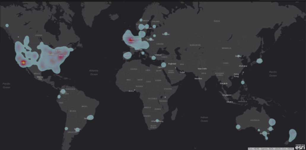
GEO Jobe Global Client Footprint and Influence
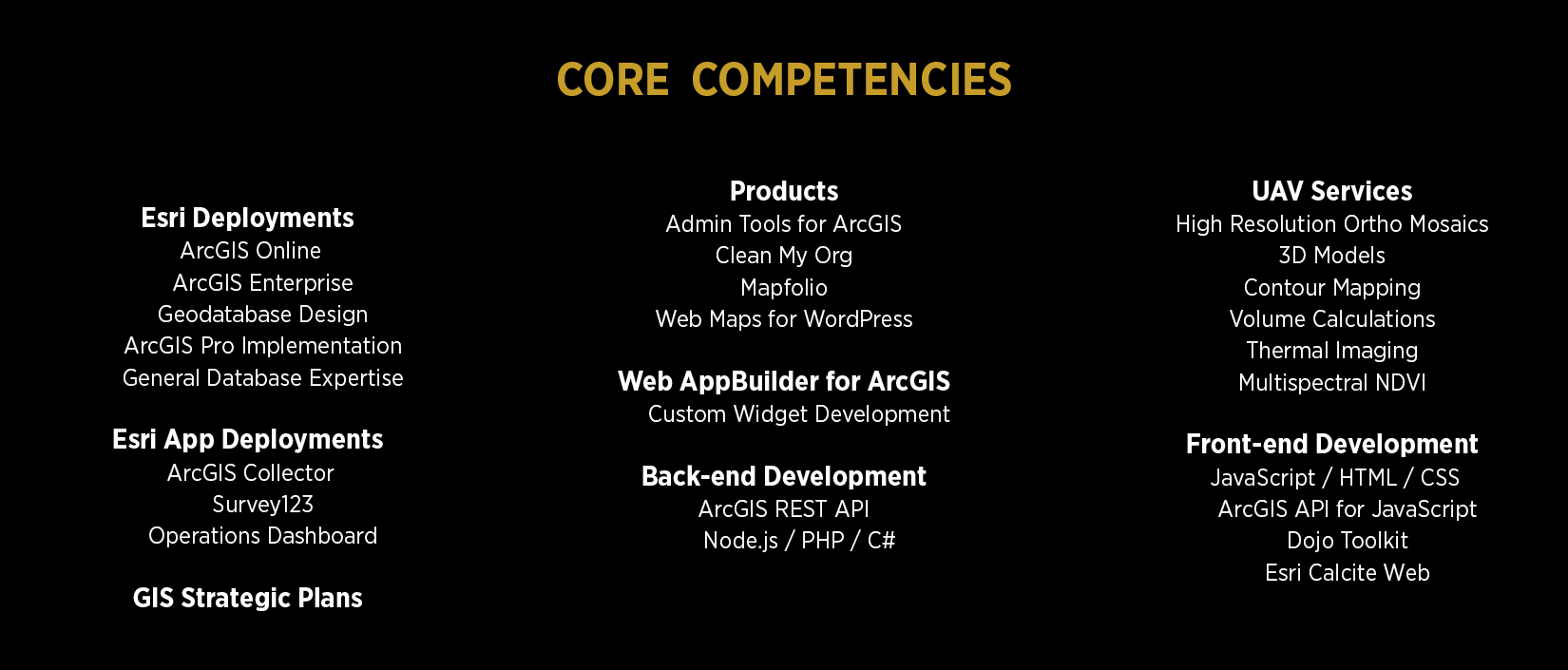
Custom Development
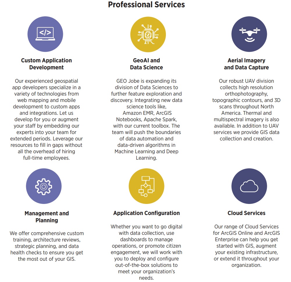
In-house development teams are not a viable solution for many businesses. The professional services software development team at GEO Jobe allows you to have easy access to development staff without the overhead.
Our team has decades of experience and success stories across multiple industries. While we are primarily focused on the Web GIS stack utilizing the ArcGIS® API for JavaScript, we also offer solutions such as custom python scripts/tools and custom ArcGIS® Pro add-ins.
Ever wish you had access to ArcGIS® capabilities while using other software? We have proven success integrating ArcGIS® with other platforms, including WordPress and Salesforce. Our full offerings include:
Web AppBuilder for ArcGIS®
· Custom Widgets
· Custom Themes
2D and 3D standalone Web Applications
· Data Review
· Analysis
· Public Engagement
· Custom Workflows
· Mobile Friendly
Configurable Application Templates
· Easily create multiple copies of an application each with different configurations directly within Portal.
Other items
· Custom Python Scripts / Tools
· Custom ArcGIS® Pro add-ins
· Integrating ArcGIS® with other software platforms
Have a software project you want to get off the ground? Let us help!
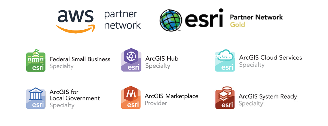 GEO Jobe Partnerships and Specialty Designations
GEO Jobe UAV
Whether you want to enhance your existing GIS with an up-to-date orthophoto, contours, and planimetrics or use a 3D point cloud and model for planning, the GEO Jobe UAV team can help. With our diverse set of platforms and sensors (fixed-wing and multi-rotor UAVs; thermal, 3D, and multispectral sensors), we are able to accommodate just about any project you can imagine...and with incredible accuracy! When you hire GEO Jobe to fly a site, you can expect the following of the data: a GSD of less than 1.25 inches; horizontal accuracy of less than 1 inch; and vertical accuracy of less than 1.5 inches.
While we are in the GIS business, we know people use other programs--and that’s okay! We regularly produce data for use in CAD programs, as well as GIS, depending on each client’s needs.
What exactly can we do for you?
Dense 3D Point Cloud: Bring this powerful dataset into your GIS or CAD program for all your planning needs. Take it a step further with a 3D model for a more realistic view!
Planimetric Feature Extraction: Edges of pavement, buildings, manholes...the list is endless! All in a file geodatabase or as a CAD file.
Contours: An essential component of any surveying project.
Thermal Mapping: Find out where you have leaky infrastructure. Keep the heat IN and the cold OUT!
Multispectral Mapping: Farmers, we’re here for you, too! See your crops in a different light with NDVI and other index maps to help improve your yield.
To request a free quote, head over to www.flythis.net.