Captivate your audience, make informed decisions, and tell your story like never before with briefings, a new presentation-style output of ArcGIS StoryMaps. With no design or coding knowledge needed, you can now create elegant and interactive slide-based presentations called briefings for succinct storytelling and offline sharing with ArcGIS StoryMaps. Next time you need to give a presentation, share slides with your dynamic maps, 3D scenes, embedded content, and more using briefings in ArcGIS StoryMaps.
Briefings is now available in ArcGIS Online and ArcGIS Enterprise 11.3.
Where Stories Unfold
ArcGIS StoryMaps is a digital storytelling tool for crafting and sharing an interactive narrative that can create awareness, influence opinion, and affect change. The easy-to-use builder allows you to weave together maps, 3D scenes, embedded content, video, photos, text, audio, and more into a modern and responsive digital story. It’s simple to publish stories and briefings as a standalone narrative or in a collection. Provide stakeholders with secure access to your ArcGIS StoryMaps content or choose to share it publicly via a link, an embed within your website, and across social platforms using built-in tools.
Elevate Your Presentations
With the introduction of briefings, ArcGIS StoryMaps is an even more comprehensive digital storytelling tool. While stories are designed for readers to immerse themselves in narratives, briefings offer a familiar, slide-based format to present key information. A briefing is ideal for those moments when you need to share concise, impactful information. You could even use a briefing to summarize a story.
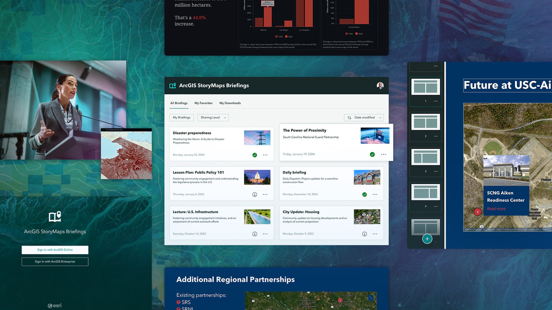
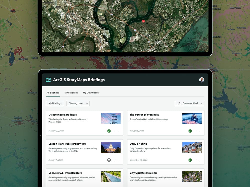
Explore a Sample Briefing
Esri helped the South Carolina National Guard create the below sample briefing on the Power of Proximity.
View this briefing in full-screen here.
Benefits of Briefings
In a constantly evolving world, having a tool to present dynamic maps and data enables your stakeholders to quickly synthesize information, facilitate meaningful discussions, and make informed decisions.
- Unify dynamic content into a seamless presentation: Briefings allow you to unify interactive maps, 3D scenes, ArcGIS content, embeds, images, and videos within a single, cohesive space. Instead of leaving your presentation to share from other platforms, in briefings, you can add dynamic content from multiple sources directly to your slides or in an attachment link that opens within the presentation.
- Captivate your audience with beautifully designed slides: A range of slide layouts within briefings help you create a structured and professional-looking presentation that demonstrates your storytelling skills. You can also leverage the power of ArcGIS StoryMaps themes to customize briefings with a click—there’s no need to style each element individually. Choose from a selection of beautiful, pre-designed themes or align briefings with your organization’s branding by creating your own in the guided builder.
- Inform stakeholders with accessibility built-in: No additional software or training is needed to create a striking presentation that follows the World Wide Web Consortium’s Web Content Accessibility Guidelines. Determine if a briefing is legible with built-in accessibility features; briefings supports keyboard navigation, alternative text, suitable color contrast, and semantic structure.
- Confidently share with simple and secure access: Share your briefings internally or externally via links or access briefings in the ArcGIS StoryMaps Briefings app to view and share on the go. Flexible sharing options help ensure that your content reaches your intended audience. With Esri’s robust security framework, your shared content remains secure.
- Effortlessly advance your slides: Finding the information you need has never been more straightforward. You can easily navigate through different slides using the built-in Table of Contents and link to other slides within a briefing to give your audience quick access to the information they need. Briefings are compatible with common presentation clickers, slide remotes, and keyboard arrows.
- Add or create interactive reference maps from the builder: Add authority to your briefing with an express map that can be created with the ArcGIS StoryMaps builder or choose from thousands of existing maps in ArcGIS Living Atlas of the World. With no additional tools or GIS knowledge, you can create or customize a map with built-in color schemes, labels, points of interest, and interactive elements such as popup windows.
- Present briefings anywhere, anytime, even offline: Share critical information with stakeholders without being limited by an internet connection. Present slides with your interactive maps and 3D scenes in a remote location, during emergencies, in sensitive environments, or even when traveling. The complementary ArcGIS StoryMaps Briefings app is now available for iOS and Android tablets and Windows computers and tablets.
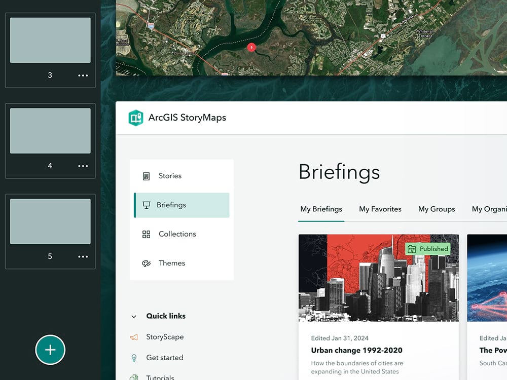
How to Access Briefings in ArcGIS StoryMaps
Getting started with briefings is as easy as creating a story or collection in ArcGIS StoryMaps. You can access briefings through your account if you’re part of an ArcGIS organization. Simply log in and navigate to the ArcGIS StoryMaps application in the app launcher. Inside ArcGIS StoryMaps, select briefings from the menu on the left and start crafting engaging presentations that will captivate your audience and drive impactful decision-making.
How to Access Briefings Offline
Having the right tool for your organization’s briefings is critical to keep your stakeholders updated wherever they are. By downloading your briefings to the new ArcGIS StoryMaps Briefings app, you can share information, no matter your location, even offline. The ArcGIS StoryMaps Briefings app is available for Android and iOS tablets and Windows tablets and computers. For more information on the app, please review this blog article.
Get Started
Get ready to tell your story like never before. Use briefings for your next presentation and demonstrate the power of location-specific connections with slides that put your dynamic maps and data front and center and can even be shared offline. If you have issues or suggestions, please share your feedback through the in-app feedback form or in the Esri Community.
- Get inspired: view sample briefings
- Learn path to create your first briefing
- Open briefings in the ArcGIS StoryMaps builder
- Present offline with the ArcGIS StoryMaps Briefings App
ArcGIS StoryMaps Briefings Builder Demo
This is Only the Beginning
We plan to release additional capabilities to enhance your experience of briefings in ArcGIS StoryMaps. Get product updates directly in your inbox by subscribing to our newsletter and explore updates to briefings in our What’s New in ArcGIS StoryMaps blog.
Please Note
This blog article was originally published on August 16, 2023, when briefings was released in beta in ArcGIS Online. It was updated on February 8, 2024, for the general availability release of briefings in ArcGIS Online. It was updated again on July 23, 2024 to share that briefings is available in ArcGIS Enterprise 11.3.


Article Discussion: