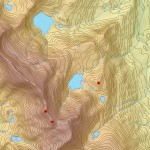
 The TopoToRaster tool is primarily used to create hydrologically correct digital elevation models (DEMs) from contour data. Additional input information such as spot heights, known locations of sinks, streams and the outline of lakes can also be used to further improve the quality of the output DEM.
ANUDEM is developed and maintained by the Fenner School of Environment & Society at the Australian National University. It calculates DEMs with sensible shape and drainage structure from a series of topographic data sets . TopoToRaster internally calls ANUDEM, which imposes some size constraints on the size of the output raster.
When TopoToRaster is run as a geoprocessing tool within ArcMap (pre ArcGIS 10.1), the output raster was limited to a size of roughly 5,500 columns by 5,500 rows, i.e. the output raster cannot have more than about 30 million cells. Increasing the amount of computer memory has no effect on the size of the output raster when using this version.
In ArcGIS 10.1 we’ve incorporated ANUDEM 5.3 in TopoToRaster. When running on Windows XP we are now able to generate an output raster of approximately 8,500 columns by 8,500 rows. If you have a machine running Windows 7 with more than 3GB of RAM you will be able to generate an output DEM of roughly 15,000 columns by 15,000 rows.
If TopoToRaster is run in ArcGIS 10.1 for Server on a machine with Windows 7 (64 bit) with 6GB of RAM you’ll be able to produce an output DEM of approximately 25,000 columns by 25,000 rows. Using ArcGIS for Desktop – Background processing (64 bit) at 10.1 SP1 you’ll be able to produce an output raster of similar dimensions.
The volume of input data, however, can also cause TopoToRaster to run out of memory. If your input features have many millions of input vertices it is advisable to split the area up into smaller regions.
Equally, if you require a larger output raster than is currently possible, splitting the area up into manageable chunks and running TopoToRaster using the MARGIN parameter is an effective solution. The output rasters can then be combined into a single raster via a Mosaic dataset or by using the CellStatistics, Mosaic or MosaicToNewRaster geoprocessing tools.

Article Discussion: