ArcGIS Pro Intelligence is built for intelligence analysts using maps, imagery, link analysis, timelines, and graphs to uncover patterns, trends, and relationships to inform decision-making. One of the key tools that we provide is the ability to understand and exploit movement data. At the 2.9 release of ArcGIS Pro Intelligence we introduced two new tools to help understand patterns and find relevant pieces of information within your movement data.
The first of these tools is Select Movement Tracks. This tool is designed select movement tracks that intersect an area of interest and can incorporate a temporal query to either before the track entered the Area of Interest (AOI), after it left the AOI, or both.
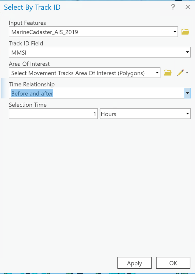
Getting started with the tool is straight forward as it can be found in the selection group on the Map tab under Select By Track ID. This will open the tool and you can begin to populate the input parameters. The Input Features represent a movement track dataset, and this needs to be time enabled to use the Time Relationship selection operations. The Track ID Field is what helps organize the data into the necessary tracks to conduct the analysis. For the AOI, you can either draw a feature or use an existing feature class. The Time Relationship specifies how you want to query the movement tracks. The options are either None (time is not considered), Before and after, Before, After. This allows you to see where a movement track was either before or after it entered the area of interest.
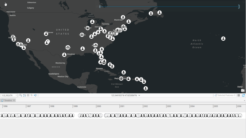
The output would look like this:
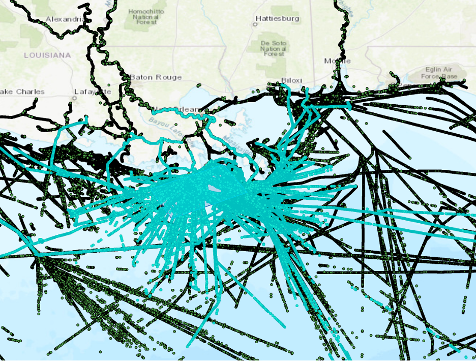
The Select Movement Tracks geoprocessing tool can help you understand where movement tracks are coming from or going quickly and efficiently.
The next tool that was introduced at the 2.9 release of ArcGIS Pro Intelligence was Find Frequented Locations. This tool was designed to help identify the pattern of life for a movement track dataset. This tool allows you to determine when and where a specific movement track was loitering across unique space-time intervals. The tool enables the user to provide a definition query to filter the movement tracks to help solve their specific problem. Additionally, users can supply a search distance, a minimum loiter time, and a time boundary. These parameters allow you to specify what constitutes a unique dwell at a given location that falls within a certain distance and time. The time boundary allows for the splitting of dwells that occur across the multiple days into multiple unique dwells to provide a more comprehensive view of the specific location. You can also specify the minimum number of dwells per location, normalization of the daily distribution, and the calculation of statistics on certain characteristics of the frequented locations.
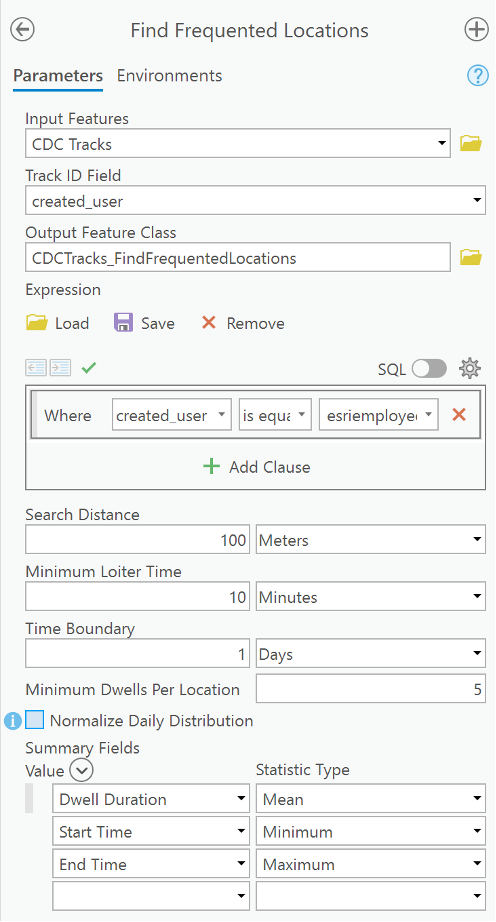
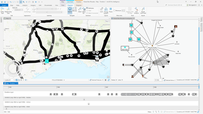
When the tool finishes running, it will give you a breakdown of what days of the week the location was active, the total number of times that the site was active, how long it was active for, and when it was first and last used.
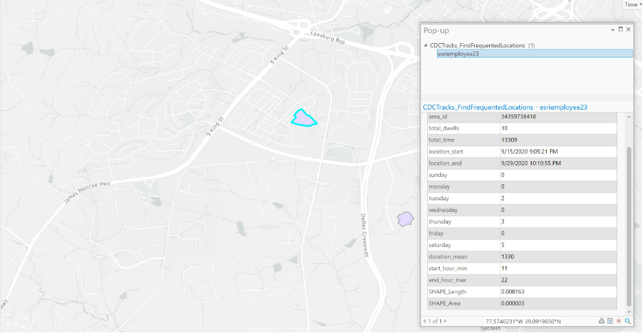
In this specific example you can see that this location was used a total of ten times, with the events split across Tuesday, Thursday, and Saturday. This tool and all of the other Movement Tools allow you to better understand patterns and trends inside your movement datasets to help you answer your investigative problems.
Stay in the Know
View more ArcGIS Pro Intelligence resources and sign-up for the newsletter to get the latest product announcements and resources.

Article Discussion: