Earlier in the year we introduced two new ArcGIS Location Services for developers: ArcGIS Static Basemap Tiles service and ArcGIS Elevation service. If you are an ArcGIS Location Platform developer, the services are currently available for beta testing through the Early Adopter Program (EAP). Learn more about the services and how to join the program below
ArcGIS Static Basemap Tiles Service (beta)
The Static Basemap Tiles service allows you to build mapping apps that display rasterized basemap tiles in PNG format. The service is ideal for client applications running on older web browsers or devices that do not support WebGL. The service API provides static tiles as 512×512 .png images. The tiles are available for multiple ArcGIS styles such as streets, navigation, topography, and outdoors. You can also specify the language preference for the map labels.
A unique feature of the new tile service is the geographic data and styles are derived from the ArcGIS Basemap Styles service (vector tiles) meaning both basemaps will always be in sync.

Here’s a few ideas of what you can do with the service:
- Display maps on devices that do not support WebGL
- Build interactive pan and zoom apps
- Select and display different map styles
- Display labels based on a language preference
- Provide an alternative to rendering vector tile basemaps

ArcGIS Elevation Service (beta)
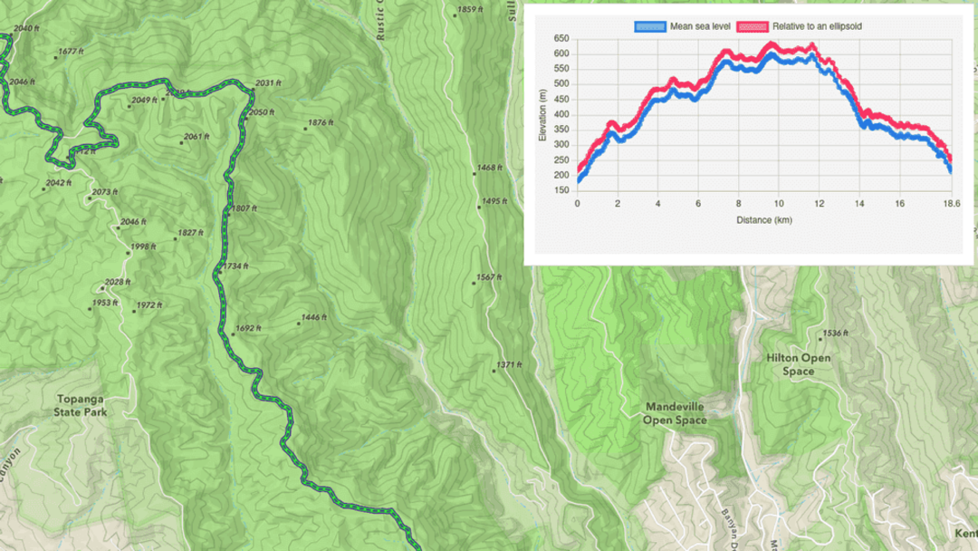
The Elevation service offers a fast and developer-friendly way to find the elevation for one or more locations. This service provides a height or “z” value for terrestrial (land-based) and bathymetric (water-based) locations. You can return elevation values relative to mean sea level or based on an ellipsoidal reference. You can request a single elevation or up to 100 elevations in a single query.
The service supports geographic coordinates in latitude and longitude and your preference of an elevation reference system to calculate the height values.

Here’s a few ideas of what you can do with the service:
- Determine the elevation of existing features such as weather stations, metering stations, and fire watch towers.
- Obtain elevation for user-defined locations or positions returned by other ArcGIS services such as Places or Geocoding.
- Assess elevation changes along roads or trails.
- Measure subterranean depths in lakes and oceans.

Beta Testing & Feedback Invitation
The beta program is exclusively available to ArcGIS Location Platform developers for testing until early 2025. To join the program go to:
If you need an ArcGIS Location Platform account, you can sign up for one for free here.
Enjoy the new services and we look forward to your feedback!


Article Discussion: