ArcGIS Field Maps is Esri’s new premier maps app for iOS and Android devices. The first release of ArcGIS Field Maps launched on November 2nd, 2020.
ArcGIS Field Maps combines the experiences of map viewing, field data collection, asset inspection, and location tracking, into a single app that you can download, a single app to sign into, and a single app to manage content for. Field Maps includes a new web app, integrated within your ArcGIS organization, that can be used to configure maps for field deployments. Please read Introducing ArcGIS Field Maps for vision and strategy details.
We just released a significant beta update last week. Let’s take a look at what’s new and what’s coming.
Indoor Mapping
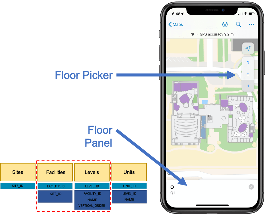
ArcGIS Field Maps now supports working indoors. Viewing a map or map package that contains a Facilities and Levels layer, that is in compliance with the ArcGIS Indoors information model, unlocks new floor awareness capabilities. A floor picker appears when a facility is in view, letting you filter all compliant layers by floor. A floor panel provides additional details about the floor you are currently viewing. This is a first step at deepening integration with ArcGIS Indoors – Indoor positioning and enhanced editing workflows will be coming next year.
New Android editing capabilities
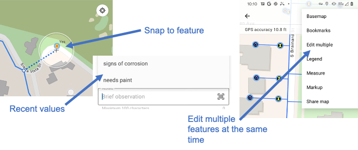
Android has now caught up with iOS-specific editing features that were recently added to Collector. This beta update of ArcGIS Field Maps includes snapping to features (points, lines or areas), the streamlined form entry provided by picking recent values (numeric values, domains, text phrases) and editing of multiple features simultaneously.
Location Tracking
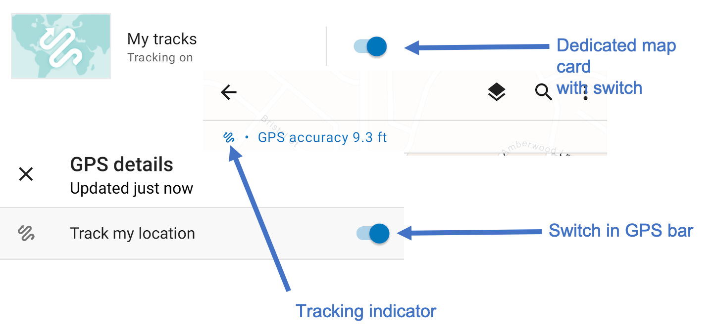
With ArcGIS Field Maps, the battery saving capabilities of ArcGIS Tracker are weaving into the experience of map viewing and data collection. Now you have the passive, battery efficient experience of background tracking and the ability to simultaneously capture points, lines or areas. With this beta update, we’ve tightened the experience between mapping and tracking. The GPS bar indicates when tracking is on and now you can turn tracking on or off directly within the map as well as from the maps page.
There are several other, minor updates to the app experience including:
- Honoring the new “Use in Field Maps” setting to show/hide maps from the maps screen
- Auto-sync is now on by default
- Profile page on iOS is not organized into categories
ArcGIS Field Maps web app in public beta
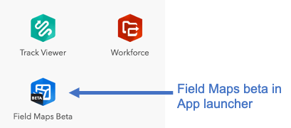
With the ArcGIS Online update on September 29th, the ArcGIS Field Maps web app is now available to all organizations and can be found in the App launcher for quick access. A new welcome message lets members of your organization know that this is a beta app and links to the Early Adopter Program.
There are lots of new and improved capabilities in the web app.
Smart Forms
Smart forms are a significant evolution to the ArcGIS platform. Starting with the open standard, XLS Forms approach introduced by ArcGIS Survey123 and now an Esri ArcGIS forms approach integrated into the web map specification, smart forms will be pervasive across the ArcGIS platform. ArcGIS Field Maps is the tip of the spear and is driving this platform-based approach.
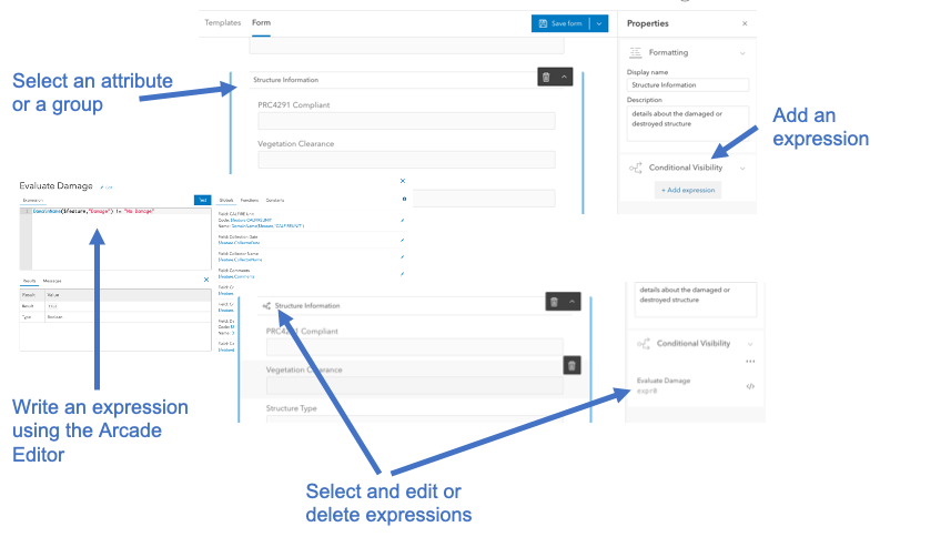
With this beta update to ArcGIS Field Maps, you can choose to show or hide fields dynamically using conditional visibility. For example, when completing damage assessment forms, all properties need to have a damage assessment report completed – even if no damage is present. Use conditional visibility to apply an expression to one or more attributes, or a group of attributes, in your damage assessment form so that they only appear when damage is present. You can add a conditional visibility expression using the Arcade Editor.
The ArcGIS Field Maps web app applies the Arcade Constraint profile to evaluate whether or not a feature meets the criteria defined in the expression. Once applied, you can visually see attributes or groups that have an expression and you can edit or delete those expressions as you see fit.
Tables
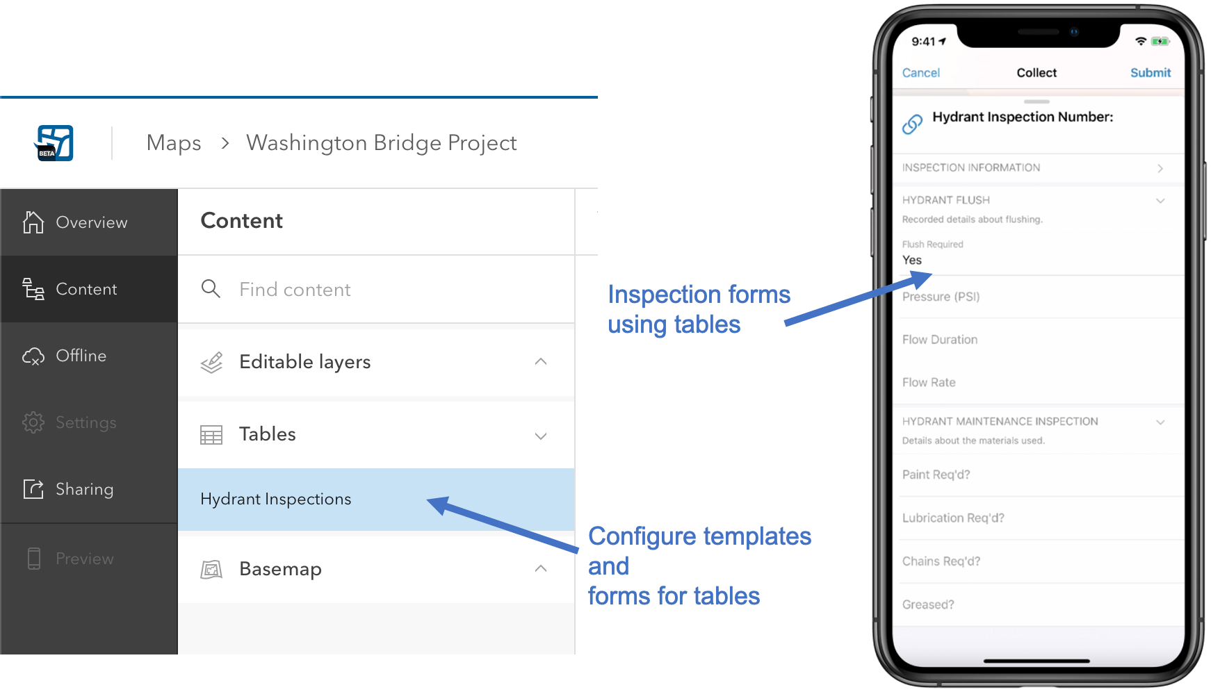
Inspections are best modeled as non-spatial tables that are related to your GIS features. For example, if you conduct routine maintenance on an asset (valve, streetlight, hydrant), you need to view a history of what was done before you and then conduct your new assessment. Tables that are related to GIS features are the best way to model this need in ArcGIS.
Throughout the ArcGIS Field Maps web app, we have added support for tables. Tables are now fully supported when defining a form so you can create a smart form for your inspection needs.
Use in ArcGIS Field Maps
ArcGIS Field Maps is Esri’s premier maps app on iOS and Android devices and we encourage you to create and share maps that are designed for a specific purpose and help your mobile workforce complete a variety of different tasks. However, sometimes it’s possible to have too many maps on your device!
We’ve added a new setting so that you can control what maps show up when you sign into ArcGIS Field Maps. A new “Use in ArcGIS Field Maps” application setting was added to web maps with the fall release and we have brought that setting into the ArcGIS Field Maps web application as well.

These are the key updates that were included in our beta update. Our goal is to focus now on releasing the first version of ArcGIS Field Maps at the end of October. There are a handful of development items coming still – including support for Arcade FeatureSets and more updates to the location tracking capabilities.
We will continue our early adopter program throughout the year. If you haven’t joined our beta program yet, please do! As we close in on release, now is a great time to evaluate how ArcGIS Field Maps can work for you!


Article Discussion: