ArcGIS Field Maps, first released in November of 2020, has been growing steadily in capability ever since. Major releases come with each ArcGIS Online update and occasionally we may stick a minor update in-between. For a look back on what happened last year, please read our 2024 Release Roundup from Sarah Saint-Ruth.
What’s new for February 2025
2025 is off to a great start and this, our first release of the year, includes several new improvements to Field Maps Designer.
Designer is your destination for creating and configuring web maps, authoring forms and templates, building geofences and offline map areas, and much more.
In this release, we’ve added several new features to Designer, including:
- Improvements to feature templates
- Added support for setting a coordinate system when creating a map from a template
- Offline improvements
Feature templates
Feature templates define categories of items that mobile workers are allowed to add, based on specific combinations of attribute values in a form for a given layer. Tapping the Collect button in Field Maps will display a list of feature templates used to create a new feature.
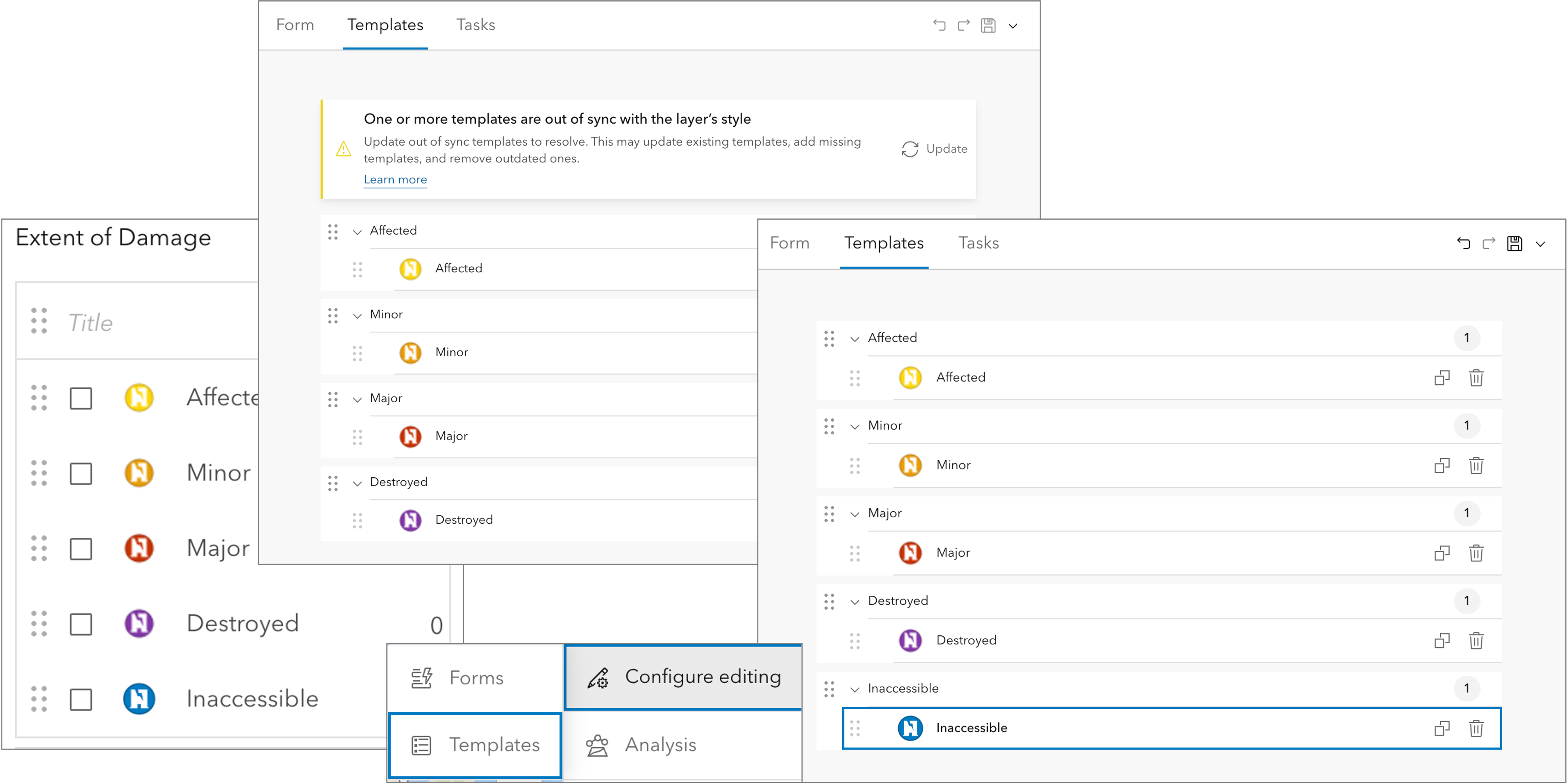
When refining map layers, it’s possible to make changes that cause a feature template style to be out of sync with the map layer’s style, especially when using unique symbols. Consider adding a new value to a choice list where the list of values is used as the map layer’s style.
If this were to occur, a new warning message will appear at the top of the Templates tab indicating feature templates are out of sync. The message includes an option to update feature templates to match the map layer’s style.
Configuring feature templates is now available within the Map Viewer as well. Click Configure editing to access the same Templates experience provided in Field Maps Designer.
Please read our considerations topic for additional information on managing feature templates.

Map templates and coordinate systems
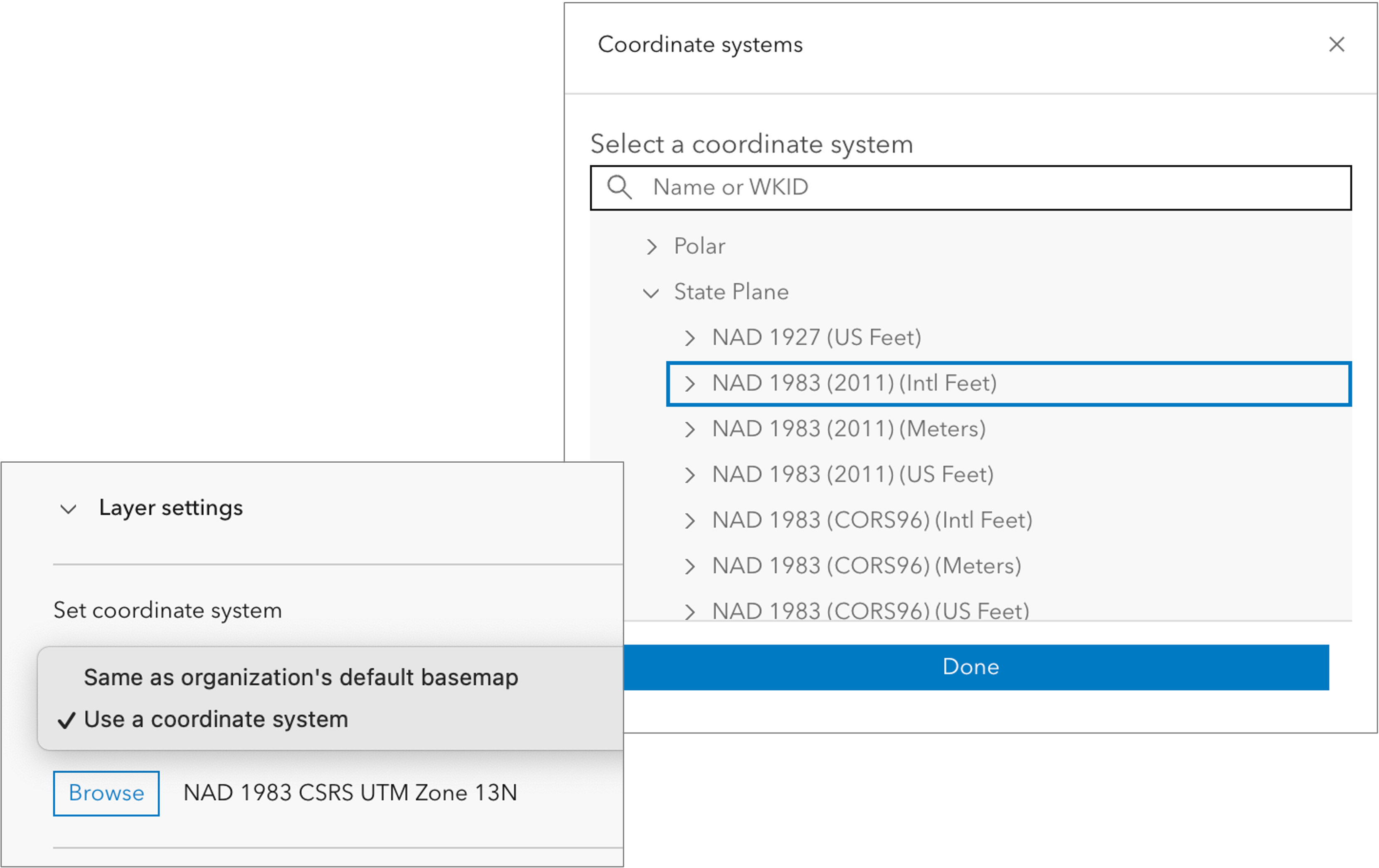
Field Maps Designer introduced creating a new map using a map template with the November 2024 release. New map layers are created using the spatial reference of the organization’s default basemap (often Web Mercator Auxiliary Sphere).
With the February release, now you can set the coordinate system to either the spatial reference of the organization’s default basemap, or you can pick a coordinate system. Choosing a local, projected coordinate system, can benefit high-accuracy GNSS data capture.

Offline improvements
With each update, we improve the way you manage offline maps for all client apps. Each layer, table, and basemap listed in the Content section of the Offline tab is evaluated for offline use and any unsupported content will be flagged as either a warning or error for you to evaluate and address.
For details, on the current list of warning and errors, please read the Enable content for offline use topic of the Configure documentation.
In this release Designer is introducing a new advanced offline setting for maintaining and downloading true curves.
Field Maps does not support true curve editing and we’re actively looking for feedback on your needs. Please email arcgisfieldmaps@esri.com and let us know what true curve editing support you’re looking for.

Mobile app updates
Our mobile development efforts have been focused on what’s coming next. The 25.1.0. update in the Apple App Store and Google Play include modest performance and stability improvements with no new features.
What’s coming next
2025 is going to be an exciting year! We’ve been busy working on some exciting new enhancements to Field Maps that are close to being available in an open beta this spring and released later this year including:
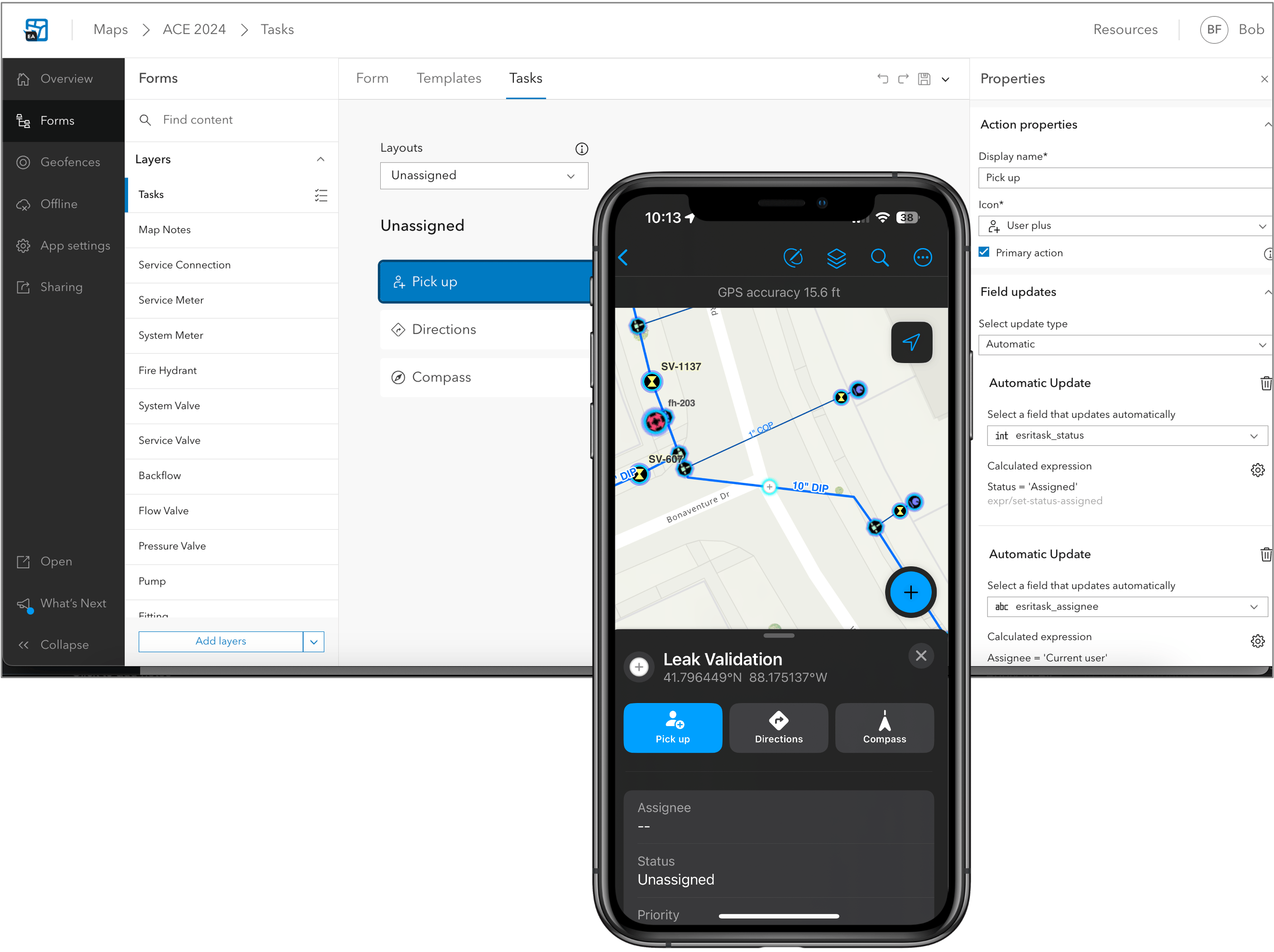
- Plan and coordinate field work using tasks.
- View and trace utility networks offline.
- Connected branch versioned editing experience.
- Editing support for subtype group layers.
- Forms support within the Edit Multiple tool.
- Enhancements to the Indoor editing experience.
- Improved experience for related records with support for Related pop-up elements.
- Geofence location-alerts that update with edits to the underlying feature layer.
- New and improved personal markup experience.
- New collaboration experience for Apple devices.
- Much more…

If you’d like to join our private preview of these new enhancements, please email arcgisfieldmaps@esri.com or wait for us to announce the public beta and then join the Early Adopter Community opportunity when it opens up.
If you have questions about ArcGIS Field Maps, please check out our Esri Community page. If you would like to connect with and learn from your fellow users, please join our LinkedIn group.

Article Discussion: