Following the introduction of ArcGIS Field Maps on June 18th, we’ve received very positive feedback — and since the launch of the beta program on July 6th, we now have over 5,000 active participants! Thank you for your interest, feedback and participation! Together we are shaping ArcGIS Field Maps.
We’ve made some significant updates to the beta software and if you haven’t joined yet, click this link to join today. If you are already a member of the beta program, please sign into the early adopter site, grab the latest updates and read our new documentation topics.
What’s new in this update
This is a very significant update to our beta software. As we push toward a fall release, we’ve unlocked a number of key new capabilities for you to test.
1. Introducing smart forms
ArcGIS smart forms are a new way to configure feature layers to provide a focused, structured experience for form editing. ArcGIS smart forms is an ArcGIS platform initiative that starts with the inclusion of forms configured and stored in maps written to the new web map forms specification.
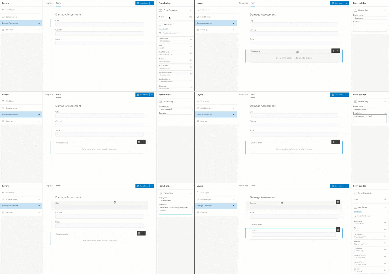
With this update, you can use the ArcGIS Field Maps web app to configure forms for editable feature layers. The Forms tab provides an empty canvas to design your form. You can begin by converting existing pop-ups, adding all attributes of a feature layer, or manually adding attributes.
Once you add attributes to your form, you can re-order them as needed and organize them into groups. Groups are a new element that can be added to a form. Groups have a name and description that appears inside of the mobile app. By organizing attributes into logical groupings, you can provide structure to the form and guide the mobile worker through their capture experience. The designer experience within the web app includes an intuitive drag and drop experience as well as the ability to use the arrow keys to re-order attributes.

Forms that you configure and save using the web app will be visible when collecting and updating features using both the iOS and Android apps. It’s time to move beyond a flat list of attributes and provide more structure to your field editing workflows.
We still have a lot of work to do with forms. Support for conditional visibility using Arcade expressions, support for tables and required fields to name a few.
2. New high accuracy GPS support
ArcGIS Field Maps includes all of the high accuracy GPS capabilities found in ArcGIS Collector, including support for Trimble receivers on Android and iOS.
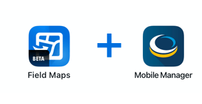
If you use a Trimble R series GNSS system with iOS devices, you will be very excited with this update. Powered by the Trimble Precision SDK, ArcGIS Field Maps utilizes the Trimble Mobile Manager app to provide a simple, intuitive, and consistent experience for bringing high accuracy GPS to ArcGIS on both iOS and Android platforms. With Field Maps, real-time corrections are defined using Trimble Mobile Manager. This integration brings support for capturing orthometric height values and regionally optimal coordinate systems or reference frames (including applying time-dependent transformations).
Using Trimble Mobile Manager, you can configure the receiver and download and apply a Geoid grid file directly within the app. The app creates a configuration file that ArcGIS Field Maps can read to incorporate support for these new features.

In addition to the enhanced abilities with Trimble receivers, we have improved handling of stale GPS locations to ensure old locations are not deemed valid for collection and updated our list of supported coordinate systems and transformations.
3. Location tracking support
We’ve started adding the capabilities of ArcGIS Tracker directly into ArcGIS Field Maps so that you no longer need to install a separate app to record and share tracks. ArcGIS Field Maps requires that your ArcGIS organization have location tracking enabled and that members signing into Field Maps have Tracker premium add-on licenses.
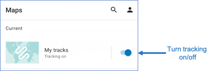
With tracking available, a new map appears in the browse screen that lets you switch tracking on and off directly from the map card.

If you want a focused view of your tracks, you can tap on the My tracks map card and see your tracks, just like you can in the ArcGIS Tracker app. In addition, you now have all of the map viewing capabilities including switching basemaps, the measure and compass tool, map markup and more.
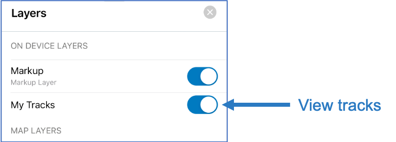
On the iOS platform, if you open another map you can visualize your tracks by switching on the My Tracks on device layer.

4. Many additional updates
We’ve added many additional updates to both the user experience and the engine powering ArcGIS Field Maps. Here are a few highlights in this update:
- Now you can point ArcGIS Field Maps to your ArcGIS Enterprise portal or ArcGIS Online organization and display publicly shared maps in the browse screen. This provides a new way for you to share the authoritative public maps and map packages you create and share. We’ve added a new anonymousAccess parameter to both the MDM configuration keywords and the App Link scheme to make this possible.
- With the Compass tool, now you can see the bearing (in degrees) as well as the distance away from a feature or dropped pin.
- Auto-sync capabilities are now available for read-only maps.
- We’ve updated to the upcoming 100.9 release of the ArcGIS Runtime SDK for iOS. This brings all of the goodness of 100.8 and more (online services in mobile map packages, *Arcade FeatureSet expressions, improved rendering performance and much more. Android will be updating to the 100.9 soon as well.
What’s coming next?
We still have a lot of work ahead of us before our fall release! Here is a preview some of what you can expect to come soon:
- Smart forms – support for conditional visibility via the Arcade Expression editor, configuring forms on tables, required fields.
- Android data collection features – snapping, edit multiple, recent value entry
- Arcade FeatureSet expression support in pop-ups
- Indoor Mapping support (recognizing indoor map layers and provide a floor picker for switching floors, automatically capture floor information when creating a new feature)
- More location tracking functionality – including support for rendering tracks on the Android platform, ability to turn tracking on/off from the map, and more.
Thank you once again for your interest in ArcGIS Field Maps and participation in our beta program.

Article Discussion: