The November 2024 release for ArcGIS Experience Builder in ArcGIS Online introduces many new features to help you easily build no-code and low-code web apps and pages.
We’ve added the new Express mode which simplifies app building so you can build apps more efficiently. It includes all the Web AppBuilder classic templates. The new Accordion widget is a layout container that you can use to organize other widgets into a vertically stacked menu with options to expand and collapse. Other highly anticipated enhancements include the new draw text tool in the Draw widget, support for setting custom filters at run time with the Filter widget, searching a specific country or region with the Search widget, and support for Subtype group layers. Let’s dive into these features.
Quick links:

Express mode
Express mode is designed to make app building easy. It provides familiar template options and workflows for users newly migrating from Web AppBuilder to Experience Builder. Start with a template, choose a map or scene, add widgets, and brand the app. Apps created in this mode are automatically optimized for any screen size. Read this blog post for more information.
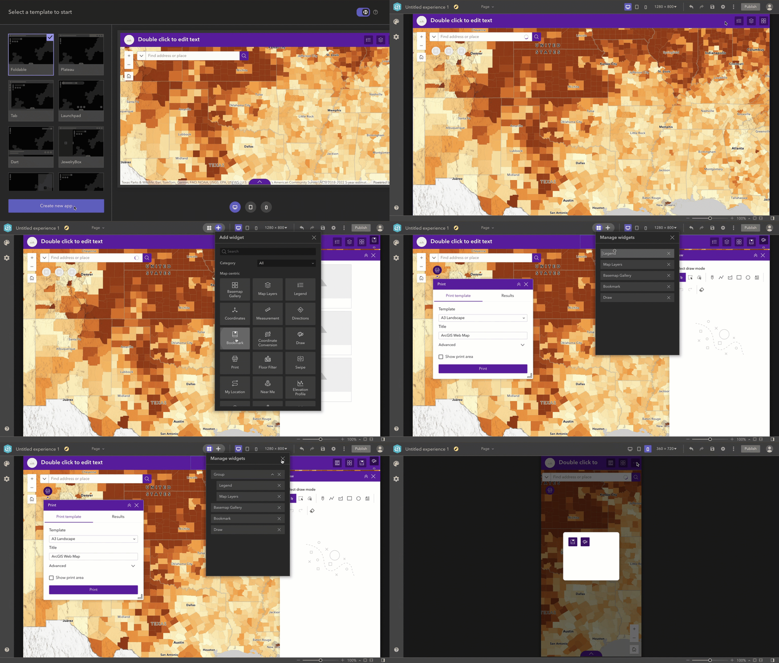
Note: you can choose a window template from the top-left of the builder toolbar and set it as a splash screen. Unlike the About and Splash widgets in Web AppBuilder, Experience Builder does not yet provide an HTML Editor to easily customize content. This feature is currently planned for the next release.
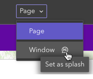
Sometimes you’d like to add your own touch to the app besides what the template offers in Express mode. For example, you may want to make the app header a little bit wider or show a legend on the map directly. To accomplish that, you can move the app or a copy of it to Full mode, where you can use all of the editing capabilities Experience Builder offers. When you do so, all of your app configuration will be carried over to Full mode. Keep in mind, this is one way road. You can’t move an app created in Full mode to Express mode.

Accordion widget
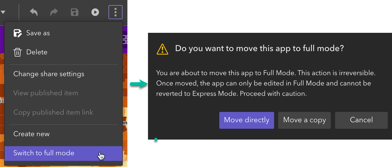
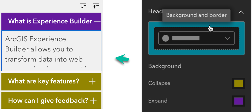
The Accordion widget is a layout container that you can use to organize other widgets into a vertically stacked menu with expand and collapse buttons. The example on the left stacks multiple Text widgets while the example on the right stacks different widgets.
You can also change the header background colors when it expands or collapses. When you click the highlighted area in the header setting, the background and border options will appear.
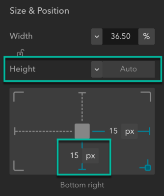
Sometimes you may want to expand the widget from the bottom-up instead of the top-down. You can do so by setting the widget height to Auto and moving the widget to the bottom of the page as shown below.

Subtype group layer
A new addition to data sources, Subtype group layers are composite feature layers that contain multiple sublayers called subtype layers. They are commonly used to model utility network data. An advantage of subtype group layers is faster performance. In addition to the Map widget, you can now use them in other widgets like the Table widget, as shown in the screenshot below.
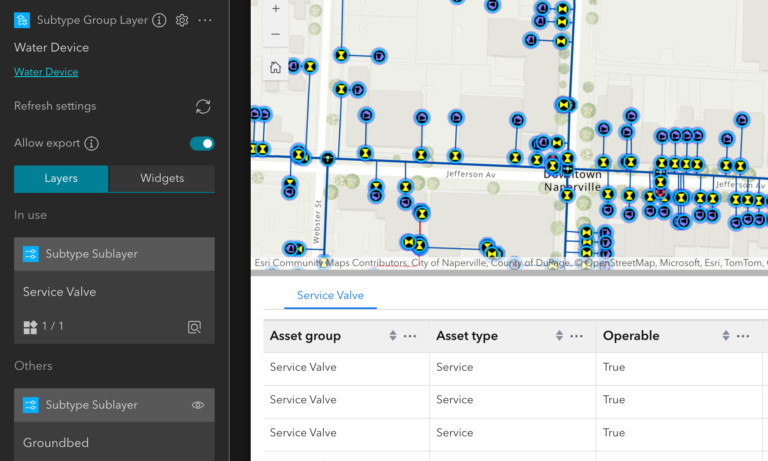
Note: The Analysis widget does not yet support Subtype group layers.

Enhancements
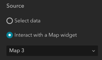
When connecting to data, many widgets now have an option to interact with a Map widget in addition to selecting individual layers as shown below. Take the Feature Info widget as an example. When you connect to a Map widget, all applicable layers from the map will be added to the widget so you don’t need to add layers one by one. The new option provides efficiency for working with the map.
Draw
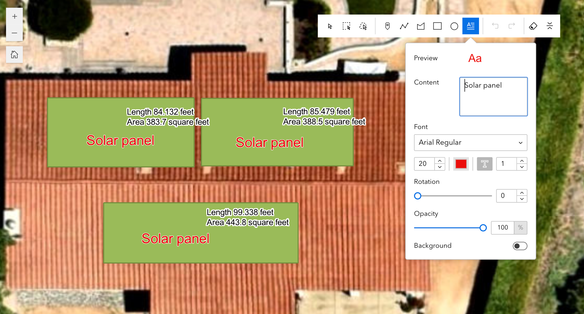
Many of you have been asking for the ability to add text on a map, like you could do with Web AppBuilder. You can now do so in Experience Builder with the draw text tool in the Draw widget. You can also turn drawn features on or off as a layer that appears in layer lists, such as the Map Layers widget and the Map widget Layers tool.
Filter
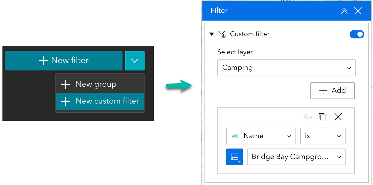
If you want users to create their own filter clauses at run time, you can add custom filters in the Filter widget.
Search
If you are using the ArcGIS World Geocoding Service, you can now specify a country or region code to narrow search results to that country or region.

Near Me
Many new features have been added to the Near Me widget, including automatically updating results based on the map extent, showing results on the map for all selected layers regardless of their visibility, and more. Check out this blog post to learn more.
Map
More improvements are made to interact with the map. When you unselect a feature from a List widget, for instance, you may want to have the map automatically zoom or pan back to its initial extent. You can now do so with a new option added to the Zoom to and Pan to actions when the map responds to Record selection changes from other widgets.

In addition, when you make the map zoom to selected features using zoom_to_selection URL parameters, you can now make feature selections based on attributes. See Map URL parameters for more information.
Map Layers
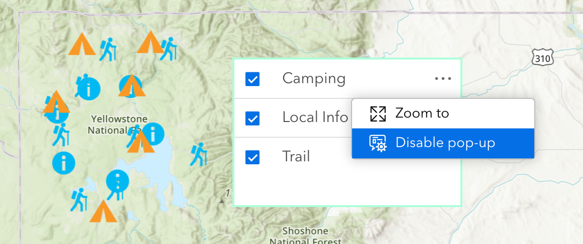
You can now turn pop-ups on or off for each layer with a new option of Enable or disable pop-up. This could be helpful when you have many layers in the map.
Feature Info
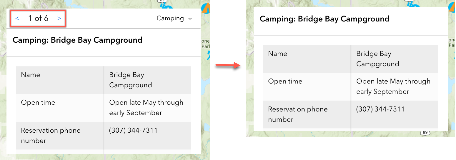
Some of you may not like to display feature navigation with the index in the left picture. A new option in the Feature Info widget settings allows you to turn it off for simplicity as demonstrated in the right picture.
Basemap Gallery
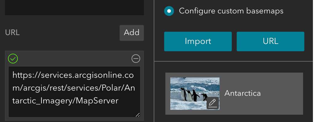
You can add custom basemaps by service URLs like you could with Web AppBuilder. Five types of basemap layers are supported—VectorTileLayer, ImageryLayer, ImageryTileLayer, TileLayer, and MapImageLayer.
Table
With the new Filter by map extent tool, you can easily filter the records in the table based on the map extent.

Query
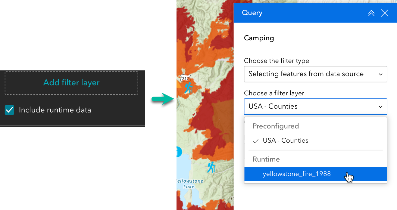
Before this release, runtime layers could not be used as a spatial filter. With the new Include runtime data option in the Query widget, this capability is now available. In the example below, the 1988 Yellowstone wildfire layer is added to the map using the Add Data widget to perform spatial analysis and understand the impact of wildfires on the camping sites.
Chart
You can now use a layer’s symbology to color a chart. This option is best suited for layers that use simple vector color symbology. See Chart widget under Data (scatter plots) for more information.
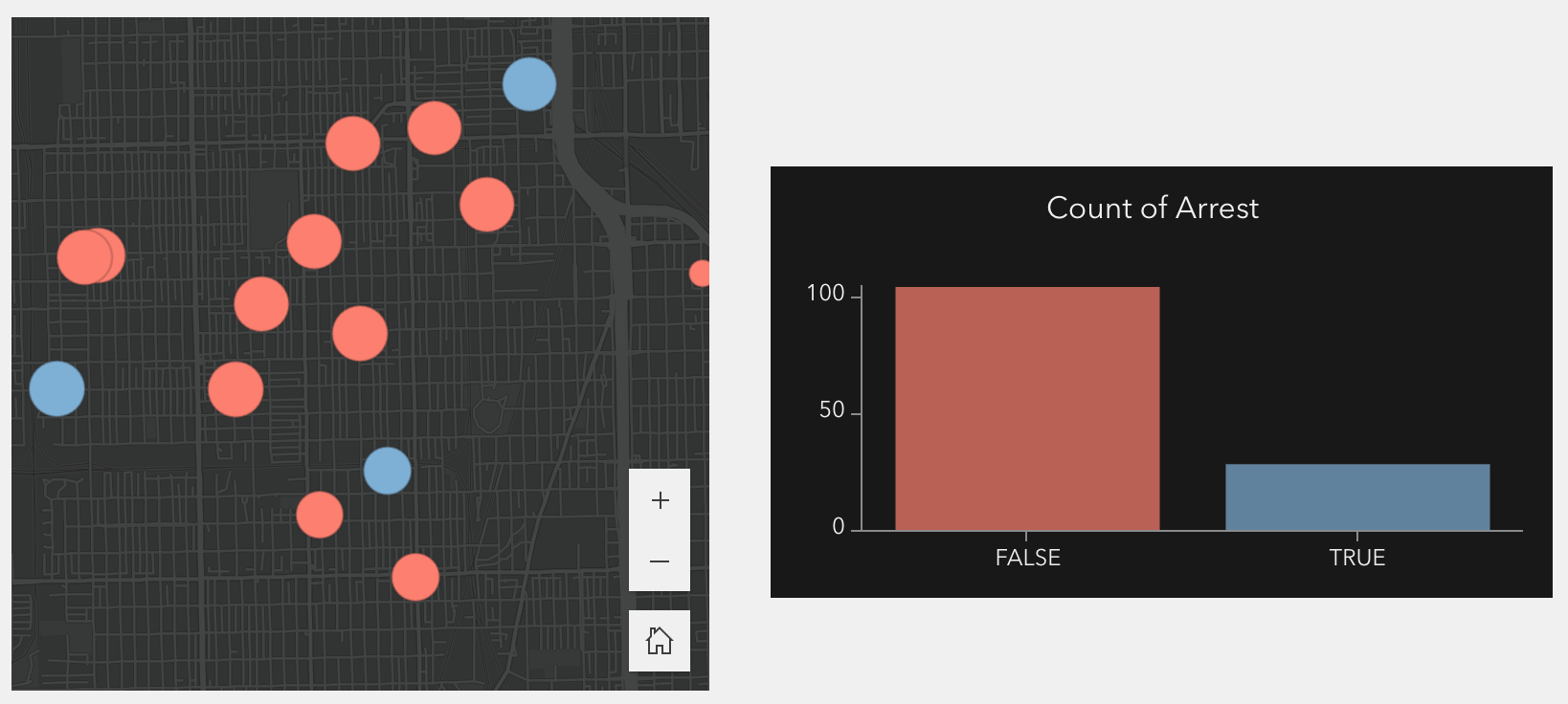
Like line charts, bar and column charts now support time binning for a date field. You can also turn off both the x- and y- axis labels.
Bookmark
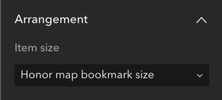
To further improve your migration experiences from Web AppBuilder, you can now honor bookmark sizing from the web map or web scene, preventing fuzzy or distorted bookmarks (slides) images. Also, the settings for customizing a bookmark’s title, description, and image are improved to make them more user friendly.
Elevation Profile
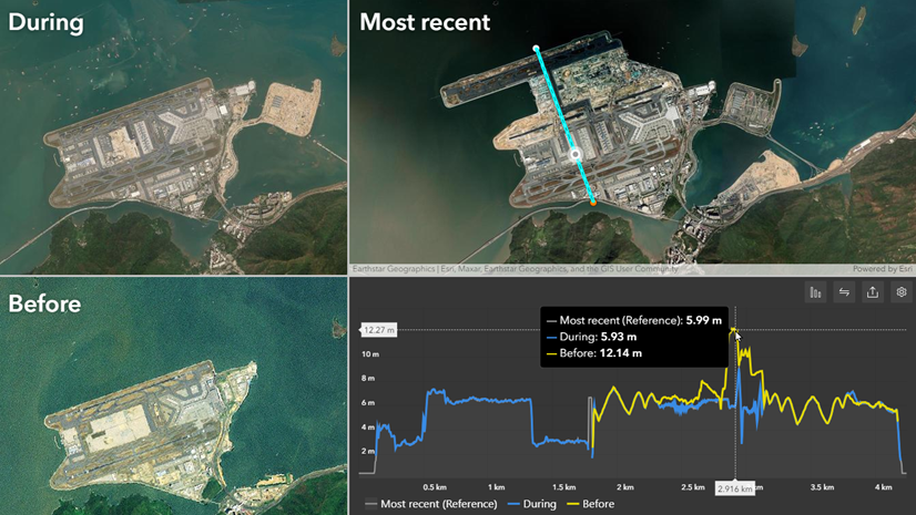
You can overlay multiple elevation layers to compare profiles as demonstrated below. Read this blog post to understand how this feature can provide helpful insights into the environmental transformations that have occurred.
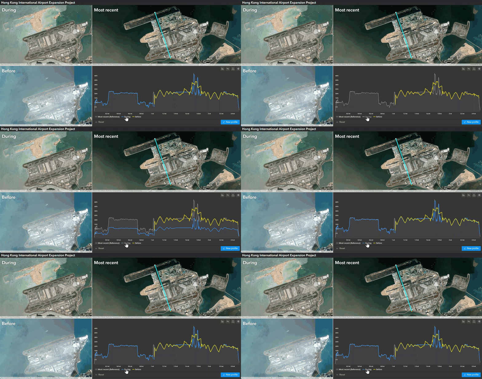
Like the Query widget mentioned earlier, you can also select lines from layers added at run time with the Add Data widget and use them to generate an elevation profile.
Timeline
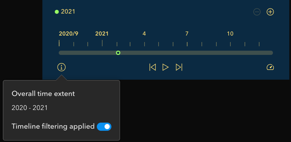
In addition to showing data within a window of time, you can now use the new Show current features option to show data at one point in time. You can set display accuracy by year in addition to by month, day, hour, etc.
Widget Controller
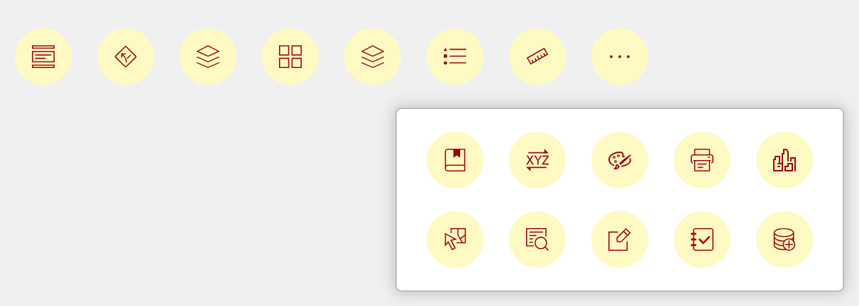
When there are many widgets in the controller, you may set its overflow style to Popup window for easy navigation. In the example below, when you click More widgets (…) at the end of the controller, a window appears listing the remaining widgets. Additionally, you can change the icon color and background of the widgets added to the controller.
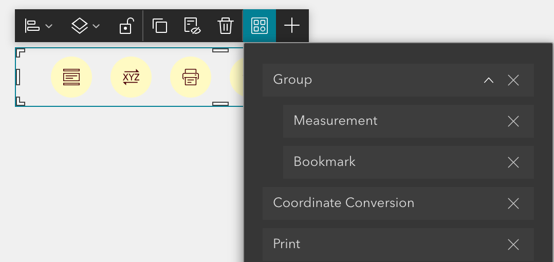
You can also easily group widgets in the controller. The shortcut toolbar now includes the Manage widgets tool so you can group, reorder, and delete widgets with drag and drop. Widgets in a group appear in a vertically stacked menu with expand and collapse buttons like the Accordion widget.
Sidebar
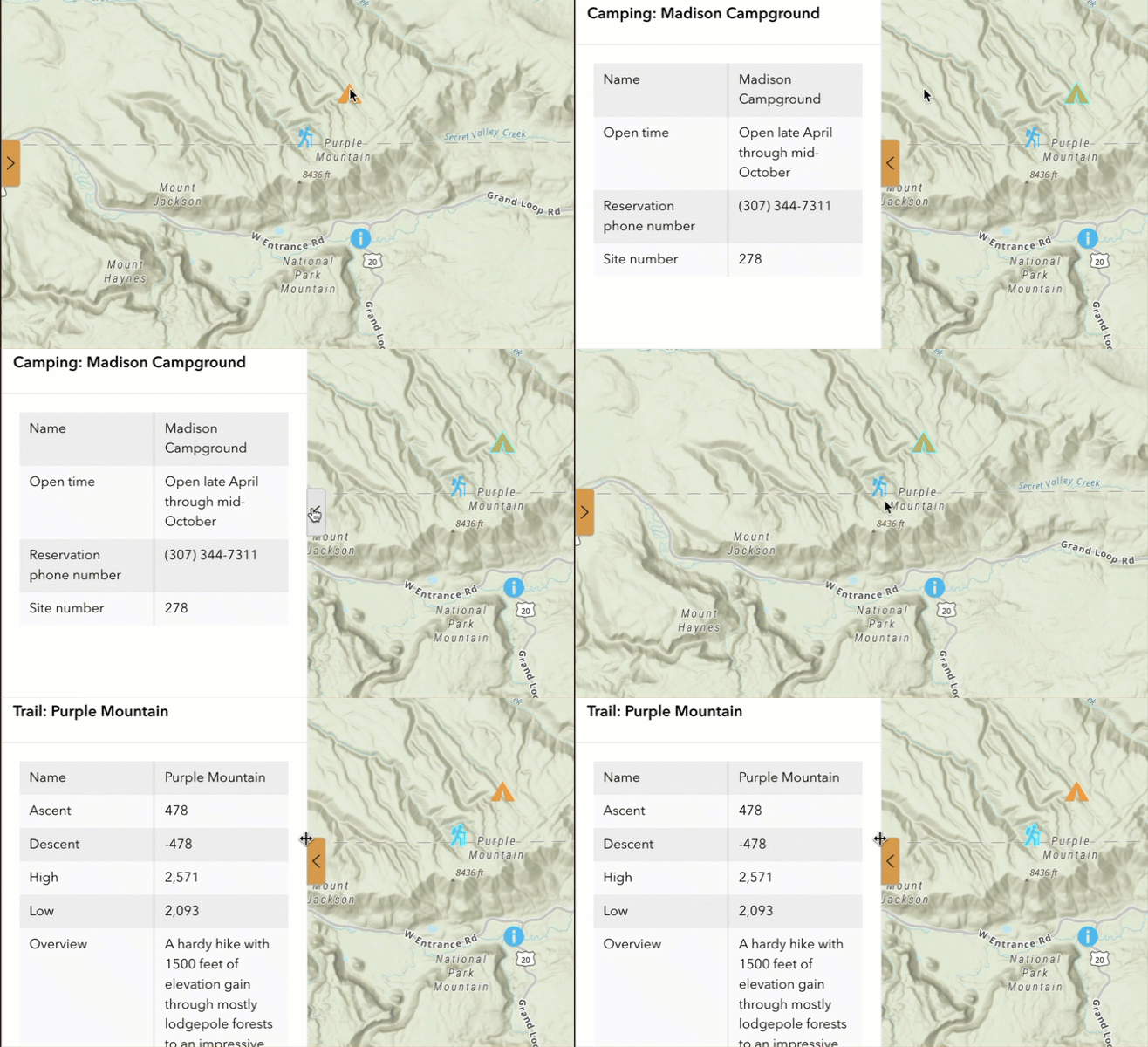
Some of you may want the sidebar to automatically open when a feature is selected on the map. The Sidebar widget now listens to the Record selection changes message as shown below.

Accessibility updates
We have been enhancing accessibility through incremental releases. The following features are improved in this release.
- Support for auto-sized elements in full-screen pages.
- Accessibility is now supported in three widgets – Search, Bookmark, and Swipe.
- The Button widget supports for Link to page top and the Button click message action.
- The Filter widget supports for two arrangement styles – Horizontal and Icon.
- The Text widget adds heading level configurations.
- Improvements on the Views Navigation and Menu widgets.
For better accessible experiences, we currently recommend using these templates to create apps – Foldable, Plateau, Tab, Launchpad, Dart, JewelryBox, Pocket, and Billboard. Read Accessibility for more information.

Deprecation
Starting this release, the Utility Network Trace widget is no longer available in the Insert widget pane and cannot be added to new applications. A deprecation notice is displayed in the builder. The widget is still available and still works in your existing apps. See Utility Network tools deprecation in ArcGIS Online for more information.
Lastly, the Web AppBuilder and Experience Builder functionality matrix document has been updated in the community. And information about functionality matrix for each widget is available here.
For more information, see What’s new in Experience Builder. Please reach out to experiencebuilder@esri.com with questions.
Thank you,
The ArcGIS Experience Builder Team
Subscribe to our newsletter to receive the latest ArcGIS Experience Builder updates, news, and content.



The accordion widget is a great addition to web experience builder, however, there is no solid boundary like you get in sections. We are currently using the accordion widget to host a set of filters and a list, however, when the list is expanded, it does not fill the entire widget space up, therefore creating dead space. Would it be possible to update the accordion widget so that the available space is filled with the content within?