Today we’re delighted to announce the release of version 100.5 of the ArcGIS Runtime SDKs. Update 5 enhances 3D and KML functionality, augments offline workflows, and introduces support for some fundamental mapping needs, such as reference scale and group layers.
Working in 3D
You’ll see lower memory usage and better all round performance when working with scenes as we continue to optimize the experience, but this release of Runtime also adds some significant 3D functionality:
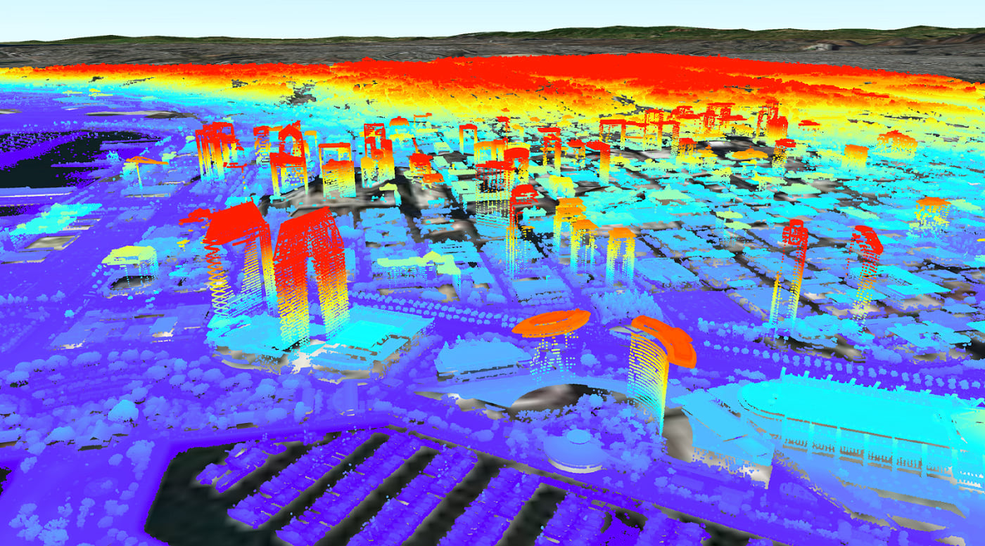
Point Cloud Scene Layer
Runtime can now display large volumes of symbolized and filtered LIDAR data. Our team has worked hard to squeeze great performance out of this layer even on mobile devices, interactively visualizing datasets of hundreds of millions of points in the palm of your hand. It’s truly impressive.

Point Scene Layer
Not to be confused with the point cloud scene layer, Point Scene Layers provide fast display of point features in a 3D view based on scale, distance, and threshold parameters associated with a viewpoint. Publish these from point feature layers as a service or as a scene layer package or part of a mobile scene package.
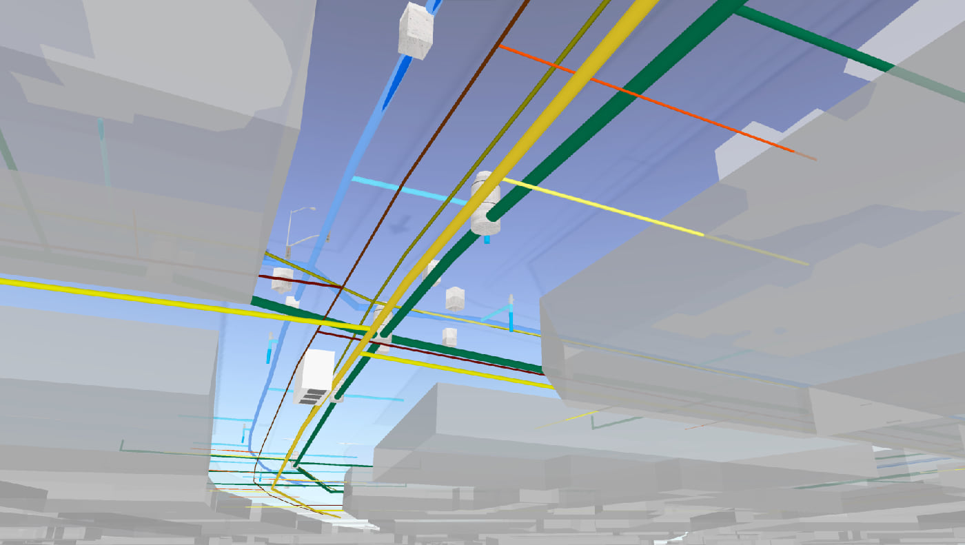
Subsurface capabilities
You can now work with features that lie below ground level by adding transparency to your scene’s surface, or simply navigate and position the camera below ground. Properties on a scene’s surface allow you to enable or disable subsurface navigation and control the transparency of the ground.

Mobile Scene Packages
100.5 adds support for Mobile Scene Packages, or MSPKs. These files parallel Mobile Map Packages but (you guessed it) for scenes, and are generated in ArcGIS Pro to be sideloaded onto your devices for an offline 3D experience.
Working Offline
Speaking of offline, we’ve been working on enhancements to the On Demand and Preplanned offline workflows, enabling even greater control when working with data while disconnected.
Basemap By Reference
In both On Demand or Preplanned workflows, you can now opt to make use of a locally stored basemap (perhaps you have a vector tile package or raster tile package already downloaded which covers your entire service area). Not having to generate or download the basemap tiles can significantly reduce the time it takes to generate and download an offline map.
Next Gen Locators and Tile Packages
Our geocoding team has been hard at work for some time on next generation locators, and with 100.5 we bring support for these .LOZ files to Runtime. The are smaller and faster. What more could you want?
Alongside that, we’ve added support for the new TPKX file format for local raster tiles. TPKX files use the Compact Cache V2 open spec. Generate a TPKX from Pro or ArcGIS Enterprise 10.7, or lean on the spec to create your own tile packages.
Reference Scale
Our utility customers have long clamored for Reference Scale (though you don’t have to be a utility to make good use of this!). Now a map authored in ArcGIS Pro can have reference scales set on the map or on individual layers, and these are honored in Runtime.
Annotation
Another feature of great use to utilities is Annotation. This is text that is pinned in place relative to a feature or to the map. It’s not a dynamically positioned label, but is statically positioned when the map is authored.
This is just the first release of Reference Scale and Annotation. They’re already very capable features at 100.5, but we’ll be enhancing them and adding APIs to better control them over the next few releases of Runtime.
WFS
Rounding out our OGC format support, we bring WFS to the mix. We now have WFS, WMS and WMTS layers that can directly display OGC services in your map.
KML Tours
KML Tours complete our functional coverage for KML. Open a KML tour in the runtime and control its playback via some new APIs.
Group Layers
Group layers are another feature that has been asked for by a lot of you, and with good reason. We’ve introduced an API to support combining operational layers into group layers in both maps and scenes. In addition, we’ll honor group layers defined in a web scene or mobile scene package.
Local Server
Local server has been updated at 100.5 to add compatibility with ArcGIS Pro 2.3 and ArcMap 10.7.
Updated SDKs
As we do at each release, we’ve taken time to ensure our world-class SDKs have been updated to cover the new capabilities we’ve added. Not only have we updated our Guide topics and API reference docs, but we’ve added new samples to the Sample apps and updated the Toolkits and Open Source apps. More information is available in the release notes for .NET, Java, Qt, Android, iOS and macOS SDKs (this is the last release of Runtime with a dedicated macOS SDK, but you can still use Java and Qt SDKs to build macOS apps).
This release also brings with it a number of bug fixes and performance improvements, and under the hood we’ve begun a number of improvements to pave the way for some exciting new features over the next few releases. We’re really proud of the Runtime and it pleases us no end to see the apps you’re building with it.
Download and get started
To get 100.5, go to the ArcGIS for Developers web site, browse the ArcGIS Runtime SDK page of your choice and download the SDK. You can also reference through NuGet, Gradle, or CocoaPods. If you’re new to developing with ArcGIS Runtime and don’t have an ArcGIS Developer subscription, simply sign up for a free account and you’ll be able to access everything you need to develop your app.


Commenting is not enabled for this article.