The 2022 Esri User Conference will be held as an in-person event in San Diego, California. Join us to learn all about the latest and greatest in GIS, the importance of data quality management, connect with thousands of peers and network with other GIS enthusiasts at the biggest GIS event of the year! In this blogpost you can find an overview over all ArcGIS Data Reviewer sessions.
Agenda
Showcase
Visit us at our booths for ArcGIS Data Reviewer in the ArcGIS Pro Showcase area. Talk to our experts, get a demo and learn more about the product.
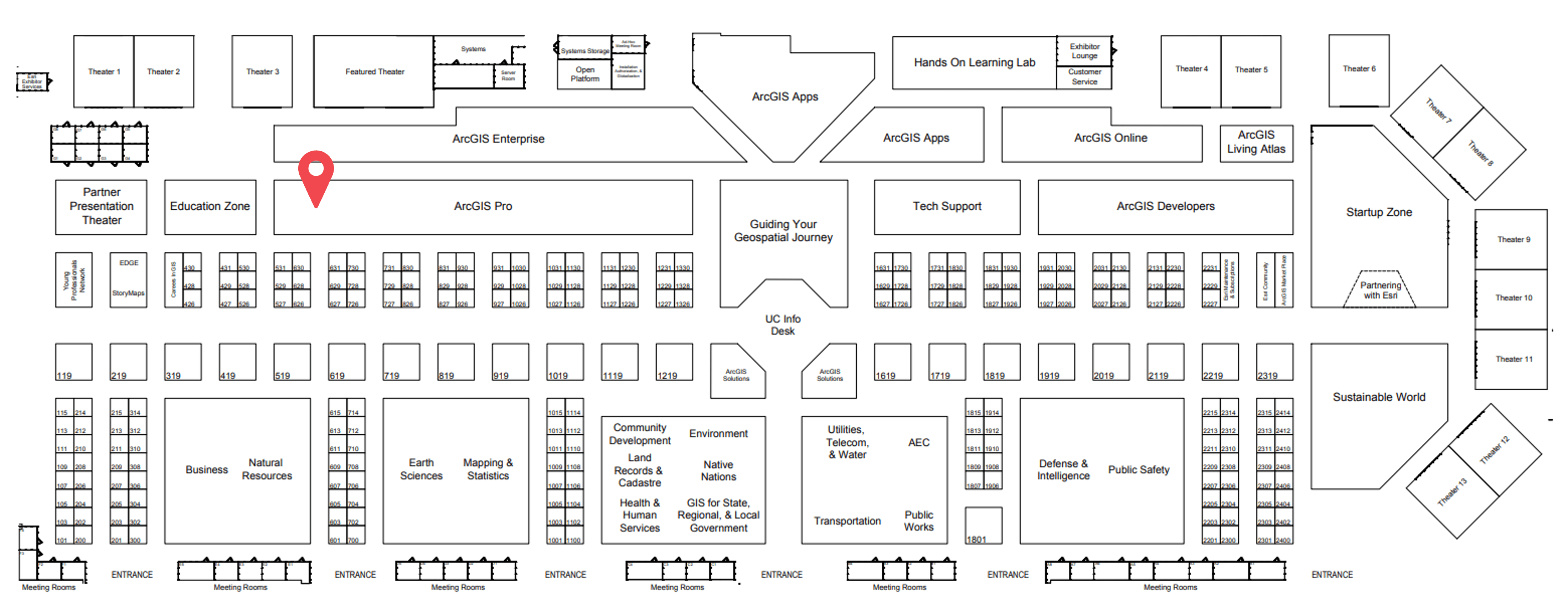
Showcase hours
Tue, July 12: 09:00 a.m. — 06:00 p.m.
Wed, July 13: 09:00 a.m. — 06:00 p.m.
Thu, July 14: 09:00 a.m. — 04:00 p.m.
Sessions
Tuesday
ArcGIS Data Reviewer: An Introduction
Tuesday, July 12, 1:00 p.m. — 2:00 p.m.
SDCC – Room 30 D
TECHNICAL WORKSHOP
Learn how ArcGIS Data Reviewer, an extension to ArcGIS Pro and ArcGIS Enterprise, improves GIS data quality and reduces data management costs. In this session, we will define GIS data quality, practices for capturing quality requirements, and identify quality-related capabilities in ArcGIS. We will demonstrate how to leverage Data Reviewer’s integration with geodatabase attribute rules to prevent and detect poor quality data. We will also highlight visual review workflows and tools to identify other sources of errors such as missing, mis-coded or spatially inaccurate features that cannot be found through automation.
Zhongping Guo, Francisco Perez, Jay Cary
Wednesday

ArcGIS Data Reviewer: Implementing Automated Review
Wednesday, July 13, 10:00 a.m. — 11:00 a.m.
SDCC – Room 30 C
TECHNICAL WORKSHOP
Learn how to implement automated workflows to improve data quality, streamline maintenance, and decrease risk for data consumers. In this session, we will cover how to use the ArcGIS Data Reviewer extension to extend Attribute rules and accelerate the implementation of data quality workflows. You will learn about “no-code” deployment of Attribute rules in the form of configurable checks, a deep-dive on the types of errors detected as well as tools that support migration from ArcMap to ArcGIS Pro.
Kaleb McNeil, Mary Mozingo, Francisco Perez
ArcGIS Data Reviewer: An Introduction
Wednesday, July 13, 1:00 p.m. — 2:00 p.m.
SDCC – Room 30 C
TECHNICAL WORKSHOP
Learn how ArcGIS Data Reviewer, an extension to ArcGIS Pro and ArcGIS Enterprise, improves GIS data quality and reduces data management costs. In this session, we will define GIS data quality, practices for capturing quality requirements, and identify quality-related capabilities in ArcGIS. We will demonstrate how to leverage Data Reviewer’s integration with geodatabase attribute rules to prevent and detect poor quality data. We will also highlight visual review workflows and tools to identify other sources of errors such as missing, mis-coded or spatially inaccurate features that cannot be found through automation.
Zhongping Guo, Francisco Perez, Jay Cary

ArcGIS Data Reviewer: Tips and Tricks for Validating LRS Network
Wednesday, July 13, 2:30 p.m. — 3:15 p.m.
SDCC – Expo Demo Theater 10
DEMO THEATER PRESENTATION
Learn how to implement ArcGIS Data Reviewer to support validation of linear referenced pipeline features. This session will highlight validation methods and implementation best practices for validating pipeline features in your geodatabase.
Mary Mozingo, Francisco Perez, Michelle Johnson

ArcGIS Data Reviewer: Tips and Tricks for Validating Address Data
Wednesday, July 13, 4:00 p.m. — 4:45 p.m.
SDCC – Expo Demo Theater 10
DEMO THEATER PRESENTATION
Learn how to implement ArcGIS Data Reviewer to support validation of address data typically used for place finding and other location analytics. This session will highlight validation methods and implementation best practices, including ArcGIS Solutions for managing address features in your geodatabase.
Mary Mozingo, Zhongping Guo, Matthew Keeling
Thursday

ArcGIS Data Reviewer: Tips and Tricks for Validating Water Utility Network
Thursday, July 14, 12:15 p.m. — 1:00 p.m.
SDCC – Expo Demo Theater 10
DEMO THEATER PRESENTATION
Learn how to implement ArcGIS Data Reviewer to support validation of water features within the utility network. This session will highlight additional methods and implementation best practices for enhancing the validation capability in the utility network. Also, we will discuss QA/QC recommendations for utility network migration.
Kaleb McNeil, Srinivas Suryanarayanaiah, Michelle Johnson


Commenting is not enabled for this article.