This is the fifth article in a six-part blog series that highlights new capabilities in the Business Analyst extension for ArcGIS Pro 2.6 release from July 2020. Be sure to read the other blog articles about the 2.6 release.
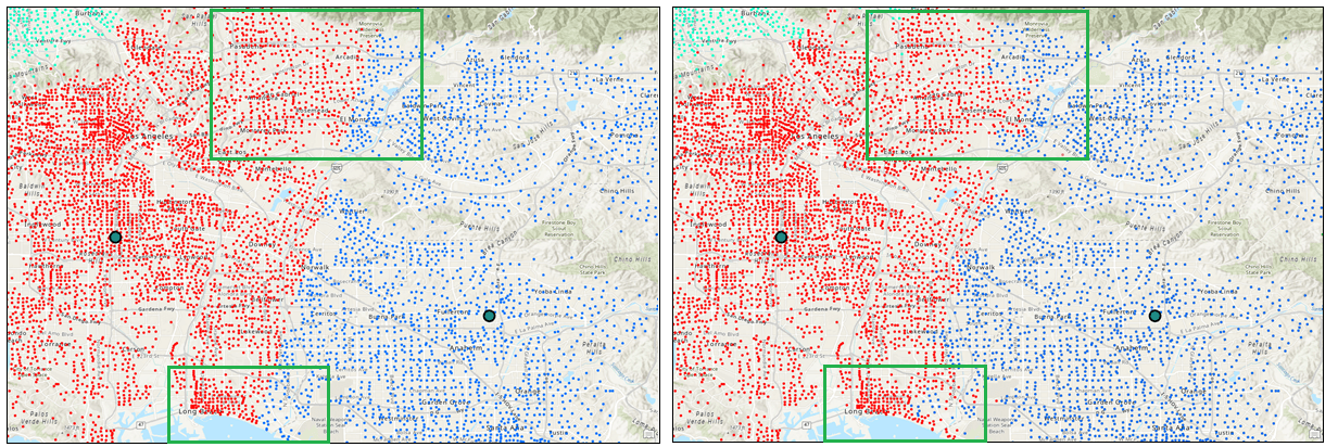
The Assign Customers by Distance tool allows users to create an association between each customer and their closest store, based on a selected distance type. Whether your customers predominantly travel on foot, in a car, or via trucking routes, the many options to calculate proximity ensure that distance is determined using a method that realistically models routing to your stores.
Assigning customers to a single store adds precision to your analysis and enables you to:
- Create store-specific customer profiles to understand the types of consumers each store attracts.
- Dynamically advertise to areas dense with each store’s customers.
- Create Customer Derived Trade Areas, differing in size and shape based on the spatial distribution of each store’s customers.
Business Analyst helps users understand who their best customers are and the geography of markets. This new tool extends these capabilities by allowing users to gain insight into the specific locations of each store’s customers and more intelligently define markets.
This 2-minute video provides a good overview of some of the tool’s capabilities.
As the video illustrates, the Assign Customers by Distance tool improves users’ ability to distinguish among customers based on the store location they are closest to.
Assign customers by straight-line distance, walking or driving routes
The Assign Customers by Distance tool helps you make the most of your customer data. You know where your customers are and how they travel. Creating a customer-to-store relationship using the customer’s prevailing travel mode guarantees that the correlation is meaningful and accurate.
The routes for various travel modes are regularly updated within the Business Analyst dataset. This ensures that changing conditions, such as new impediments, are reflected in all available travel types.

Model route congestion during peak business hours
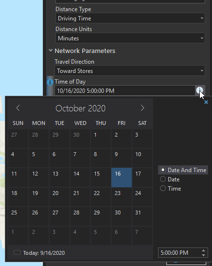
The Assign Customers by Distance tool also offers the capability of specifying the time and direction of travel. This can help you understand route congestion for your customers during peak business hours. Toggling the direction of travel to be away from the store (rather than towards it) may be particularly useful for users wishing to examine delivery capabilities from a business to its customers.

We’re excited to share these new capabilities with you. Additional information about these enhancements can be found in the ArcGIS Pro documentation for the Assign Customers by Distance tool. Please reach out and let us know if you have any questions about this new tool or any other capabilities in ArcGIS Business Analyst.
Email the team: businessanalyst@esri.com


Article Discussion: