Integrated workflows allow centralized project data to be operated on by multiple teams using their familiar tools. ArcGIS integrations bring GIS and CAD teams together on parcel fabric workflows. You can use ArcGIS Pro to read, georeference, and tidy up linework for property boundaries. Take it further by pairing the geometry with the ArcGIS Parcel Fabric data model. Publish the attributed parcel information, keeping it centralized and available to other project teams, including CAD teams using ArcGIS for AutoCAD.
Let’s walk through an illustrative scenario and see how ArcGIS tools allow GIS and CAD teams to come together.
Collaborate across GIS and CAD teams on updates to parcel information
An ongoing project requires the addition of new subdivision lots to existing parcel information. The GIS team has adopted ArcGIS Parcel Fabric as a comprehensive framework for managing, editing, and sharing parcel data in both multiuser (ArcGIS Enterprise) and single-user environments. The CAD team is equipped with ArcGIS for AutoCAD, and can work with GIS features directly within Autodesk® AutoCAD® and Civil 3D®, including GIS features associated with ArcGIS Parcel Fabric.
To update information for the subdivision lots in ArcGIS Parcel Fabric, the GIS and CAD teams collaborate on tasks. Using available integrations, each team gets the most out of their respective tool. For example, the CAD team can focus on drafting updates to the feature layer geometry, while supporting the parcel fabric data model. The GIS team can focus on reconciling changes from the CAD team and managing the broader collection of parcel data.
Share authoritative parcel information with project stakeholders
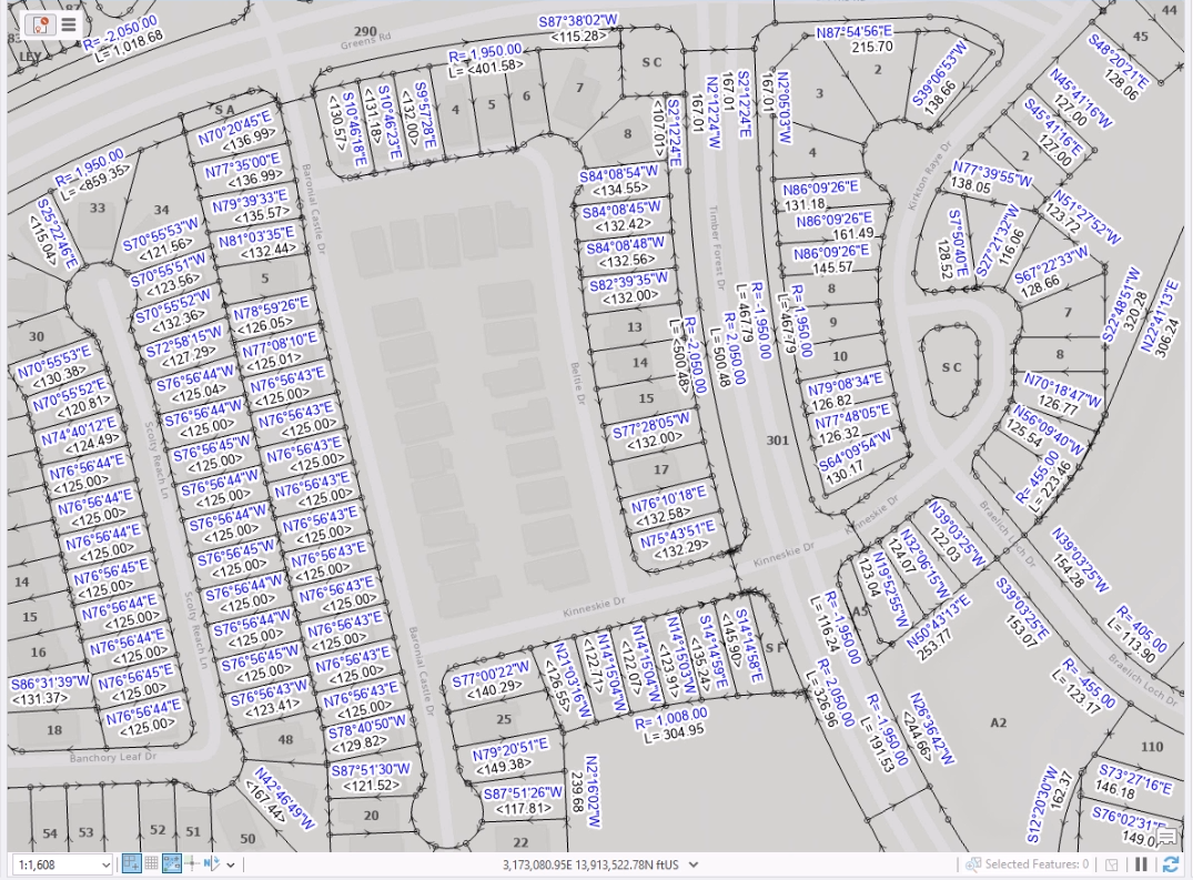
To enable the collaborative workflow, the GIS team first shares out Parcel Fabric feature services for the existing subdivision lots to ArcGIS Enterprise. This makes the authoritative dataset available to the CAD team as well as other project stakeholders. Parcel Fabric feature services combine geometry of the property boundaries with a data model. Line segments making up the property boundaries throughout the subdivision each contain attribute fields of type double. Fields include Arc Length, Direction, Distance, Radius, and a second radius for spiral curves (Radius2). Further, each line segment is drawn with added COGO symbology and COGO dimensions.

ArcGIS Parcel Fabric requires the geodatabase connection to be branch versioned. This allows for multi-user editing workflows, including when edits are made and by whom through Editor Tracking.
Jointly tackle parcel updates
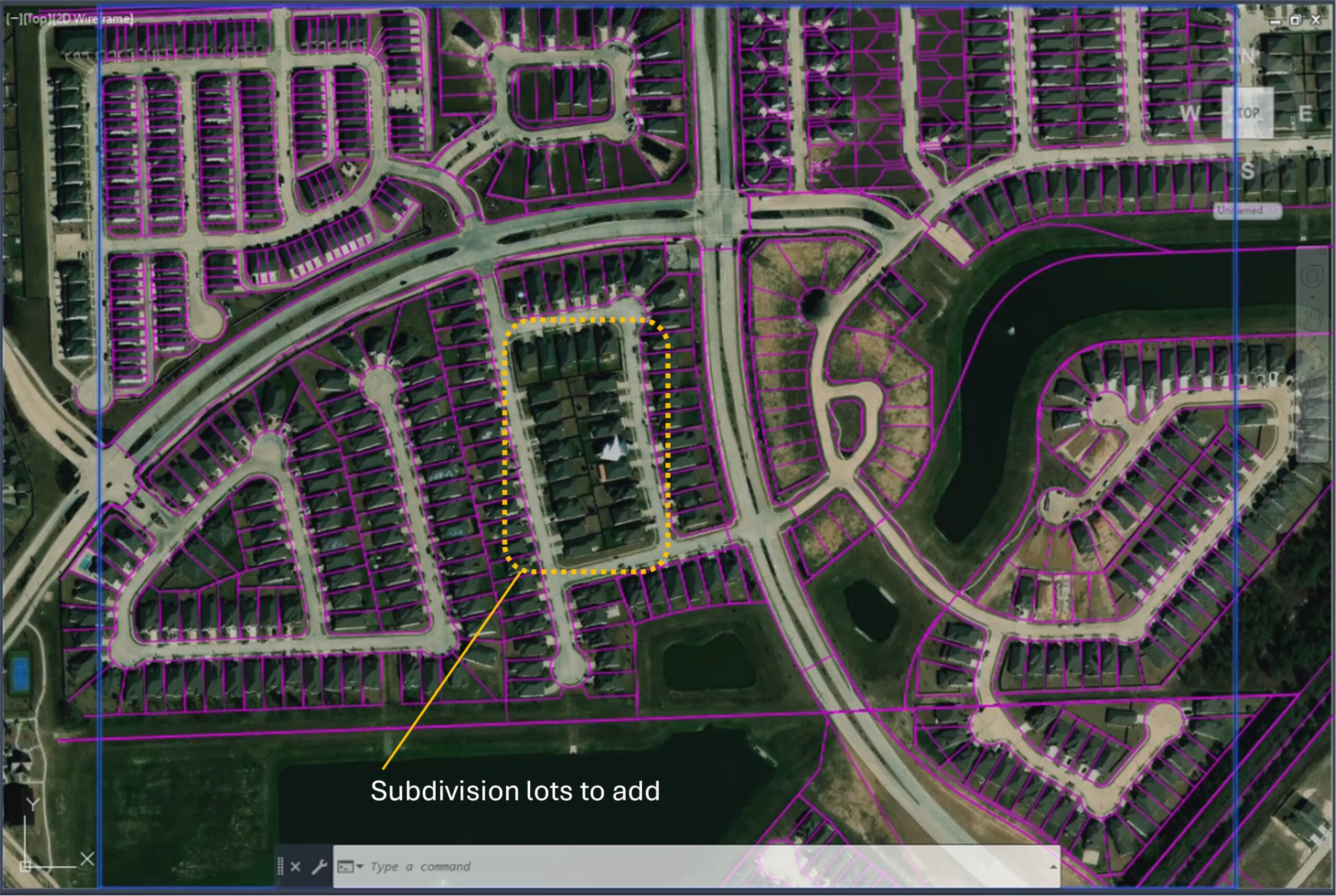
After the GIS team shares the existing feature layer of COGO lines, a contractor notifies the organization that additional lots were completed in the subdivision. These lots must be incorporated into the existing feature layer of COGO lines centralized on ArcGIS Enterprise. Instead of taking on the full effort themselves, the GIS team collaborates with the CAD team to incorporate the additional lot geometry into the feature layer.

Edit and synchronize COGO feature lines from CAD
The CAD team uses ArcGIS for AutoCAD to directly work with the ArcGIS web layer of COGO lines from within their CAD environment. To add a web feature layer to their drawing, they can use the Add Data dialog box and interactively browse to the web feature layer, or directly supply the URL to the service layer, as an Esri named user. ArcGIS for AutoCAD supports branch versioning as well, allowing a CAD teammate to add the default version of the layer.
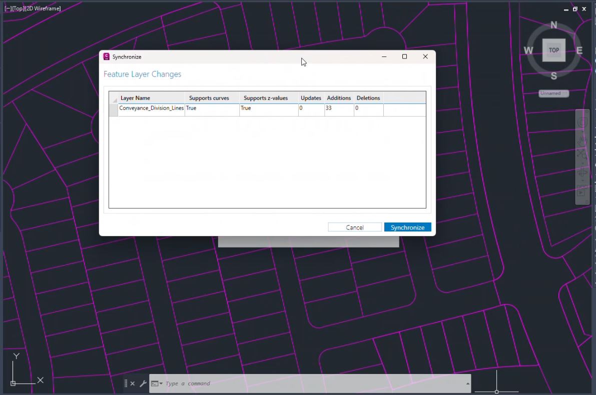
The CAD teammate proceeds by creating a named version of the web feature layer and switching to it from within their CAD tool. Then, they draw the new lots on that named version using normal CAD commands, based on information provided by the contractor. Once the new geometry is in place, the CAD teammate synchronizes edits to the named version layer from CAD to ArcGIS Enterprise. This approach automatically pairs the newly added geometry with the same schema as that associated with all other COGO lines on the feature layer.

Assess, reconcile, and post changes from CAD users in GIS
The GIS team is now ready to complete the overall workflow, including assessing updates for the newly added subdivision lots. After reconciling and posting the changes to the branch versioned layer on ArcGIS Enterprise, the authoritative parcel information again reaches a state of being centralized and available for use by other project stakeholders.
In ArcGIS Pro, a GIS teammate changes to the named version, previously created and populated by the CAD team, to perform necessary reconciling and posting. After reviewing the additions they will carry out any needed cleanup, for example, running Split Lines into COGO and the Planarize tool. These tools will compute the COGO measurements based on the geometry of the lines.
See this collaborative workflow in action in the video below.
Summary
Integrated CAD and GIS workflows are essential to keeping authoritative project data centralized and accessible to GIS teams, CAD teams, and other project stakeholders. These integrations provide opportunities to get the most out of both GIS and drafting tools, enabling teams to jointly tackle project tasks. ArcGIS for AutoCAD serves as a key tool in these integrations, allowing CAD technicians to transact on GIS content directly from within AutoCAD and Civil 3D.
These integrations also benefit GIS teams working with CAD datasets across a wide variety of workflows. This includes collaborating and transacting on shared layers while preserving the data model needed to manage parcel information using ArcGIS Parcel Fabric.
Discover more
Take the next step and unlock the full potential of integrating GIS into your CAD workflows using ArcGIS for AutoCAD. With a solid foundation in place, your team can navigate GIS data integrations with ease and confidence, leading to more efficient design outcomes.
Learn more about getting started with ArcGIS Parcel Fabric.
Download ArcGIS for AutoCAD and bring GIS into your built-environment projects today.


Article Discussion: