This post was updated 13-July 2020 with session links for users registered for the Esri UC 2020. All live sessions are in Pacific Daylight Time (PDT). Please note: All listings subject to change; not every paper or event may be presented here.
Many sessions and events at the UC are related to your Geospatial Collaborative’s organization, engagement, capacity building, and data & technology initiatives. Listed below are some favorites to help you find sessions organized by the topics that interest you most:
- Overview of SDI and Geospatial Collaboratives
- Organizational Ingredients
- Community Engagement
- Capacity Building
- Data & Technology
SDI and Geospatial Collaboratives Sessions
| UC Expo – Technical Workshop | |
|---|---|
| on-demand |
Implementing Next Generation SDI with ArcGIS* |
Audience: Executive Sponsors, GIOs, GIS Managers, GIS Council Members and Stakeholders in government, industry, NGOs, higher education
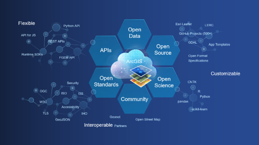
Spatial Data Infrastructures (SDIs) are rapidly evolving. Together, the internet and cloud computing are transforming the way organizations manage data and collaborate. Web GIS is significantly easier to use, deploy, and integrate into an SDI ecosystem than traditional system. Whether you call it an NSDI, OneMap, Regional Information System, Geoportal, or otherwise, SDI are pervasive at all levels of government and across many sectors. In this session you will learn how to leverage the ArcGIS platform to create new value for your SDI. Use ArcGIS Online and Hub with Open Data to set up a standards-compliant multi-organizational data sharing portal that will delight your partners and end-users.
*Join the Open Platform team virtually July 13-16, 2020 in the UC Expo for this and related on-demand Workshops and Demo Theater Presentations.
| Special Session (Main Stage) | |
|---|---|
| Wed 1:40 pm – 2:40 pm PDT |
SDGs Today: A Panel Discussion |
To understand and effectively track progress on the Sustainable Development Goals (SDGs), we need reliable, quality, and timely data. Yet, with only 10 years left to achieve them, too much of the data is still out-of-date or unavailable, and too many people are being left behind in the numbers. Following the plenary session on “GIS – Interconnecting Our World: Making Geographic Knowledge Pervasive,” world-renowned economist, author, and President of the UN Sustainable Development Solutions Network will answer questions on the new open access data portal, SDGs Today, as well as discuss the importance of timely data and the critical role geospatial data and GIS play in ensuring the achievement of the SDGs with a panel of leading experts.
Organizational Ingredients
Organization includes leadership and vision, it encompasses the representative governance structure, strategy, investments, sustainable partnerships, as well as policies, and practices, and tracking/reporting progress on KPIs.
| Live Sessions | |
|---|---|
| Mon 1:40 pm – 2:40 pm PDT |
Developing and Executing a Geospatial Strategy |
| Mon 2:50 pm – 3:50 pm PDT |
Assessing and Managing Technical Risk |
| Tue 1:40 pm – 2:40 pm PDT |
Incorporating Business Value in Your GIS Strategy |
| Wed 7:30 am – 8:30 am PDT |
Don’t Forget the People – The Importance of the Team During Change |
| UC Expo – Technical Workshops | |
| on-demand |
Evangelizing GIS |
| on-demand |
Esri Best Practices: Collect and Manage Requirements for Successful GIS Projects |
| on-demand |
Esri Best Practices: Moving to the Cloud |
| on-demand |
Esri Best Practices: Managing Successful GIS Projects |
| UC Expo – Demo Theater Presentation | |
| on-demand |
Where to Start: Project Prioritization |
| on-demand |
Developing Winning Public Polices With GIS |
| on-demand |
The Modern Regional Government: The Rise of Collaborative Hubs |
| on-demand |
Communicating the Value of GIS in Your Organization: How to Measure Return on Investment |
Community Engagement
Geospatial Collaboratives engage with their communities through open data, inclusive programs and initiatives, information products (like dashboards and story maps), surveys, and events.
| Live Sessions | |
|---|---|
| Mon 2:50 pm – 3:50 pm PDT |
ArcGIS StoryMaps: What’s New and What’s Coming |
| Tue 2:50 pm – 3:50 pm PDT |
ArcGIS Hub: Collaborating and Engaging with Your Community |
| Wed 1:40 pm – 2:40 pm PDT |
Building Web Applications in ArcGIS Online |
| Wed 1:40 pm – 2:40 pm PDT |
ArcGIS Urban for Smart Cities |
| UC Expo – Technical Workshops | |
| on-demand |
ArcGIS Survey123: An Introduction |
| UC Expo – Demo Theater Presentation | |
| on-demand |
ArcGIS Online: Building Apps to Go Viral |
| on-demand |
Quickly Build Great‐Looking Web Experiences Using Templates in ArcGIS Experience Builder |
| on-demand |
Content that Communicates: Effective Visualization with Living Atlas |
| on-demand |
Getting to Know ArcGIS Dashboards (BetaVersion) |
| on-demand |
ArcGIS StoryMaps: Map Choreography and Map Actions |
| on-demand |
Developing Winning Public Policies With GIS |
Capacity Building
Geospatial Collaboratives build Capacity by nurturing developers, business talent, and innovation. They train staff and stakeholders, enable easy and affordable access to data and tools, and mentor the next generation of leaders and users.
| Live Sessions | |
|---|---|
| Mon 1:40 pm – 2:40 pm PDT |
Spatial Data Science in ArcGIS |
| Tue 1:40 pm – 2:40 pm PDT |
ArcGIS Notebooks: An Introduction |
| Tue 2:50 pm – 3:50 pm PDT |
ArcPy: An Introduction |
| Wed 1:40 pm – 2:40 pm PDT |
100 Million Reasons for Hope: Taking Education Further |
| Wed 1:40 pm – 2:40 pm PDT |
Spatial Analysis and Data Science: The Road Ahead |
| UC Expo – Technical Workshops | |
| on-demand |
Overview of Field Data Collection for Classroom Projects |
| UC Expo – Demo Theater Presentation | |
| on-demand |
Training: A Key Strategy to Achieve Technology ROI |
| on-demand |
Startups and the Public Sector: The Market to Accelerate Growth |
| on-demand |
Engage the Entire Enterprise with GIS |
| Special Interest Group (SIG) | |
| Thu 9:15 am – 10:15 am PDT |
Higher Education Special Interest Group (SIG) |
There are several opportunities for members of underrepresented or otherwise marginalized groups to connect at the UC, see themselves represented, share experiences and concerns, and learn about the many organizations helping underrepresented groups in GIS overcome barriers to thrive.
SIGs provide an opportunity to connect with people from the same industry or area of interest. Although you won’t see an SDI SIG on the agenda this UC, we anticipate offering opportunities to connect throughout the year and would like your input! Register your thoughts about SDI SIG topics on our SDI GeoNet page.
Data & Technology
SDIs use Data & Technology to build, manage and share interoperable common core foundational and business data in an open, secure, and integrated geospatial infrastructure to be used and re-used in solutions that meet societal and business needs. Jump to:
Finally, don’t miss the Plenary Session livestreams and Special Interest Groups!
Esri CEO Jack Dangermond explores how geographic information systems (GIS) facilitates interconnected intelligent systems across government, private businesses, and society. You’ll hear inspiring stories from users who are at the forefront of our industry, as well as from special guests.
| Plenary and Closing Sessions | |
|---|---|
| Mon 10:00 am – 12:00 pm PDT |
Part 1 | Interconnecting Our World |
| Tue 10:00 am – 11:00 am PDT |
Part 2 | Interconnecting Our World: ArcGIS Technology & Applications |
| Wed 10:00 am – 11:00 am PDT |
Part 3 | Interconnecting Our World: Making Geographic Knowledge Pervasive |
| Thu 8:00 am – 9:00 am PDT |
Closing Session |
Stay Connected After the UC
Connect with the Esri Community for Spatial Data Infrastructure (SDI)
Connect with the Esri Community for Open Platform, Standards & Interoperability
Explore more resources on Integrated Geospatial Infrastructure and modern SDI


Commenting is not enabled for this article.