The cartographic process for Defense Mapping users in ArcGIS Pro has not changed that significantly. What has changed are tools and the product support files that are needed for the cartographic process.
Defense Mapping supports specifications like MGCP Topographic Maps (MTM) and Topographic Maps (TM). The elements, symbology, and tools that are needed to produce these maps have been migrated to ArcGIS Pro.
Product files
ArcGIS Defense Mapping users must download product files for the ArcGIS Pro version you are using. ArcGIS Production Mapping and ArcGIS Defense Mapping provide separate installers for the product files, including support files for doing end-to-end production with ArcGIS Production Mapping and ArcGIS Defense Mapping. For more information, see
Files for the following are included:
- Predefined geodatabases
- Predefined Edit templates for editing
- Predefined QA/QC files for quality control
- Map layouts
- Symbology
- Maps
- Surround information
- Generalization models and generalization rule files
- Predefined Workflow Manager workflows
Cartographic preparation
Use the following for cartographic preparation.
Map templates
Predefined map documents in ArcMap have been migrated to ArcGIS Pro layout files.
MTM50_TRD_4_X.mxd -> MTM50_layout.pagx
MTM100_TRD_4_X.mxd -> MTM100_layout.pagx
TM25_TDS_7.mxd -> TM25_layout.pagx
TM50_TDS_7.mxd -> TM50_layout.pagx
TM100_TDS_7.mxd -> TM100_layout.pagx
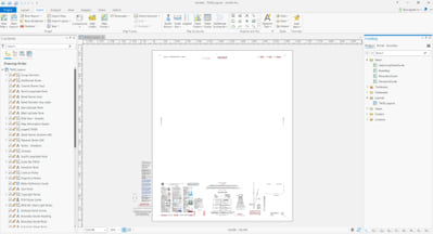
These layout files contain surround information, map frames, layers, symbology, labeling, and elements needed to create MGCP and TDS standard specification maps.
Symbology
Symbolizing maps in ArcGIS Pro has significantly changed by using only standard symbology symbols. Representations are not used in the cartographic process for ArcGIS Pro. ArcGIS Pro only reads representation symbology and does not allow you to edit representations or overrides.
ArcGIS Defense Mapping symbology for MTM and TM map products has been converted to this new standard symbology. The maps in the layout files have also been converted to using this standard symbology along with using Arcade expressions to assign symbols based on attribution. This replaces the ArcMap Visual Specification Table that would apply symbols to feature layers using SQL statements.
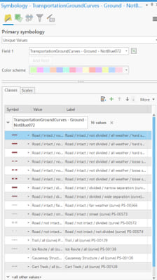
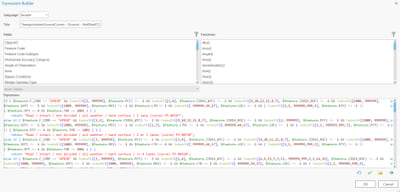
If you have customized map documents and symbology outside the out-of-the-box templates in Defense Mapping, contact us for migrating custom map documents to ArcGIS Pro.
Elements
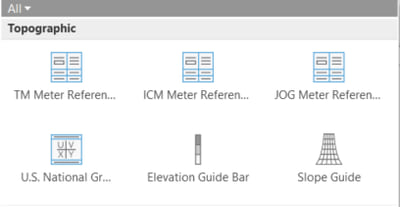
ArcGIS Defense Mapping has implemented the standard elements that are in the MTM and TM map specifications, which are available in the predefined layouts for the MTM and TM specifications that are in the Defense Mapping product files. You can also insert these elements from the Insert ribbon in ArcGIS Pro in the Map Surrounds section.

Elements available from the Insert ribbon include north arrows, meter reference guides, a slope guide, and an elevation guide bar.
North arrows are in the North Arrow drop-down list in the Topographic section.
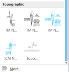
The other specification elements are in the Additional Surrounds drop-down list.
Cartographic geodatabase
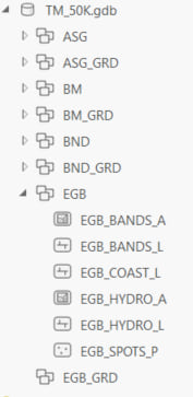
ArcGIS Defense Mapping delivers predefined cartographic geodatabase in the product files. These cartographic geodatabases are configured to work with cartographic refinement tools and automation processes in workflow management. The geodatabases have additional attributes for automated cartographic editing and the geodatabase structure is fine-tuned for automation.
Cartographic data preparation tools
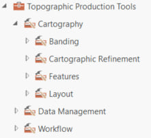
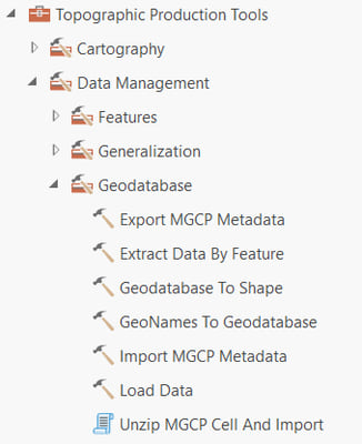
In ArcGIS Pro, you will see differences in the location of tools for ArcGIS Production Mapping and ArcGIS Defense Mapping. Both Production Mapping and Defense Mapping geoprocessing tools are now located in the Topographic Production toolbox. For more information, see An overview of the Topographic Production toolbox.
Extract data
In ArcMap, the Extract and Clip Data tool was used to extracting data for Cartographic Product. ArcGIS Pro has a new tool called Extract Data by Feature for extracting data or creating checkout replica of the cartographic product area of interest. For more information, see Extract Data By Feature (Topographic Production).
Create contours
The Create Contours tool is now called Generate Topographic Contours tool and is available in the topographic production toolbox to create and smooth contours from an input raster. For more information, see Generate Topographic Contours (Topographic Production).
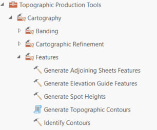
Create spot heights
Creating spot heights tools in ArcGIS Pro are the same as the tools in ArcMap, except that the name in ArcGIS Pro has changed to Generate Spot Heights. For more information, see Generate Spot Heights (Topographic Production).
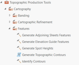
Production tools
The production process of MTM and TM maps in ArcGIS Pro is similar to the process in ArcMap. Most of the same tools exist in ArcGIS Pro but are renamed and have some additional functionality. In the end, the same output spec driven maps are created.
Generate Product Layout
The rapid graphic tool has been replaced by the Generate Product Layout tool in ArcGIS Pro. The Generate Product Layout tool uses an input geodatabase and runs through tools to produce the map data needed for several map frames like Elevation Guide and Adjoining Sheet Guide. For more information, see Generate Product Layout (Topographic Production).
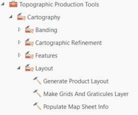
Tools within Generate Product Layout include the following:
Generate Elevation Guide Features
This tool creates data for an elevation guide diagram surround element as required by various supported map product specifications. The tool leverages existing banding and thinning tools to generate output elevation band features, spot height features, and hydrology features. For more information, see Generate Elevation Guide Features (Topographic Production).
Generate Adjoining Sheets Features
This tool generates features necessary for display in a typical topographic map adjoining sheets diagram. Features generated include sheet polygons for labeling, sheet lines for symbolizing sheets from different series uniquely, coastal polygons for displaying open water with coastal polylines for displaying shoreline, and a calculated area of interest (AOI) for generating a feature grid for the diagram. For more information, see Generate Adjoining Sheets Features (Topographic Production).
Populate Map Sheet Info
This tool populates text in graphic elements on a map layout. Text is populated with feature attribute values from a selected area of interest (AOI) feature in the map. The tool searches each graphic element for tagged (<tag></tag>) text. It compares tagged text to values in the PopMapInfo table. Any matching values are replaced in the graphic
element with an attribute value from the selected AOI feature. For more information, see Populate Map Sheet Info (Topographic Production).
Make Grids and Graticules Layer
This tool creates a grouped layer of feature classes depicting grid, graticule, and border features using predefined cartographic specifications. Grid layers are ideal for advanced grid definitions that are scale and extent specific. For more information, see Make Grids And Graticules Layer (Topographic Production).
Cartographic refinement
We have built equivalent cartographic refinement tools in ArcGIS Pro Production Mapping. The following tools are used for cartographic refinement using the OCTS layout template provided in ArcGIS Production Mapping and ArcGIS Defense Mapping. For more information, see Populate Map Sheet Info (Topographic Production).
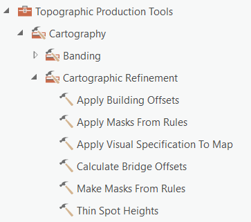
Apply Building offsets
This tool aligns, moves, and hides building or bridge marker symbols based on product specification rules defined in an .xml file.
Calculate Bridge offsets
This tool calculates the offsets necessary to properly display bridges at a given location.
Thin Spot Heights
This tool generalizes spot heights for a given area of interest in accordance with product specifications. For more information, see Thin Spot Heights (Topographic Production).
Make Masks from Rules
This tool creates polygon masks for features based on color rules. For more information, see Make Masks From Rules (Topographic Production).
Apply Masks from Rules
This tool applies symbol layer masking to feature layers in a map based on an XML rule file and mask features created by the Make Mask from Rules tool. For more information, see Apply Masks From Rules (Topographic Production).
Map publishing
Map publishing has changed from ArcMap. ArcGIS Pro now supports SPOT colors. All MTM and TM map templates have been updated to use SPOT color export as defined in the specification. The maps and layout files in the ArcGIS Defense Mapping product files have had the colors defined as SPOT.
Export map
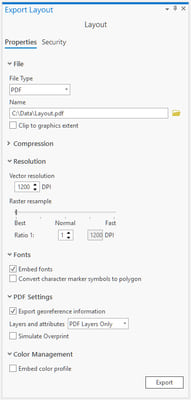
ArcGIS Pro does not use Production PDF. The layout and maps for MTM and TM have the SPOT colors defines on them. Use the ArcGIS Pro export tool with the PDF option, and the export files will contain the SPOT color exports incorporated into the PDF document. No tool is needed like the Production PDF in ArcMap to export SPOT color MTM and TM maps from ArcGIS Pro. For more information, see Export to PDF.
Custom colors
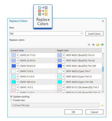
If you have maps that have colors outside of the MTM or TM color specification, ArcGIS Defense Mapping has a tool that can help in mapping these colors.
The Replace Colors tool will allow users to replace colors in a map, layout, or style in the catalog view. Use this tool to update color mapping, including specification-driven color changes, in which updates apply to all colors in a product. For more information, see Replace colors.
For migrating generalization processes from ArcMap to ArcGIS Pro, refer to the Migrating Production Mapping generalization processes from ArcMap to ArcGIS Pro Community blog post.

Article Discussion: