Adverse weather conditions have a major impact on the safety of roadways and communities depend on efficient winter weather operations to keep roads safe and traffic flowing. As a result, state and local agencies spend more than 2.3 billion dollars on snow and ice control operations annually. Unfortunately, the increasing frequency and severity of winter storms is consuming a larger percentage of operations and maintenance budgets each year.
While every community will face challenges responding to winter weather, progressive communities leverage mapping technologies to prepare for winter weather operations and manage response activities. Understanding where snowplows have traveled and are currently located optimizes response activities and helps clearly communicate what roads have been serviced during a winter storm.
The ArcGIS Solutions for Winter Weather can be used by public works departments, road commissions, departments of transportation (DOTs), and other road authorities to develop winter weather response plans, monitor weather operations, respond to requests for service, and communicate progress during winter weather events.
Improve winter weather planning
When winter storms occur, Public Works Departments and Departments of Transportation (DOTs) are the primary government agencies responsible for winter weather operations. Typically, they draft winter weather plans that outline service level agreements and maintenance responsibilities on roadways they are responsible for servicing during winter storms.
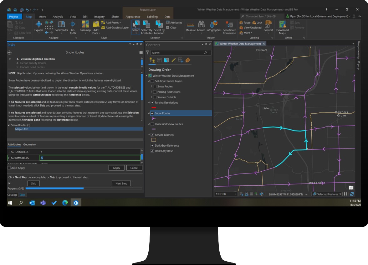
Developing an effective snow response plan before the winter weather season begins requires reliable and current data. The Winter Weather Data Management ArcGIS Pro Project helps you manage an authoritative inventory of snow routes, parking restrictions and service area boundaries so you can develop winter weather response plans.
Inventory vehicles
The ArcGIS Velocity analytics shipped with the Winter Weather Operations solution are designed to work with both existing AVL providers as well as ArcGIS location tracking technology. Maintaining a vehicle inventory helps you understand the current state of automated vehicle location (AVL) technology used by your fleet, identify the needs of vehicles without AVL, and helps you document important information for each vehicle required by the solution.
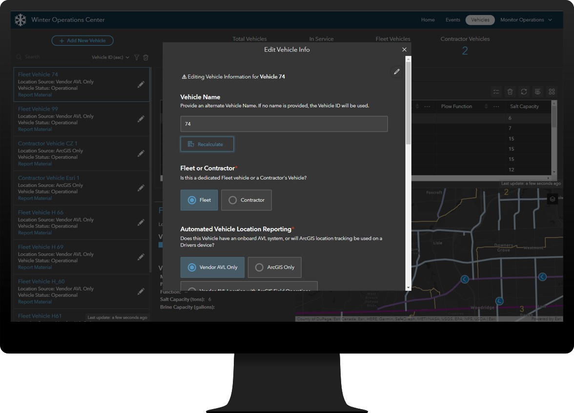
Create and manage an authoritative inventory of winter fleet vehicles with the Winter Operations Center so you can bring together disparate sources of information and create a common operating picture of vehicles supporting your winter weather operations.
With your vehicles inventoried and snow routes and other foundational datasets created, you will be ready for the first snow event of the year when it arrives.
Define winter weather events
The ability to define winter events, or each operational period of snow removal and ice control activity, is important for organizations that want to track key performance metrics and help justify budget needs for the next winter season. By defining a winter event, you can also compare response activities over the course of the season and associate response activity and key metrics with weather condition observations.
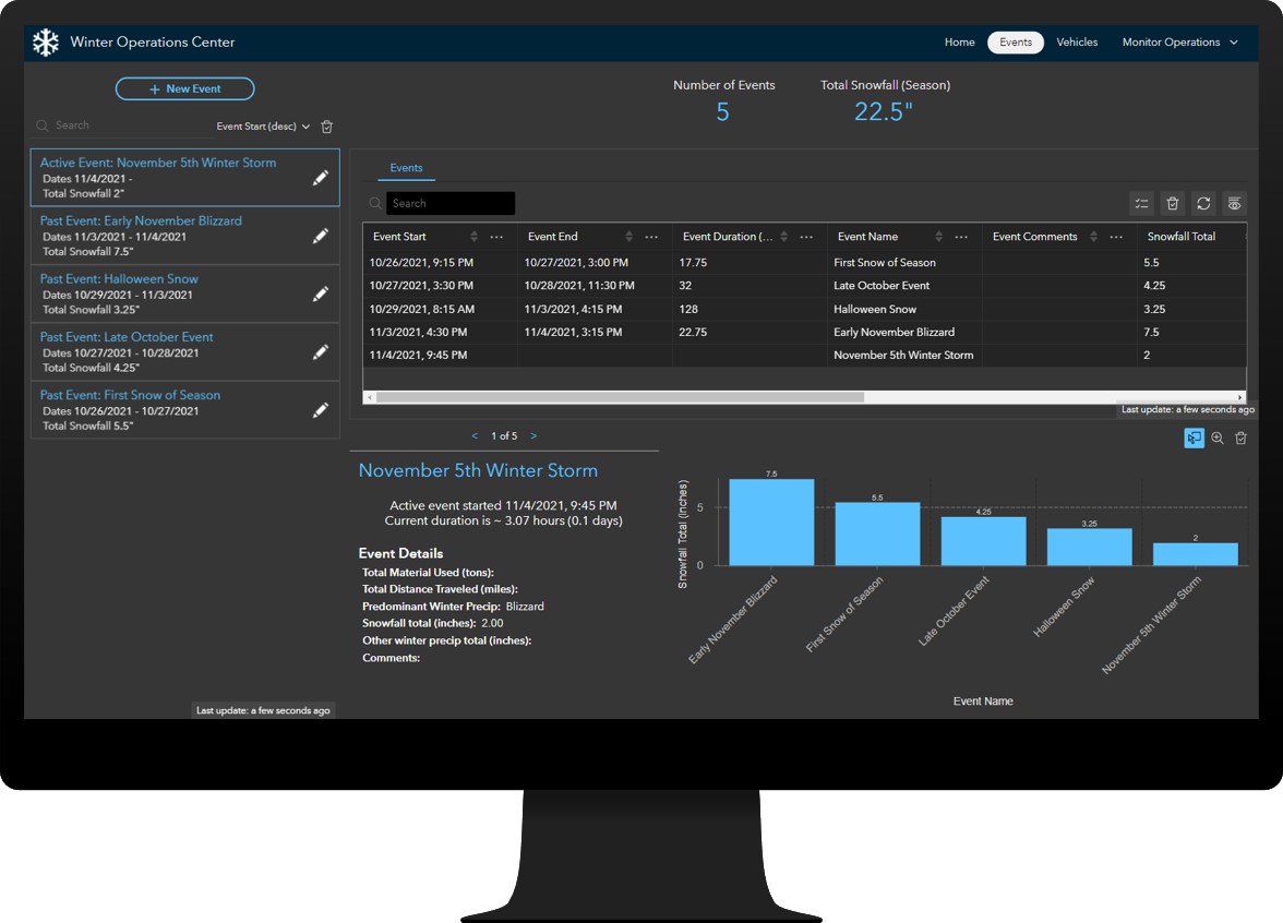
The Events page of the Winter Operations Center can be used to define winter weather events so you can track key performance metrics during operational periods.
Winter events are also used to help automate tasks in ArcGIS Velocity with the use of the Winter Weather Operations Notebook. When a new event is created, and the notebook is configured to run on a schedule, at its next scheduled run-time, the notebook will start all feeds and analytics associated with the solution, saving time, and freeing up resources. When the active event ends, the notebook will stop all feeds and analytics associated with the solution, including resetting the route status information.
Streamline winter weather operations
Public works and transportation agencies can use ArcGIS to extend their ability to track and monitor winter weather operations by including vehicles with limited or no existing AVL technology on board. Drivers equipped with ArcGIS location tracking technology and field operations apps can be tracked alongside vehicles supported by an AVL system, and yard supervisors and operations managers can help record material used for any vehicle during operations.
The Status Reporter ArcGIS QuickCapture project can be used by drivers to record current vehicle location, service status and material used during winter weather operations.
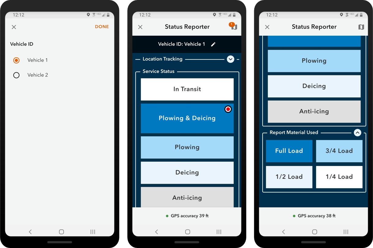
Agencies have the flexibility to decide how material is reported and by whom. Some vehicles may have existing sensors to that track this information as a part of their AVL system, while other vehicles do not.
The Material Reporter app can be used by operations managers and yard supervisors to help record material used for any vehicle during operations, giving operations managers another data point to validate other material-use reporting for their fleet. The Material Reporter can be used by accessing the Vehicle page in the Winter Operations Center, or by directly accessing the web form.
Monitor winter weather operations
Real-time information and transparency are critical during winter weather response activities. Understanding where snowplows have traveled and are currently located during a winter storm optimizes response activity and helps clearly communicate what roads have been serviced.
The Active Events Dashboard helps you monitor snow response activities during operational periods so you can ensure service agreements and key performance metrics are being met.
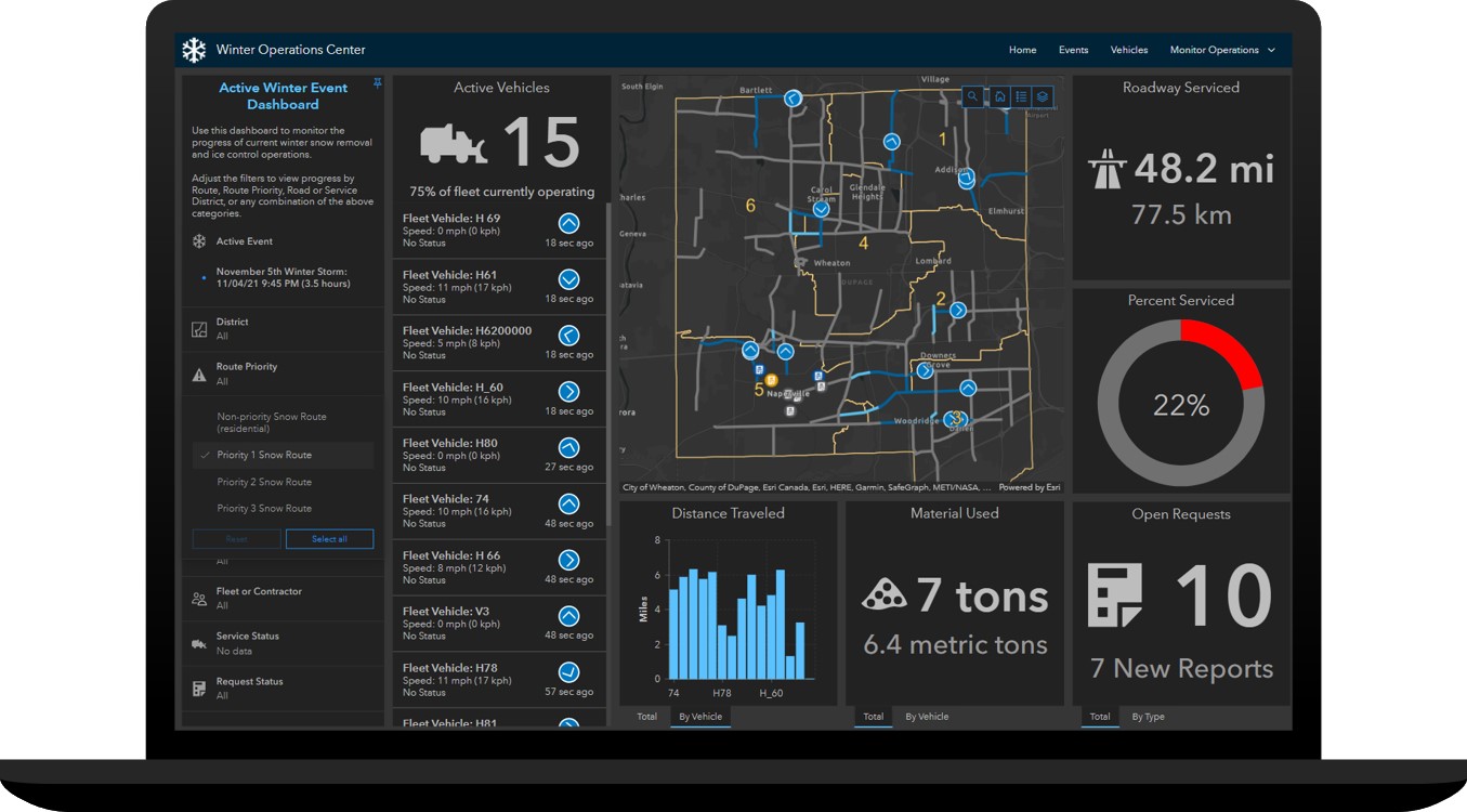
The Active Events Dashboard can be used by public works and transportation agency directors and operations managers to monitor real-time snowplow locations, and measure key metrics such as the amount of roads serviced by route priority, service area, and determine when any given route was last serviced during the current operational period.
The Winter Season Dashboard helps you review response activities for any winter weather event so you can adapt future response plans and address performance challenges.
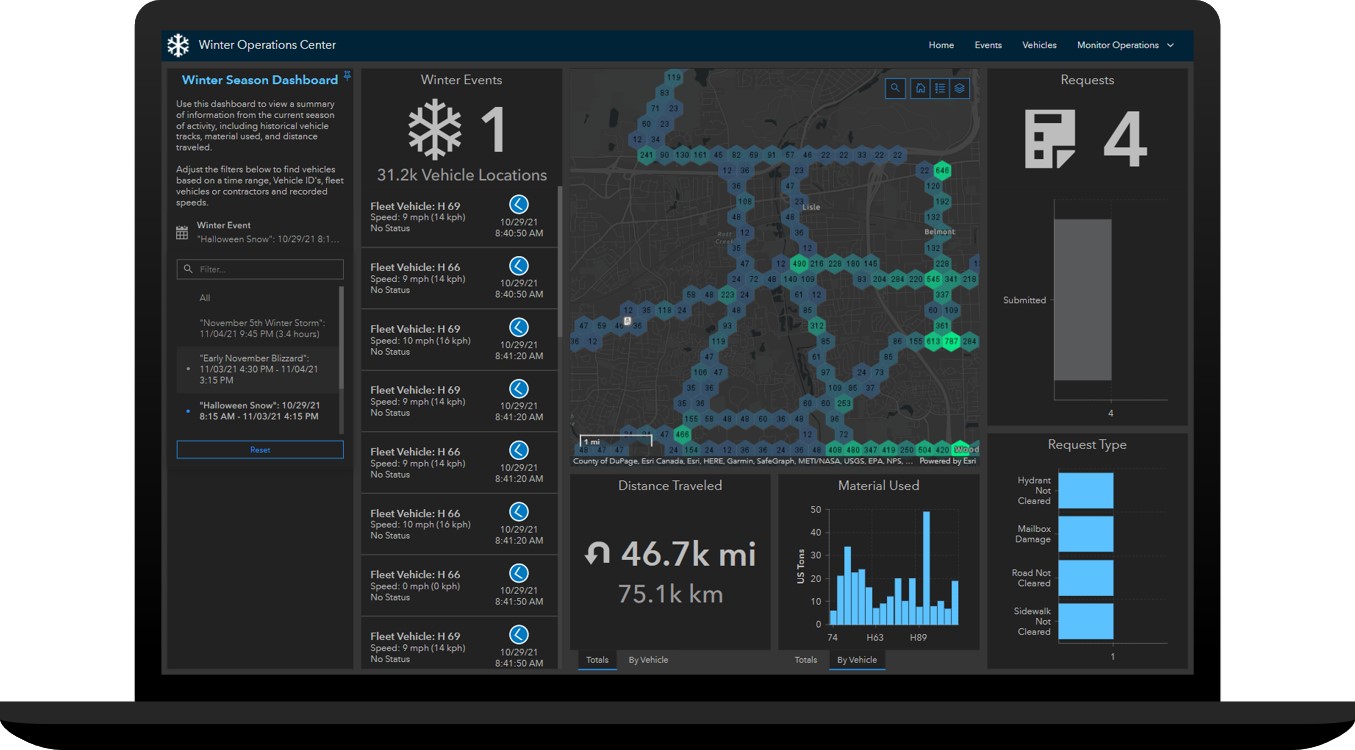
The Winter Season Dashboard can be used by public works and transportation agency directors and operations managers to review vehicle location history and key metrics tracked during different operational events.
Increase transparency and public trust
Progressive communities use mapping technologies to help inform the traveling public about their winter response plans and when routes were last serviced so drivers can plan for a safer commute.
Providing 24-hour access to your organization in a single website destination helps the public easily discover information about winter weather response in their community. The Safe Winter Roads site organizes content into three sections to help users easily discover route status, request service, and review snow plan information.
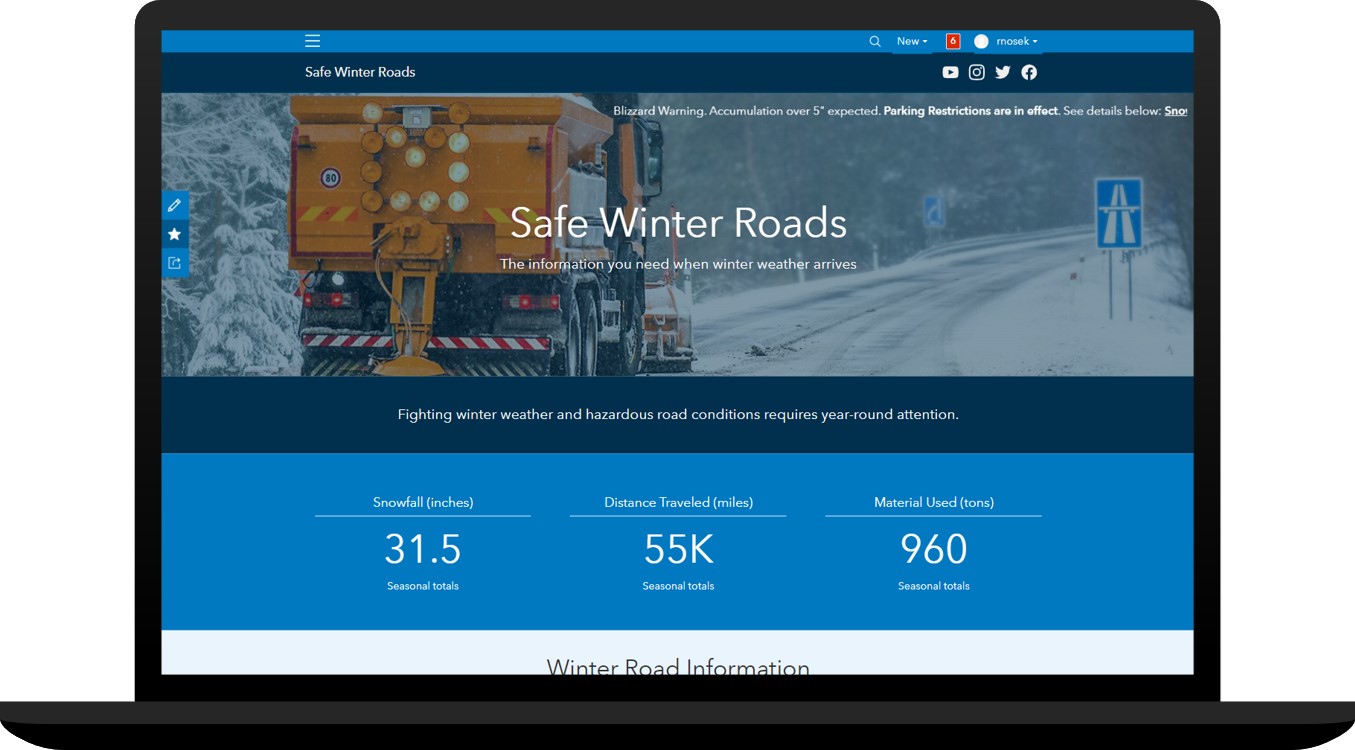
The Safe Winter Roads site can be used by transportation and public works organizations to share winter weather plans, communicate route status updates, and solicit winter weather requests for service from the public.
The Current Road Status section features an app of current, up-to-date status of routes in the community. The Route Status app can be used by transportation and public works organizations to share near real-time road status updates during winter weather events.
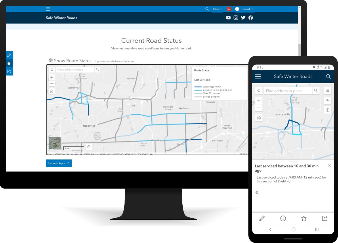
If your organization is using the Winter Weather Operations solution, route status updates are automated with the use of analytics shipped with the solution. If your organization is only using the Winter Weather Outreach solution, manual snow route updates can be provided using the Route Status Manager.
The Request Service section provides links to the Snow Requests form, a digital survey form that helps you solicit winter weather service requests from the public.
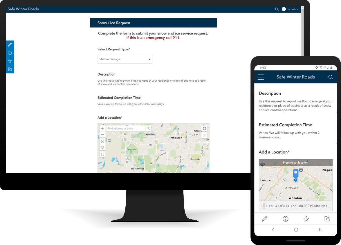
To manage incoming requests, staff can use the Snow Request Manager app to triage snow and ice service requests from the community. This allows staff to monitor and address small issues before they become too big, costly, or unsafe for your community.
The How We Operate section provides two additional topics to help direct users to important information. The Snow Plan topic can be used by transportation and public works organizations to direct users to additional snow plan content hosted by the organization’s website, while the Snow Routes and Restrictions topic will link users to the Snow Routes and Parking Restrictions web app.
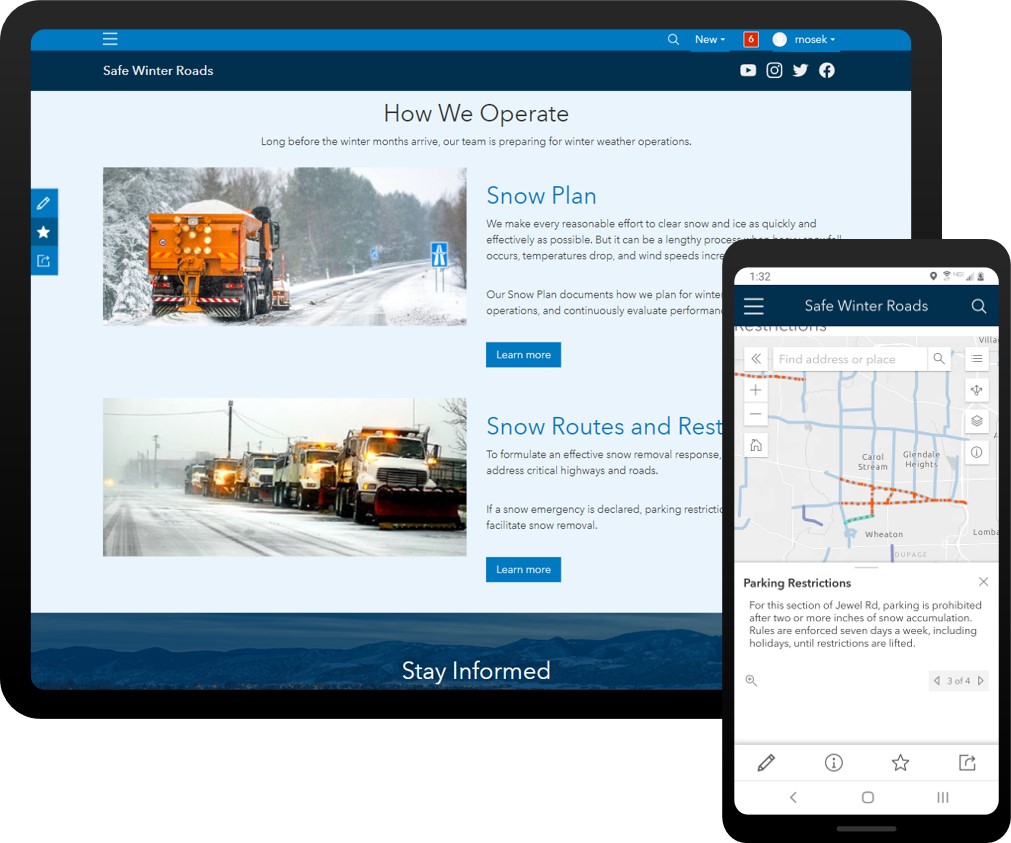
The Snow Routes and Parking Restrictions app can be used by transportation and public works organizations to share snow routes, route priorities, and parking restrictions.
Additional Resources
Learn more about the ArcGIS Solutions for Winter Weather and how you can quickly deploy the Winter Weather Operations solution and the Winter Weather Outreach solution on the ArcGIS Solutions site. For questions and feedback, chat with us on Esri Community or contact Esri Support Services.

Commenting is not enabled for this article.