ArcGIS Solutions helps you make the most of your GIS by providing purpose-driven, industry-specific configurations of ArcGIS.
Rotary aircraft—helicopters to the layperson—are agile forms of transportation, well-known for their ability to maneuver with precision in a three-dimensional space. In fact, their agility is precisely why they are deployed by both the military and emergency services when a quick response is crucial, such as to evacuate casualties, offer wildfire support, provide humanitarian assistance, or support military offensive operations.
Of course, these critical deployments are frequently to isolated areas, far from established heliports or airfields. Therefore, to reach maximum efficiency, helicopters must be able to land at and take off from a range of environments, which means that geospatial staff must be able to quickly identify safe and effective helicopter landing zones (HLZ).
This November, ArcGIS Solutions released HLZ Suitability, a solution designed to help defense and emergency management organizations identify and understand these locations. Included with ArcGIS, this solution can be deployed to your ArcGIS Online account or ArcGIS Enterprise portal and then downloaded for use in ArcGIS Pro or ArcGIS AllSource.
Improving operational planning
Your organization’s geospatial team can use the solution’s ArcGIS Pro project to identify and assess terrain suitable for helicopter landing zones (HLZ) per operational standards, create HLZ candidate locations, and share HLZ map products with staff.
Assess terrain for HLZ suitability
Three primary factors impact the suitability of terrain for HLZs: land cover, ground slope, and obstacles. The solution guides you through assessing each of these factors.
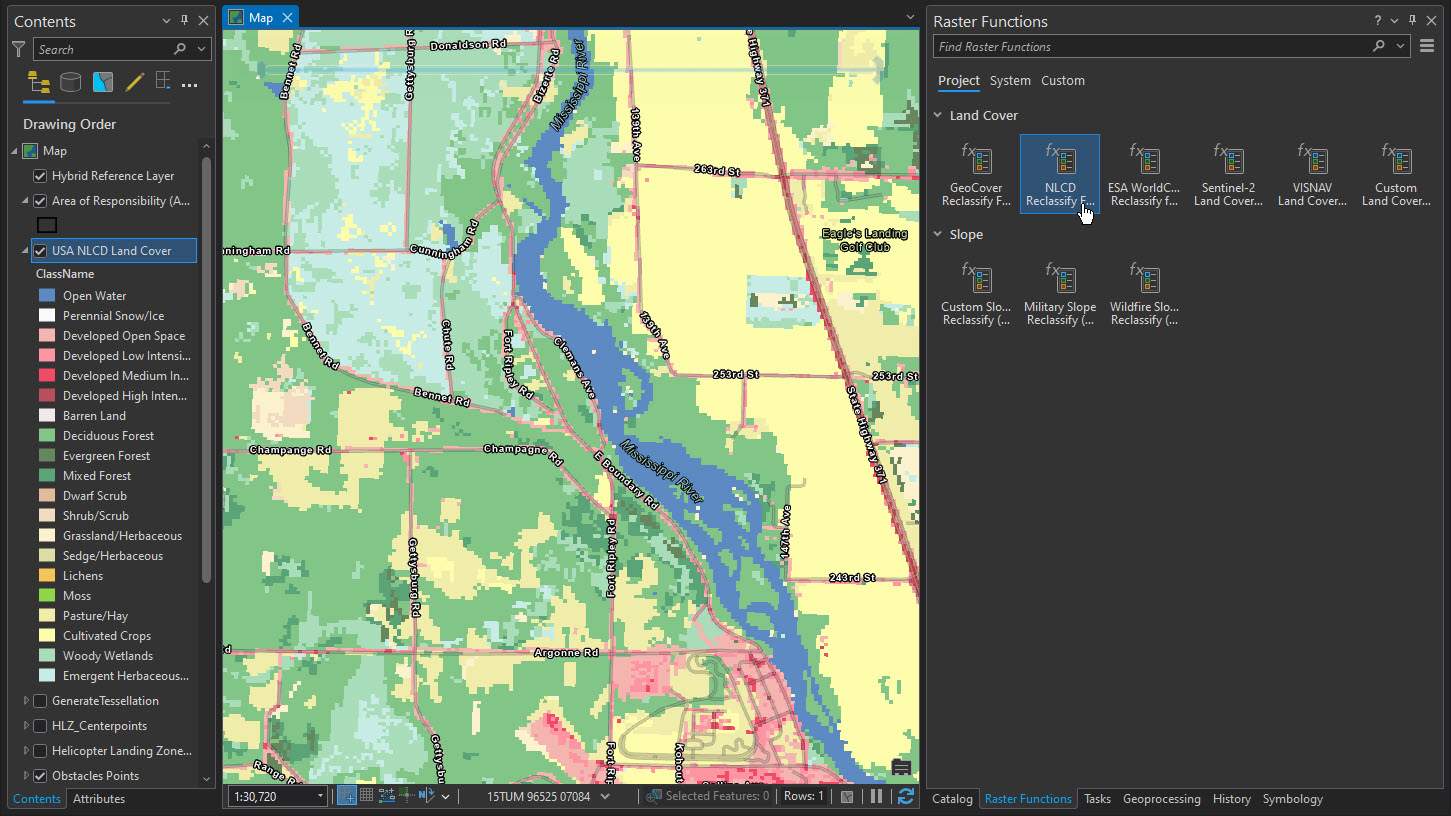
Not all land cover is suitable for an HLZ; forests, urban areas, and waterbodies are problematic at best and more likely prohibitive. Additionally, helicopters have ground slope limits, with the maximum degree varying slightly depending on the aircraft. Using preconfigured raster functions, you can reclassify land cover and elevation datasets to areas that are acceptable, acceptable with caution, or unacceptable. These raster functions account for a variety of different data sources and operational standards, such as military doctrine and wildfire response standards, but you can also use your own data schema or define your acceptability criteria.

Although it’s possible for land cover and ground slope to be classified as acceptable with caution, obstacles such as cell towers, agricultural equipment, and energy infrastructure are more prohibitive. The solution’s ArcGIS Pro project allows you to identify these features using data from the U.S. Federal Aviation Administration, by loading other obstacle datasets, or by digitizing your own obstacle features. Then, you can create obstacle offset buffers at either the standard 10:1 offset ratio or your own custom offset ratio. These buffers will help clearly identify areas where obstacles pose a risk to helicopter operations and should therefore be avoided.
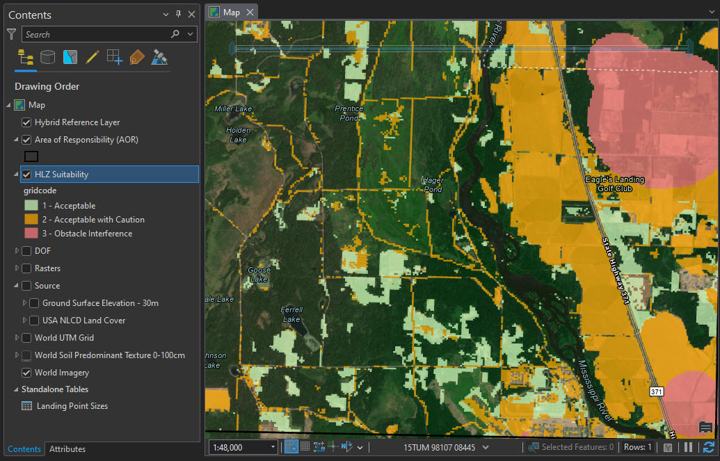
After you have assessed land cover and ground slope and generated obstacle buffers, you can create an overall HLZ suitability raster layer that depicts areas that are acceptable, acceptable with risk, or that include obstacle interference. This raster layer provides a great overview of these conditions, but the solution can take your review even further by allowing you to remove locations that do not meet the minimum military and wildfire aircraft area requirements from the overlay. Additionally, the solution can generate a reference tessellation grid to help you visually review and assess if areas meet your aircraft requirements. You can also upload imagery and soil data to help you visually inspect and review if locations are acceptable for HLZs.

Create candidate locations
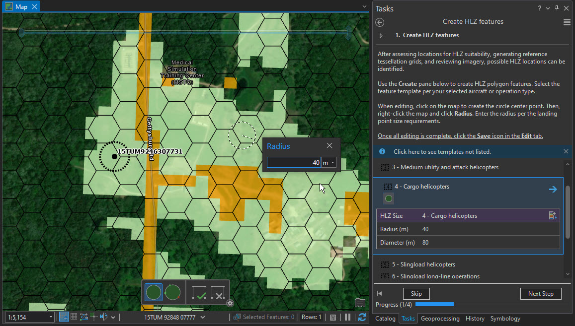
Rotary aircraft vary significantly in size, speed, and maneuverability, so a minimally viable HLZ is not one size fits all. For example, in military operations, a CH-47 Chinook helicopter requires a minimum landing zone diameter of 80 meters, but a Type 3 wildfire response helicopter only requires a 23-meter one. The solution’s ArcGIS Pro project accounts for these differences by including various aircraft types in its feature editing templates and reference tables. After assessing terrain suitability, you can create candidate HLZ locations specific to your organization’s aircraft and operational requirements.

Disseminate HLZ map products
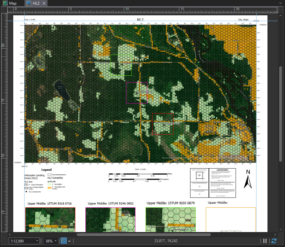
Once you’ve completed your analysis and have identified HLZs suitable for your organization’s aircraft, you have several options for sharing the information directly from ArcGIS Pro or ArcGIS AllSource with operations staff members or leadership. For example, you can publish and share services through your ArcGIS Online organization or ArcGIS Enterprise portal. These services can then be added to planning or operations applications that can be leveraged by the entire operations team. You can also create a map layout in ArcGIS Pro that can be shared as a PDF file or even printed and distributed to aircraft personnel or HLZ managers. With this shared information, you can effectively break down information silos and improve overall unit effectiveness.

Taking off
Rotary aircraft are essential to a wide range of organizations—domestic and international defense, wildfire response, emergency management, search and rescue, and nongovernmental, to name a few—but without accurate information about suitable landing zones, these aircraft are essentially grounded. The HLZ Suitability solution can help you get the information you need to quickly identify these suitable landing zones, thereby enabling continued rotary aviation operations in support of your organization’s larger mission and objectives.
Learn more
For more information about the HLZ Suitability solution, check out the following resources:
- Learn how to deploy, configure, and use the solution.
- View a demo video.
- Discover related solutions: Emergency Management Operation, Gridded Reference Graphic, Military Ground Mobility, Weather Operational Effects.
- Learn more about ArcGIS Solutions.

Article Discussion: