ArcGIS Solutions helps you make the most of your GIS by providing purpose-driven, industry-specific configurations of ArcGIS.
Solar power: a clean, renewable energy source subsidized by government tax credits. It isn’t surprising that solar has become a booming industry. But, as is frequently the case with fast-growing industries, there are still challenges to face.
Traditional energy providers, such as electric and gas utilities, have been around for decades. Highly regulated, these organizations must follow strict standards, and as a result, they have learned exactly what kind of data to track, how to track it, and how to report it. They have developed a long history of relying on geospatial technology and maps to represent and understand information and can rely on well-established industry mapping standards.
It’s different for utility-scale solar sites. The solar industry is still working out best practices and standards for mapping these sites. In the meantime, solar providers must invest company time and resources to determine how to represent the features of their sites spatially and how to best depict them on a map.
Here’s where our new Solar Site Data Management solution comes in. The solution delivers a set of capabilities that helps solar site operators centralize and standardize their operations and provides a preconfigured data model that simplifies the whole process.
Setting standards
Solar site operators strive to maximize energy production and reduce operating costs. But solar sites can be enormous, spanning hundreds of acres and containing thousands of solar panels, not to mention an array of electrical equipment, natural features, and infrastructure. Keeping track of everything isn’t easy, especially if a site’s recordkeeping hasn’t kept pace with the rapid boom of the solar industry.
Here’s how Solar Site Data Management can help:
Create requirements for solar sites
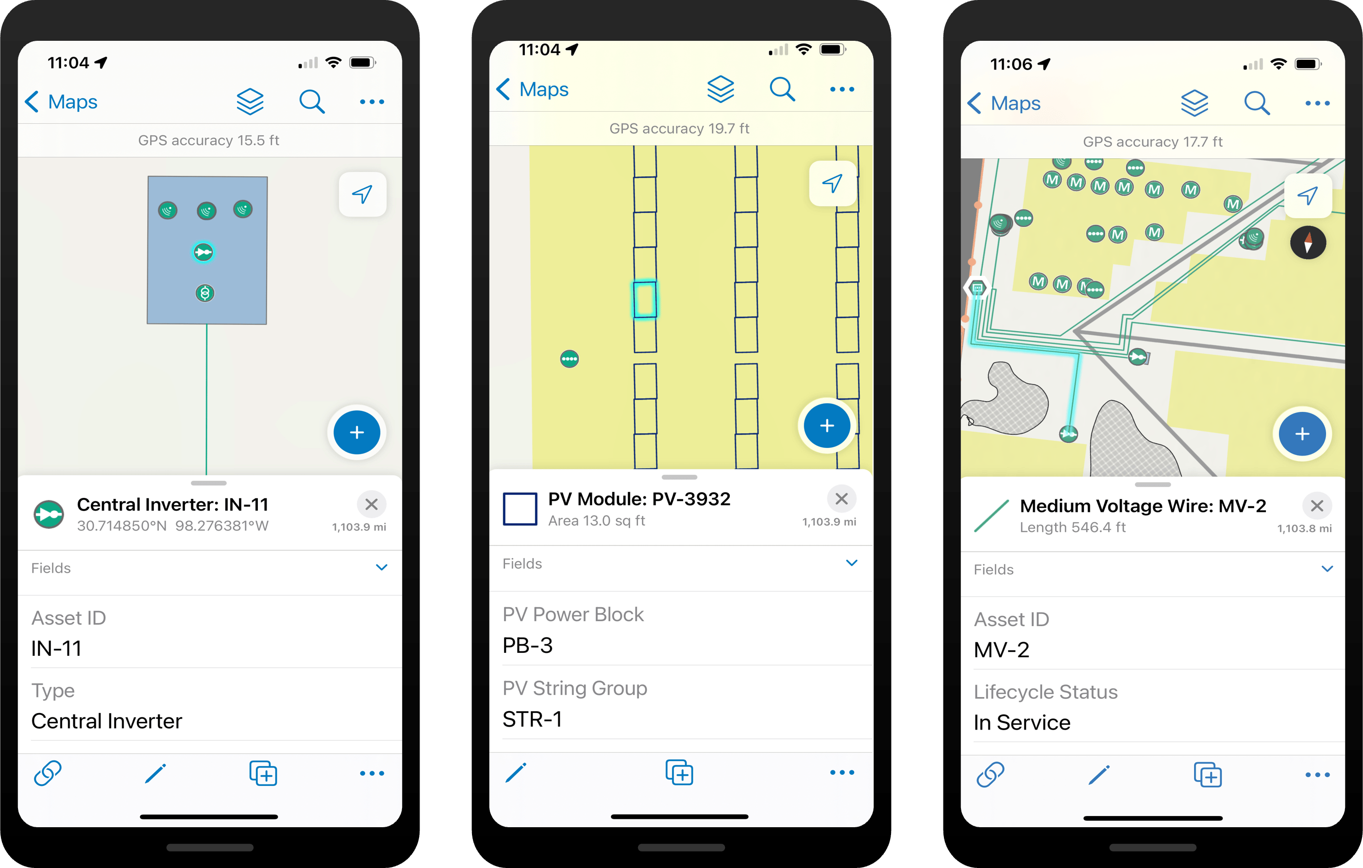
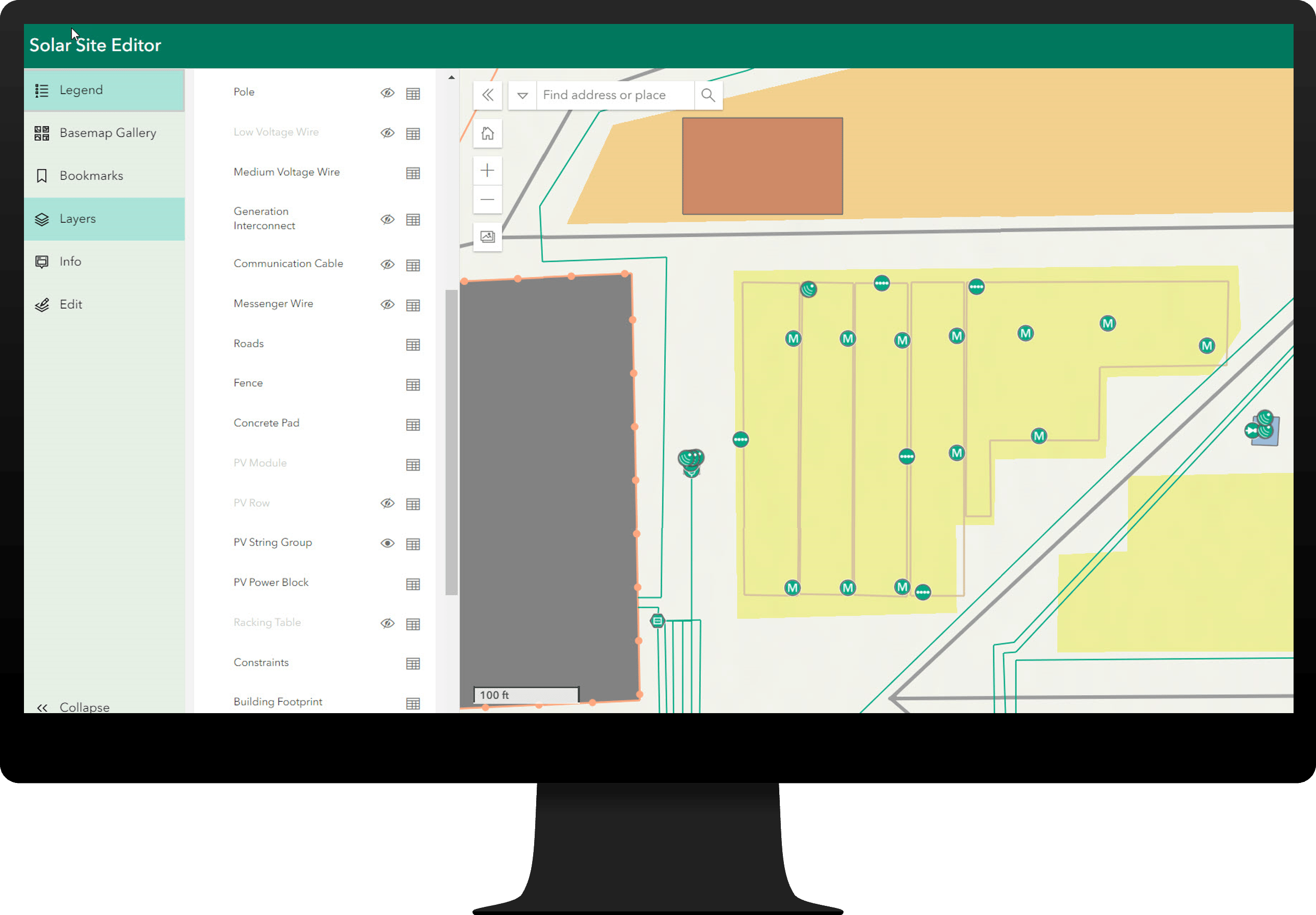
The Solar Site Data Management solution aims to define all the layers critical to managing an operating site and includes a list of layers and attributes that can be used to standardize each site’s datasets. The layers include common solar site assets, like PV modules and inverters, of course, but they also include electrical groupings, such as power blocks and string groups, and other on-site features, such as constraints, fences, and roads. Layers are also configured with scale dependencies to make data visualization easier to work with as users zoom in and out of their maps.
Increase organizational efficiency
Solar Site Data Management includes three preconfigured groups—Solar Site Map Notes Managers, Solar Site Editors, and Solar Site Viewers—that help managers organize their workforce based on the type of work each member does. After members are added to the appropriate group, they have access to the apps and maps they need and can begin collaborating immediately. Best of all, because these apps and maps are all built from the same data, any edits or updates made by one group are visible to everyone in the organization.
Map solar sites
The solution delivers a full set of data-loading capabilities that can help an organization build a comprehensive solar site map. Editors can load existing data that may currently be stored in CAD or KMZ files, digitize site data with ArcGIS Online or ArcGIS Pro, or collect site data directly from the field using ArcGIS Field Maps.

View site maps and asset reports
After data is loaded, anyone in the organization can immediately view it, and members with editing privileges can edit, update, or remove data or add notes about specific assets and their conditions. Because everyone is working with the same data, they see the same changes, which helps streamline operations.

One-click deployment
Solar Site Data Management is included in ArcGIS and can be deployed to your ArcGIS Online organization with a single click. Start mapping your solar site today!
Learn more
For more information about the Solar Site Data Management solution, check out the following resources:
- Learn how to deploy, configure, and use the solution.
- View a demo video.
- Learn more about ArcGIS Solutions.


Commenting is not enabled for this article.