ArcGIS Solutions helps you make the most of your GIS by providing purpose-driven, industry-specific configurations of ArcGIS.

In the November 2024 release, you will find eight new solutions for state and local governments, utilities, defense, and public safety agencies. There are also many enhancements to the existing solution portfolio that can be leveraged by organizations of all types.
Here’s what’s new:
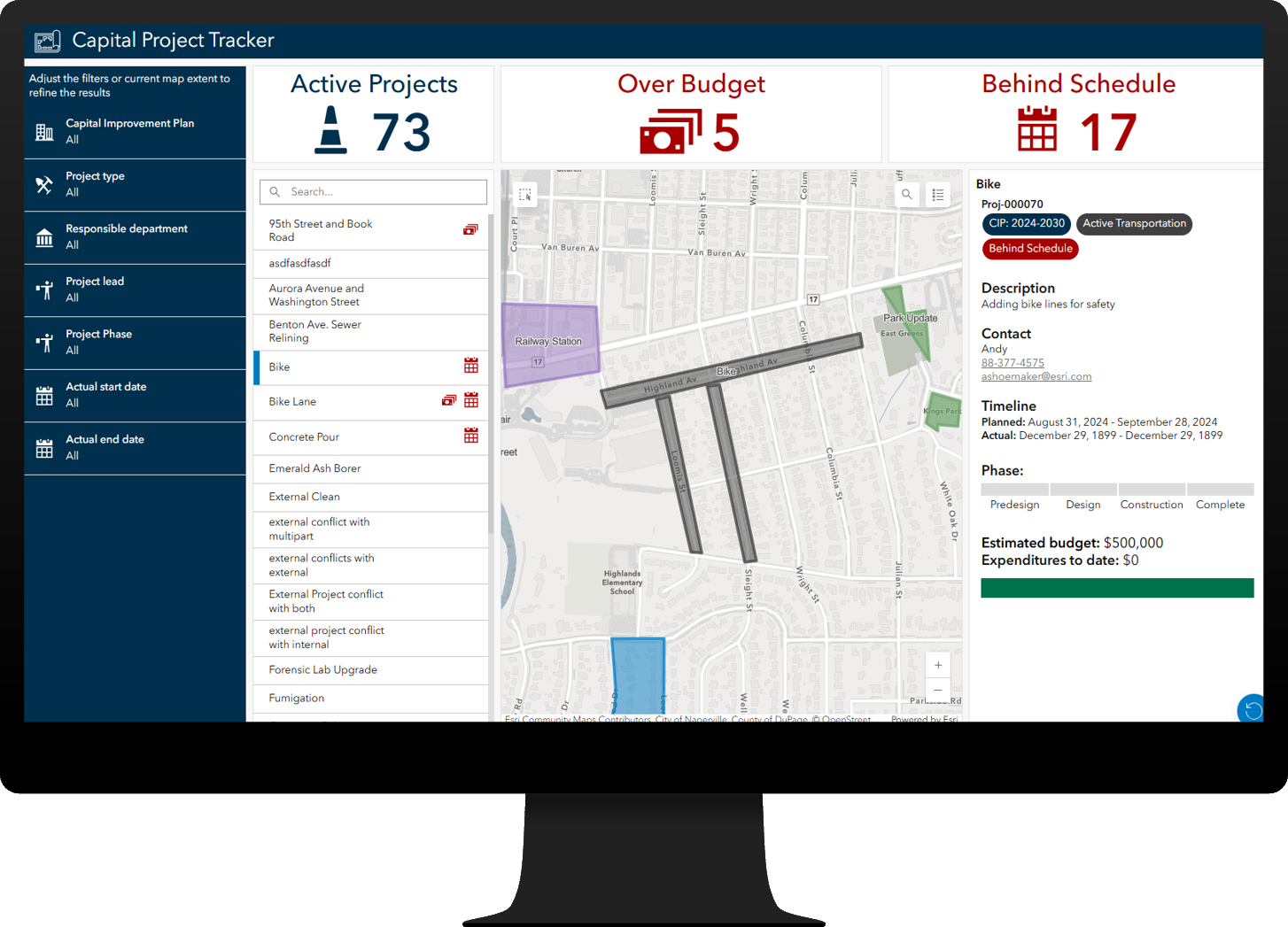
Capital Project Coordination
Robust infrastructure is vital for economic growth and quality of life, leading state and local governments to create capital improvement plans that detail the location, timing, and financing of capital projects.
The Capital Project Coordination solution can be used to define and coordinate capital projects, track performance, and communicate investments to stakeholders, aligning public infrastructure projects with private utility investments.
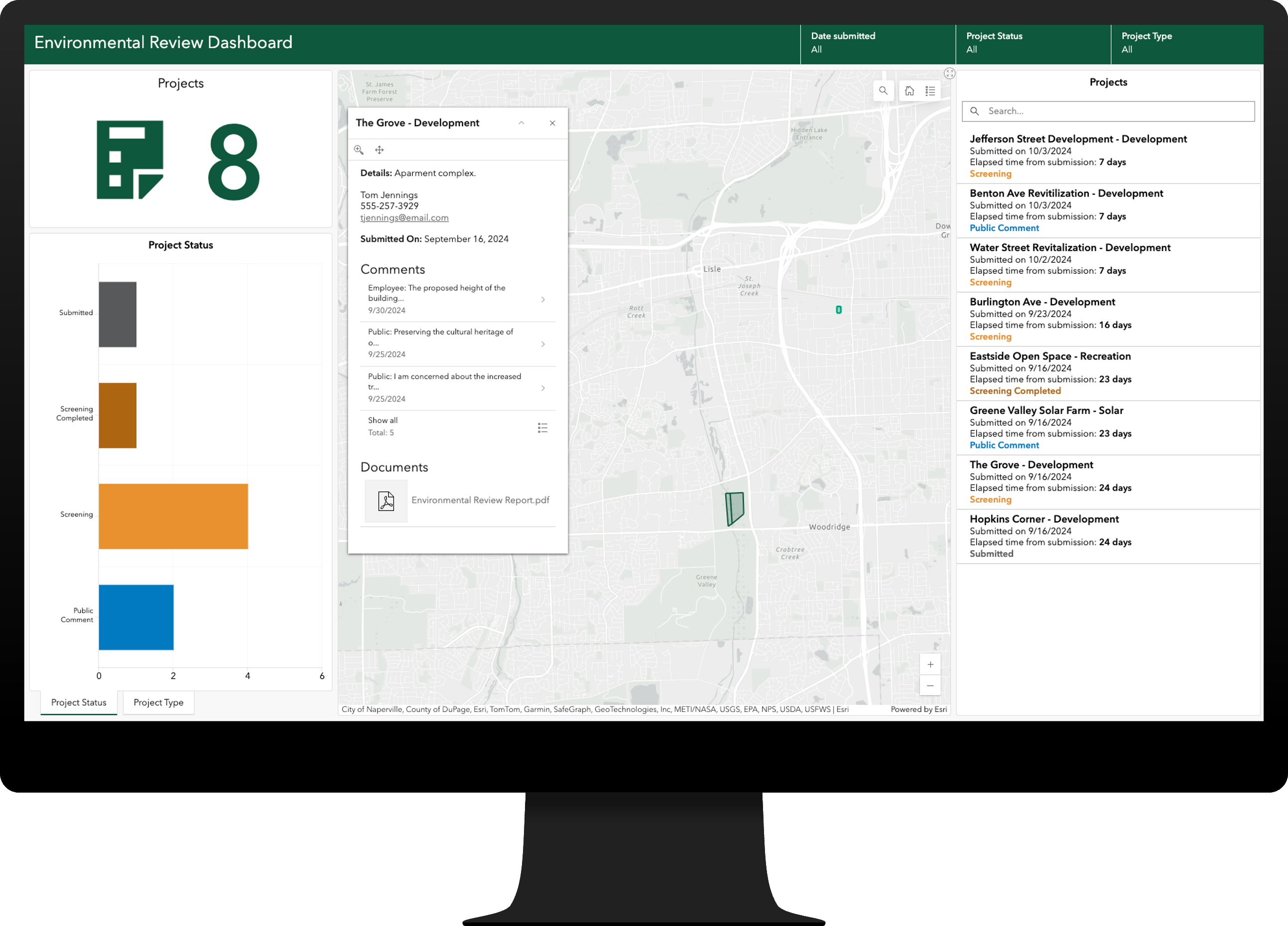
Environmental Review
Environmental reviews evaluate a project’s potential impact on ecologically sensitive areas and ensure compliance with environmental standards.
The Environmental Review solution can be used to facilitate environmental review applications, gather feedback during the review, and share project information with internal and external stakeholders.
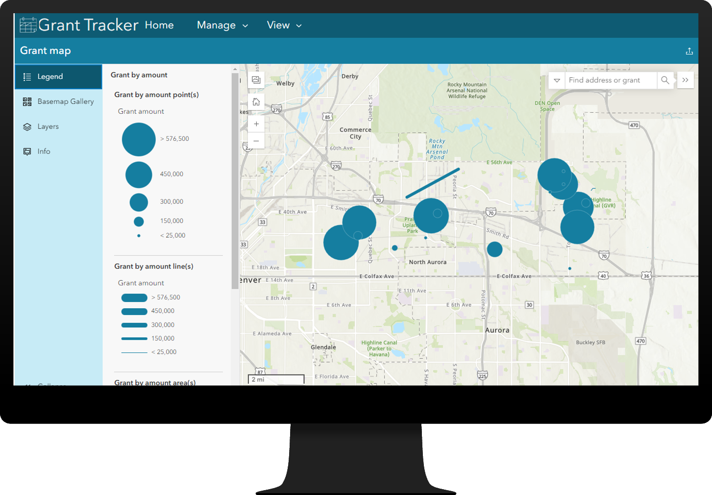
Grant Tracker
Grants provide essential financial support for a wide range of public services and effective grant administration maximizes these financial resources, supports compliance, and ultimately ensures grants are achieving the goals set forth by an organization.
The Grant Tracker solution can be used to develop an authoritative inventory of grants, track grants through key phases, evaluate their effectiveness, and inform internal and external stakeholders.
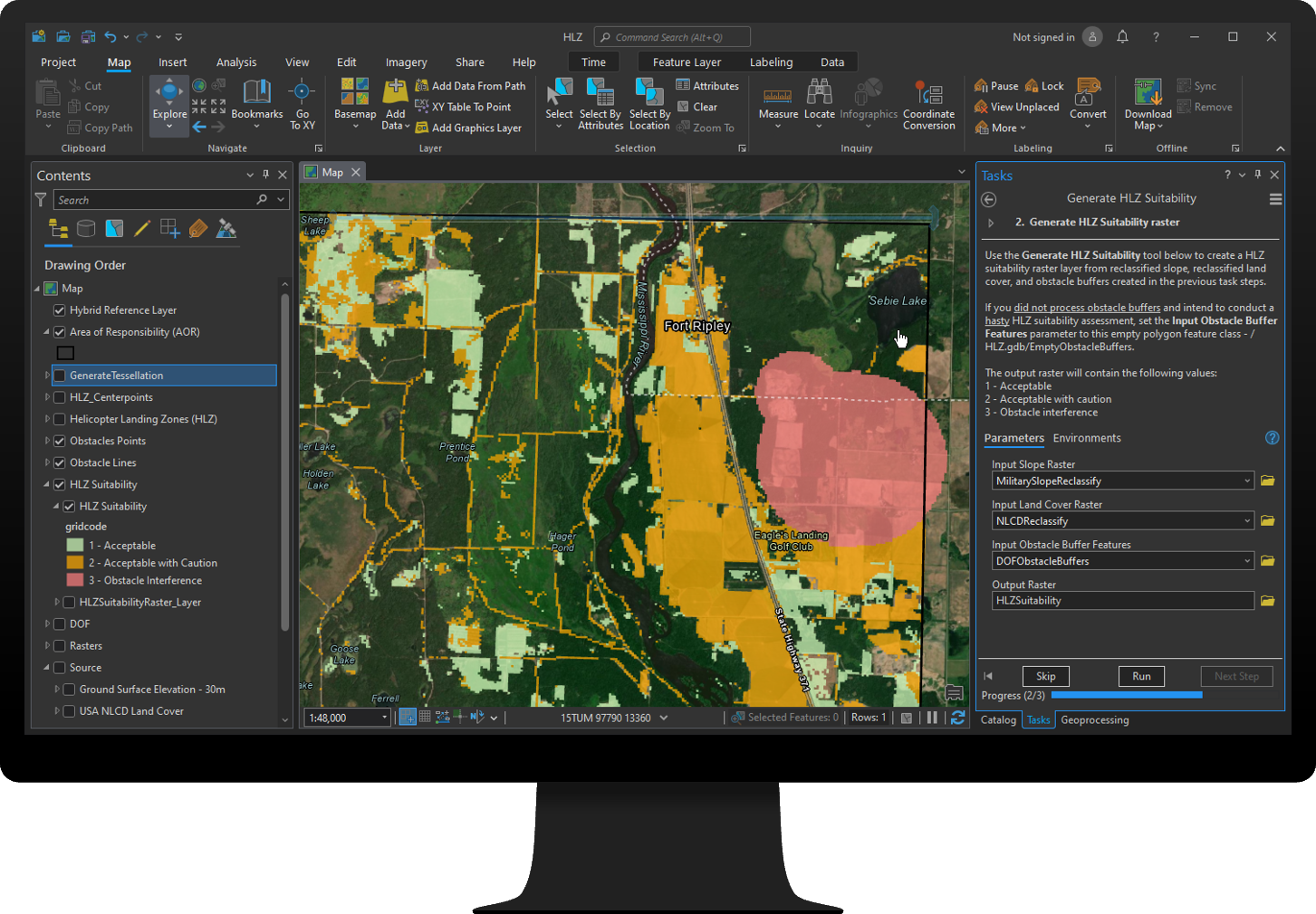
HLZ Suitability
Rotary aviation is frequently used during military, humanitarian, and emergency situations to evacuate individuals, deliver aid, respond to wildfires, and conduct military offensives.
The HLZ Suitability solution can be used to identify and understand suitable locations for expedient helicopter landing zones.
Map Notes
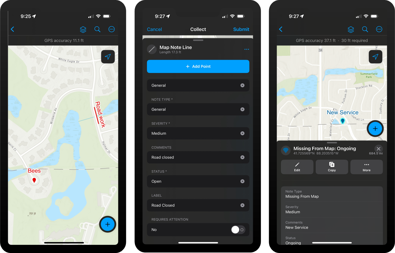
Map notes are a common way for people to capture information and show where map data may be incorrect or identify an issue that needs to be addressed.
The Map Notes solution can be used to capture map notes, triage each note to determine if action is necessary, and share this institutionalize knowledge with stakeholders so it can be easily accessed in future.
Mowing Operations
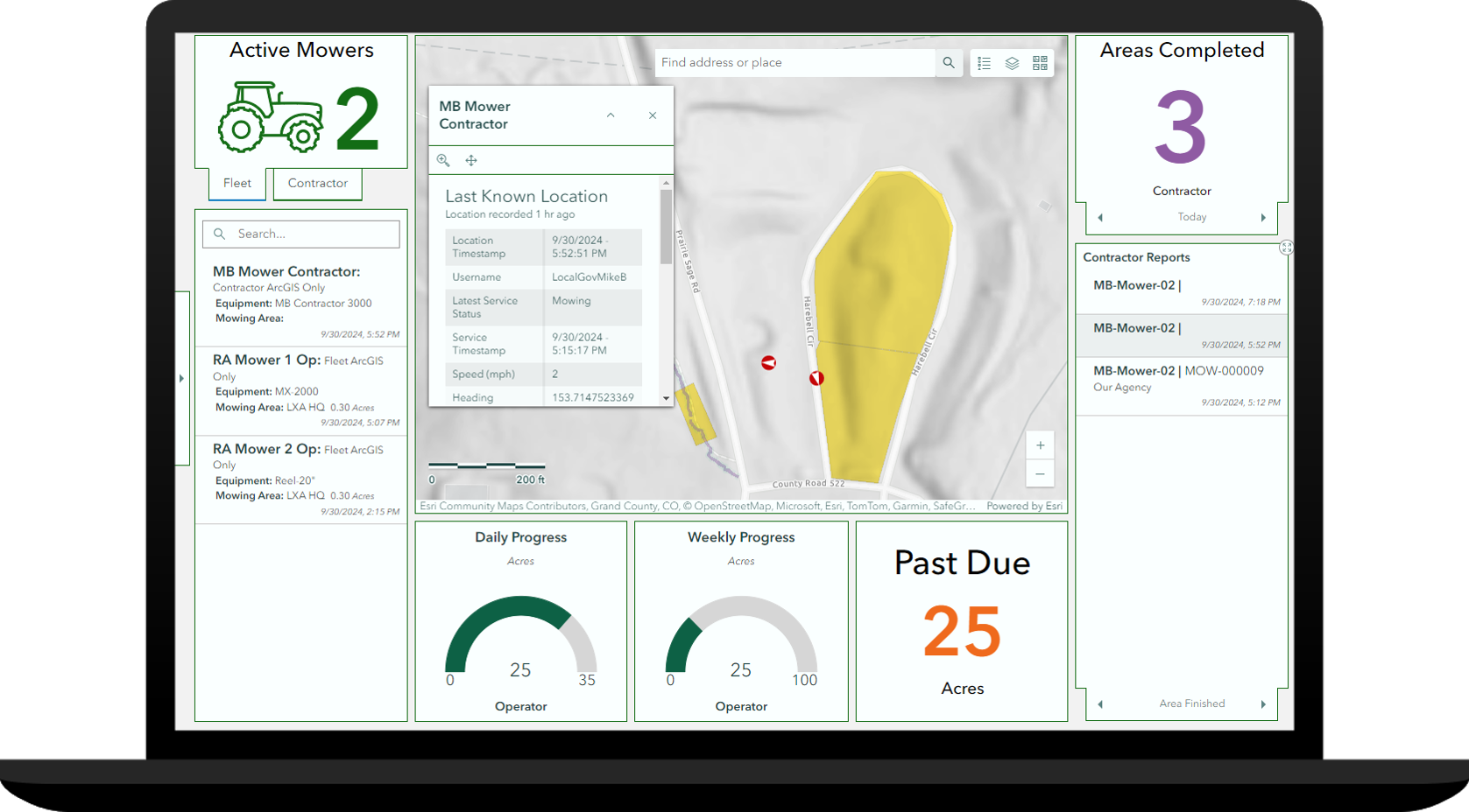
Road and parks agencies typically draft mowing plans and service level agreements to maintain parks, open space, and roadsides that improve the overall appearance of a community.
The Mowing Operations solution can be used to develop seasonal mowing plans, manage a central repository of mowers, and monitor real-time mowing activity and service performance.
Renewables Land Acquisition
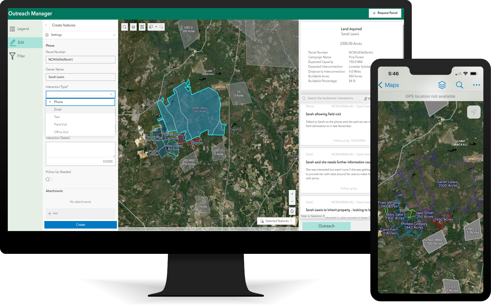
Renewables companies often rely on spatial data to acquire large tracts of land for the development of new utility-scale renewable sites.
The Renewables Land Acquisition solution can be used to streamline processes by enabling organizations to share parcel information with stakeholders, track interactions and agreements, manage expert input, and monitor the acquisition process.
Special Event Permitting
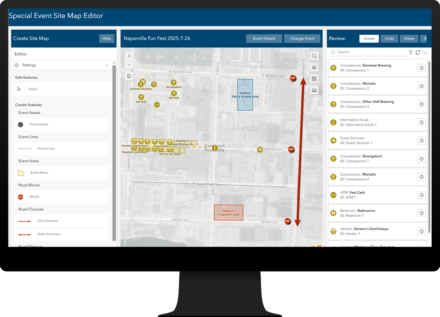
Special events bring people together, drive economic development, and are vital to quality of life but many times may also strain community resources.
The Special Event Permitting solution can be used to collect permit applications and event site maps, coordinate the permit review process, gather feedback during permit review, share approved permits with stakeholders, and promote events occurring in a community.
Major Enhancements
There are eight major enhancements, and many minor enhancements to the existing portfolio.
- Citizen Problem Reporter
- Crime Analysis
- Damage Assessment
- Gas Distribution Data Management
- Gridded Reference Graphic
- Land Use Outreach
- Lead Service Line Inventory
- Special Event Operations
Learn more about the minor enhancements to the existing solution portfolio in this release.
Exciting news!
Our catalog of Enterprise-ready solutions continues to grow. We’ve just added five new solutions, bringing the total to over one hundred ready-to-deploy solutions with ArcGIS Enterprise 11.4 on your managed infrastructure.
Lifecycle changes
Capital Project Planning has been moved to the Mature lifecycle phase. Capabilities have been replaced with Capital Project Coordination.
Capital Project Tracking has been moved to the Mature lifecycle phase. Capabilities have been replaced with Capital Project Coordination.
Environmental Analysis has been moved to the Mature lifecycle phase. Capabilities have been replaced with Environmental Review.
Special Event Permitting and Operations has been moved to the Mature lifecycle phase. Capabilities have been replaced with Special Event Permitting and Special Event Operations.
Transit Outreach has been moved to the Mature lifecycle phase
Learn more
For more information about ArcGIS Solutions, check out the following resources:
- Explore the ArcGIS Solutions gallery.
- Learn more about ArcGIS Solutions.
- View the full collection of solution demo videos available to the community.


Article Discussion: