With the release of ArcGIS Pro 3.3, we now have three workflows that allow you to use a robust collection of data models, workflows, and planning tools tailored for flooding: Arc Hydro, the Flood Impact Analysis solution, and the new flood simulation capabilities in ArcGIS Pro.
All these workflows can function independently or together. We’ll outline a high-level summary of each and how they can be used concurrently to support your understanding of flooding in your community.
Arc Hydro

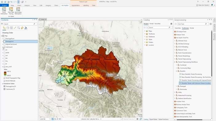
Arc Hydro is a framework that helps you build a foundational dataset that can be used in water resource analyses and for integration with water resource models. It standardizes water data structures so that data can be used consistently and efficiently to solve a wider range of water resource problems at any scale—regional, national, or international. The primary objectives of Arc Hydro are to allow you to do the following:
- Extract hydro information and drainage system characteristics from digital elevation models (DEMs) and supporting data
- Understand where the water comes from and where it flows to
Arc Hydro is a separate toolbox and add-in that that can be installed to use with ArcGIS Pro and visualize data in 2D with a Creator user type or ArcGIS Pro Basic license. Learn more about Arc Hydro.
Flood Impact Analysis

The Flood Impact Analysis solution, part of ArcGIS Solutions, delivers a set of capabilities that helps you develop localized flooding scenarios and visualize the impact of flooding on public infrastructure and critical facilities. This allows stakeholders to gain valuable insights into the potential impact of floods, helping to facilitate effective decision-making and planning strategies. With the workflows and tools provided in Flood Impact Analysis, you can do the following:
- Define flood impact areas for each assessed flood stage
- Identify impacted buildings and critical infrastructure and the severity of impact
- Share the results with key community stakeholders
Flood Impact Analysis provides tools and tasks that can be used with ArcGIS Pro in 2D and visualized in 3D with a Professional Plus user type or ArcGIS Pro Advanced license. Learn more about Flood Impact Analysis.
Flood simulation

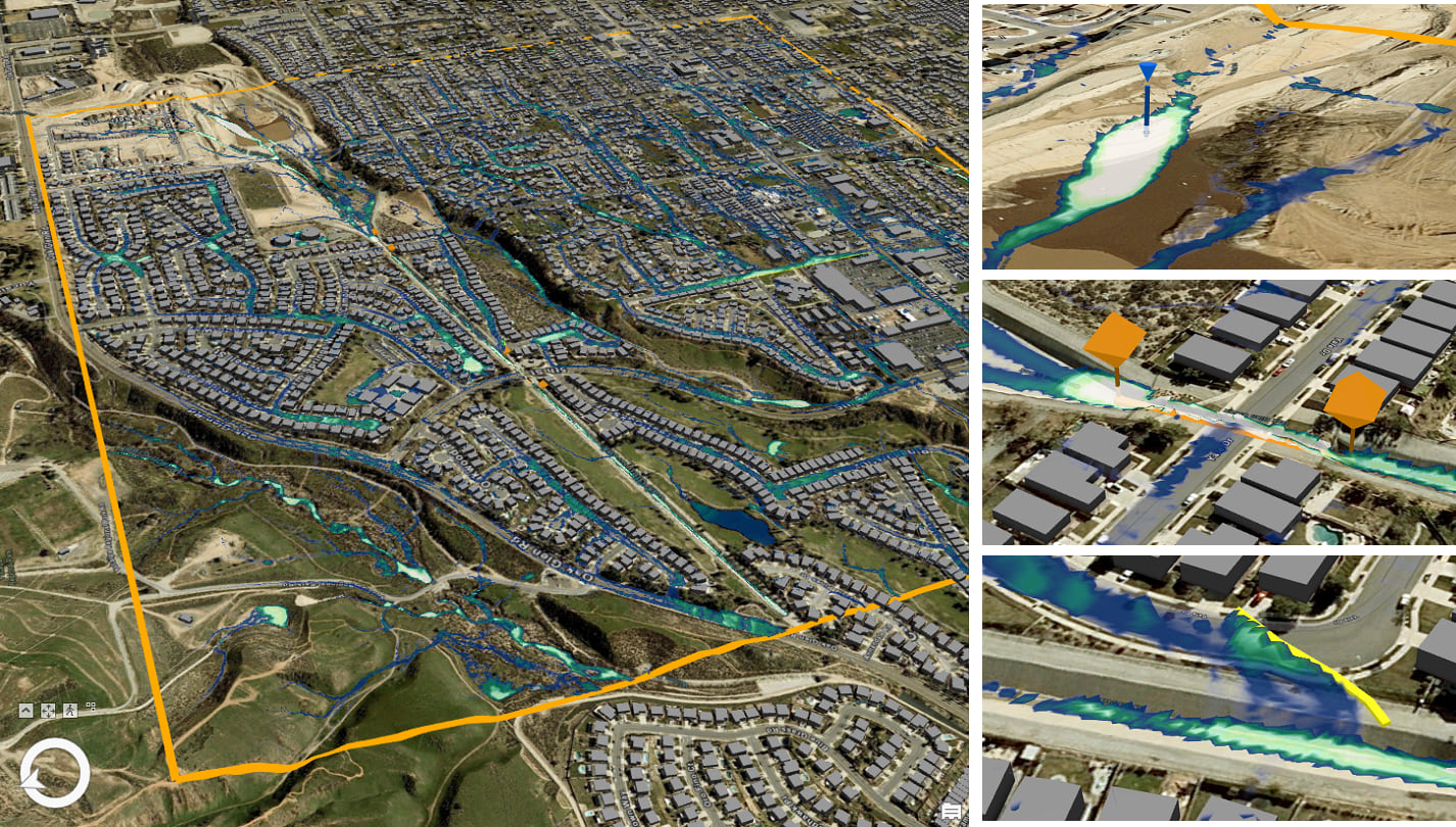
Flood simulation can perform flood simulations in 3D scenes using elevation surfaces and buildings to realistically model water flow using a simplified 2D hydraulic routing model. After defining a flood scenario for an area of interest, you would be able to do the following:
- Identify how added rainfall, water source points, and initial depth interact with the terrain
- Determine how barriers and channels could redirect flow
- Visualize how water is removed by infiltration and evaporation
This tool runs directly upon the content being drawn in the 3D view and is particularly useful for geodesign scenarios in which you need to try out multiple ideas quickly. It is not meant to replace existing engineering-style flood simulation models, but rather to help users get reasonable estimates quickly and iteratively, and then focus more deeply on an area. This is ideal for limited areas of interest, such as a business district or neighborhood where you want to evaluate potential designs and plans.
The flood simulation capabilities are part of the ArcGIS Pro 3.3 release and provides users out-of-the-box capabilities that can be used in ArcGIS Pro 3D scenes. This requires a Professional Plus user type or ArcGIS Pro Advanced license. Learn more about Flood simulation.
Bring them together
Arc Hydro, Flood Impact Analysis, and flood simulation can work together seamlessly to create a nearly all-encompassing flood analysis and planning workflow. Let’s explore some scenarios in which these tools can be used together.
Create flood depth rasters
The Flood Impact Analysis solution requires that you have an elevation raster and flood depth rasters to complete the analysis.
Both Arc Hydro and flood simulation can create flood depth rasters, depending on the scale of the area in question. Small-scale areas, such as a city or county, could generate these rasters using the tools within Arc Hydro. Large-scale areas, such as a business district or small neighborhood, could use the tools in flood simulation if they are already working within a 3D scene. Once running through either option, you can save flood depth rasters as an output to be used in the Flood Impact Analysis solution.
It is important to keep in mind that flood depth rasters generated in these tools are not intended to replace those of an official hydrological study, but they can help provide some visual insight into the possible effects of flooding in an area.
Mitigation planning
After you’ve completed an initial analysis using the Flood Impact Analysis solution, you could use the 3D scene created in the Visualize Flooding Scenarios in 3D task with flood simulation. This could be particularly useful because with your initial analysis, you may have been able to identify smaller hot spot areas that experience greater impacts.
With flood simulation, you can then focus on these hot spot areas to test various mitigation measures, such as placing berms to divert water flow away from a section of buildings. The flexibility of flood simulation being able to run multiple scenarios to test and see the effects of implementing various mitigation measures also means users can see what yields the least impact—invaluable knowledge when you need to act quickly in an emergency. After testing these different measures with flood simulation, you could then export the new flood depth rasters and rerun Flood Impact Analysis to compare changes.
A system to understand flooding
ArcGIS Pro has comprehensive workflows that support communities looking to understand flooding:
- Arc Hydro completes complex analysis at all scales in 2D.
- The Flood Impact Analysis solution, part of ArcGIS Solutions, provides a workflow to understand and visualize impacts to infrastructure in 2D or 3D.
- ArcGIS Pro’s flood simulation capabilities can iteratively visualize water movement in 3D within a limited area of interest.
Depending on your needs, one or many of these flooding workflows in ArcGIS Pro will be best suited for the needs of your organization. Use this blog and the links below to better understand your options.
Article Discussion: