The GIS of the future is 3D, a model of the real-world that provides an engaging and intuitive interface for visualization, analysis, monitoring, and sharing. Recent technology advances in data collection—such as “reality capture” from drones or airplanes, building information models (BIM), commercial “street view” equipment, 3D photogrammetry, and Internet of Things (IoT) sensors—are creating massive amounts of rich 3D data that can be transformed into useful, actionable information.
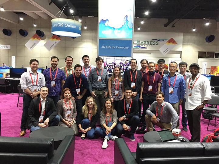
Next month at the 2018 Esri User Conference in San Diego (July 9th – 13th), connect with 3D GIS experts to learn about the latest 3D GIS software and experience how Esri’s 3D GIS technology has transformed the way 3D information can be managed, utilized, and integrated with your enterprise GIS. 3D is a core GIS capability that’s easier than ever to integrate into your current workflows.
At the 2018 Esri UC, visit the 3D GIS Showcase where you can:
- Discover how Esri’s Enterprise 3D GIS strategy can transform your work.
- Learn best practices when creating 3D scenes and experiences.
- Connect with Esri professionals to answer your questions and help you get started with 3D GIS.
The 3D GIS Showcase will be open:
Tuesday, July 10th 9:00 AM–6:00 PM
Wednesday, July 11th 9:00 AM–6:00 PM
Thursday, July 12th 9:00 AM–1:30 PM
Ground Level Exhibit Hall A, SDCC
Also, be sure to check out theater sessions to dive deep into 3D and see how it’s all done. Esri staff will demonstrate the latest in 3D technology, from CityEngine to Web Scenes, and provide the audience with great tips & tricks to implement into current GIS workflows. The sessions highlighted below run the gamut of all things 3D.
If you’d like to meet one-on-one with a 3D GIS expert, email mschueren@esri.com to coordinate a time.
Engineering Summit @ Esri UC
Sunday, July 8-10 | Marriott Marquis San Diego Hotel & Marina
Learn how 3D GIS is transforming the A/E/C industry. Connect and collaborate with fellow industry users, attend focused presentations on specific challenges and lightning talk presentations providing new best practices with the latest technology.
Imagery Summit @ Esri UC
Sunday, July 8-10 | Marriott Marquis San Diego Hotel & Marina
Get a detailed look at new imagery and remotely sensed data processing and analytical techniques in ArcGIS. Learn how to tell meaningful stories in 3D using enhanced imagery visualization and mensuration tools, artificial intelligence classification techniques, advanced raster analytics, and satellite, aerial, and drone imagery sensor data.
Esri Showcase
| Tuesday, July 10 | ||
| 11:30 am | AR/VR Special Interest Group Meeting | SDCC – Room 28 E |
| 12:15 pm | Delivering A/E/C Projects with ArcGIS | Envisioning Center 1 – Hall C |
| Thursday, July 12 | ||
| 1:00 pm | ArcGIS Pro: Q&A with the Development Team | SDCC – Ballroom 06 A |
Pre-Conference Seminars
| Sunday, July 8th | ||
| 8:30 am – 5:00 pm | Building Great 3D Scenes | San Diego, CA |
3D GIS Demo Theater
| Tuesday, July 10 | ||
| 10:00 am | GIS and BIM Industry Collaboration | Demo Theater 13 |
| 11:15 am | 3D Zoning and Development Capacity Analysis | Demo Theater 04 |
| 12:15 pm | 3D: Enable Your Campus and Workplace | Demo Theater 04 |
| 12:15 pm | 3D Feature and Sub-Surface Analysis | Demo Theater 10 |
| 1:15 pm | 3D Web Apps for Community Engagement | Demo Theater 12 |
| 1:15 pm | VR and AR in ArcGIS: An Introduction | Demo Theater 04 |
| 2:30 pm | ArcGIS 3D Solutions | Demo Theater 04 |
| Wednesday, July 11 | ||
| 10:00 am | Refining 3D Buildings Extracted from LiDAR | Demo Theater 04 |
| 11:15 am | Creating and Sharing Awesome 3D Web Scenes | Demo Theater 04 |
| 1:15 pm | VR and Game Engine workflows with CityEngine | Demo Theater 04 |
| 2:30 pm | 3D: Dynamic Text and Advanced Animation Tips | Demo Theater 04 |
| 4:00pm | VR and AR in ArcGIS: An Introduction | Demo Theater 04 |
3D GIS Technical Workshops

Harnessing the power of 3D has never been easier. Take advantage of 3D as a core GIS capability, allowing anyone to access 3D content and tools anywhere and in any environment. Use 3D GIS to deliver useful content and capabilities to anyone who needs them, in the way that’s best suited to their work. We hope you’ll stop by the 3D GIS Showcase to experience the latest and greatest – don’t be a stranger!
-Madeline
PS – Follow Esri CityEngine & Geodesign on Facebook, Twitter, and Instagram.

Commenting is not enabled for this article.