With the recent release of ArcGIS Pro 1.4, we’ve posted a number of updates on some of the latest Pro SDK for .NET capabilities, including a What’s New overview, and spotlights on configurations and also light/dark theme UI styling for the new Pro dark theme.
In this post, we’ll take a brief look back at what ArcGIS Pro add-ins are and why extending Pro with the Pro SDK is a powerful way to enhance and focus Desktop GIS workflows for your organization and your customers. But before discussing add-ins, just a few words on ArcGIS Pro, to help better understand it’s importance as the foundation for your GIS work.
Pro is Esri’s new premier Desktop application, with capabilities that continue to advance Desktop GIS and empower users to better analyze and manage their spatial data.
Overall, Pro’s distinctive capabilities provide opportunities and new ways to get work done:
- More efficiently – with tasks and 64-bit multithreading
- With better results – with 2D and 3D, and improved cartography
- Standardized across the platform – with sharing, mobile packages, and vector tiles
Pro is also the foundation for much of the important map authoring workflows that allow organizations to fully leverage the ArcGIS platform.
Extending Pro
So there are three main ways of looking at building on Pro’s out of the box functionality. You can:
- Configure Pro through tasks or the basic configuration settings
- Automate Pro with Python for repeatable geoprocessing operations
- Extend Pro with the Pro SDK for additional UI/UX functionality
As you become more familiar with Pro, you can see how each approach can accomplish a certain objective, and how each also has an associated level of effort and technical skills. With the Pro SDK, it’s possible to build a very customized and streamlined user interface and user experience which can allow you to build focused tools and full solutions which meet the needs of your specific users.
Again, each of the above approaches has specific benefits, and these are discussed further in this earlier Pro SDK post.
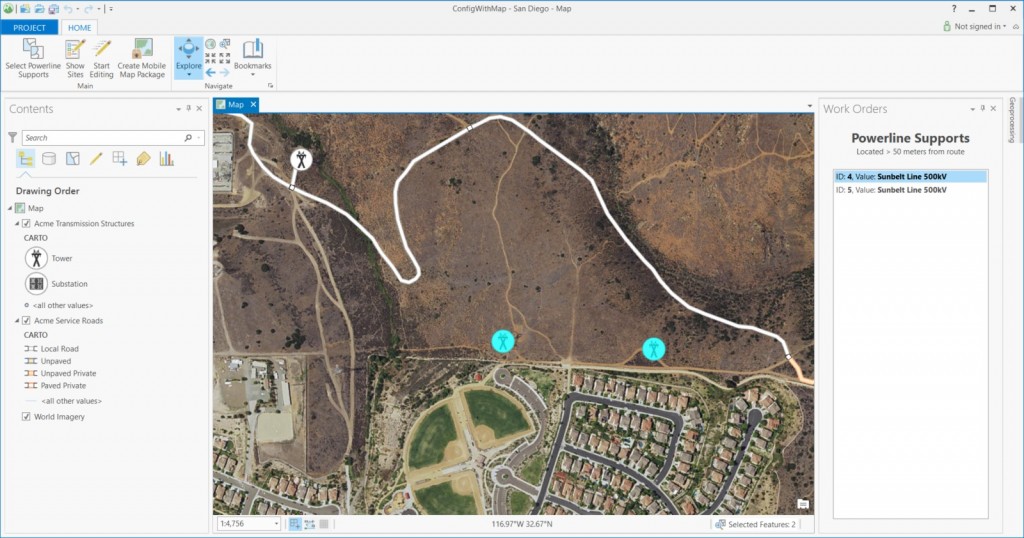
Here is an example of a streamlined Pro UI provided in an SDK solution configuration:
Building Add-Ins with the Pro SDK
The ArcGIS Pro SDK for .NET allows developers to access the Pro API and create add-ins using the Microsoft .NET framework and Visual Studio. The SDK provides developers with an extensive set of templates, tools, documentation and code samples for efficiently working with the Pro API.
Also, there is an extensive set of resources for learning the Pro SDK, which grows with every Pro release, and this earlier post provides a fairly comprehensive overview. Also, one of the exciting updates and additions to the learning resources is the brand new, instructor-led Pro SDK course, “Extending ArcGIS Pro with Add-Ins”, which is now available and offered from Esri Educational Services.
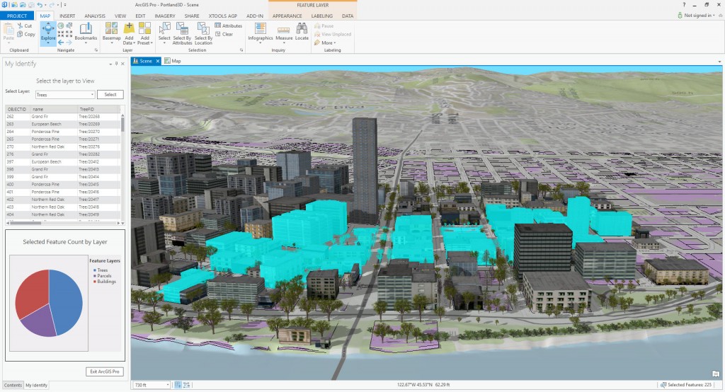
Here is an example of a Pro add-in community sample showing custom feature identification capabilities:
Commercially Available Pro Add-Ins
Sometimes the best way to show the power of add-ins is simply by showing how some of the exciting add-ins being developed by Esri Partners. There is a growing list of commercial ArcGIS Pro add-ins on the market and these will continue to grow with the release of Pro 1.4, and as more and more users make Pro their go-to GIS Desktop application. Last year, two of the first commercial add-ins appearing on the market included Bergmann Impact 3D, developed by Bergmann Associates, and XTools AGP, developed by XTools, LLC.
Bergmann Impact 3D from Bergmann Associates
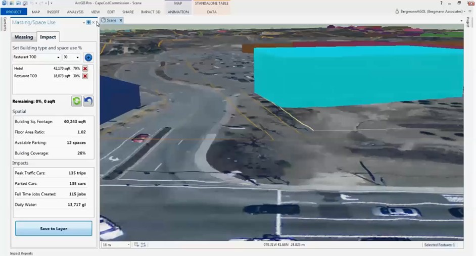
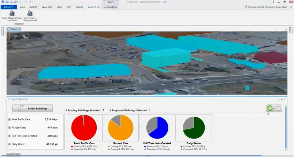
Bergmann Associates have developed an add-in for the urban planning market which they call Bergmann Impact 3D. The add-in builds on CityEngine and 3D basemaps to provide planners with tools to visualize and analyze the impacts of new development.
As you can see in the illustrations, the Bergmann team has built custom dockpanes which allow the user to have quick access to tools to assess the different types of impacts from a new structure, which are built with a custom CityEngine rule package. They’ve also developed a number of charting and reporting tools which allow planners to assess, capture and share web scenes from an analysis. Here is a link to their marketing video which provides a nice overview of the product.
XTools AGP from XTools, LLC
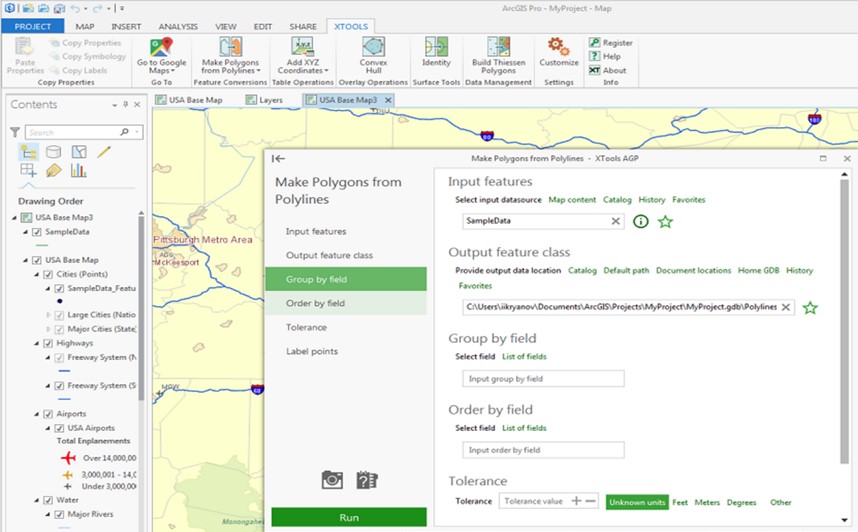
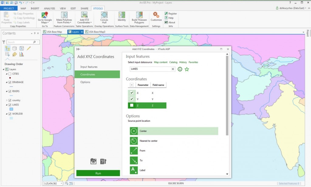
XTools, LLC, have developed an add-in for Pro, called XTools AGP, which builds on their longstanding XTools extension for ArcMap. You may have seen XTools used either in your own organization or at other ArcGIS Desktop sites. They’re a powerful set of efficiency tools that are used in many different industries, and they have a version available now for ArcGIS Pro.
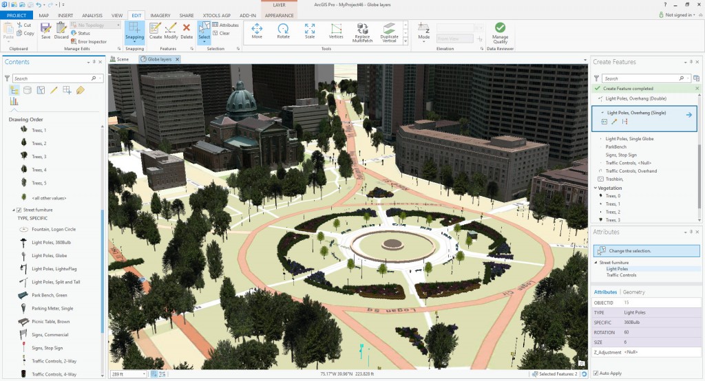
As you can see in the illustrations, the XTools team has built a set of efficiency tools accessible by custom dockpanes. The tools cover a wide range of functionality from data management to spatial analysis, and they’ve developed an appealing, modern user interface and user experience for each of the tools as well. You can learn more about the add-in by going to their website at the link provided here.
The number of Pro add-ins developed by Esri Partners continues to grow every year.
Finally, a good place to find free add-ins today is the ArcGIS Solutions site, where you can find Esri-developed and supported Pro add-ins. These Pro add-ins are focused on different industry sectors which you can search on.
We hope you’ll take advantage of these exciting new capabilities and opportunities for extending ArcGIS Pro with add-ins developed with the Pro SDK.

Article Discussion: