Buildings, landscaped gardens, parks and open spaces, neighborhoods, major highways and roads, points of interest, railways, and waterbodies – it’s all included in Esri’s latest basemap release with significant large-scale content for the countries of Japan, the Netherlands and Switzerland.
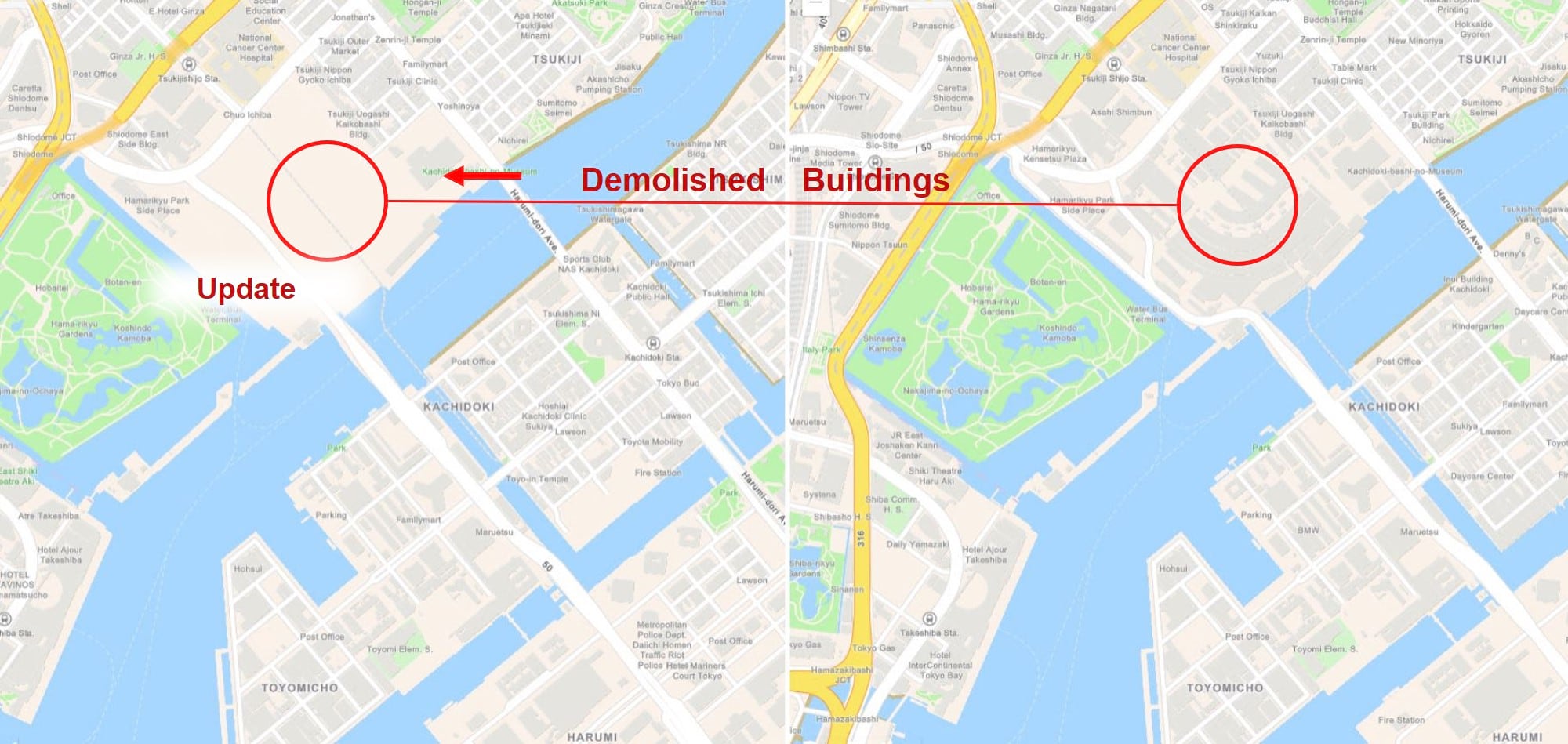
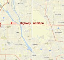
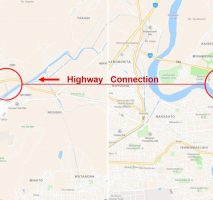
Just in time for the upcoming Olympic Games in Tokyo, the country of Japan has been updated with new buildings, special areas and points of interest and other key infrastructure that will help support the games, athletes, visitors, and citizens moving forward.
The gallery below shows select areas of these updates.

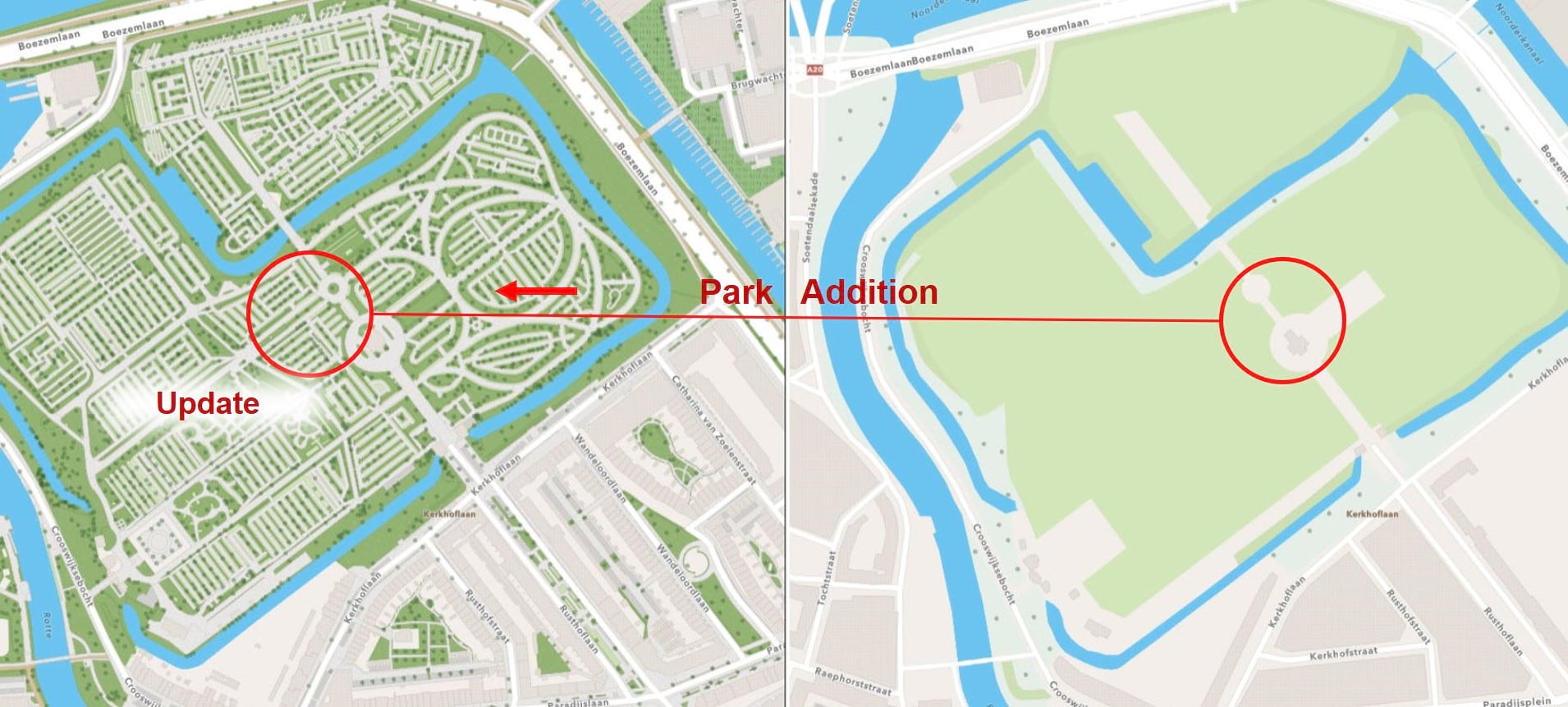
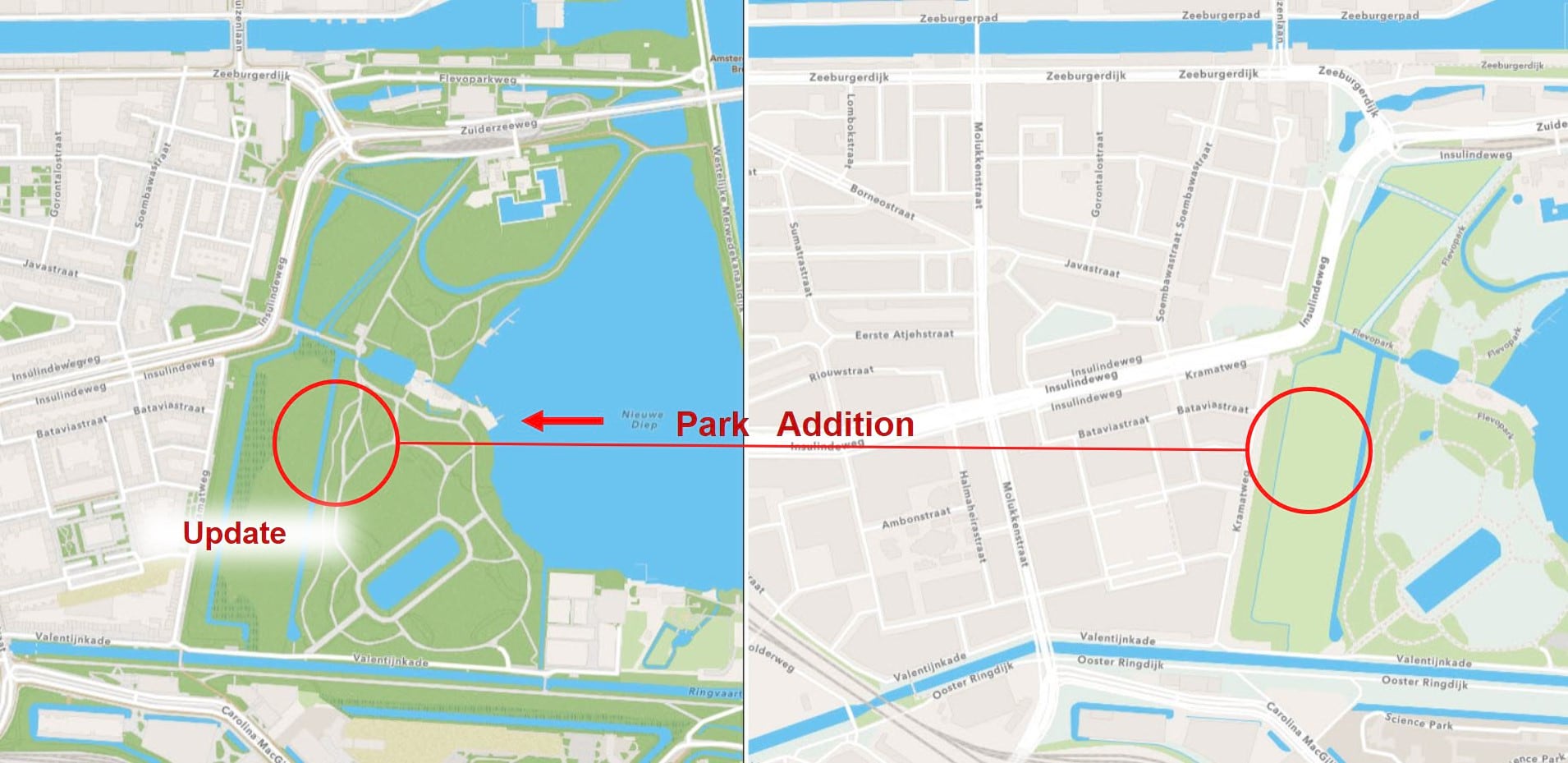
In the Netherlands, Amsterdam and Rotterdam area parks have been greatly enhanced with large-scale content that includes sidewalks, walking paths, trees, and other amenities.
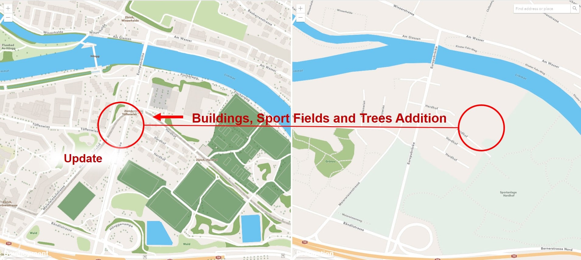
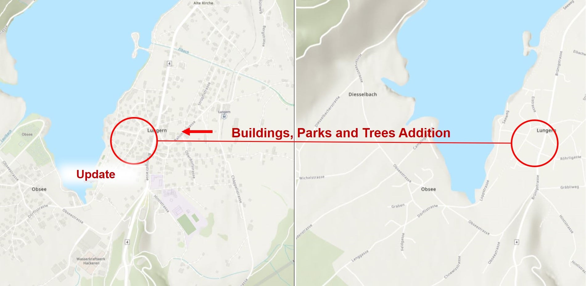
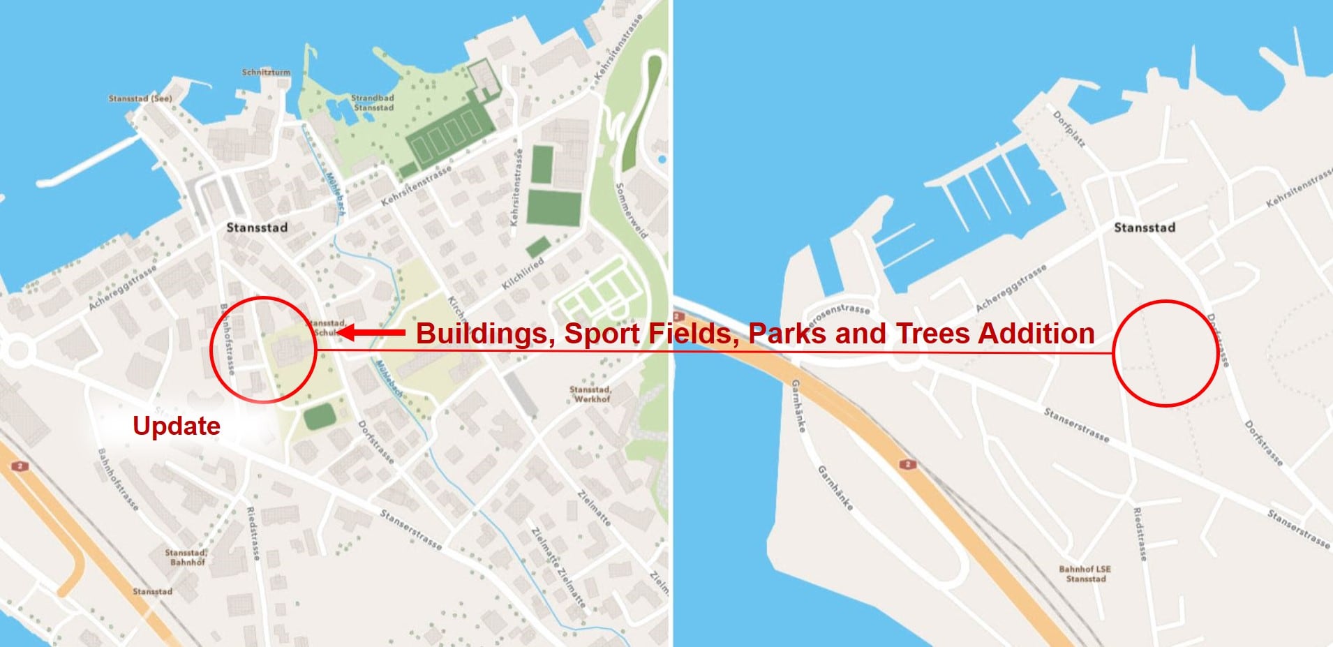
Switzerland has shared building footprints, sports fields, parks and trees throughout the country.
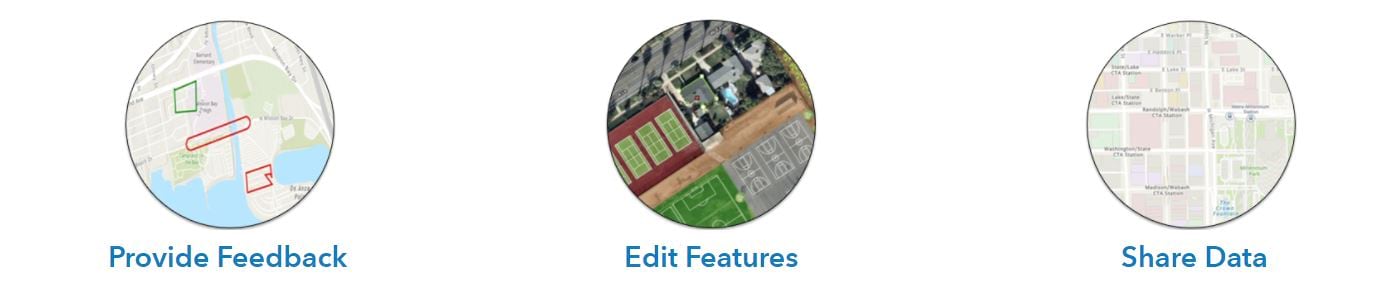
Providing feedback, editing features, and sharing data are all great ways to share your local geographic knowledge. Click on the link below to explore the best sharing workflow for you and your organization.
Join the Community Maps Program

This is so awesome, I think there should be a series of these like individual blogs on changing font style, color, size and etc. respectively.
Also, it would be nice to know if there’s a way to turn off the basemap name labels completely when using your vector data labels.
Also also it would nice these features integrated in Map Viewer and to be able this stuff in Pro as well
Thank you for your comments. Please see the associated blog which has 5-parts on different cartographic styling topics as well as an Esri Learn Lesson on personalizing maps.
I’ve forwarded your comment to the Vector Tile Style Editor team on the ability to remove all labels at once (as opposed to needing to go through every label layer).
This works for renaming Gulf of Mexico to Gulf of America. To import it into ArcGIS Pro, save the modified Vector Tile Style Editor project. Open it from the home content (not Vector Tile Style Editor styles). From here, you have several options but the easiest is to click the “Open in ArcGIS Pro” button to download the .pitemx file. Open the .pitemx file from your file explorer in ArcGIS Pro. Right click the layer then click Sharing > Save As Layer File to save a .lyrx file which contains a reference to the data source. The .lyrx file can… Read more »