The June 2024 ArcGIS Online update introduces new features and key updates throughout the site. The same applies for ArcGIS Instant Apps, as we have rolled out many updates and new features to our existing apps, further improved choosing and managing your apps on the Instant Apps home page, introduced two new beta app templates, and addressed various bugs and enhancements to help stabilize and improve your experience across the site. See the highlights below.
Introducing: Streamflow Viewer (Beta)
Interact with streamflow forecast data through a chart and time slider using the new Streamflow Viewer (Beta) template. This app includes a multi-day river forecast service from the European Centre for Medium-range Weather Forecasting (ECMWF) that displays data in 3-hour time intervals. App creators can generate apps that help alert users about potential flood risks with a chart to compare historical data to currently forecasted streamflow data. The Global Water Model service is updated once daily and is automatically added to your app when you choose a map or scene in the app configuration. The chart and time slider are both interactive and can be used to further explore the streamflow data in your area.
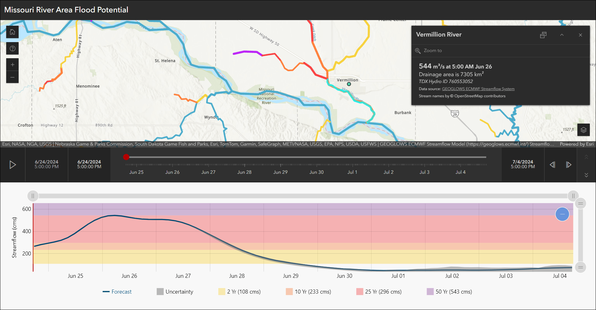
For all details with creating and configuring an app using Streamflow Viewer (Beta), check out our Introducing Streamflow Viewer (Beta) blog.
Introducing: Compare (Beta)
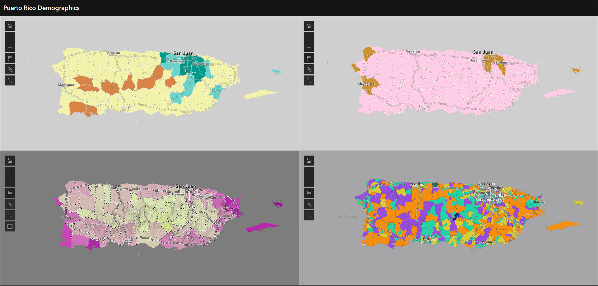
Visualize data at one or more locations using multiple maps and scenes with side-by-side or stacked layouts in the new Compare (Beta) app template. Choose between two comparison modes to compare multiple maps at the same location or compare multiple locations of the same map. This app supports up to 4 maps, scenes, or a combination of both. Import bookmarks or slides, or create locations manually to compare areas of the same map or scene. The views can be synced or unsynced when using the app.
Use Multiple maps mode to compare different data at the same location such as housing cost, homeownership, and median income. Use the app configuration to choose each map containing the different data variables.
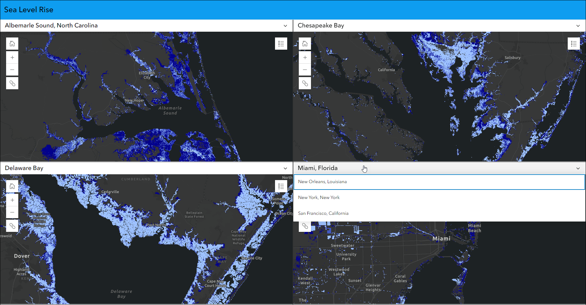
Use Single map mode to compare data at multiple locations, such as the impact of sea level rise on different global cities. Choose the sea level rise map in the app configuration then create locations manually to add to the layout or import bookmarks to automatically create locations to compare.
Reporter out of beta
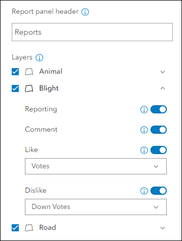
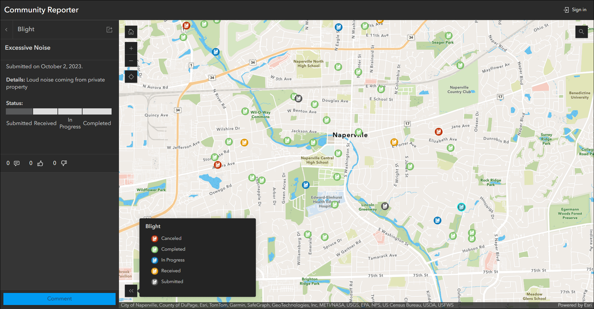
View and submit issues or observations in an area using the new Reporter app template. This new app lets users create a report that displays on the map. They can also view existing reports and use basic map exploration tools to navigate the map. New at this release is the ability to sign in to the app and provide comments and submit votes. To create an app that supports commenting, a related table record is required. Voting requires that you choose a numeric field to store the values. Set up commenting and voting on the Reporter tab of the app configuration on a layer by layer basis.
For a full introduction and more details about creating and configuring an app using Reporter, check out our ArcGIS Instant Apps: Introducing Reporter blog.
Reporter was previously released as a beta app in February of 2024. All apps created in the beta phase (Feb 2024 – June 26, 2024) must be republished to fix a breaking change. For more information, visit this KB article.
Atlas updates
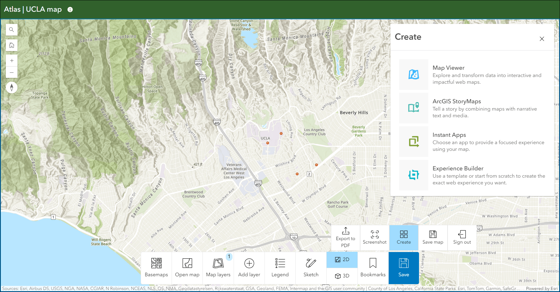
Atlas provides viewers with tools to explore maps and layers with light weight mapping and data exploration capabilities. Viewers can open a map and add individual layers to it. They can utilize measurement tools, generate an elevation profile, toggle the view between 2D and 3D, use a swipe tool and adjust transparency on layers, and view data as a table. They can now create apps from maps after signing in to launch their map in one of several apps such as Map Viewer, StoryMaps, and Instant Apps. Enable Create in the app configuration and choose which apps to include as options. When using Atlas, an app viewer can sign in and then from the toolbar’s Save menu choose Create to access the list of app options.
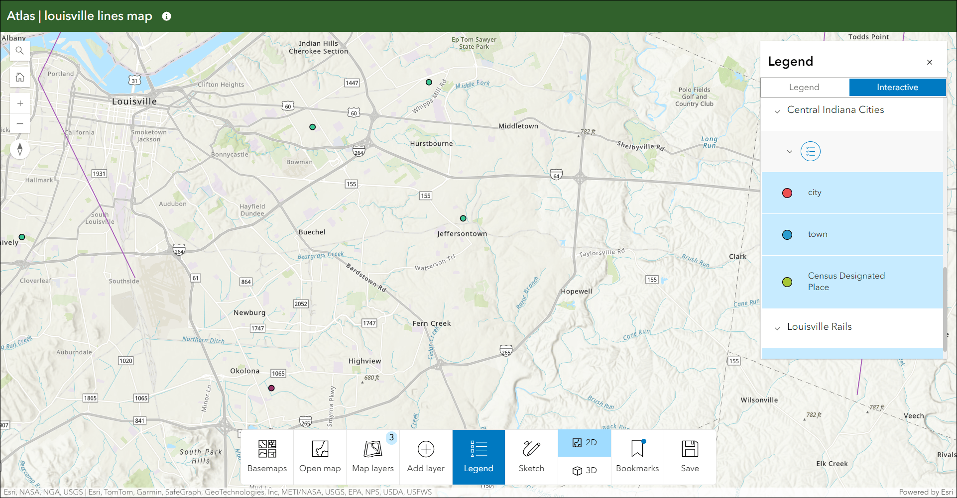
The legend has been updated to include the choice of using an interactive legend in the app. In the app configuration, choose “Interactive” in the Legend type drop-down. The interactive legend lets you click to toggle elements on and off to enhance data exploration and visualization in Atlas.
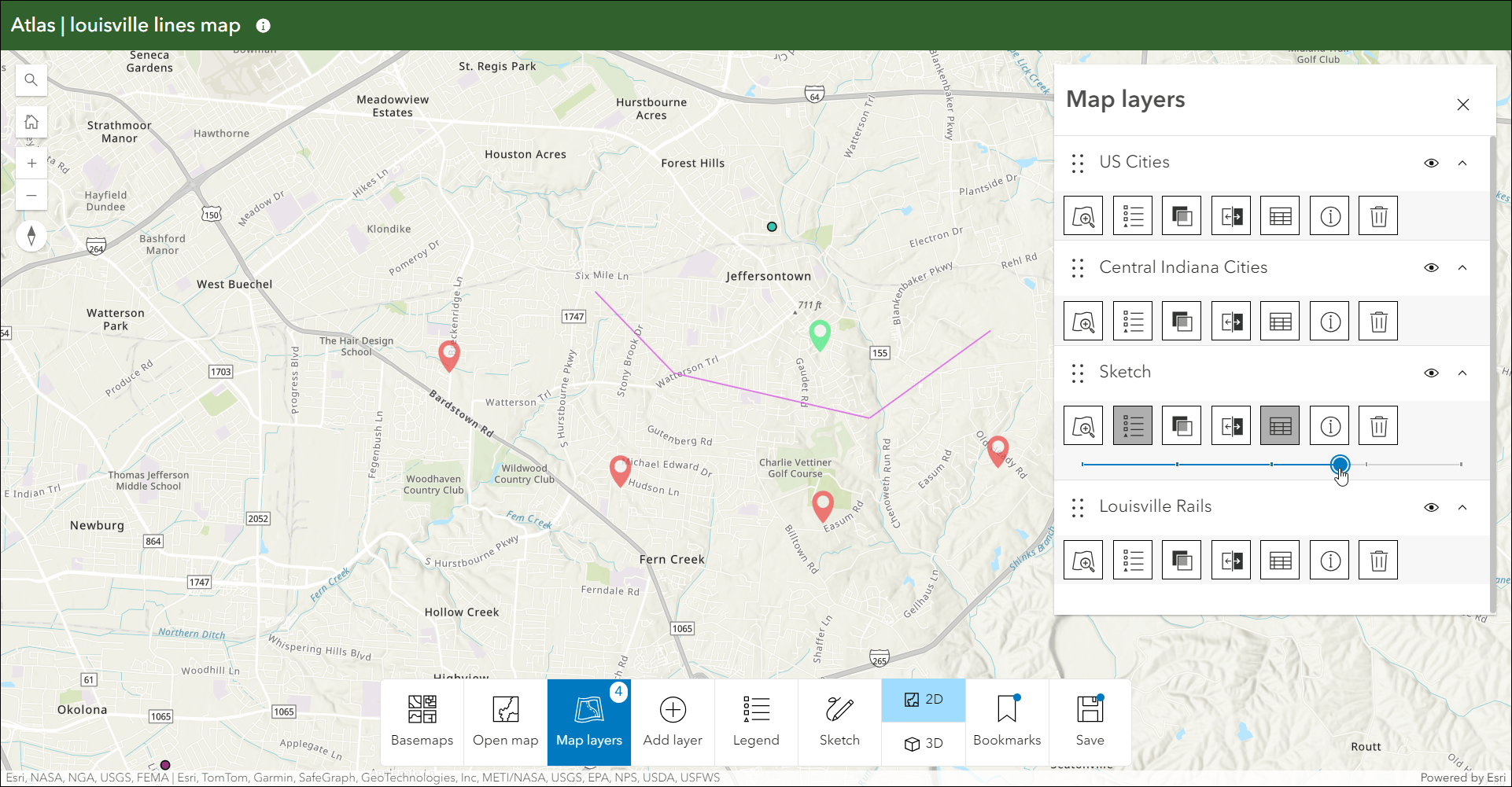
Now when you create sketches you can access and modify them in the Map layers panel. When you create a sketch it will appear as a layer in the Map layers panel and include helpful options such as swipe, layer transparency, and more.
To learn more about what you can do with Atlas, check out our Introducing Atlas blog.
Language switcher updates
The new Language switcher setting in the app configuration let’s you publish a multilingual app that combines your translated custom text and the UI translations for supported languages. Use the options available on the Language Switcher tab in the configuration to choose which additional languages you want to include, which specific texts will be translated and what those translations are, and what icon will be used in the published app for app viewers.
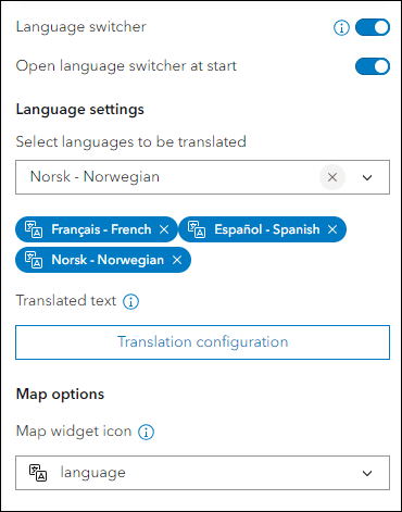
With this update we are happy to offer machine translation directly in the configuration. Now you can automatically translate your text with a few clicks. This feature is currently in beta, and is not intended to replace human translators. Use the Auto translate (Beta) button in the header while configuring your translations to begin the process. Choose to auto translate text for one or multiple languages at once. Click Translate and let the machine translator handle the rest within a few moments.
For more details about Auto translate (Beta) and using it to include machine translations in your apps, please check out our Instant Apps Language Switcher now includes Auto Translate blog on Esri Community.
As of the June 2024 update, the Language switcher is included in 11 Instant Apps templates and we plan to add support for the rest in coming releases. Visit the Instant Apps: Create multilingual apps with the new language switcher component blog for more information on this and a deeper dive into all details about using the new language switcher.
Portfolio updates
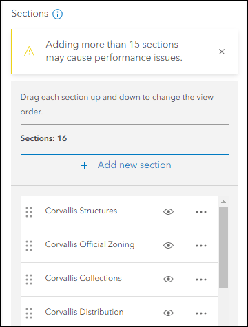
Use Portfolio to showcase different types of content all in one place by curating multiple resources related to a specific topic. We have updated the app to have no limit to the number of sections you can add. When you add new sections in the configuration, it lets you know how many you currently have created and does not display the previous restriction of 20 sections. Note that with adding a lot of sections, especially if they contain performance impacting content, the overall performance of the app and the sections could be affected. When you add a 15th section to the app a message in the configuration will appear that notifies you of this possibility.
Manager updates
Review and edit data from multiple maps and layers using the new Manager app template. For example, review problems and feedback with new public transit stations that were collected using crowdsourcing. Use the app configuration to choose each map used in the project that you want included for review. A browser in the configuration lets you search and find any map you have access to so that there’s no need to rely on having everything contained inside a single group.
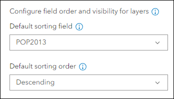
This release we have added the ability to set a sort order on a specific field in the table so that the app displays the records in the table using this order by default. Use the app configuration to set the Default sorting field and Default sorting order options on the Interactivity > Table options tab. First pick a map and then click the Field editor button to the right of any layer to access these two settings. The configuration lets you set this for each layer within each map in the app.
Attachment Viewer updates
Display photos, videos, and PDF files stored as attachments alongside your map using the Attachment Viewer app template. App users can now auto-play through feature attachments in the app at a given speed. Use the app configuration to enable the Play button setting then supply a Play duration in seconds. This adds a Play button to the header over the map that can be clicked by the app user to begin the auto-play. Note that this new feature is only available for Attachment focused layouts. This is not available for apps configured using the Map focused layout.
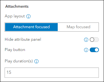
Exhibit updates
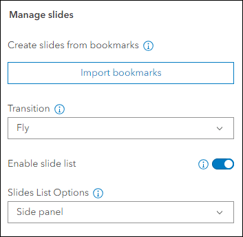
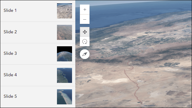
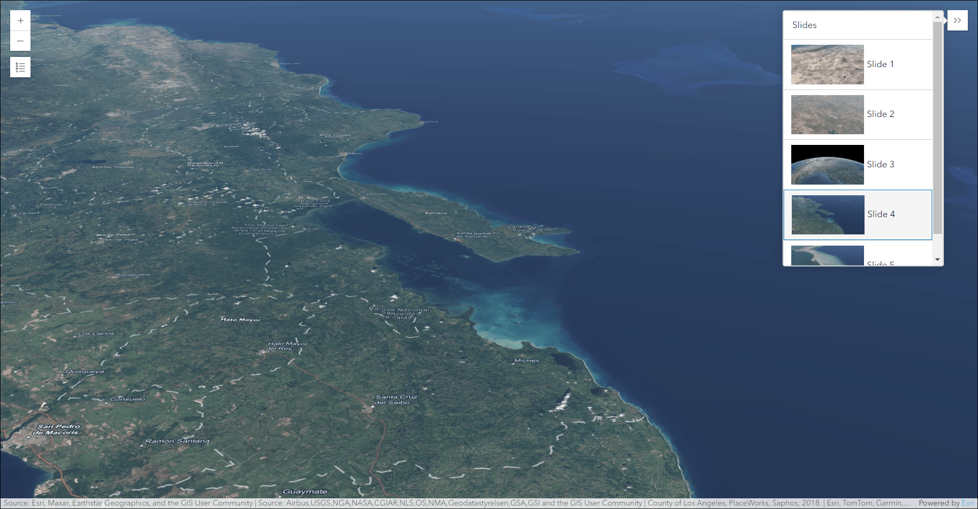
Design an interactive presentation of your map using Exhibit. Tell a linear story by choosing specific areas of your map to highlight using slides that offer interactivity options such as toggling layer visibility and choosing a unique basemap. Enable a slide list that provides a table of contents that make it easy for app users to navigate from slide to slide. New this release is a Side panel layout for the slide list. Choose this option in the app configuration to display slides neatly in a side panel alongside the map or scene.
Zone Lookup updates
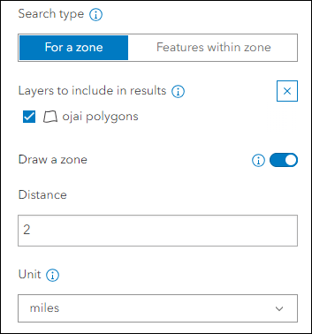
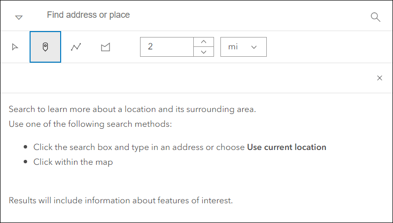
Discover locations within a zone or region to provide information using Zone Lookup. This app is great for identifying school districts, store regions, emergency evacuation zones, and more based on current location or a location provided by the app user. New at this release is the ability to create a search zone by drawing a point, line, or polygon on the map. A buffer distance can then be used around the drawn sketch to find features in the map. In the app configuration, enable the “Draw a zone” setting on the Zone Lookup > Options tab. Then supply a default search distance and units for the buffer. In the app, the user can choose between point, line, or polygon to draw a sketch on the map and also change the distance or units as they explore.
3D Viewer updates
Present a 3D scene with a variety of exploration tools using 3D Viewer. We’ve added a new URL parameter that let’s you open a 3D Viewer app directly to a specific slide from the web scene. The parameter is “slide” and uses a numeric index (starts at 0) to use a specific slide. For example, to have your app open up to the 3rd slide just append “&slide=2” to the URL. Note that the Display preset slides setting in the app configuration must be enabled to use the URL parameter, which can be found on the Interactivity > Explore/navigate tab.
Instant Apps home page updates
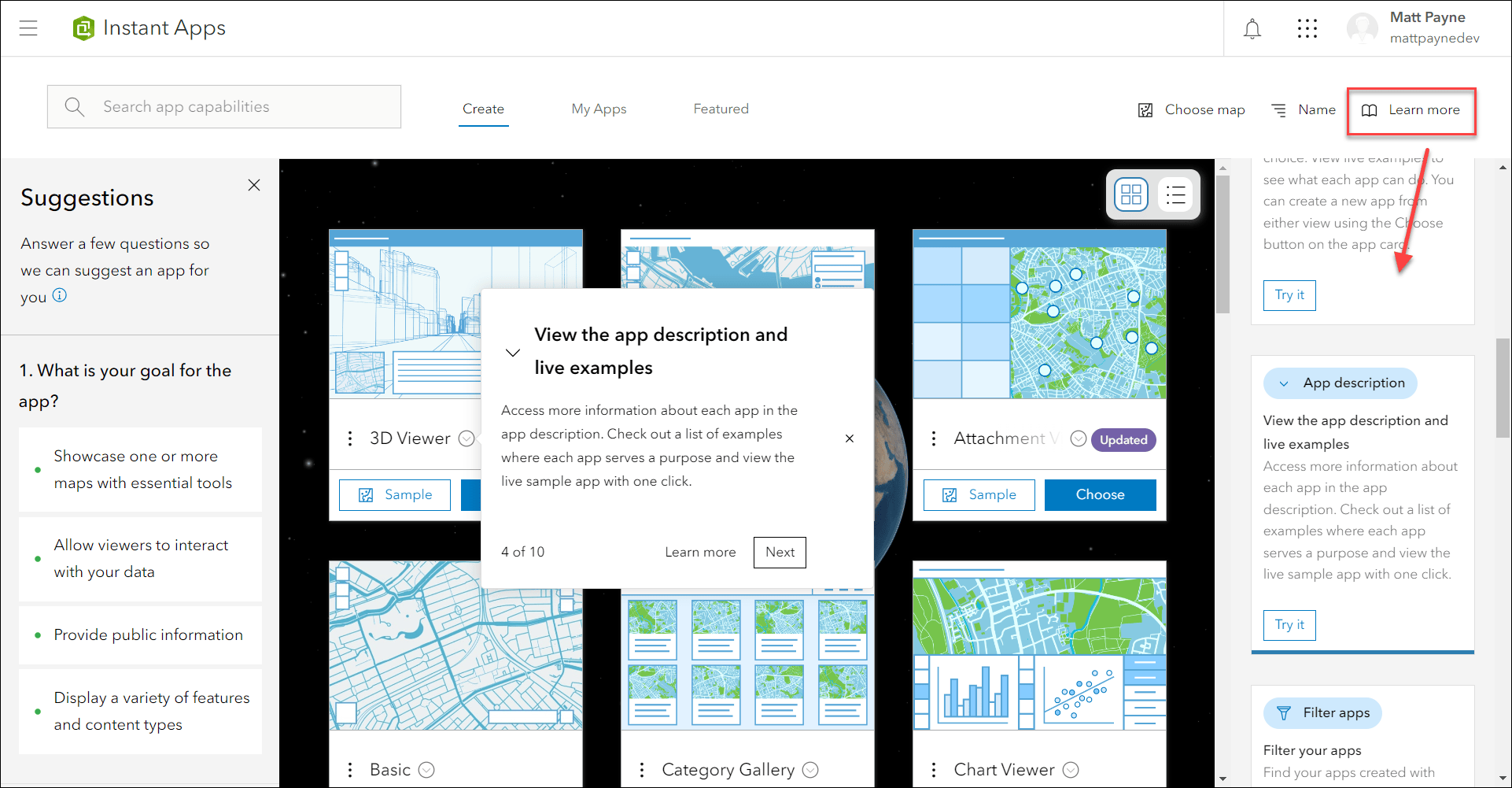
The Instant Apps home page offers a centralized place to browse, choose, create, and manage ArcGIS Instant Apps. This release we have added new onboarding messages and tips that help provide guidance and resources for using and navigating the page. A pop-up displays on the screen calling out a specific feature and offers the ability to click through to the next message or close out. All messages and information are contained within the Learn more panel accessed on the far right side of the header. Within the panel, click Try it for any tip to open it’s respective pop-up on the page.
The new Recycle bin feature is available in the Instant Apps home page. On the My Apps tab, the Delete button will show as a Recycle bin icon if your organization has this feature enabled. You can choose to send an existing app to the Recycle bin for up to 14 days or permanently delete it.
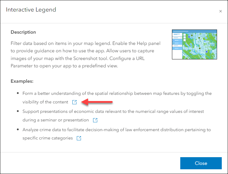
We have added more live example apps to the templates on the Create tab. In Gallery view, click the down arrow icon next to any template name to view its App description and see the examples. In Details view, the app description and examples are already shown by default in this view and the new live app hyperlinks for each template are as well.
Deprecation Notice for ArcGIS Configurable Apps
As of the June 2023 update of ArcGIS Online, a deprecation notice has been issued for ArcGIS Configurable Apps. Deprecation does not impact the availability, functionality, and Product Lifecycle Support phase of ArcGIS Configurable Apps.
ArcGIS Configurable Apps continues to be available until it is officially retired, but will not receive new features or other enhancements. Before retirement, users are still able to create apps using ArcGIS Configurable Apps templates and existing apps will continue to work.
Retirement of Configurable Apps is expected to happen towards the end of 2025. Please take a look at our detailed announcement blog: Deprecation Notice for ArcGIS Configurable Apps.
More information
For more information please reference our documentation page where you can find details about getting started with creating and sharing ArcGIS Instant Apps.

Article Discussion: