The December 2020 ArcGIS Online update introduces new features and key updates throughout the site. The same applies for Configurable Apps, as we have added enhancements to the new app configuration, updated existing apps, and addressed various bugs to help stabilize and improve your experience across the site. We have also added a new app that leverages 3D web scenes. See the highlights below.
New app: 3D Viewer
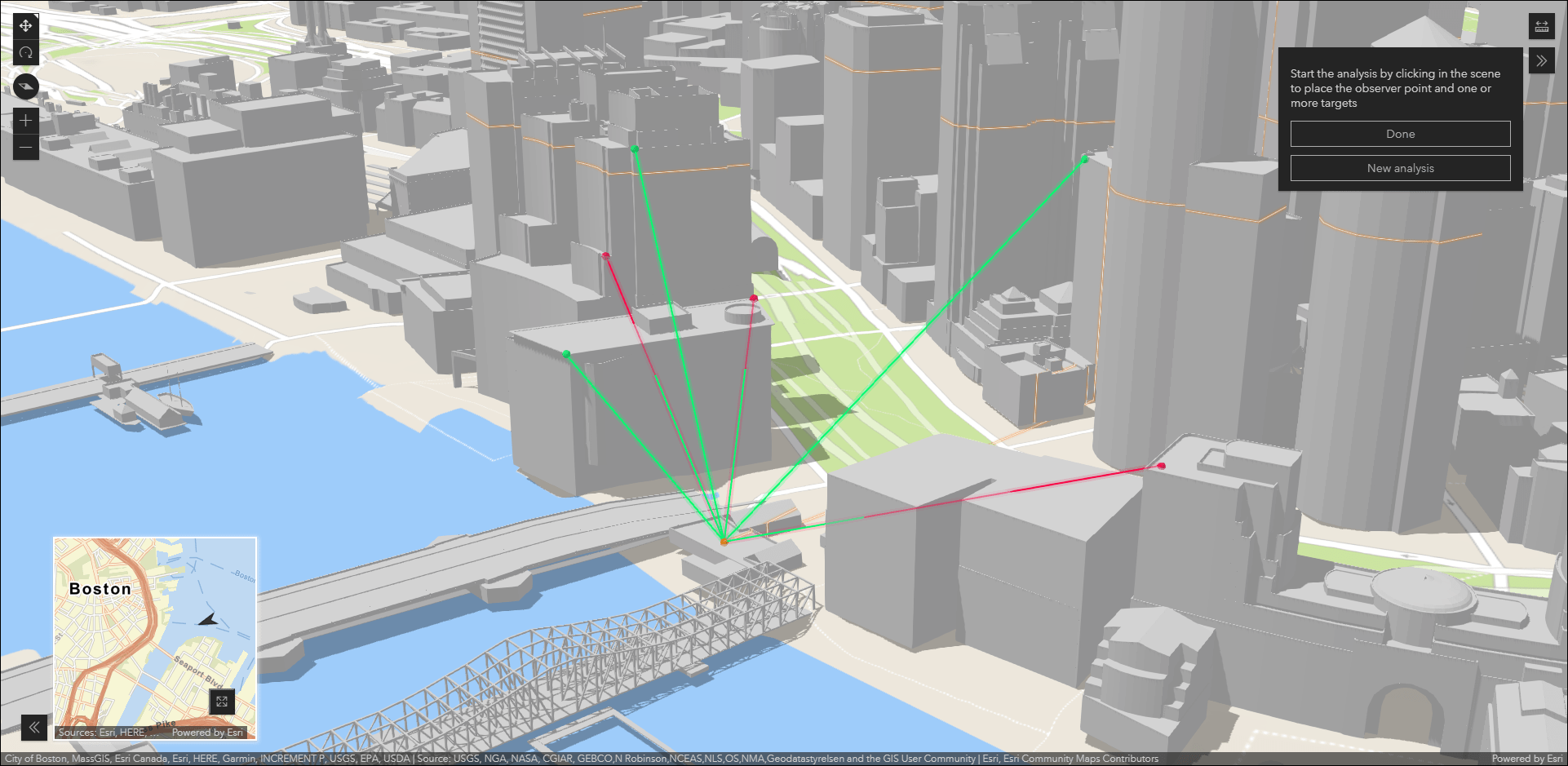
Present a 3D scene with a variety of exploration tools using the new 3D Viewer. This app is built using ArcGIS API for JavaScript 4x and offers capabilities such as Line Of Sight, measurement tools, inset map, preset slides, and slice tool. Use the inset map to show the app’s map area in the context of a broader view. This configuration setting offers both side by side and stacked layout options. Display slides that zoom and pan the map to a collection of preset extents that are saved in the web scene. Use the line of sight tool to determine if one or multiple targets are visible from an observer point.
For an in depth introduction to using the new 3D Viewer app, check out our Introducing 3D Viewer, a new Configurable App blog.
Support for Google Analytics
Track your app with Google Analytics by enabling the Web Analytics option in the new app configuration. This requires a valid Tracking ID from Google. Optionally, enable a consent message that appears at the bottom of the app that informs viewers about app tracking. Details and options are shown on the menus after clicking the Web Analytics button at the bottom of the app configuration.
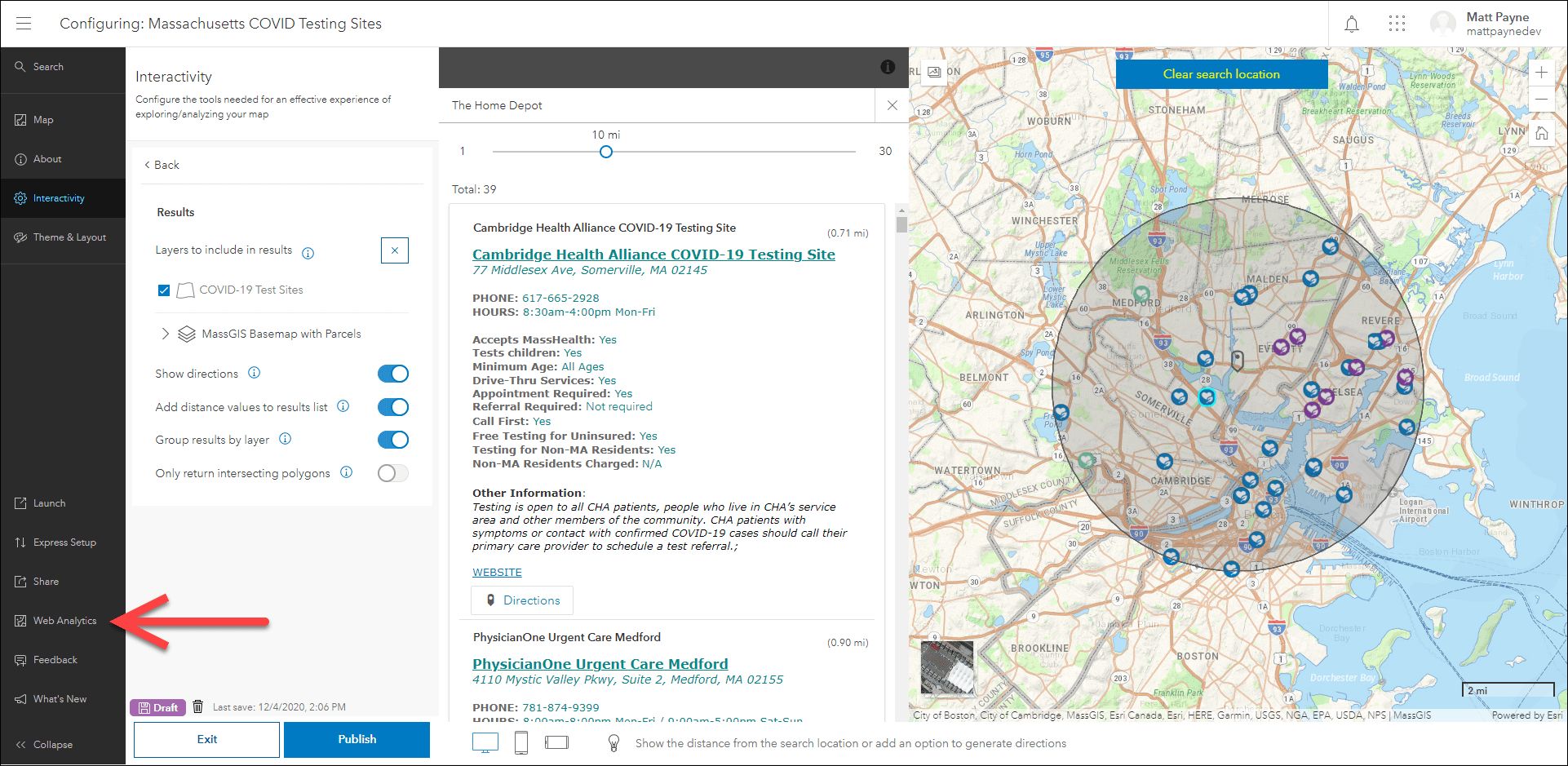
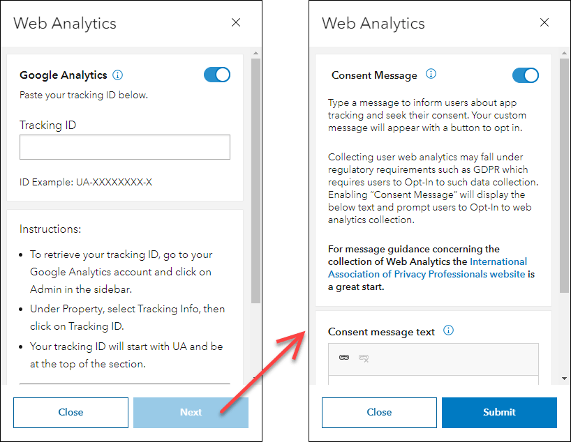
Note that some organizations may not see the Web Analytics button in configurable apps at first. There is an organization setting that controls this and is titled Esri User Experience Improvement program. It is located on the General tab of the organization settings, and the setting toggle is called Send anonymous usage data. Toggling this on will enable the Web Analytics button in the app configuration.
Category Gallery migrated to the new app configuration
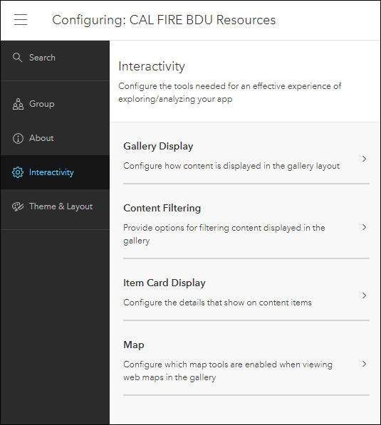
We have migrated Category Gallery to the new app configuration. Category Gallery provides a variety of ways to filter and sort content from a group. A great feature is the ability to utilize group categories and organization categories. Content is displayed in the gallery as a list or grid, and can be opened and explored within the app.
The updated app configuration offers new functionality such as Express Setup, updates on the fly, the ability to search for settings, mobile device preview, and Web Analytics. Refer to our June What’s New blog for more details: What’s New in Configurable Apps (June 2020): Introducing the New App Configuration
Enhancements to the Navigation Boundary setting
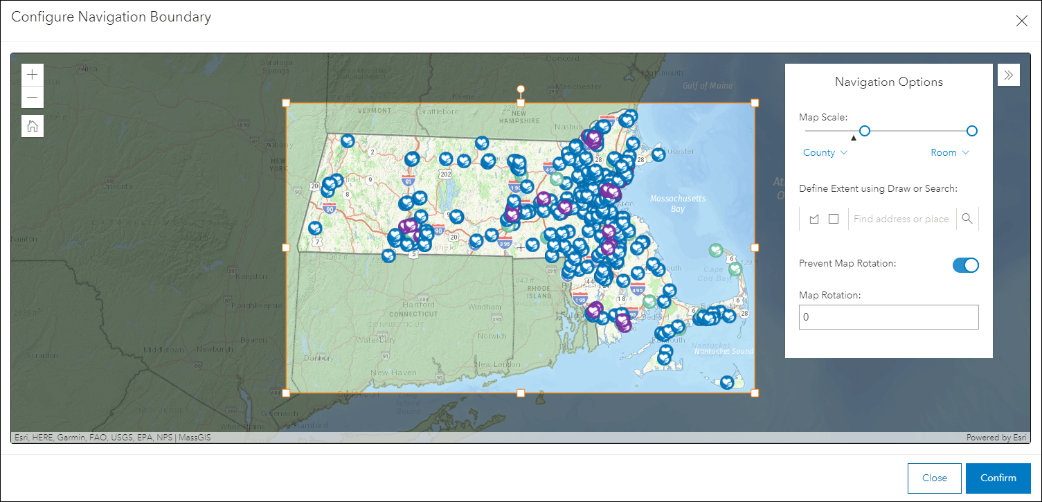
In September we released a new configuration option that allows you to define the navigation boundary of the map in your app. This controls how far app users can zoom in and out, as well as pan in the x and y directions. This is useful for keeping the focus on the data and area of interest that is important in your map.
We have enhanced this experience for app creators and added more control over fine-tuning the navigation boundary. In the configure window is the Navigation Options menu that contains several options for defining the visible extent such as map scale, extent drawing options, address search, and map rotation. The Prevent Map Rotation option, when enabled, prevents the app viewer from rotating the map. Use the Map Rotation option to define a value in degrees for the default map rotation when the app loads.
For a deeper dive, check out our Refine the Configurable App Experience using Navigation Boundary blog.
Multiple apps moved to mature support phase
We have moved 15 configurable app templates into the mature phase of the Product Lifecycle. Check out our October announcement blog, Apps Scheduled to move to Mature Support Phase December 2020, for details about which apps have moved and how to move forward with our recommended alternatives.
These apps have been removed from the default Configurable Apps gallery, however, they will remain as items in ArcGIS Online and still accessible to create new apps from. If you have already configured an application using an app template that is now in the mature phase, the app will continue to work and be accessible to your users. Refer to the detailed blog mentioned above for further information on this.

Article Discussion: