Last year at the Esri User Conference, we announced plans to introduce an expanded set of point-of-interest (POI) and other places data into our ArcGIS location services. This includes integration of places data in our maps, geocoding, and directions services. This month, we are releasing (in beta) the first set of this places data in the Esri Vector Basemaps.
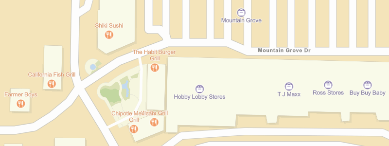
With the first update of the Esri Vector Basemaps in 2020 released this month, we now include a “Places” layer that displays the locations of restaurants, stores, businesses, and other POIs. The initial release includes several million places in the United States, using SafeGraph Places as the data source. The Places layer will be available in many of the styles available for the Esri Vector Basemaps, and has first been added to our popular Streets and Imagery Hybrid maps.

The Places layer displays at medium-to-large scales, with increasing numbers of places displayed as you zoom in to the larger scales. The places are symbolized by category (e.g. shop, school, theater, etc.), with unique symbols for over 100 types of places.
Why Now
The Esri basemaps have always included a limited number of POIs, such as transportation stations, but we have limited that because many of our users intend to overlay their own POIs or other point data on our basemaps. With the Esri Vector Basemaps, we now have the option to include a much more comprehensive set of places as a separate layer that can easily be turned on or off in the style. You will be able to choose from various ‘ready-to-use’ styles in which places are displayed by default, and you will be able to customize other styles to display the places layer in your map. You will also be able to filter the categories of places that are included (e.g. select restaurants and cafés) to display just the types of places that are relevant for your map.
Data Updates
One of the challenges of including places in a basemap is that the data is often changing. Businesses open and close each week, or move to new locations. Our partner SafeGraph is keeping up with these changes in various ways to provide the most accurate POI data available for the United States. We are actively updating the places layer in the Esri Vector Basemaps with the latest monthly updates of SafeGraph Places data to ensure we offer the latest data with each basemap release. And, if you see something that is wrong or missing in the places data, you will be able to help fix it using our Community Maps Editor app so it is reviewed and updated in a subsequent release.
What’s Next
The new Places layer will be added to additional basemap styles over the coming weeks. You will be able to find all of the currently available styles in this Places group.
Over the next few months, we will be updating the Places layer to include data for many other countries around the world. At that point, we’ll end the beta release and you’ll be free to use the places in your public maps and apps. These places will also be added to our Geocoding service so that you can also find them in your searches. In the future, the places will be added to our Routing and Directions service so they can be used as landmarks in directions. We’ll keep you updated as new capabilities become available!

Commenting is not enabled for this article.