Announcing 18 New Hosted Feature Layer Items
Local climate resilience planning just got an assist from some newly released content in ArcGIS Living Atlas of the World!
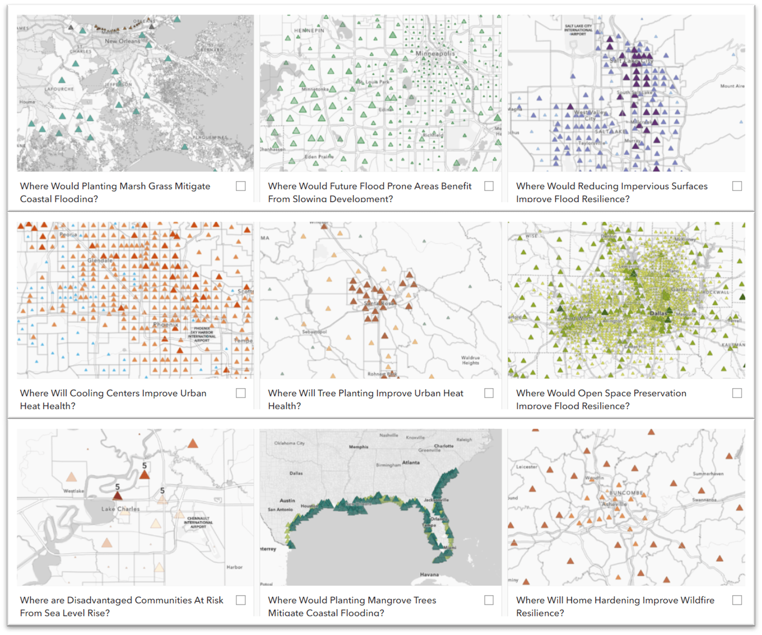
Eighteen hosted feature layer items, designed to support local climate resilience planning, are now available in Living Atlas. These Climate Resilience Index layers combine climate risk exposure variables with data like land cover type and demographics to create a composite index. You can use the indices to help plan and deploy risk mitigations at the census tract level. You can quickly incorporate the ready-to-use feature layer items into your planning and mitigation workflows as is. Or you can customize the style and cartography to suit your needs.

Composite Indices
The composite indices focus on four climate hazards; extreme heat, wildfire, inland flooding, and sea level rise, and have been styled into intervention maps. The maps are intended to aid you in prioritizing where to take specific action to help mitigate against each hazard.
We used a solution-first approach to developing these climate resilience indices by starting with a particular action, or intervention, in mind and working back from there. First, we identified the intervention, then we selected the most useful input variables for targeting the specific intervention.
Tree Planting Intervention
Let’s use tree planting as an example to explain the process. First, we identified tree planting as the intervention to help reduce urban heat islands. Next, we asked questions like,
What data already exists in Living Atlas that could support a tree planting intervention?
and
Could these data be meaningfully combined into an index that helps in determining which census tracts could benefit most from planting more tress?
Planting trees in targeted locations is well understood to be beneficial for mitigating extreme heat. We selected three inputs with the help of heat health experts that included surface temperature, lack of existing tree cover, and population density for the tree planting index. Combining these variables will help identify census tracks that are hotter than others, have fewer trees, and would benefit the most people. The ArcGIS Pro Calculate Composite Index geoprocessing tool is just the tool needed to meaningfully combine these inputs into a composite index to enrich census tract polygons. All three of these tree planting input variables are either already in ArcGIS Living Atlas of the World or can be easily derived from existing Living Atlas data.
Available in Living Atlas
All 18 Climate Resilience Index layers, covering 4 climate hazards, are now available with your ArcGIS Online subscription and ready for you to explore and use in your workflows. We prepared each one with default symbology to save you time so you can start working with them immediately. Use them standalone in your own maps, combine them into new maps, and even customize the symbology for your specific needs.
For more information about how the composite indices were created and how you can use and customize them, check out these great resources.
- Explore the New Calculate Composite Index Tool in ArcGIS Pro 3.1
- Introducing the Calculate Composite Index Tool in ArcGIS Online Map Viewer
- Creating Composite Indices Using ArcGIS: Best Practices
- Customize a climate resilience index
All Adobe Stock images are © 2024 Adobe Stock. All rights reserved.

Article Discussion: