ArcGIS Enterprise 11.3 is a long-term support release that is packed with new features and enhancements designed to elevate your GIS experience. From simplified content management and enhanced analysis capabilities to improved visualization tools and ArcGIS app enhancements, this release empowers organizations to achieve more with their data through location intelligence.
Here are just a few cool things you can do with ArcGIS Enterprise 11.3 on Windows and Linux.
- Refresh Living Atlas content in your organization between ArcGIS Enterprise upgrades.
- Create custom web tools in the Map Viewer analysis pane.
- Utilize four new field types that give more flexibility when storing and managing your date and time data.
- Discover newly available apps, like ArcGIS Urban and ArcGIS GeoBIM.
Watch our video, What’s New in ArcGIS Enterprise 11.3, and continue reading to learn more.
ArcGIS Enterprise portal
ArcGIS Enterprise 11.3 introduces many new enhancements and features to the ArcGIS Enterprise portal. These improvements will support your mapping, visualization, and analysis needs for working with both 2D and 3D data. Enterprise 11.3 also introduces the new metadata editor and many administration enhancements.
Map Viewer Updates
Map Viewer now supports four new field types for managing date and time data. The Date Only, Time Only, Timestamp Offset, and Big Integer fields allow you to have more control when working with temporal data. For example, the Date Only and Time Only field are helpful if you have data that does not require both data and time. Date Only could be used for birthdays or school year start and end dates while Time Only could be used for the opening and closing times of a business. These field types were a beta feature in Enterprise 11.2 and are now generally available in Enterprise 11.3. Visit the documentation to learn more about beta features.
Another time-related enhancement is the ability to now set specific time zones for your web maps. Previously time data was always displayed in the time zone of the device (web browser, cell phone, etc.) from which the viewer was accessing the map. This meant that viewers who were accessing web maps from different time zones would see different date and time values. You can choose to set a web map to a specific time zone or the device’s time zone. If you choose a specific time zone for your web map, all viewers will see the same date time values no matter where they are accessing the map from. The time zone label widget displays the time zone for the web map, making it easy for viewers to know which time zone the date time values are displaying in.
There have also been enhancements to working with related records in Map Viewer. You can now work with and edit related records for feature-to-feature relationships. This is supported for both hosted and referenced feature layers and sub feature layers within a map service layer. These related records can also be displayed as a pop-up in Map Viewer.
Map Viewer now also supports the ability to duplicate sketch features. Simply select the sketch feature that you want to duplicate, and then click the “Duplicate” button. The new sketch feature will be created at the same location as the original feature, and it will have the same attributes. You can also copy sketch features to a new sketch layer. This can be helpful if you want to create a backup of your sketch features, or if you want to use them on a different map. To copy sketch features to a new sketch layer, simply select the features that you want to copy, and then click the “Copy to new layer” button in the sketch toolbar.
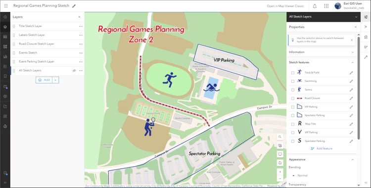
Another new feature in the Map Viewer is the ability to enable ToolTips to show feature dimensions while drawing sketch features. This can be helpful when you’re trying to create precise sketch features. To enable ToolTips, simply click the “Enable ToolTips” button in the sketch toolbar.
Finally, you can now add titles and pop-ups to multiple sketch features at a time. This can save you time if you’re creating a large number of sketch features. To add titles and pop-ups to multiple sketch features, simply select the features that you want to edit, and then click the “Add titles and pop-ups” button in the sketch toolbar. For more information, check out the What’s New product documentation.
Scene Viewer Updates
This release introduces significant enhancements to Scene Viewer, designed to improve user experience and streamline workflows. Scene Viewer now supports direct modifications to an integrated mesh scene layer within the browser, enhancing the editing process. Additionally, the new presentation mode features minimal UI elements and a streamlined slide ribbon for easy navigation, making it ideal for showcasing and communicating 3D content and scenes with stakeholders.
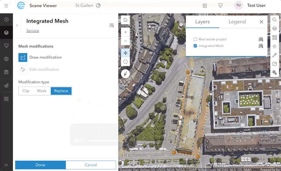
Pop-ups in 3D have also been enhanced, enabling users to utilize Arcade expressions and related records. This new functionality allows users to access and display a wealth of information, thereby enhancing the interactivity and exploration of 3D data. Scene Viewer now includes support for constraints, which enables more precise and concise edits, streamlines the editing process, and ensures accuracy.
Furthermore, 3D Basemaps, previously in beta in Enterprise 11.2, are now fully supported in Enterprise 11.3. This expanded support offers users a wider range of basemaps, facilitating the creation of visually appealing and informative scenes. These updates significantly enhance the overall user experience in Scene Viewer, empowering users to effectively visualize, analyze, and present their 3D data. View the blog to learn more.
Analysis Updates
The analysis updates in ArcGIS Enterprise 11.3 provide users with increased flexibility and access to new analysis capabilities, so you can improve your workflows and get more out of your GIS data.
One of the most notable analysis updates is support for custom web tools in Map Viewer. Custom web tools can be created from a notebook or geoprocessing service, from a script or a model. They also can be used to perform a wide variety of tasks, such as spatial analysis, data processing, and visualization right within your web map.
Another significant update is the support for map services as feature inputs for analysis. This can be useful when you want to analyze data that is stored in a map service. For example, you could use a map service for census data to perform spatial analysis on the data.
In addition to these major updates, there are several new analysis tools and raster functions, such as Geocode Location from Table and Calculate Composite Index. They provide additional capabilities for spatial analysis and data management, while raster functions like Gradient and Interpolate Raster by Dimension provide additional analysis and visualization options. For a complete list of the new analysis tools and raster functions in ArcGIS Enterprise 11.3, please refer to the documentation.

Metadata Editor
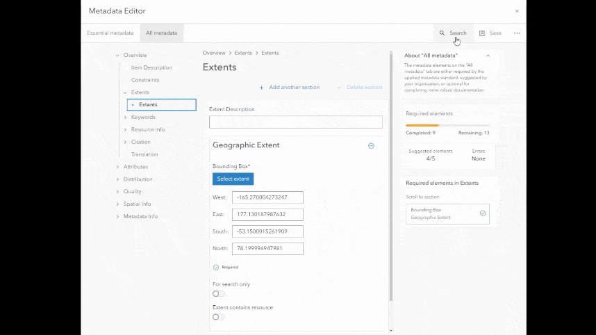
Metadata Editor provides an intuitive, user-friendly interface and streamlined experience for creating high quality geospatial metadata. Users can quickly complete what’s needed in the Essential Metadata section and complete more detailed documentation in the All Metadata section. Plus, a new search tool has been added which enables users to find matching metadata elements, along with other tools to download, overwrite, and reset it. Administrators can enable the Metadata Editor for their organization. Once enabled, the new editor is the default option, but the classic metadata editor is still available. The Metadata Editor was originally introduced as a beta feature in Enterprise 11.2 and is now fully supported in Enterprise 11.3. Visit the documentation to learn more about features.
ArcGIS Enterprise Portal Organization Administration Updates
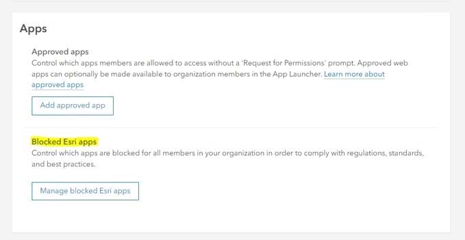
Blocking Esri Apps
This functionality allows organizations to block selected ArcGIS apps that cannot otherwise be blocked through privileges and licensing and provides organizations more control to curate the applications their users need to complete their work.
For example, there may be apps available to your users through their license that they may not need for their work. Blocking those apps can provide your users with a more curated experience. Apps that have been blocked will be removed from the app launcher, and app items cannot be created from the content page or from a web map.
New Custom Administrative Privileges
Now, users can create and manage reports as well as administrative groups. When a user is given custom report privileges, they will be able to create and manage administrative organization reports in the ArcGIS Enterprise portal.
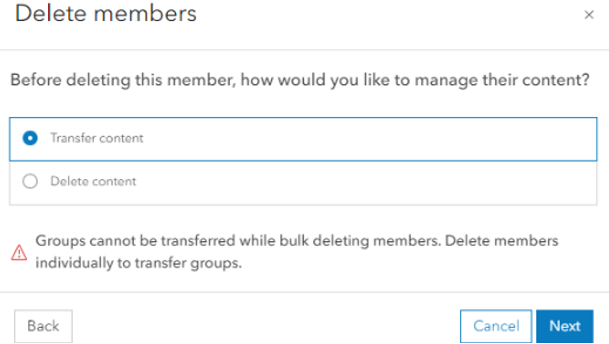
Ability to Bulk Delete Users
Administrators can now delete content in groups when deleting an individual member (instead of transferring ownership of the content) which will save time. Additionally, administrators have the ability to bulk delete up to 100 members at a time in their ArcGIS Enterprise portal. One thing to note about bulk deleting members, the ability to transfer groups during this workflow is not yet available.
Content and Data Management
Update ArcGIS Living Atlas Content
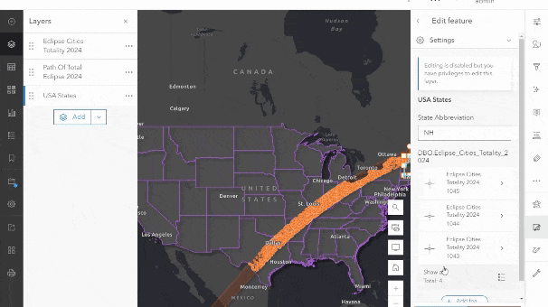
With the click of a button, administrators can now update the ArcGIS Living Atlas content for their organization. Additionally, updates to the content can be scheduled, and notifications will be displayed within the Enterprise portal when new content is available. This means that organizations can now ensure that they have access to the latest and most up-to-date content from Esri in between ArcGIS Enterprise upgrades. View the blog to learn more.

Enable service extensions in the Enterprise portal
Now, you can enable server object extensions (SOEs) and server object interceptors (SOIs) from the item details page in the Enterprise portal for map services. In previous releases, this could only be done through ArcGIS Server Manager or when publishing from ArcGIS Pro. This further builds up upon the service management capabilities introduced into the Enterprise portal in 11.2.
Distributed Collaboration
Distributed collaboration extends the reach of your GIS content by enabling your organization to seamlessly connect content with other Enterprise and Online organizations, and metadata makes that content easier to document, locate, and use. This new enhancement enables users to share content accompanied by item and sublayer metadata with collaboration participants, making the content you share more useful and collaboration more effective. Additionally, the sending organization can edit the metadata and sync the changes for collaboration participants to view. This workflow empowers organizations to share their authoritative content through collaboration while minimizing metadata discrepancies and errors.
ArcGIS Data Store updates
Your administrators can replace the self-signed certificate used by the relational, tile cache, graph, or object data stores with a CA-signed certificate to improve security. In addition, administrators can use the new –roles options in the configuredatastore utility to designate a role for each machine in their spatiotemporal big data store cluster. Previously, every machine in a cluster was both coordinating the cluster as well as storing and retrieving the data. This feature, if utilized, will provide more control to system administrators and enhance the scalability of the spatiotemporal big data store significantly, as functions of the data store can be isolated to dedicated machines.
ArcGIS Enterprise server roles
ArcGIS Image Server
ArcGIS Image Server 11.3 empowers your enterprise with better insights from imagery and streamlined data access. New features include two new raster tools in Map Viewer (Multidimensional Principal Components, Detect Change with Deep Learning), and improved cloud storage support for deep learning. View the documentation to learn more.
ArcGIS Knowledge Server
ArcGIS Knowledge 11.3 offers enhanced capabilities like the new Knowledge Studio web-based interface, custom pop-ups, simplified data loading, and more. Share link charts and maps across platforms, integrate insights from your knowledge graph into web map pop-ups, and analyze your enterprise knowledge graphs with ease. View the blog to learn more.
ArcGIS Notebook Server
With the release of ArcGIS Enterprise 11.3, ArcGIS Notebook Server now supports Docker Engine installed from binaries on Windows. This newly supported workflow can serve as an open-source alternative to Mirantis Container Runtime (MCR) for deploying Notebook Server with Windows containers. View the blog to learn more.
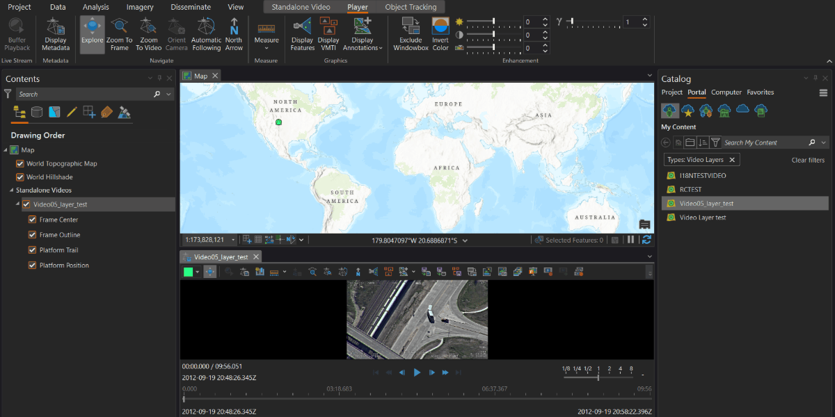
ArcGIS Video Server
ArcGIS Image Analyst and ArcGIS AllSource are now integrated with ArcGIS Video Server to support video layers and perform video analysis. Image Analyst users can use the same full motion video workflows they know and love in ArcGIS Pro, and the intelligence community can apply video as another data source to their workflows. View the blog to learn more.
ArcGIS Workflow Manager Server
ArcGIS Workflow Manager now includes support for hosted ArcGIS Survey123 surveys in disconnected environments, a new ArcGIS Arcade variable, improved step template functionality, and browsing capabilities for hosted feature layers. Additionally, ArcGIS Workflow Manager Server can be federated to an ArcGIS Enterprise on Kubernetes deployment. View the blog to learn more.
App updates
ArcGIS Dashboards
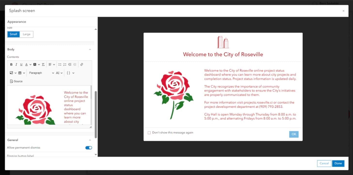
Time Zones enable you to control how date and time values are processed and displayed for viewers that are spread across multiple time zones. Also, the new splash screen feature enables you to display your organization’s brand, a welcome message, important disclaimers, and much more. View the documentation to learn more.
ArcGIS Enterprise Sites
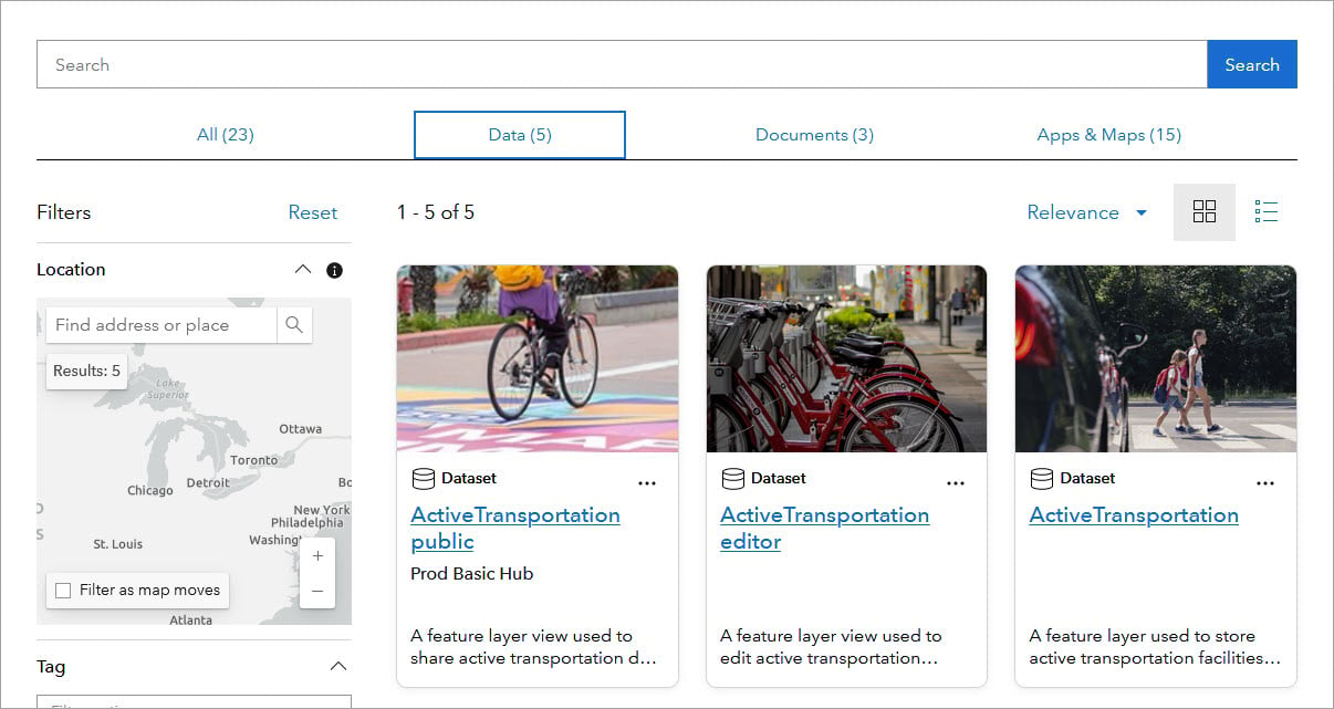
ArcGIS Enterprise Sites includes a new flexible, search view. This view allows users to search for content by location, type, or keyword. It also provides a more visual way to browse and organize content; site visitors can now view items as a list or grid. View the blog to learn more.
ArcGIS Excalibur
ArcGIS Excalibur streamlines how users share project information, access observation layers, and connect to livestreams using ArcGIS Video Server. Also, Excalibur now supports knowledge graph layers. View the blog to learn more. View the blog to learn more.
ArcGIS Experience Builder
Add geoprocessing tools to an app with the new Analysis widget or find features within a specified distance of a defined location with the new Near Me widget. View the blog to learn more.
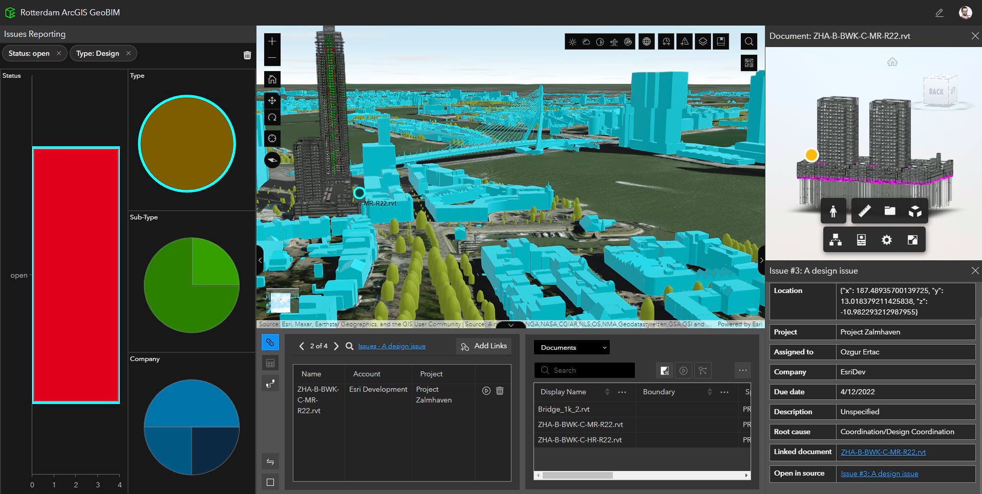
ArcGIS GeoBIM
New to Enterprise!
ArcGIS GeoBIM is a web-based application that connects geospatial data with design and construction information for teams to explore and collaborate on building information modeling (BIM) projects. Now, you can deploy the application in your self-hosted enterprise IT environments to meet greater security and data requirements. View more in the blog.
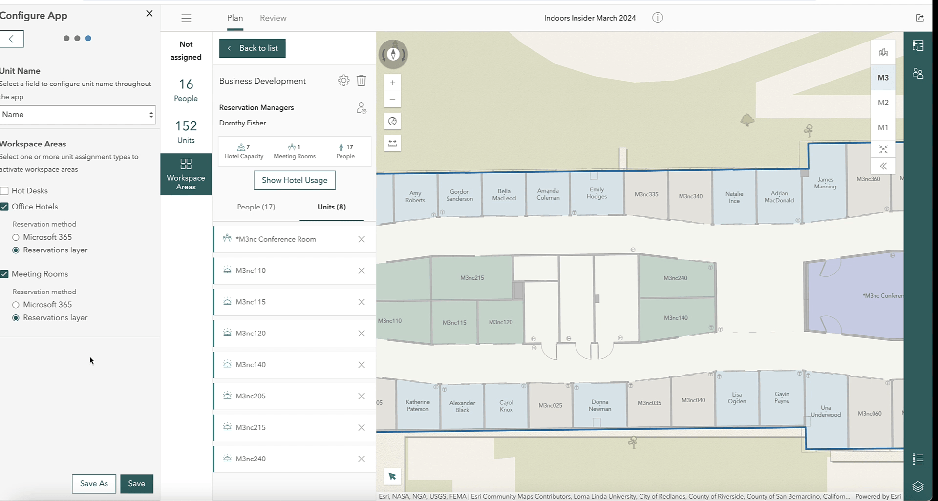
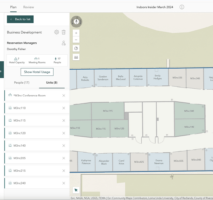
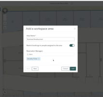
ArcGIS Indoors
ArcGIS Indoors now streamlines workspace reservations and floor plan management, allowing users to manage all reservable workspaces in one place. In addition, meeting room bookings and workspace reservations support more capabilities and provide a better user experience. View the blog to learn more.
ArcGIS Instant Apps
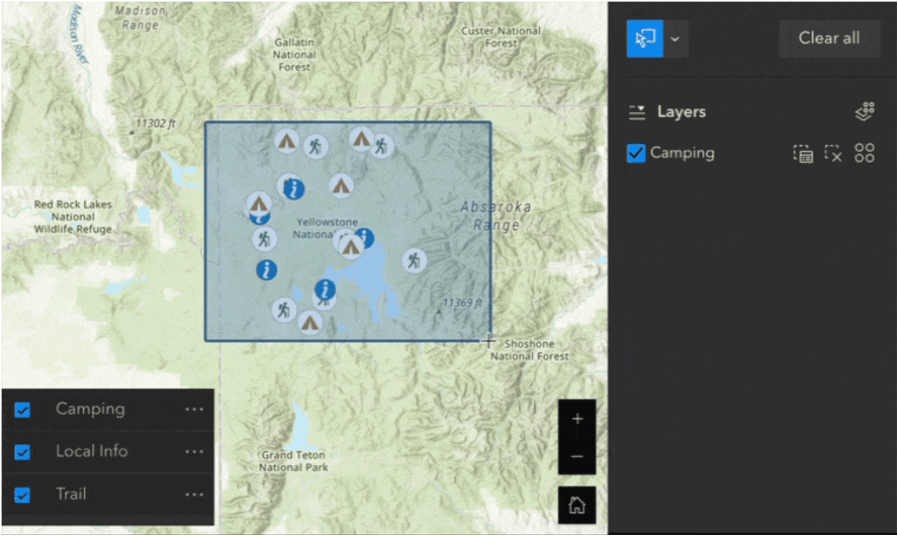
Create multilingual instant apps by choosing a language from a drop-down list and viewing text in that language. The Insets template has expanded the range of geographies covered, enabling users to interact with the data in those regions. View the capabilities matrix and blog to learn more.
ArcGIS StoryMaps
ArcGIS StoryMaps briefings were a beta feature in Enterprise 11.2 but are now generally available in Enterprise 11.3. Briefings are perfect for sharing slides and creating engaging stories for your audience with new functionalities such as autoplay, alternative media, printing, and more. View the blog to learn more.
ArcGIS Urban
New to Enterprise!
ArcGIS Urban is a 3D scenario modeling application for urban and regional planners. With interactive 3D visualizations and dynamic data analysis capabilities, planners can create what-if scenarios to inform zoning, land use, and development decisions. By deploying ArcGIS Urban on Enterprise, planners can benefit from enhanced performance and scalability, and leverage the existing security infrastructure within their organization to ensure data privacy. View the blog to learn more.

Other Important Updates in ArcGIS Enterprise 11.3
Network Management Release
ArcGIS Enterprise 11.3 is a Network Management release that includes new features and enhancements that offer utility organizations more efficient ways to manage their networks. To learn more about network management releases, visit the blog.
.NET 8 Support
ArcGIS Enterprise 11.3 introduces support for the .NET 8 framework, which is a long-term support release from Microsoft. This update brings a range of enhancements and features that developers can leverage to enhance their ArcGIS applications. To take advantage of these benefits, developers will need to update their Visual Studio to a supported .NET 8 version. For those developing new SDK extensions or migrating existing ones, it is recommended to use .NET 8. This ensures compatibility and allows developers to leverage the latest capabilities offered by the framework.
Learn more
For even more details on what is included with this release, delve into the documentation available in the What’s new in ArcGIS Enterprise topic to discover the full range of enhancements and how they can benefit your organization.
When you’re ready to get started with ArcGIS Enterprise 11.3, head over to your My Esri account for your licenses and software.
We’d love to hear what you think of this latest release of ArcGIS Enterprise in the Esri Community! Your feedback helps ArcGIS Enterprise be the best it can be.


Commenting is not enabled for this article.