ArcGIS Enterprise portal administrators tend to wear many hats and perform a wide range of tasks: managing organization members and content, securing the Enterprise portal, customizing the website with company branding, and so on. We recognize the complexity of the administrator role for organizations, both big and small, and are constantly working to simplify administrative tasks. With the 10.8 release of ArcGIS Enterprise, we have added several new features that make it easier to administer your portal!
At the top of the list, we have introduced two new features: the access notice and information banner. These features allow organization administrators to control and display information to all users that access the Enterprise portal. Let’s take a deeper dive into these new features.
Access notice
Many of you have asked for the ability to configure a notice that would display to all users accessing your Enterprise portal. We have heard feedback along the lines of:
“My organization requires that users agree to terms of use before they can access the Enterprise portal and my organization’s information”; Or
“Our users must acknowledge a disclaimer and privacy information before entering our website.”
You spoke, we listened! With the new access notice feature, you now have a way to communicate information to users when they access your Enterprise portal website. Users can accept, acknowledge, or simply read the notice before entering your website, depending on how you set it up.
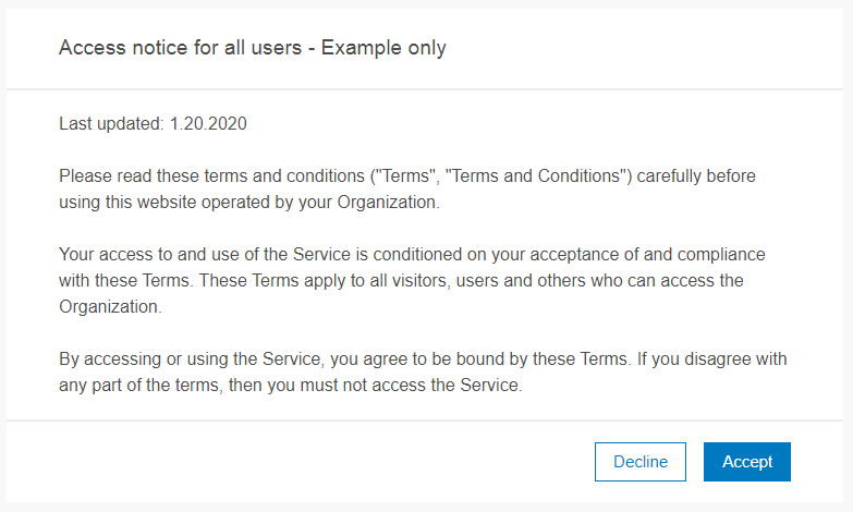
Within the Enterprise portal Organization Settings, on the Security tab, you will find this new access notice setting where you can configure and customize a notice that meets your organization’s unique needs.
Information banner
With the new information banner feature, you can configure a static message that appears for every user at the top and bottom of each page in the Enterprise portal. The banner can be used to display information such as the status of the organization (e.g. the portal is undergoing maintenance, or the organization is in read-only mode), important notices, and security classification levels.
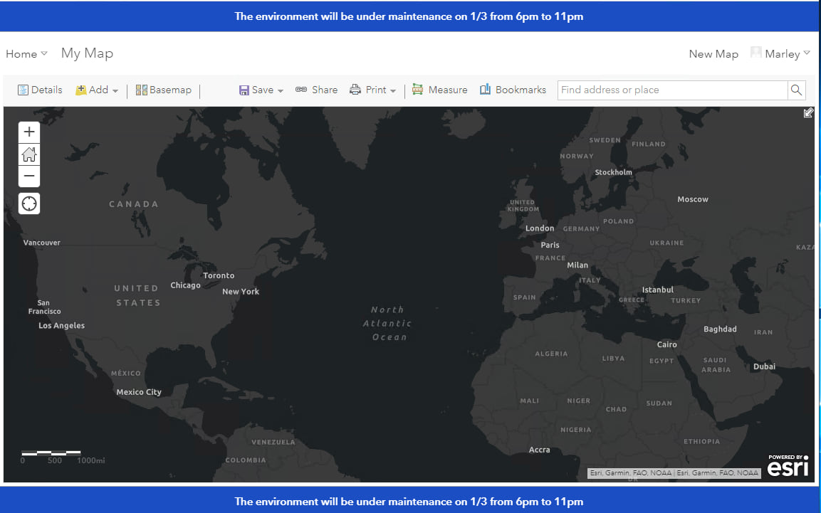
This feature may seem familiar to some of you. The information banner is replacing the classification banner that was customizable in Portal for ArcGIS versions 10.3-10.7.1. Why did we add the new information banner if we already had a banner feature? Those of you using the classification banner already know the answer… and we can assure you that the new information banner is easier to configure and maintain!
Let’s compare the banner configuration experience at previous versions of the portal, and now using the new information banner at ArcGIS Enterprise 10.8.
Banner configuration: Comparing old and new
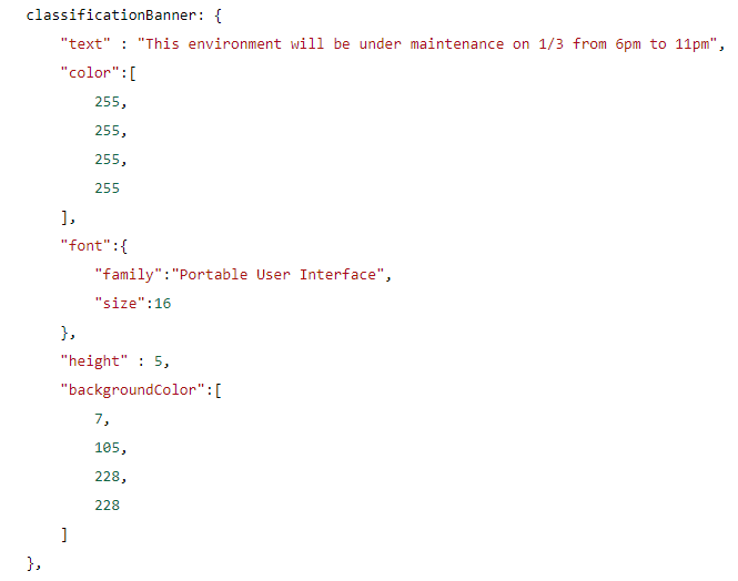
To add a banner in previous versions of the portal, you were required to edit the portal configuration file and add CSS syntax to the “classificationBanner” property. Following these edits, you were required to restart the Portal for ArcGIS service to have the changes take effect. Additionally, edits made to this configuration file were not maintained through an upgrade of Portal for ArcGIS. To reapply your banner following an upgrade, you were required to reconfigure the banner from scratch and restart the service.
At 10.8, configuration of the information banner is a breeze! You can configure an information banner within your Enterprise portal’s Organization Settings on the Security tab.

When enabling the information banner, you will find an interactive settings dialog where you can customize the message for your banner and preview your changes before saving.
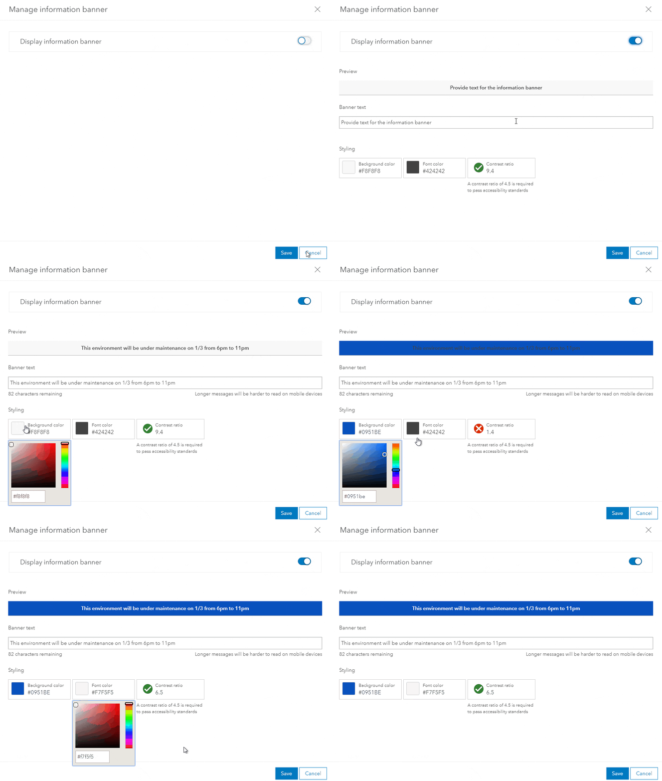
Not only are you no longer required to restart the Portal for ArcGIS service to apply your banner configuration, but your configurations will also be maintained when upgrading. With added flexibility and no interruption to your users, we hope you can use the information banner to help keep your users informed!
Next, we are going to discuss new features we have added to help you manage your organization members. The variety and complexity of member management tasks can be overwhelming, especially to administrators of large organizations with many members. At this release, we have added new filtering, group features, and easily configurable member defaults to help make managing members easier!
Member filtering
For Enterprise portal administrators who manage organization users, you will be happy to hear we’ve enhanced the member search and filtering experience. Added member filters and searching capabilities allow administrators to easily locate specific members and perform administrative tasks, such as inviting members to groups, assigning licenses, and assigning roles.
At 10.7 we added the ability to filter members by role and user type. At 10.8, it is now possible to additionally filter members by last login date, assigned add-on apps, and group membership.
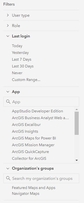
The addition of member filters and searching lets administrators and other users easily find the specific organization members they want to interact with. Some of the top requested filtering options that you can now perform at 10.8 are:
- View all members who have never logged in
- View all members that belong to a specific group
- View all members assigned an ArcGIS Insights license
We have also extended the member filters for other workflows outside of the Organization Members tab. You can now use these filters when inviting members to groups and managing licenses.
Group capabilities: Administrative groups and groups with a hidden member list
We have added a new group capability called administrative groups that puts complete membership control in the group managers’ hands. Only default Administrators can create administrative groups, and members added to administrative groups cannot leave the group unless removed by a group owner or group manager.
The administrative group option can be enabled under the group settings when creating a group. You cannot update an existing group to be an administrative group.

Administrative groups are powerful when used in parallel with the new member filtering and search options by providing the ability to group and categorize members of your organization. You can use the group membership filter to perform bulk management tasks like assigning licenses or updating the role of all members of the group. Administrative groups were also added in a recent update to ArcGIS Online. Read the Getting to Know Administrative Groups in ArcGIS Online blog post for practical examples of how administrative groups can be used in both ArcGIS Online and ArcGIS Enterprise.
Another group capability we’ve added for the 10.8 release is the ability to hide the list of members on a group’s Members tab. This option is particularly useful for public groups where you wish to protect the privacy of group members. Like the administrative groups option, only default Administrators can create groups with a hidden members list. This setting is exposed when creating a new group and can also be enabled under the settings for existing groups.

There are a few important things to note when enabling this setting. Once you have hidden the member list from the group members, this setting cannot be reverted. The group owner and managers will always be visible on the Members tab, regardless of which setting is selected. In addition, the item owner’s user name will be exposed on the content tab for items shared to the group.
License ArcGIS Utility Network and ArcGIS Parcel Fabric using user type extensions
If your organization is using Utility Network or Parcel Fabric, you should make note that the licensing for these products has changed at the 10.8 release of ArcGIS Enterprise. As of the 10.8 release, Utility Network and Parcel Fabric functionality can only be accessed by users that have been assigned the appropriate user type extension. The Utility Network Service and Parcel Fabric Service extensions are included in the GIS Professional Standard and GIS Professional Advanced user types and can be assigned as an add-on license to most other user types.
We hope that these new administrative features and capabilities help with your daily administrative tasks. Please share your feedback on these new features and join the discussion on geonet!


Article Discussion: