ArcGIS Earth 1.4 gets a significant boost!
ArcGIS Earth is an interactive 3D experience to plan, visualize, and evaluate events on the globe. It’s a free and easy-to-use tool that provides situational awareness on desktop and mobile devices for improved decision-making and the Esri 3D team is excited to announce the release of ArcGIS Earth 1.4. This release focused on streamlining enterprise deployment workflows and on enhancing the Portal for ArcGIS experience.
In addition, major improvements have been made to Earth’s drawing and table of contents (TOC). An upgraded popup window improves HTML display, the ability to log errors, and more KML functionality are all part of the new release.
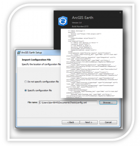
Administrators get more flexibility for deploying Earth in controlled user environments. A configuration (.xml) file can be distributed along with the installer and can allow the pre-configuration of many of Earth’s setting and parameters. Preset parameters can include navigation, units, error logging, start up layers, basemaps, terrain and more. Newly added for organizations running ArcGIS Earth behind firewalls is the ability to specify organization’s portals including setting a default portal URL.
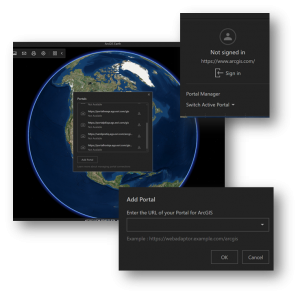
As a compliment, a new portal configuration interface was added, creating an experience similar to the ArcGIS Pro portal experience in which the app remembers previously accessed portals. Users can now easily switch among Organizations in on premises ArcGIS Enterprise portals or ArcGIS Online with the new portal configuration tool.
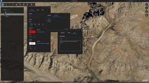
Drawing features such as points, lines, and polygons got a major overhaul. Users have enhanced drawing functionality that includes:
- Extended color, size, and labelling choices
- An expanded icon set as well as the ability to add their own custom icons
- Draw features that can be draped or set to absolute and relative values
- Creating snapshot views for individual draw features
- Providing additional context including text, images, and HTML links to draw features
- Option to open HTMLs in popups information in the Earth popup window or in a web browser
- Export draw features grouped within individual folders
- Edit point, line and polygon drawings
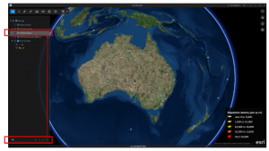
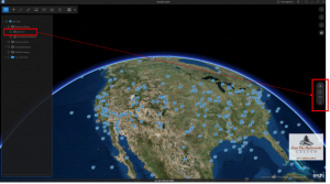
Earth’s table of contents has also been improved. A new search feature has been added that allows users to search through massive amounts of data layers. The function will find and jump to the location of text within the TOC, even if it is embedded within subfolders. The ability to create custom folders for grouping imported data and drawing features was added as well as the ability to save out multiple drawing features grouped under a folder. Users will also notice credits for Esri Living Atlas imagery sources displayed on the viewport.
KML functionality is expanding in Earth as well as across the platform. The 1.4 release adds the ability to play KML tours in ArcGIS Earth. Simply drag and drop and select ‘Play tour’ to start a tour’s automated navigation. Look out for increased KML functionality in upcoming releases.
ArcGIS Earth 1.4 introduced some great new features that will enhance workflows for visualizing data on the globe, accessing portals, and sharing across organizations. Simplification of the installation and configuration in enterprise environments eases the burden for the administrator in large scale deployments and quickly gets users up and running. We appreciate the feedback as we continue to add new functionality and features. Please keep the feedback coming. Try out ArcGIS Earth 1.4 – it’s free and available for download now!
![]()

Commenting is not enabled for this article.