We are excited to announce that ArcGIS Earth 1.2 is now available for download.
ArcGIS Earth 1.2 adds new capabilities including:
- View integrated mesh data
- Use more local data and work offline
- Additional configuration ability
- Export simple KMZ
View Integrated Mesh Data
Integrated meshes are large, textured triangular meshes that are typically generated from oblique photogrammetry data sets that may be captured by satellites, aircraft, drones or other vehicle-mounted cameras. From the size of a house to the size of a small country, ArcGIS Earth can now view integrated mesh data and will even blend the mesh data with the ground elevation so that the user does not see any clashing or ‘z-fighting.’ Integrated mesh data in Esri’s I3S scene cache open specification is now being generated by Drone2Map 1.0 and partners such as Pix4D and Vricon. Bentley Systems even announced recently that their new application, ContextCapture, is generating I3S integrated meshes that can be hosted in ArcGIS Online.
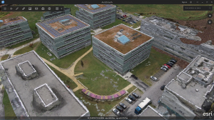
Earth 1.2 can view integrated mesh scene layers as services shared in ArcGIS Online or Portal for ArcGIS and Earth can view integrated meshes as local scene layer package (SPK) files. The largest test I’ve run is to bring in 420GB of Vricon data at once. It’s impressive.
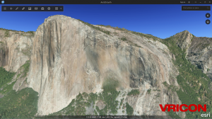
Today, integrated mesh layers may be used for visual inspection and context in Esri apps, including ArcGIS Pro, the ArcGIS Online scene viewer, and ArcGIS Earth. In the future, we’ll be expanding integrated mesh capability to allow users to better integrate meshes with other GIS data and to access attributes that may be attached to the mesh.
Local data and working offline
Users can now explore the ability to work offline by using Earth with new types of local data sets including scene layer package files (SPK) for 3D objects and integrated meshes, imagery tile packages (TPK), and a variety of local elevation files.
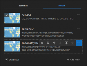
Users who want to work offline will follow this general workflow:
- Open Earth in the default state, generally connected to ArcGIS Online or an on premises Portal for ArcGIS
- Open the Basemaps window and add a basemap by pointing to a local file, including SPK, SHP, KML, or imagery TPK files
- Switch to the Terrain tab and add a local terrain by pointing to a local file
- Optionally add other local SPK, KML/Z, CSV/TXT, and SHP files
- Optionally, configure the administrative config file in the install directory to add some local layers as ‘StartUp Layers’
- Go offline
Export simple KMZ
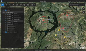
Users who want to preserve their drawing elements can now save them as a KMZ that can be loaded back into Earth or used in other applications, such as ArcGIS Pro.
Additional configuration ability
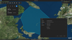
Beyond setting up local basemaps and elevation services, Earth adds new personalization and administrative configuration capabilities.
Users can now personalize Earth with the ability to set default units and users can backup and import their workspace.
Administrators or users who have access to change the install configuration file can use WMS, KML, and services to set default startup layers and they can customize and change the links to help and feedback site locations.
What’s next?
We plan to continually improve Earth based on user feedback and customer need. We are planning on improvements to the drawing workflow, more integration with ArcGIS Online and Portal for ArcGIS, expanding the TOC capabilities and more “GIS compatitibility” features, such as the ability to display attribute tables.
If you haven’t downloaded ArcGIS Earth 1.2, yet, get it here: www.esri.com/earth
We look forward to your feedback as you start to explore Earth’s new capabilities.

Article Discussion: