Esri recently released additional international data to its already expansive Global Demographic offering on the ArcGIS platform. This release includes:
- New Advanced data for Spain
- Additional postal geography levels added to the Advanced data for Germany
- Additional current year spending data and building permit data added to the Advanced data for Australia
Spain
The Advanced data for Spain contains data on income, household type, presence of children, place of birth, nationality, housing and property type, employment, and 87 different spending attributes. There are over 650 variables included in this database. The vintage of the data varies from 2012 to 2014, and the source is AIS. This Advanced data is available at the following five geography levels:
Comunidade 19
Municipio 8,162
Provincia 52
CensusSections 36,071
CensusDistricts 10,512
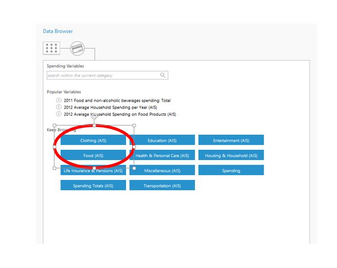
The Advanced data for Spain is available on the ArcGIS platform and through the GeoEnrichment services. To find this data, look for data collections that have “(AIS)” at the end.
In addition, there are 18 web maps available on ArcGIS online that feature this data. They are available at the following links:
Average Household Income in Spain
Average Household Spending in Spain
Average Property Age in Spain
Average Residential Property Size in Spain
Clothing and Shoe Spending in Spain
Education Spending in Spain
Food and Beverage Spending in Spain
Foreign Population in Spain
Healthcare Spending in Spain
High Income Households in Spain
Housing and Utilities Spending in Spain
Insurance Spending in Spain
Leisure and Entertainment Spending in Spain
Low Income Households in Spain
Population 65 and Over in Spain
Population Density in Spain
Population Under 15 in Spain
Transportation Spending in Spain
Click here for more information on the Advanced data for Spain, including the methodology statement and full variable lists.
New Postal Data for Germany
The Postcode 2 and Postcode 5 geography levels were added to the Advanced data for Germany, which was released in December 2014. The Advanced data for Germany contains detailed data on age, purchasing power, ancestry, household size, tenure, lifestyle, vehicles available, and summarized business data. There are over 400 variables included in this database. The vintage of the data is 2013 and the source is Nexiga. This Advanced data is now available at the following seven levels of geography:
Country 1
Bundeslaender 16
Gemeinden 11,366
Kreise 402
Wohnquartier 86,336
Postcode2 95
Postcode5 8,217
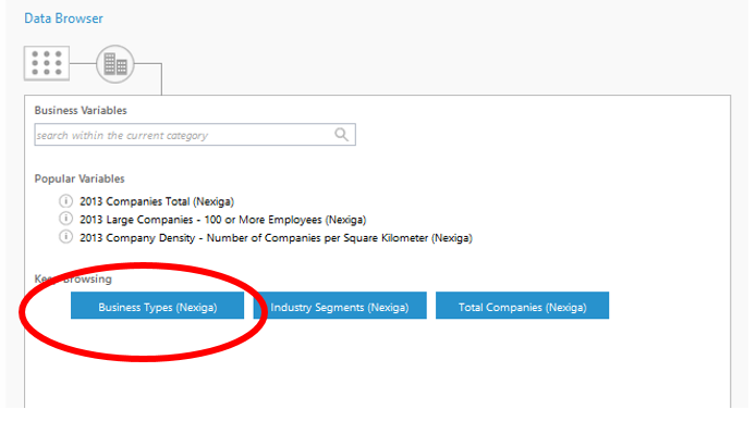
The Advanced data for Germany is available on the ArcGIS platform and through the GeoEnrichment services. Look for data collections that have “(Nexiga)” at the end like the one circled below to start using this valuable data:
In addition, we added several web maps to ArcGIS Online from this Advanced dataset from Germany. These are available now at the following links:
Foreign Population in Germany
Households Denying Advertisement in Germany
Population 65 and Over in Germany
Population Density in Germany
Population Under 15 in Germany
Purchasing Power in Germany
Tenant Households in Germany
Two-Person Households in Germany
For more information on the Advanced data for Germany, you can find the methodology statement and full variable list here.
New Spending and Building Permit data for Australia
Over 950 attributes on building permits and spending were added to the Advanced data for Australia that was released in December. The Spending data provides a total and average amount spent on over 400 different goods and services including housing, medical, entertainment, transportation, food, apparel, and education. The Advanced data is available at the following levels of geography:
Country 1
State 9
Statistical Area Level 1 54,805
Statistical Area Level 2 2,214
Statistical Area Level 3 351
Statistical Area Level 4 106
Greater Capital City Statistical Areas 34
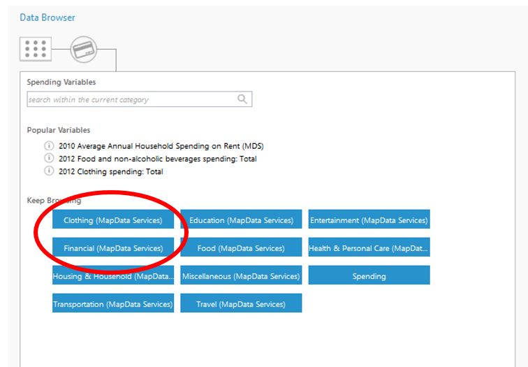
This database is available on the ArcGIS platform and through the GeoEnrichment services. Look for data collections that have “(MapData Services)” at the end like those circled below:
In addition, the following web maps are now available on ArcGIS Online for this newly added database:
Airfare Spending in Australia
Average Annual Rent in Australia
Beer Spending in Australia
Daytime Population in Australia
Gasoline Spending in Australia
Health Insurance Spending in Australia
Home Entertainment Spending in Australia
Household Donations in Australia
Income Taxes in Australia
Public Transportation Spending in Australia
Restaurant Spending in Australia
More information on the Advanced data for Australia, including the methodology statement and full variable lists, is available here.
These Advanced datasets for Spain, Germany, and Australia enhance the current portfolio of International demographic data available on the ArcGIS platform. For more information on Esri’s international coverage and details about our Standard and Advanced data, please visit Esri Demographics.
The new web maps and some reports for each Advanced dataset can also be accessed through apps such as Business Analyst Online, Community Analyst, Esri Maps, and Explorer. Learn more about these apps from Esri on the ArcGIS Marketplace.


Article Discussion: