ArcGIS Pro is the primary desktop client for image visualization, processing and management. The Image Analyst extension extends ArcGIS Pro to be an image analysis workstation, with tools for improved image interpretation, feature extraction and imagery analysis. The extension is designed for imagery analysts, geospatial analysts, and image scientists who focus on image interpretation and the creation of information products from imagery.
As part of the ArcGIS Pro 2.3 release, the Image Analyst extension has been expanded with several advanced capabilities and features. In addition to enhancements in deep learning, motion video, and image analysis functions, there has been a strong focus on quality improvements and bug fixes in the stereo and image space capabilities.
Here are some of the key highlights of the new capabilities you’ll see.
Machine Learning and Image Classification
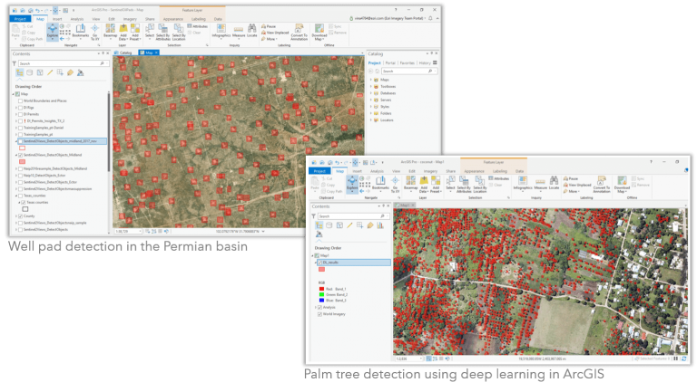
Machine learning and image classification tools let analysts create derived products, such as land cover and land use classification maps, using advanced classifiers and machine learning algorithms. The tools enable users to classify remote sensing imagery using statistical and machine learning classification methods. The Deep Learning toolset is introduced in the Pro 2.3 release. Highlights in this release include:
- Three new geoprocessing tools to support image classification and object detection workflows that use deep learning models generated by popular deep learning frameworks
- Support for deep learning frameworks such as TensorFlow, CNTK and Keras
- Enhancements to the existing Create Training Samples geoprocessing tool to simplify creating training samples and metadata for input to deep learning frameworks

Motion Imagery (Full Motion Video)
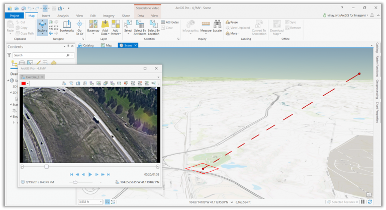
Motion Imagery, added in ArcGIS Pro 2.3, is the evolution of the FMV add-In for ArcMap to enable management and interactive use of video with embedded geospatial metadata. With this release, you can:
- Display GIS layers (e.g. building polygons, hydrology features, etc.) in the video player and the map view
- Create and edit features in the video player and update existing feature classes
- Extract metadata from both live video feeds and archived videos
- Extract image frames from video for analysis in your GIS
- Export video frames to PowerPoint for rapid report generation
- View videos synchronized to the time slider to improve integration with time enabled feature classes

Most of the functionality available in the FMV add-in for ArcMap is now fully integrated into Pro 2.3. Plus, FMV now takes advantage of the powerful architecture, 3D scenes, asynchronous processing, smoother video playback and better performance available with ArcGIS Pro.
Raster Functions
The extension expands the list of raster functions accessible in Pro with additional statistical operators, enabling analysts to design and run complex custom image processing algorithms as raster function chains. One new function is available in this release:
Focal Statistics is now available as a raster function in the Image Analyst extension. Focal, or neighborhood statistics calculate a variety of summary statistics on neighboring pixels. The function is used for a variety of purposes from data smoothing and noise reduction to edge detection for identifying roads and buildings.
Additional resources
For an overview of the Image Analyst extension and more on how to get the extension – click here
For more information on authorizing the Image Analyst extension – click here
For general help and getting started with the Image Analyst extension – click here

Commenting is not enabled for this article.