The newest version of ArcGIS Drone2Map has been released and we’re excited to share the latest features and enhancements. This blog contains just some of the highlights. For a complete list of everything new or improved please check out the help documentation.
Processing Improvements
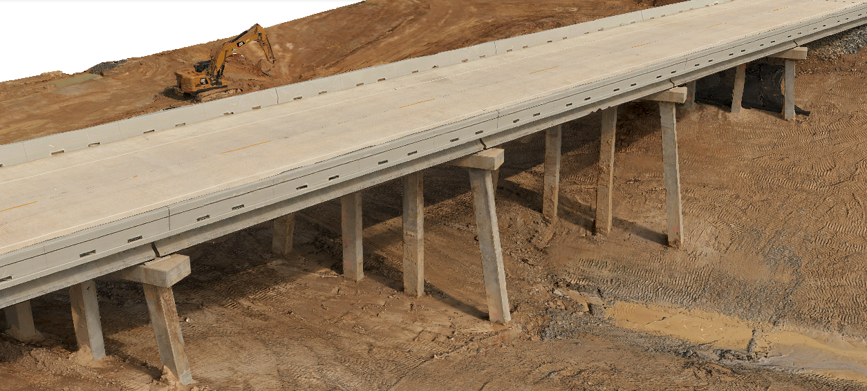
3D Point Clouds and 3D Mesh products have received a few improvements this release. Overall processing time to generate a 3D Point Cloud product has been reduced, and the quality of both 3D Point Clouds and 3D Meshes have improved.
3D Mesh products processed with high point cloud density will now include more detail on thin structure features, such as transmission towers, traffic poles, and fences. The detail for a 3D Mesh is also better preserved when zooming in and out of a scene.
Control Point Improvements
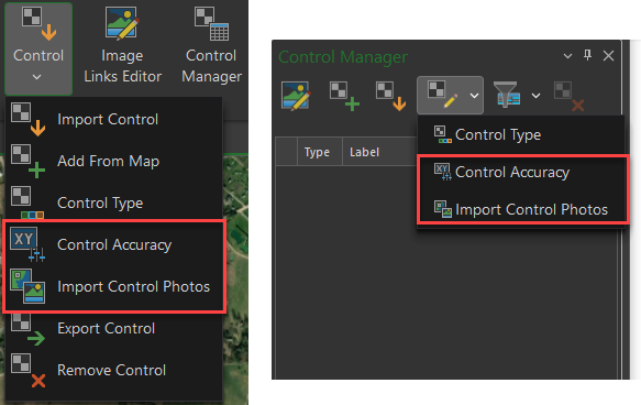
More flexibility has been added for importing control point photos and changing the accuracy of control points.
It is now possible to import photos of control points after a project has been created through new tools on the home tab and control manager pane. Additionally, when working in the image links editor, you can add, replace, and delete control photos on a per control point basis.
Control point accuracy can also be easily updated after a project has been created. This provides an easy way to update the horizontal and vertical accuracy of one or more control points.
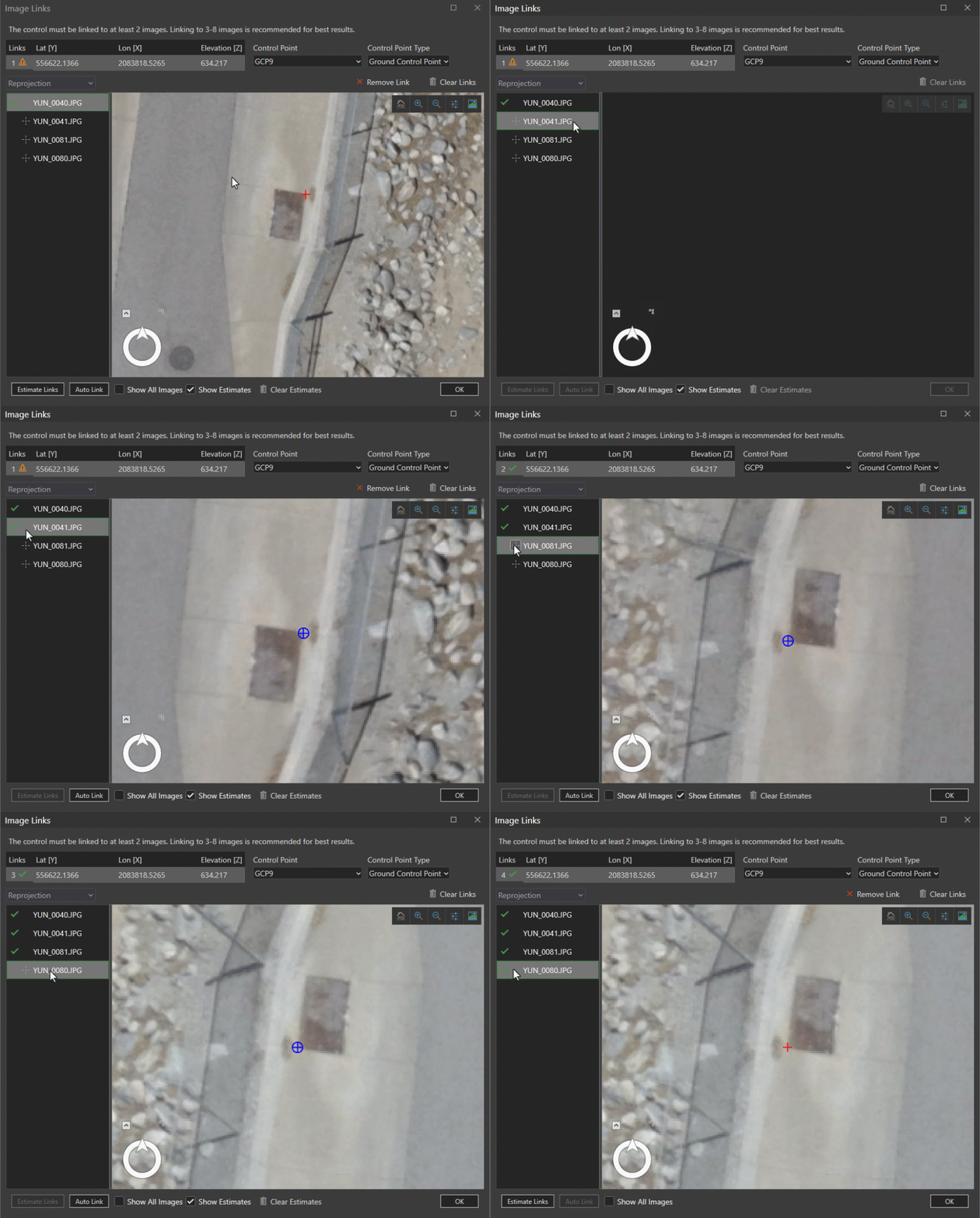
The image links editor has been enhanced based on some much-requested user feedback. When using estimated image links, you can now select and accept the image links individually instead of having to accept all the estimates, speeding up the linking process and reducing the chance of incorrect links.
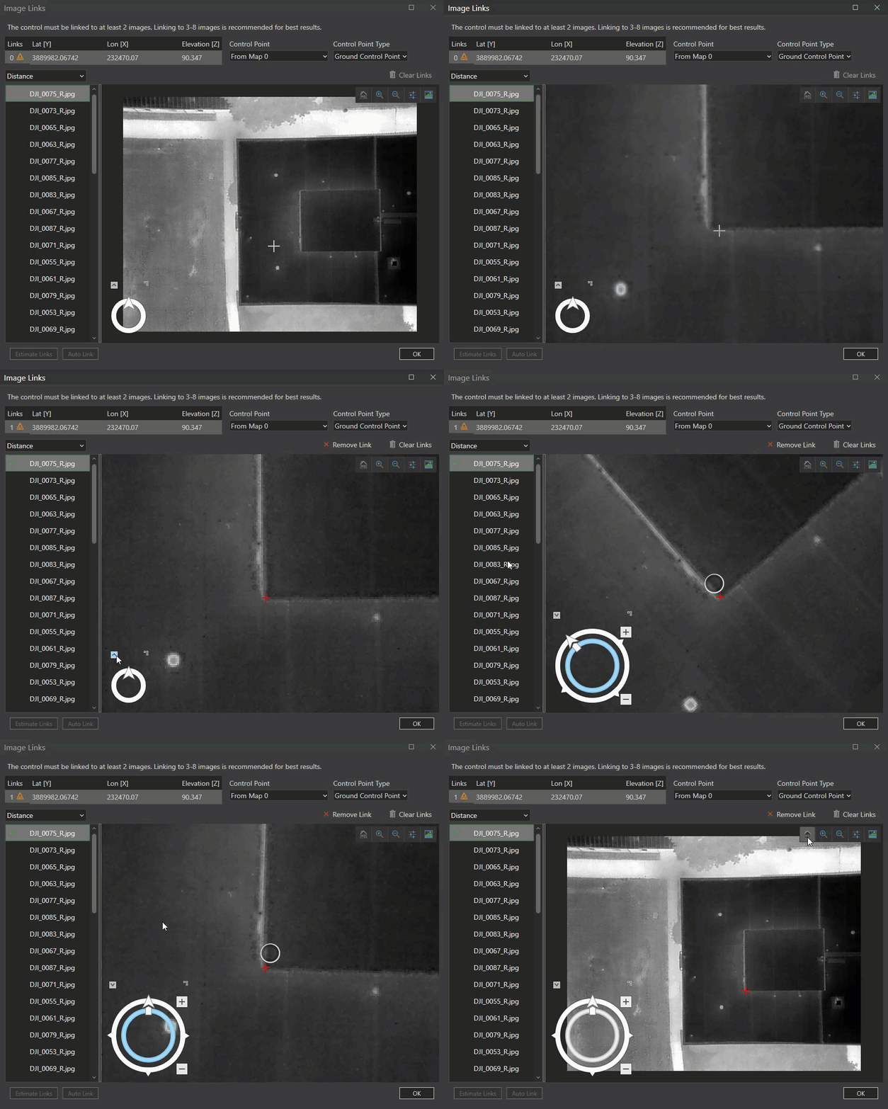
Improved navigation and image display options now make it easier to adjust various image settings and link control points within images on low resolution datasets such as thermal imagery.
Measurement Enhancements
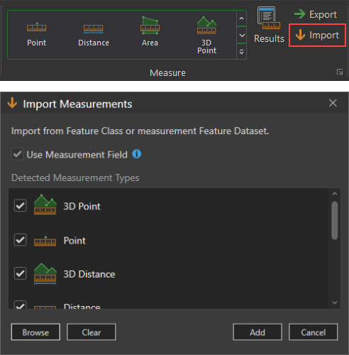
Up until now, measurements within a Drone2Map project have been limited to features drawn within that project. With Drone2Map 2024.2 we have introduced the ability to import existing feature classes or measurement feature datasets. If you are frequently flying the same area and taking measurements or volume calculations the measurements from those projects can now be imported to help track change over time.
Additionally, we have also added the ability to copy measurements. Any measurement you create within a project can be easily copied through a new button on the mensuration results pane. When copying the measurement, settings can also be modified so you can perform calculations from different elevation layers or base surfaces and compare results.
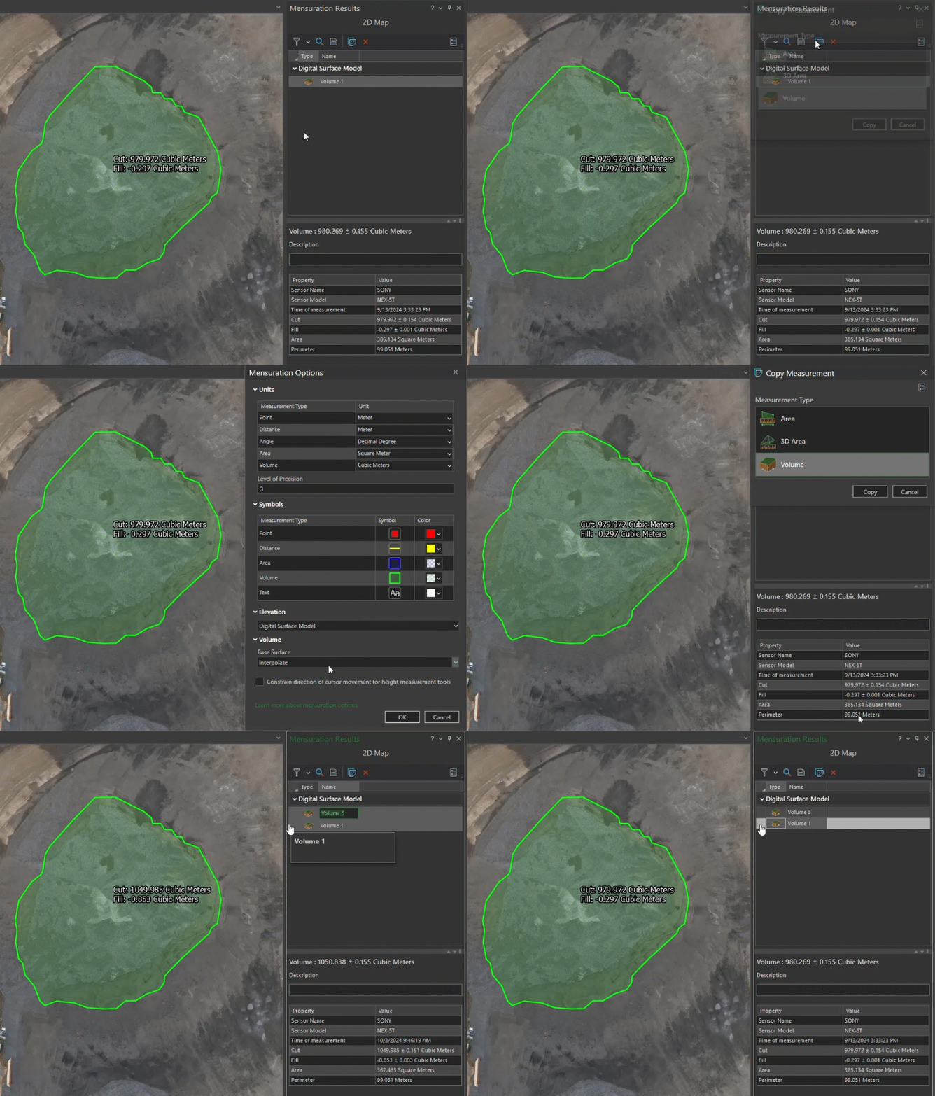
Image Metadata Viewer
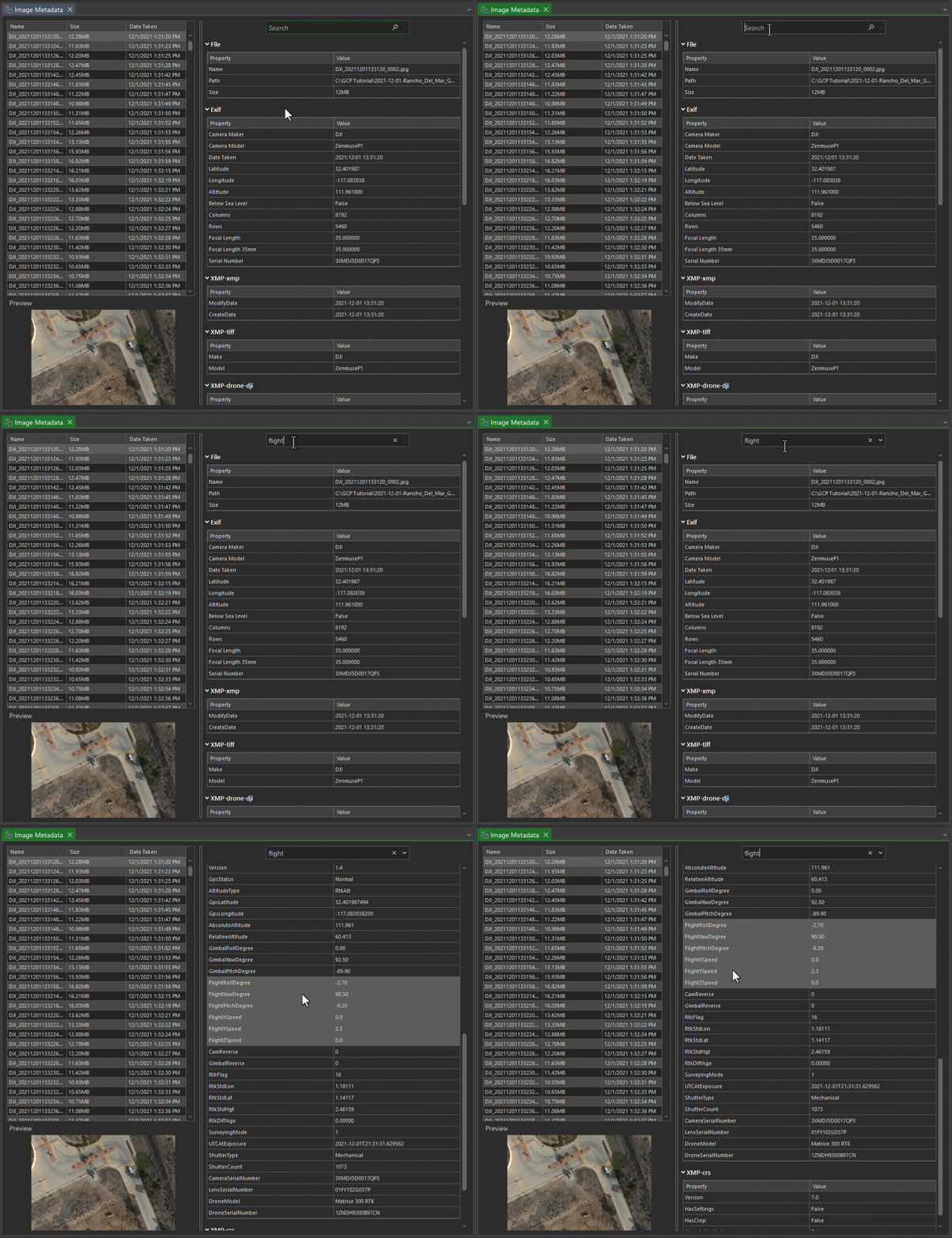
Metadata drives the successful processing of drone data. To help troubleshoot the results of processing it is helpful to have access to the image metadata to make sure settings were configured properly. To help make this easier, a built-in, searchable image metadata viewer has been added.
The image metadata viewer presents all your images in a table alongside the metadata and a preview of the currently selected image. When you click an image within the table, the metadata viewer will update and show all the relevant metadata for the selected image.
Stay Connected
If you have any questions or ideas, we’d love to hear from you! Visit the Esri Community page and let us know what you think. If you’d like to stay up-to-date on the latest product news and announcements for Drone2Map, make sure to sign up to be on our email list.



Article Discussion: