It was a long journey to Esri!
Applying for Esri’s summer internship has become a tradition for me every fall since my junior year in college. Majoring in GIS and Computer Science, this internship is a valuable opportunity to work with experts and professionals who develop industry-leading GIS technologies and provide solutions for clients worldwide. In the fall of 2023, I continued studying Urban Spatial Analytics as a master’s student, and the 2024 internship program opened for applications. Although I missed out twice before, this was my last opportunity to apply, and I did not give up. After years of accumulation, my resume improved significantly, and I got an interview with the Spatial Analyst team. I showcased my latest class project using the Suitability Modeler, and we discussed the use cases and fundamental differences between various raster tools. Two days later, I received the offer, and my dream finally came true. It was hard to imagine how great the summer would be!
What a challenging project!
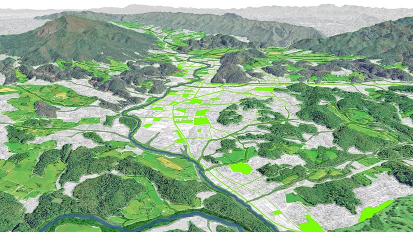
During my 12-week internship, I worked on a capstone project using the Spatial Analyst toolset in ArcGIS Pro using Python scripts. The project’s overall objective was to plan a “Sponge City” smartly, identifying communities with low flooding resilience scores, and developing a cost-effective solution for allocating green infrastructure in the Atlanta metro area. It was an interdisciplinary study of GIS, remote sensing, statistics, urban planning, and civil engineering, giving me a broader vision of how vital GIS is in building sustainable cities. To achieve this goal, the project was divided into four sequential steps: 1) assessing flash flooding risk, 2) calculating communities’ flooding resilience scores in high flooding risk areas, 3) locating suitable sites for constructing green infrastructure, including green roofs, bioretention, and permeable pavements, and 4) creating a bi-objective optimization model.

Undoubtedly, the project would be a challenging project. Before developing the workflow, I conducted a detailed literature review and felt confident in my methods. However, the actual implementation was not as easy as expected. For example, I spent more time processing the data than anticipated but it turned out that was the most essential part of the project, since doing that well determined the efficiency of the main analysis process and the quality of the results. The raw data from various sources were in different formats such as Living Atlas Imagery services and USGS 3DEP collections. I not only had to ensure the same analysis environment using the same cell size and spatial reference, but also needed to understand why we used specific indicators and tools. This is one of the underlying premises behind the work of Product Engineers. Since my knowledge of flooding was limited, I first studied some academic papers. My Team colleagues also provided significant help in understanding the basic concepts, different modeling techniques, and how to use them appropriately for my geographic area of interest.
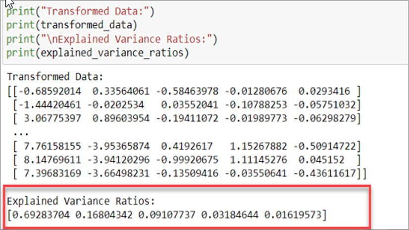
From that project, I created Python scripts for the Analytical Hierarchy Process (AHP) method and the Pareto Front in multi-objective optimization. The AHP method is widely used in multi-criteria decision-making and helps determine weights when calculating overall scores. Optimization models can save costs and create the largest benefits. Here is the link of the story map for more details. Future work will include developing these tools as geoprocessing tools and making them available to the broader user group.
There are many more interesting events!
Doing a full-time internship is not about sitting in front of computer screens all day. Each week, the university program scheduled daily events for us, and my favorite was “What’s Next Wednesday.” It provided the best opportunity to communicate with department directors and chief officers. I was deeply impressed by their continuous passion and contributions to technological innovation over decades. Their encouragement helped me overcome many challenges.
")
I also attended the second day of Esri’s 2024 User Conference in San Diego. My main purpose was to gather useful information to improve my project, as well as learn how to help users solve their problems. I spent most of the day attending presentations, visiting the map gallery, and working with my team at the Spatial Analysis and Data Science showcase area. The convention center became a GIS world of its own, with thousands of professionals gathering to discuss how to make the larger world better.
I also got the opportunity to participate in the Hackathon event during my internship. Over two days, I worked with three other interns to develop our “Pinpoint” web map application, which provides peer reviews of interesting places for newcomers to a city, offering personalized suggestions based on users’ current locations, transportation preferences, and weather conditions. It was also exciting to see other teams’ products that incorporated Extended Reality, NLP models, and many more new ArcGIS products. In one weekend, these innovations made significant impacts on solving real-world problems!
The future is bright!
Previously, my perspective on internships was that I should do as much work as possible and focus on writing about the quantity of work on my resume. However, this summer added a lot of new perspectives. My mentor was right—the internship taught me many things, including how to become a qualified geospatial analyst, efficiently manage my time, and produce results timely. All these things, and more, came together preparing me for a great career ahead. It marked my transition from a graduate student to a real-world professional. I would like to thank my mentor, all my team colleagues, the university program team, and my fellow interns. It was a great honor working with all of you this summer. With this experience, I feel much more confident in exploring career opportunities, and I am excited to continue contributing to “the power of where!”

Article Discussion: