This article takes an inside look at the Mapping and location services developer guide, the resources it contains, the types of applications you can build, and some helpful tips on how to use it.
Who is it for?
The Mapping and location services guide is an essential programming resource for any developer wanting to learn how to build new mapping applications or integrate ArcGIS Location Services into existing applications. Location services are available to developers who have ArcGIS Location Platform or ArcGIS Online.
What’s inside?
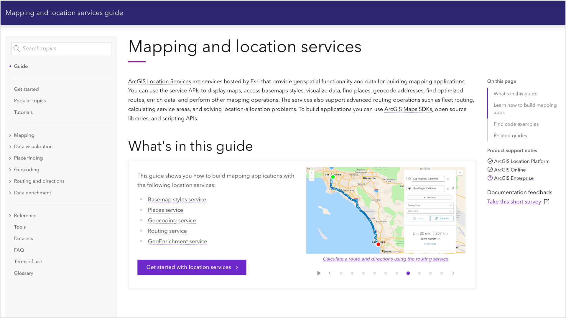
The guide contains key concepts, programming patterns, and examples of how to build different types of mapping applications. You’ll learn the fundamentals of how to display a map with a basemap and data layers. It also covers the types of mapping apps you can build. Each chapter then explains how to add functionality to your apps by using different location services. The code examples show you how to access the services directly with the REST API and with different ArcGIS Maps SDKs, open source libraries, and scripting APIs.
Here’s a quick breakdown of the chapters:
- Mapping: Create 2D and 3D maps with the basemap styles service and data services.
- Data visualization: Apply data-driven styling to style features in feature services.
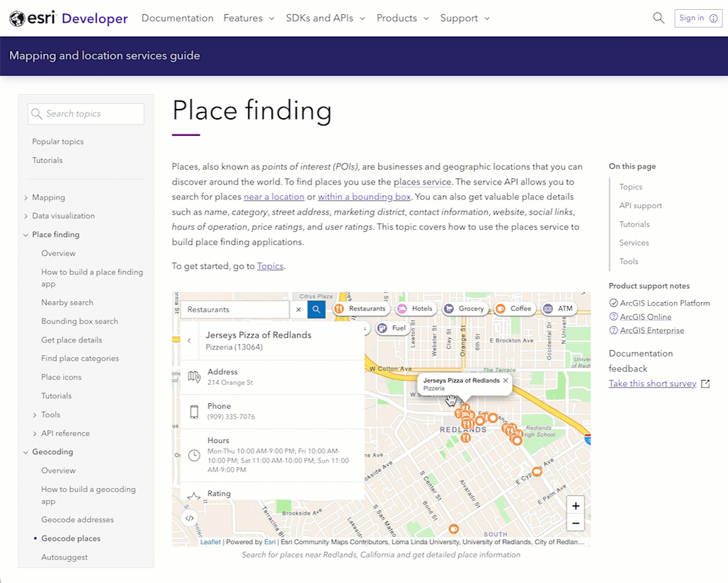
- Place finding: Find geographic locations and businesses with the places service.
- Geocoding: Geocode addresses and get suggestions with the geocoding service.
- Routing and directions: Find routes and directions with the routing service.
- Data enrichment: Get local facts and demographic data with the GeoEnrichment service.
The guide also has helpful features such as topic search and the ability to interactively learn more about key terms as you explore the content.
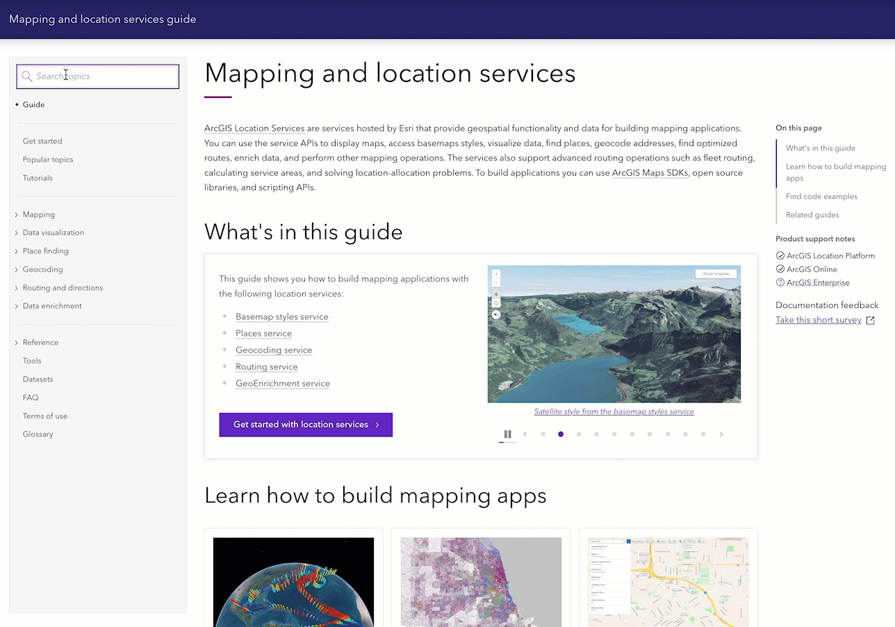
Tip: Use “Search topics” to find topics and hover over words to learn more.
Learn with How to’s
The guide contains a number of how to’s that show you how to build apps with location services. How to’s provide a high-level development path to learning how to use a location service. They help you choose the correct operations and parameters to use for different development scenarios. For a deeper dive, you can jump to individual topics or the REST API documentation.
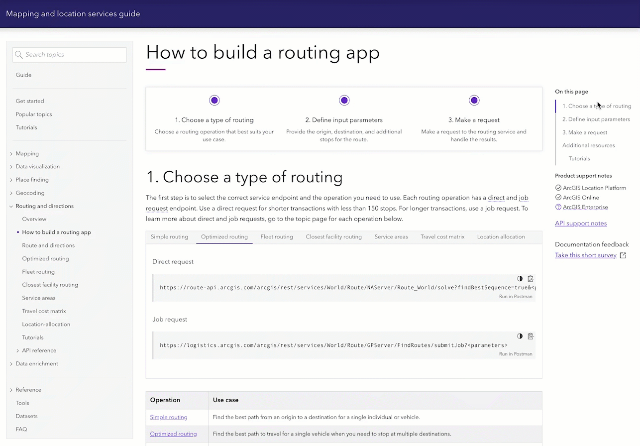
Tip: How to’s guide you through the high-level steps required to use location services.
Apps, code examples, and tutorials
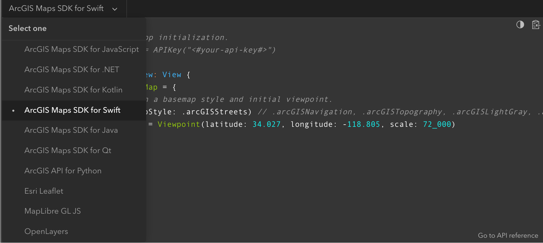
The guide also contains a number of sample apps, examples, and tutorials that provide great starting points for you to build your own applications. The code examples are available for many different SDKs and APIs such as the ArcGIS Maps SDKs, ArcGIS API for Python, ArcGIS REST JS, ArcGIS REST API, EsriLeaflet, MapLibre GL JS, OpenLayers, and CesiumJS.
Once you select an API in the guide, the code switchers are “sticky” and the code for the same API is displayed on all subsequent pages.
You can also run any of the sample apps in the guide in CodePen. All you need to do is click on the link (in the app), paste in your access token, and then run the app.
Tip: Use the “View in CodePen” button to access and run any of the sample apps.
Developer tools
The guide also contains a number of built-in tools that will reduce the time required to build applications.
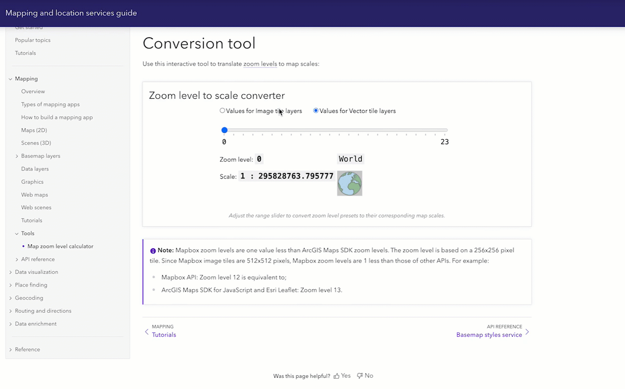
For example, you can use the map zoom level calculator to get the correct zoom or scale value for your mapping app. Or you can use tools such as the Places service category finder or the GeoEnrichment service variable finder to get the JSON of the names and IDs for the types of data you want to search.
Tip: Use built-in developer tools to save time for common mapping development tasks.
Ready to get started?
So if you are ready to start building your own mapping applications, go to the Get started page in the guide, learn how to use the different types of location services, and start building apps! Or just grab any of the source code and start from there.
We want your feedback!
When visiting the guide, please take our survey to let us know what improvements we can make.
)

Article Discussion: