As a local assessor, you are responsible for discovering, listing, and valuing agricultural parcels. However, tabular computer-aided mass appraisal (CAMA) systems—commonly used in local government—fall short when it comes to visualizing spatial patterns, analyzing the impact of soil type and land use, and measuring the overall productivity and value of agricultural parcels. So how can you ensure that agricultural parcels are valued in a fair and equitable way?
We’ve got a solution for that! Our new Agricultural Parcel Analysis solution offers you a simple way to visualize agricultural parcel characteristics and delineate parcels with varying land use and soil type.
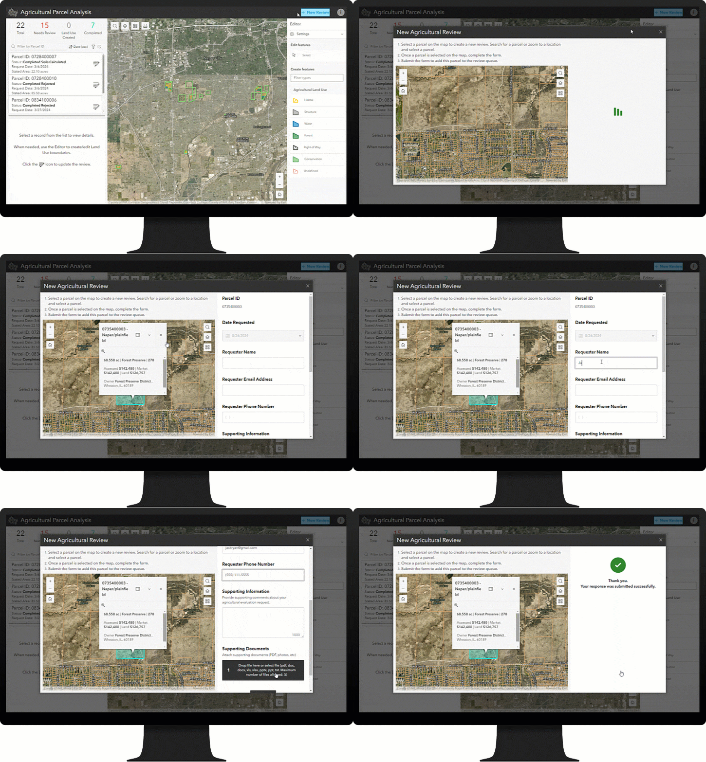
Add agricultural parcels to the queue
The first step in the process is to identify your agricultural parcels. Agricultural Parcel Analysis offers several methods for adding agricultural parcels to your review queue. If you already have a dataset of parcels, you can upload it directly into the queue. To add a new parcel, you or any assigned users in the assessor’s office can use the solution’s Agricultural Parcel Analysis app. And, if you want to solicit agricultural exemption requests from property owners, you can give them access to the solution’s Agricultural Review Request app.
Regardless of the methods you use, all parcels are added to the same queue that assessors will use later in the process.
Review agricultural parcel status
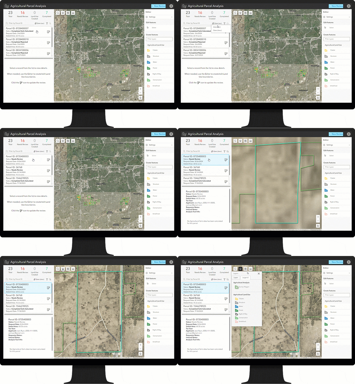
As an agricultural assessor, you already have a deep understanding of the composition of agricultural parcels in your county. When you review a new agricultural exemption request and verify it against the existing agricultural property status, you may need to make adjustments. With the Agricultural Parcel Analysis app, you can review parcel details and explore associated operational layers that may influence a parcel’s agricultural status. And, when necessary, you can use the same app to refine the parcel queue.
Define assessment units (land use)
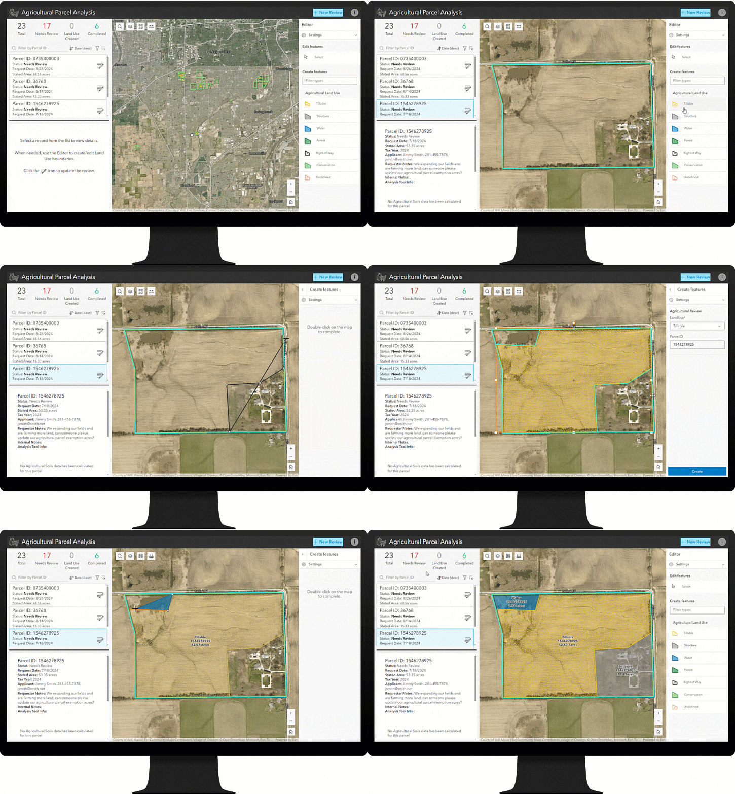
To verify that a property meets the qualifications for agricultural status, you need to determine if the land is capable of producing agricultural products such as crops and livestock. Valuation methods usually consider soil quality, water availability, climate, and current use in agricultural production. Typically, this data is collected by the GIS team with aerial photography and desktop GIS software. This strategy works well, but it can also be problematic for many organizations, especially ones with only one or two GIS professionals on staff. Agricultural Parcel Analysis helps these organizations avoid workflow bottlenecks by including an easy-to-use web editing experience that any assigned user in the assessor’s office can use to create land use areas for each parcel.
Update an agricultural review
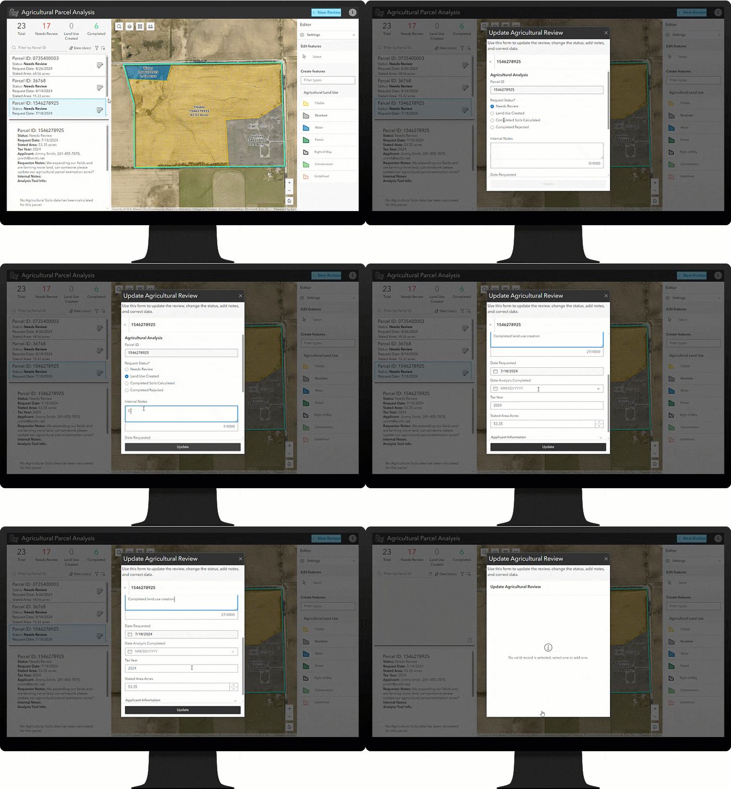
What if a parcel doesn’t qualify for agricultural status or there’s a change to a parcel’s land use features? No problem! During the review process, any assigned user in your office can make changes to review details, such as updating its status, adding internal notes, or correcting issues with associated contact information.
Aggregate agricultural parcel information
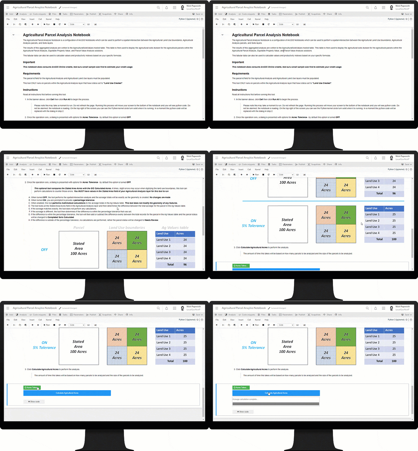
After you have completed the agricultural review process and created the land use appraisal units, it’s time for your GIS team to get to work. They’ll use the Agricultural Parcel Analysis Notebook app to perform spatial data analysis and aggregation to determine the soil composition for the agricultural parcels. The notebook computes this information from parcel, land use, and USDA soil data. It can be run on an as-needed basis or can be scheduled as a task.
Do you need your agricultural tabular calculation totals to exactly match legal acres? The notebook contains an option to adjust acreage totals to match the legal or deeded acres exactly. This option can be used with a user-defined tolerance that performs calculations on the tabular information after the spatial data aggregation has occurred. More information about this option can be found within the notebook.
Use aggregated agricultural data
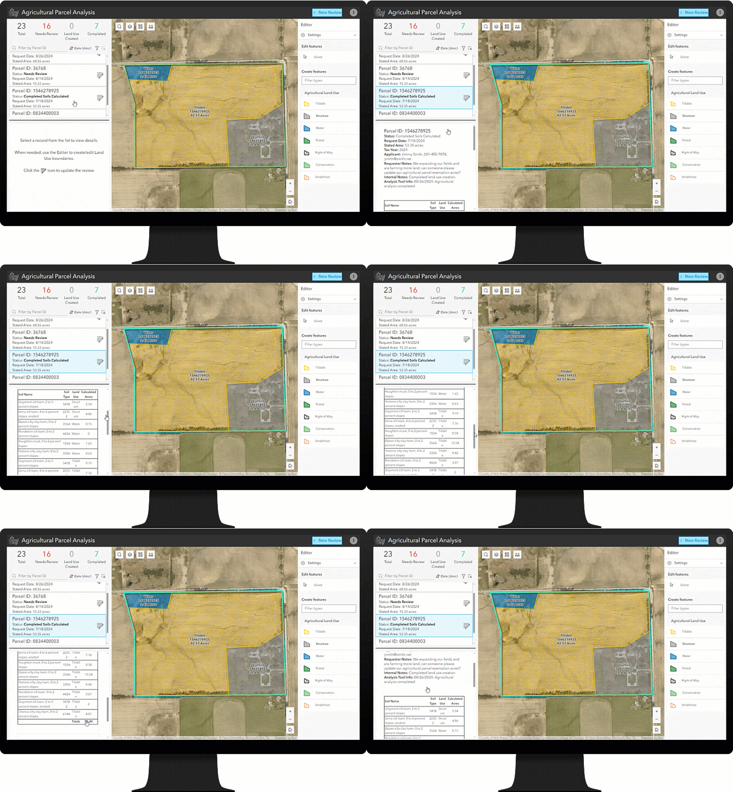
After soil data aggregation is completed, you have many options for working with it. When talking to assessors, we found that each county assessor is very unique in how you perform the assessment value calculations. That being the case, we do not perform the value calculations by default with the solution; rather, we leave that up to you. For example, you can export the tabular data to a spreadsheet that can be used within your CAMA system to calculate assessed values. You can also use the tabular data to further calculate agricultural assessed values based on their specific soil values within ArcGIS. You may choose to work with one of our great Esri partners to further refine this data and calculate the assessed values based on your unique requirements. Or simply use the Agricultural Parcel Analysis app to review the aggregated soil data.
Optionally, the aggregated agricultural soil data can be used with the Parcel Value Analysis and Equitable Property Value solutions.
Assessing agricultural parcels is complex, but it doesn’t have to be complicated. Deploy the Agricultural Parcel Analysis solution today to enable everyone in your organization to contribute to the agricultural assessment process.
Learn more
For more information about the Agricultural Parcel Analysis solution, check out the following resources:
- Learn how to deploy, configure, and use the solution.
- View a demo video.
- Learn more about ArcGIS Solutions.

Article Discussion: