The June 2024 release of ArcGIS Velocity is here! This release brings two new feed types, existing feed enhancements, as well as quality and performance improvements with updates to backend libraries and dependencies. Key highlights include:
- A new Waze feed type that allows Waze partners to connect to and receive various Waze information types from the Waze API including Alerts, Irregularities, and Traffic information.
- A new Samsara feed type, designed to seamlessly connect and deliver telematics data from your vehicle fleet, ensuring real-time insights and optimized fleet performance.
- Additional sharing options for the HTTP Receiver and gRPC feed types that allow the owner to decide whether users or groups the feed is shared with can send data to the shared feed when using ArcGIS authentication.
Let’s take a deeper dive into each of these and other new capabilities and enhancements in this release!
Add community-based information to your analytics and maps using the Waze feed
With the new Waze feed type, Waze partners can easily incorporate different types of information provided by the Waze API into analytics and frontline apps. The illustration below is an example of ingesting alert data into Velocity and performing hotspot analysis on the historical data.
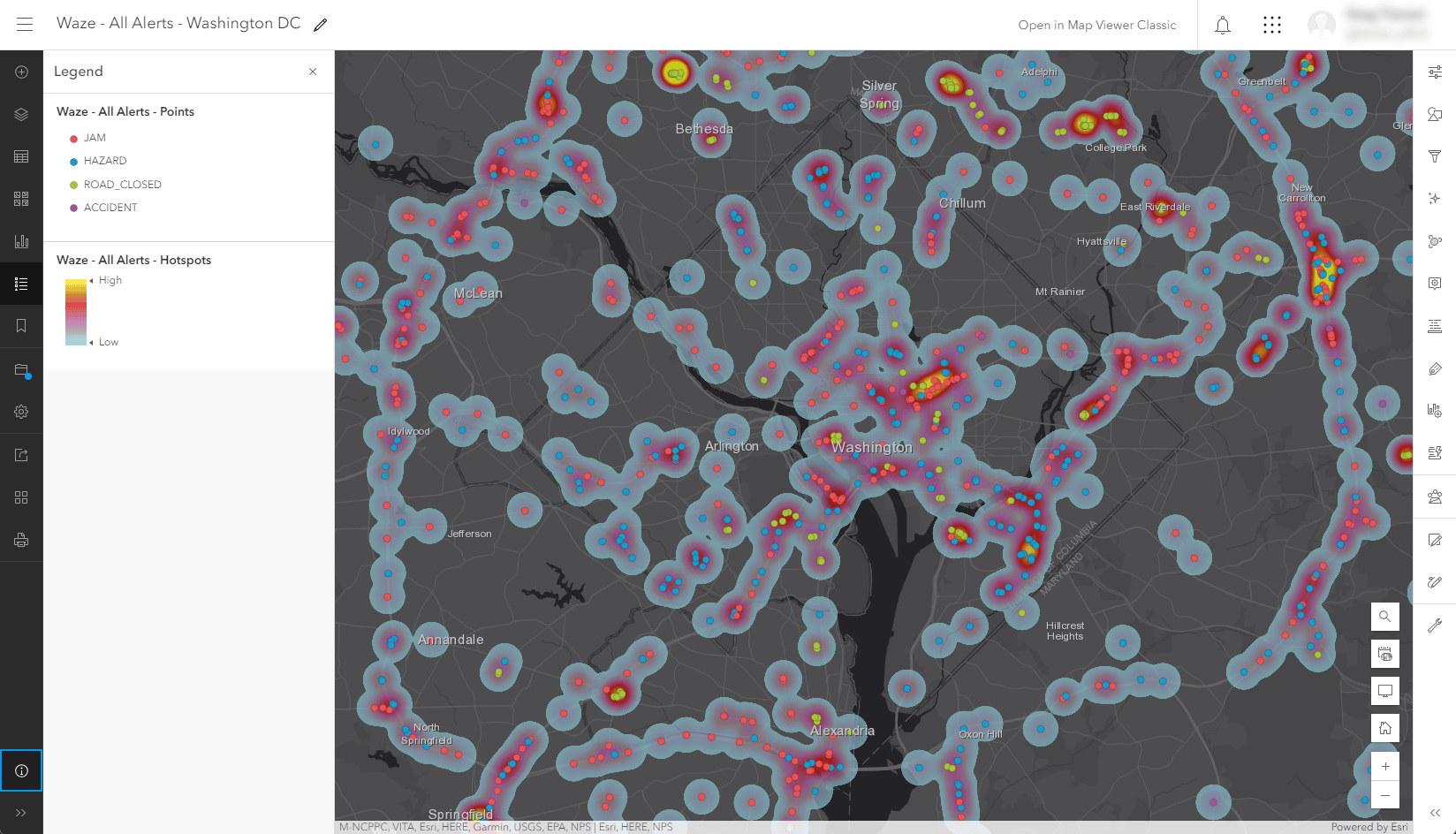
Incorporating Waze information into analytics and apps can help communities monitor and respond to real-time driver traffic reports, identify problem areas reported by users, and run analysis on data over time to facilitate data-driven decisions.
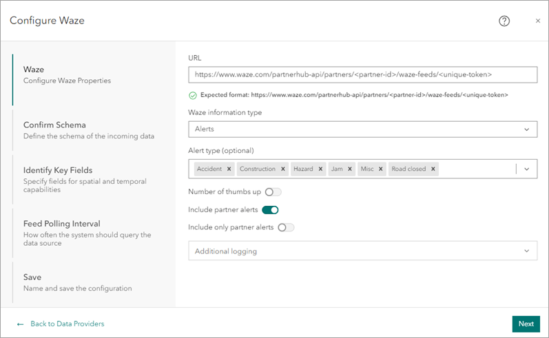
The Waze feed queries your specified Waze URL at a user defined interval for one of three different types of information including alerts, irregularities, and traffic. A description of each follows:
- Alerts include information on several different types of alerts as defined by Waze including accidents, contruction areas, hazards, jams, miscellaneous issues, and closed roads.
- Irregularities, or unusual traffic, includes information on alerts and jams that are affecting a large number of Waze users.
- Traffic includes information about alerts (incidents reported by Waze users) and jams (slowdowns determined by Waze users’ speed and location).
If you are just getting started with or want more information on the Waze data specification or partnering with Waze, refer to Waze Data Feed Specification and Partner with Waze. If you’re already a Waze partner, you can easily get started using the Waze feed in ArcGIS Velocity by logging in to the Waze Partner Hub, finding your Waze URL, and creating a new Waze feed.
Track and monitor your Samsara telematics devices
The new Samsara feed type in ArcGIS Velocity allows you to connect to the Samsara API to receive telematic data from assets equipped with Samsara devices. The Velocity feed type will automatically handle communication with the Samsara API including pagination in API requests. Additionally, the Samsara feed type allows you to query as frequently as every five seconds as allowed by the Samsara API. Getting this data in your maps and apps provides a real-time view into your assets and enables analysis on stored observations to gain further insight into patterns, trends, and anomalies.
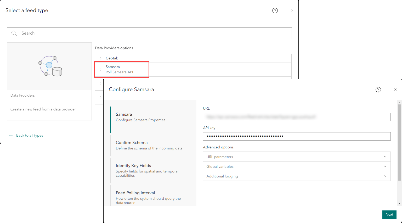
The Samsara feed type in Velocity supports GET requests to Samsara v2 API endpoints. To learn more and get started with Samsara REST API, see the Overview topic in the Samsara REST API documentation.
Improved feed sharing options and authentication support
Another area of improvement you will notice is that the HTTP Receiver and gRPC feed types now allow the owner of the feed to decide whether other users or groups in the organization the feed is shared with can send data to the feed. The shared feed must be configured to use ArcGIS authentication for this option to appear. This expands the collaboration options in your organization, providing further flexibility for other users to utilize these shared feeds.
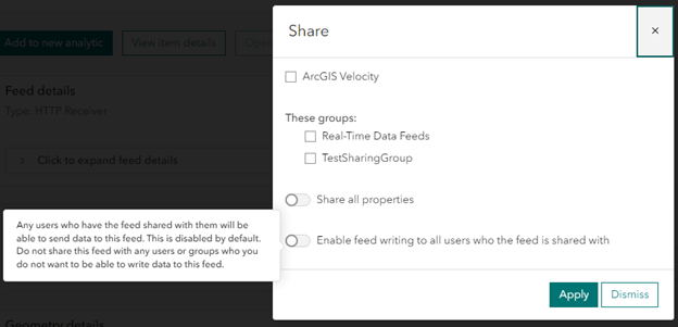
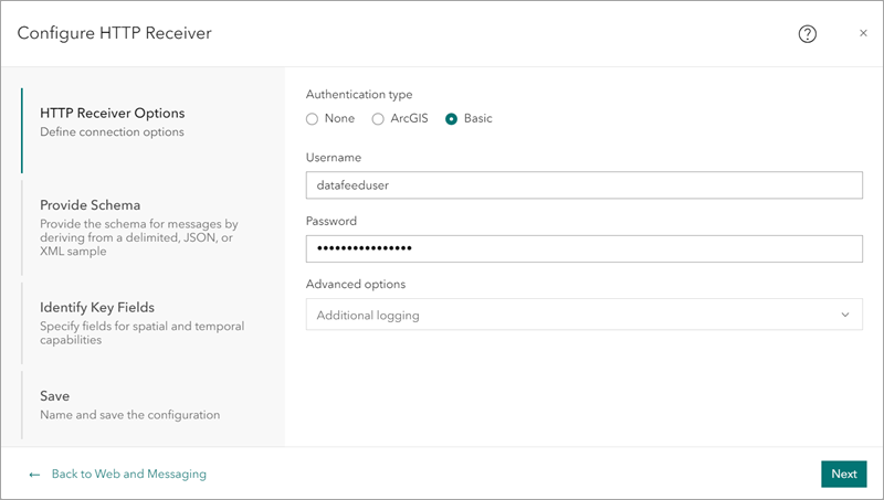
In addition to the new sharing options above, support for Basic authentication was added to the HTTP Receiver, in addition to its existing authentication types of None and ArcGIS. This provides you with another option to secure who can send data to your receiver feeds.
Long field names in your data’s schema?
Oftentimes, you don’t have control over the schema of the data you want to ingest into ArcGIS Velocity. And as you may or may not know, feature layers have a 31-character limit for field names. So, if you are sending real-time data to a feature layer, using either the Feature Layer (existing) or Feature Layer (new) outputs, you may encounter field names that are truncated if the field name is longer than 31-characters.
With this release, when you’re defining the schema of a feed or data source, you will now see a warning icon next to any fields in that data that are longer than 31-characters. As mentioned, this is important if you’re using feature layer outputs, you now know ahead of time if any field names are too long for feature layers and can update those prior to creating the new feed or data source.
And more…
For more information, check out the what’s new topic in the documentation and to see what bugs and enhancements were addressed in this release, check out the latest issues addressed list. If you have ideas, enhancements, feature requests for the product, be sure to post them on the ArcGIS Velocity Ideas board in the Esri Community.
To learn more about Velocity, peruse all the available resources including product videos, tutorials, documentation, and more.
If you’re attending Esri User Conference (July 15-19, 2024) in San Diego, check out all the sessions and activities related to the Real-Time Visualization and Analytics capabilities in the Real-time Visualization and Analytics Guide to Esri User Conference 2024 blog.

Article Discussion: